 Highlights:
- Snow arrives tonight for central; northern parts of the state
- Even colder air coming
- Pattern of storms and rumors of storms
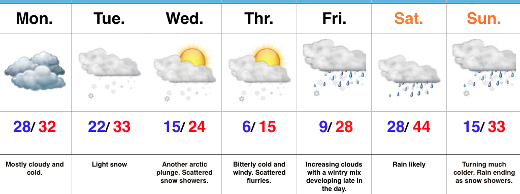
Snow Develops Tonight…Today is mostly dry and cold, including a mostly cloudy sky. Clouds will lower and thicken this afternoon and give way to light snow late tonight across north-central Indiana and points north. As milder air is pulled north Sunday, snow will transition to a wintry mix and eventually a cold light rain across central Indiana. Further north, this will remain mostly snow before transitioning to a wintry mix. Precipitation will end for everyone Sunday night.
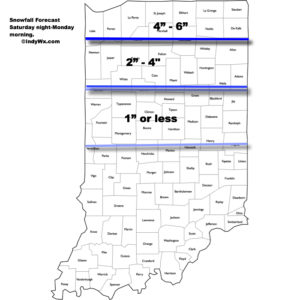
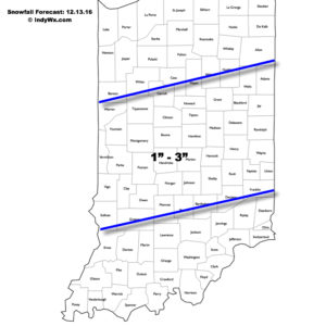
Here’s the current thinking on storm total snowfall with this event. (Click to enlarge).
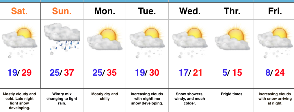
 We’ll open the work week with dry and cold conditions, but all eyes will be on the next arctic front by this time. It’ll blast through here the middle of the week with even colder air than what we’re currently “enjoying.” 🙂 Expect sub-zero wind chills mid week. Snow showers and gusty winds remain in the mid week forecast and will require fine tuning as we draw closer. A quick note, medium range modeling and beyond will really struggle in run-to-run consistency with such a pattern. The slightest difference in handling respected upper air energy will lead to dramatic changes in the sensible weather the modeling paints. There’s no sense in changing the forecast daily (or, in some cases, multiple times per day, only to change it back to where we began as time draws closer).
Finally, yet another winter weather maker awaits for the end of the week. Clouds will be on the increase Friday with snow (or a wintry mix) developing at night. It’s a busy, cold pattern…
Upcoming 7-Day Precipitation Forecast:
- Snowfall: 1″ – 3″
- Rainfall: 0.10″ – 0.25″

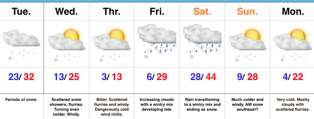
 Fresh arctic air will pour into the region tomorrow evening, along with a gusty NW wind. Tuesday’s snow should be rather wet in nature so we don’t anticipate blowing/ drifting issues to result as the arctic hounds roar into town. However, there will likely be periods of flurries and scattered snow showers as the bitterly cold air arrives in the Wednesday-Thursday time frame and this could lead to light additional coatings in spots. The big weather story through mid and late week will be the bitter air. “Air that hurts” is what we’re calling it and wind chill values will approach 20 degrees below zero Wednesday night/ Thursday morning.