One cold front moved through central Indiana last night with rain showers and a notable wind shift. A secondary cold front will sweep through the region later this afternoon. Not only will this deliver reinforcing cold air to wrap up the short work week, but with enough upper level energy and instability, it’ll also serve to ignite some intense snow squalls by evening. This won’t be a “uniform” snow event, but where the squalls develop, expect rapid reduction in visibility (brief white-out conditions), and a quick coating to 1″ of snow. Winds will also gust to 40 MPH by evening and overnight.
Here’s an idea of what the radar may look like later this evening:
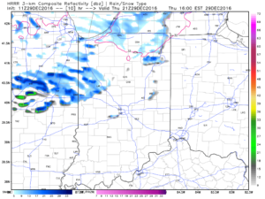
4p forecast radar
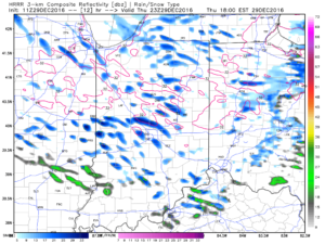
6p forecast radar
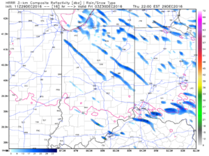
10p forecast radar
If you have travel plans this evening into tonight, please allow extra time to reach your destination as these intense snow squalls lead to brief white-outs and quickly create slick travel. Scattered snow showers will continue into Friday morning, especially across the northern and eastern sections of the state. Friday will be a cold day as highs top out around 30.
More with an updated 7-day forecast later today!

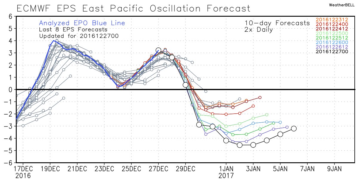
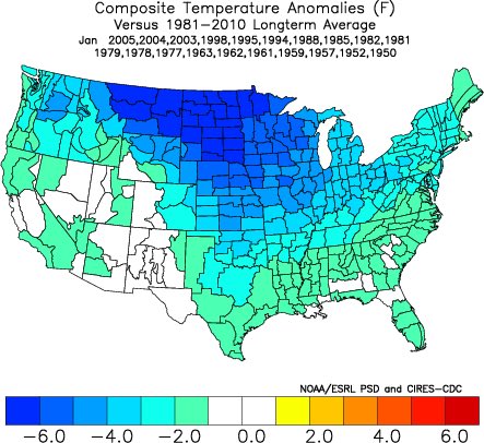
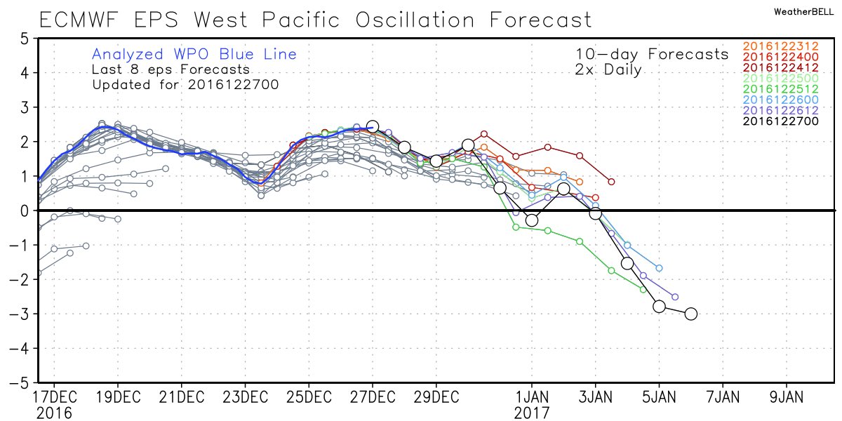
 Accordingly, we see the ensemble data flipping to a colder pattern over the upcoming (10) days. Note the low anomalies in the higher latitude regions today (Image 1) versus Day 10 (Image 2).
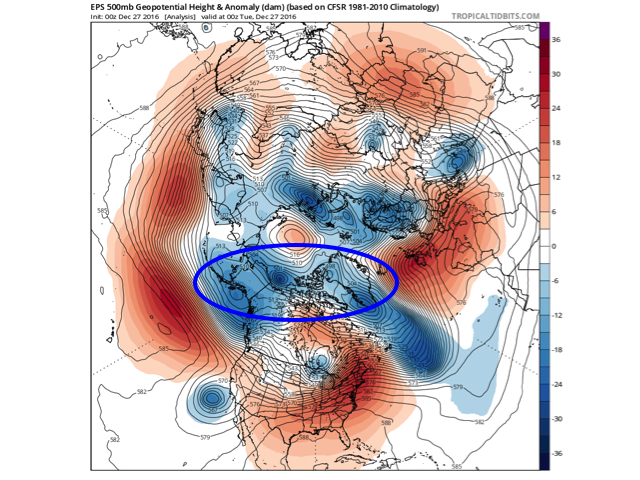
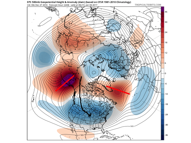 The pattern developing by Day (10) is one capable of producing another frigid regime- only January style. Cross-polar flow sets up shop and, unlike, December, some blocking is noted, as well. This can help the mean storm track shift further south. (Bye-bye Great Lakes cutters, though Mid Western and Ohio Valley Snow Lovers will find a new worry in the form of suppression potential ;-)). Individual storms will have their respected challenges, as always. As a whole, it’s a very cold, stormy look and a pattern capable of leading to an expanding snow pack across the Lower 48.