Sunday Afternoon Rambles…

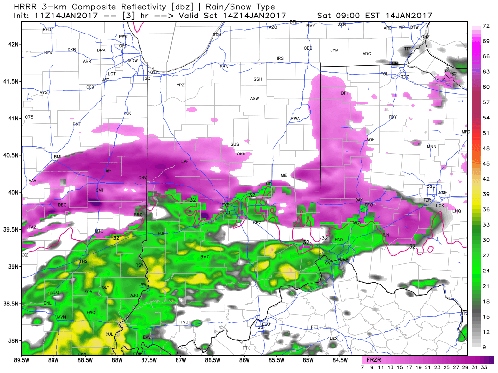
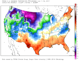
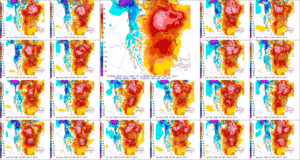
1.) January, month-to-date, is running slightly above normal at IND (+1.2 F) and nearly 1″ above normal in the precipitation department.  Keeping true to the winter, overall, greatest cold departures are centered over the northern Plains and northern Rockies.

conus_mtd_t2max_anom_2017
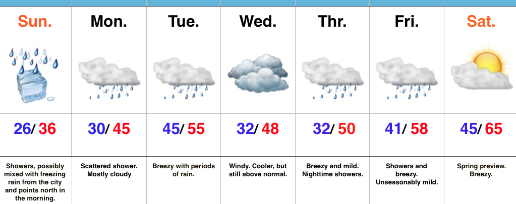
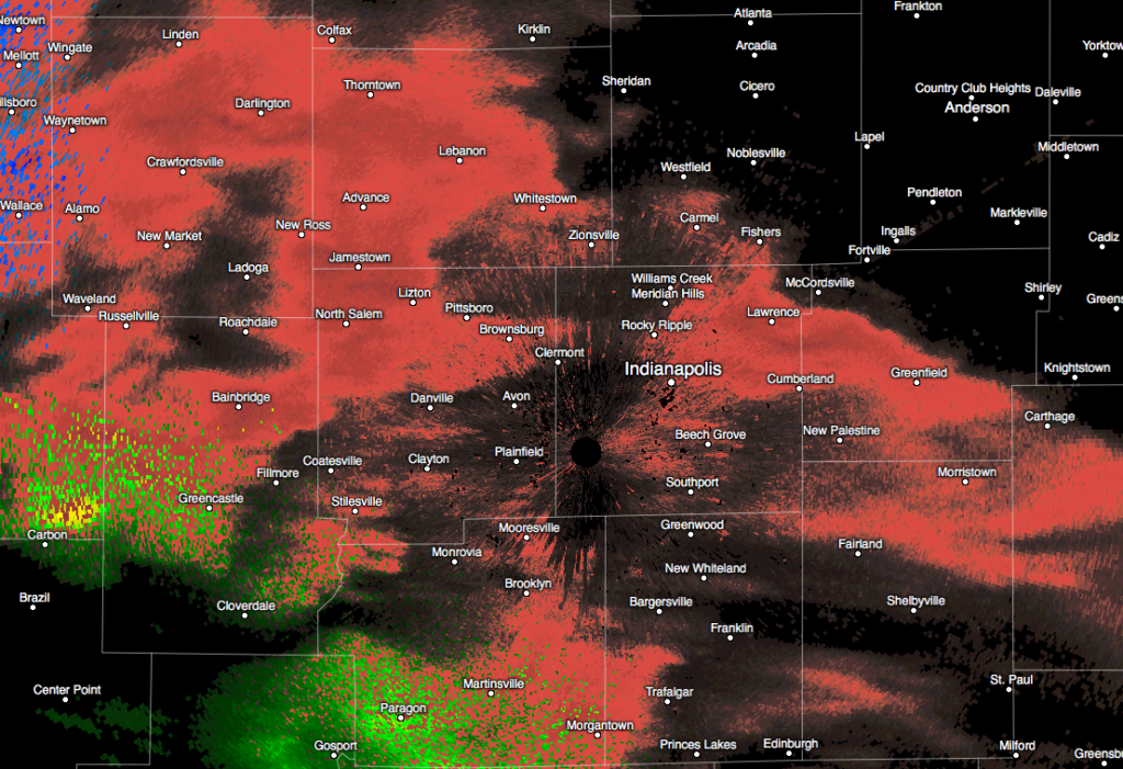
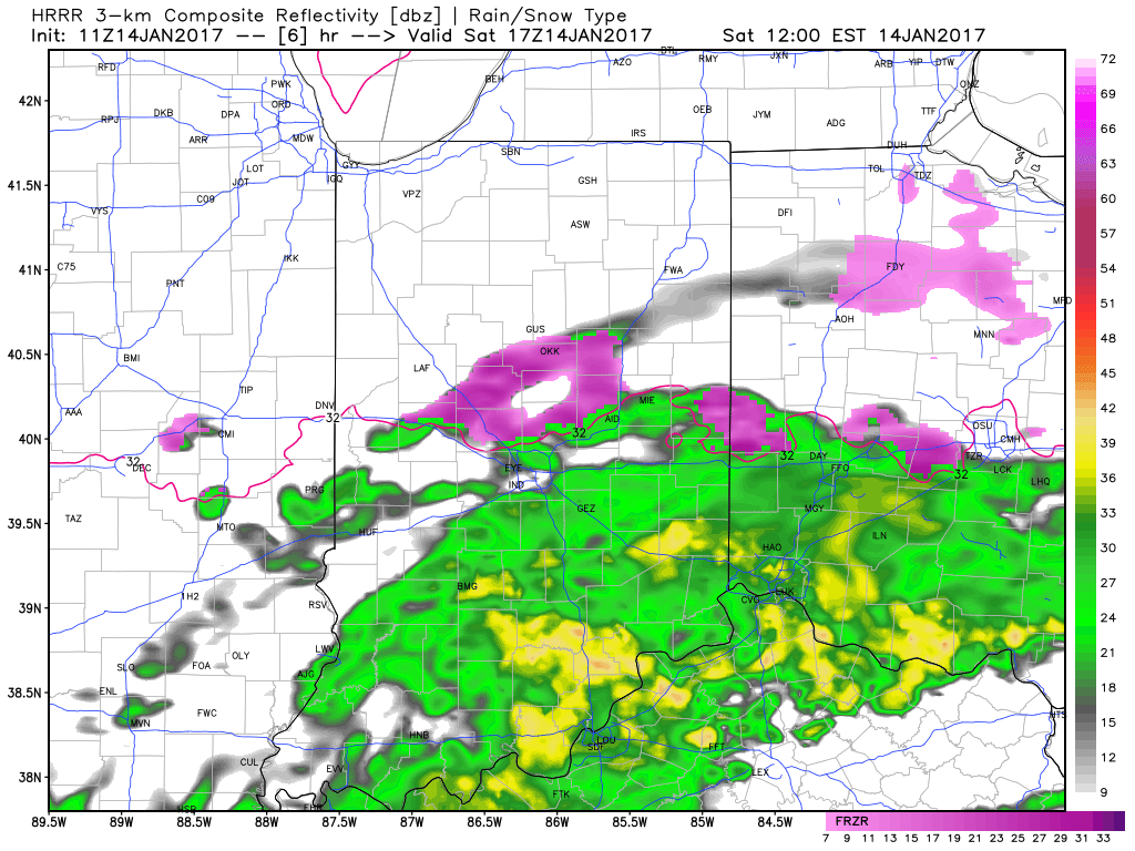
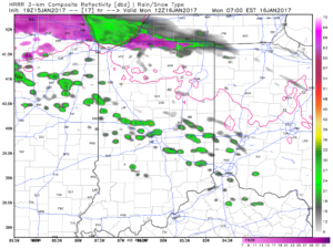
2.)  Showers will creep north overnight into Monday morning, but shouldn’t amount to much.  They will be scattered in nature across central Indiana.

hrrr_ref_indy_18
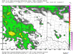
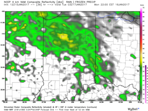
3.)  More widespread rain and embedded thunder will develop Monday night into Tuesday morning.  This should amount of widespread half inch to one inch totals across the viewing area.

hires_ref_indy_37

hires_ref_indy_40
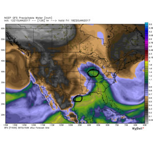
4.)  A moist southwest flow will help push a warmer regime northward for the second half of the week.  Though warm, we’ll also have to deal with periods of rain as disturbances track northeast.  We circle Friday and Sunday as the wettest days and remain optimistic Saturday will feature dry and unseasonably warm conditions (lower-middle 60s).  Between the rainy days Friday and Sunday, additional rainfall totals of 1″-2″ seem like a good bet.

SW Flow

D7
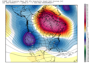
5.)  The evolution of the pattern just beyond the 7-day period we’ll begin to take on an increasingly wintry look and we remain confident on a flip back to wintry conditions as we roll through the last week of the month.  We’ll have to keep a close eye on a storm system in the 8-10 day period.  It’s obviously way too early to discuss specifics, but this will be the time the pattern is beginning to turn back towards a wintry regime…

ecm_eps_z500a_noram_11


Permanent link to this article: https://indywx.com/sunday-afternoon-rambles-2/

January Thaw For The New Week Ahead…

Screen Shot 2017-01-14 at 4.13.32 PMHighlights:

  • Damp, chilly Sunday
  • Milder week ahead
  • Spring-preview late next week

Improvements Coming…Most of tonight will feature dry conditions along with temperatures settling back below freezing (most of central IN will fall into the middle to upper 20s).  Another surge of light precipitation will arrive Sunday morning into the afternoon and this could begin as a period of freezing rain from the city and points north.  Similar to today, we don’t expect any major problems from the freezing rain and all of the region should warm above freezing during the afternoon.

While Monday could feature a quick-hitting shower at any given time, more widespread steady rain will push into central Indiana during the day Tuesday, along with breezy conditions.  Those breezy southwest winds will help give temperatures a boost into the middle 50s for afternoon highs.

We’ll shift that southwest wind around to the northwest Wednesday and this will help push cooler air into the state for mid week.  Despite the cooler feel, we’ll remain well above average with breezy conditions.  (Average highs in central Indiana are in the middle 30s this time of year).

The big news for the latter portion of the forecast period will be a true spring-like feel developing as we rumble into the weekend.  In fact, temperatures will surge well into the 60s next Saturday.  Modeling isn’t in total agreement on rain chances with a moist southwest flow in place.  We’ll take the “optimistic” route at this time and forecast a dry Saturday, understanding that we’ll have to maintain a close eye on things.

Quick heads up, longer term data continues to suggest we’ll flip into a much colder and stormy pattern as we wrap up January and head into February.  Winter is far from over…

Upcoming 7-Day Precipitation Forecast:

  • Snowfall: 0.00″
  • Rainfall: 0.50″ – 1.00″

Permanent link to this article: https://indywx.com/january-thaw-for-the-new-week-ahead/

Saturday Morning Freezing Rain Update…

More widespread precipitation is spreading across central Indiana this morning.  Most of this precipitation is falling as freezing rain.

Radar at 7:19a.

Radar at 7:19a.

Modeled forecast radar continues to show moisture streaming across the region through around the lunchtime hour before diminishing.

9a forecast radar

9a forecast radar

12p forecast radar

12p forecast radar

Temperatures will remain around 30-32 degrees along and north of the I-70 corridor as this rain falls so it’ll freeze on contact.  Allow extra time if you must travel and slow down.  Due to our phenomenal road crews and marginally cold temperatures, we don’t expect major travel issues this morning, but do use caution if traveling.  A light glaze of ice (around 0.10″) is possible on elevated surfaces, including tree limbs and power lines.

Temperatures will go above freezing this afternoon across most of central Indiana and precipitation will end.  Highs both today and Sunday should top out in the middle 30s across the region.

5p forecast radar

5p forecast radar

Lows tonight will settle back down into the middle to upper 20s, but dry conditions should remain for most of the night.

10p forecast radar

10p forecast radar

Our next round of precipitation looks slated for a Sunday morning arrival and, similar to this morning, this precipitation will likely fall as a mixture of light rain and light freezing rain.

Updated 7-day out later!  Have a great Saturday!

Permanent link to this article: https://indywx.com/saturday-morning-freezing-rain-update/

Surge Of More Widespread Precipitation Saturday Morning…

Light freezing rain and drizzle has been falling across central Indiana this evening, mainly from the city, itself, and points south. A light glaze of ice has been reported into the forecast office in Monrovia and Plainfield. 

For the next several hours, patchy light freezing rain and drizzle will continue, but nothing in a widespread, “uniform” fashion (great news for those night owls out and about).

However, we do note some of the higher resolution forecast models suggesting a waive of more widespread precipitation arriving into central Indiana Saturday morning. This most likely pushes in sometime between the hours of 7a-9a and encompasses the heart of the state, including Indianapolis. 

This “slug” of moisture will continue to fall across central Indiana through the morning hours before tapering off and diminishing around lunchtime. The afternoon and evening should be void of any widespread precipitation of significance. 

While this won’t be a crippling event by any stretch of the imagination, be careful for slick spots Saturday morning and allow road crews room for salting. In general 0.05″-0.10″ of glaze still seems like a good bet for most central Indiana neighborhoods by lunchtime Saturday. 

More in the morning! Have a great night!

Permanent link to this article: https://indywx.com/surge-of-more-widespread-precipitation-saturday-morning/

Quick Friday Evening Notes…

1.)  While we’re still expecting freezing rain across central Indiana tonight into the early morning hours Saturday, dry air will really limit totals.  Instead of the 0.10″-0.20″ of glaze per…

You must be logged in to view this content. Click Here to become a member of IndyWX.com for full access.  Already a member of IndyWx.com All-Access?  Log-in here.

Permanent link to this article: https://indywx.com/quick-friday-evening-notes/