Still Some Summer Left In The Tank…
 Highlights:
- Warmth builds
- Storms chances (finally) return
- Rinse and repeat
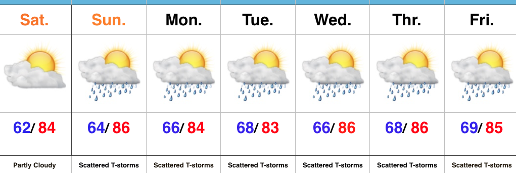
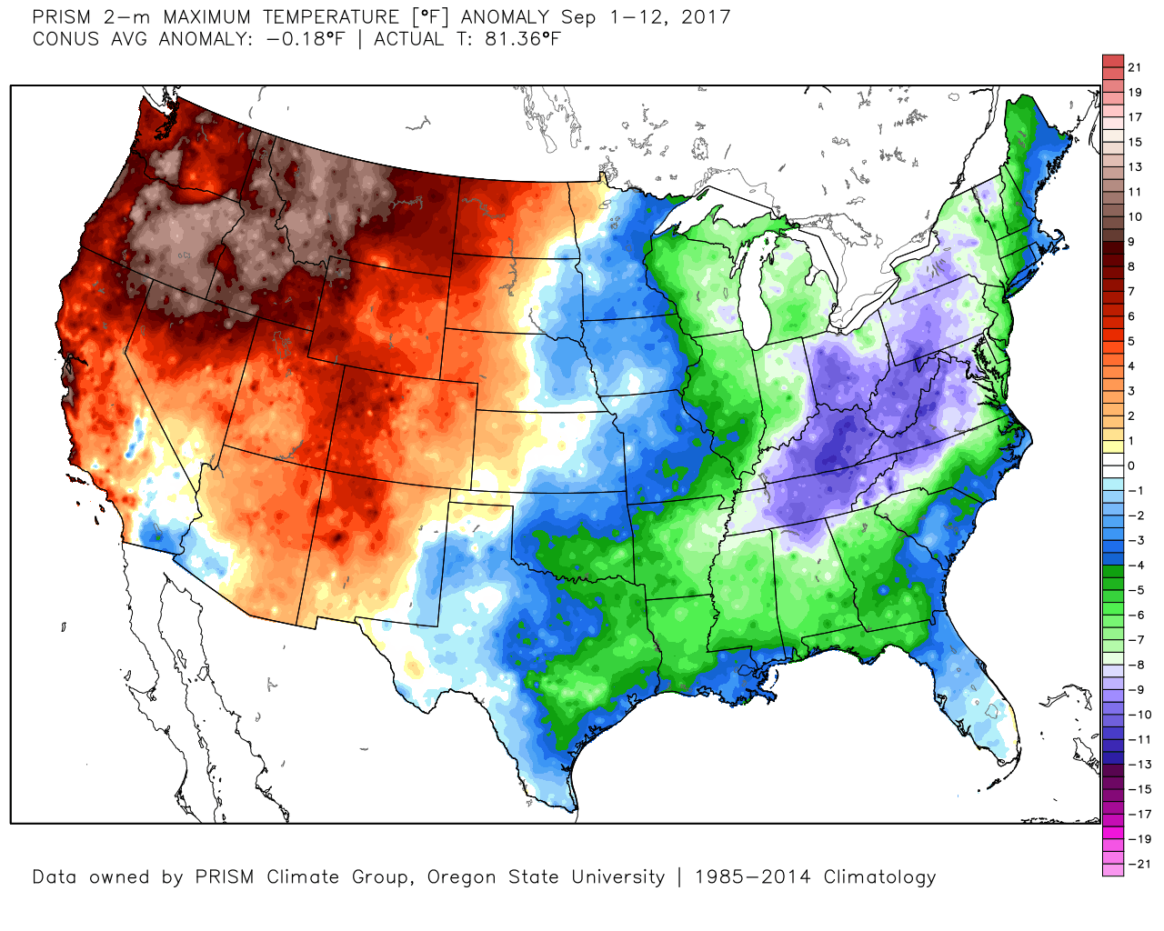
Summer Isn’t Finished Yet…We may be inching ever so much closer to the official start of autumn (next Friday), but don’t tell Mother Nature that. After an unusually cool close to August and open to September, we’re set to make up for lost time over the next couple of weeks. Heat will build and expand across the Mid West this weekend and that will set the tone for the upcoming forecast period.
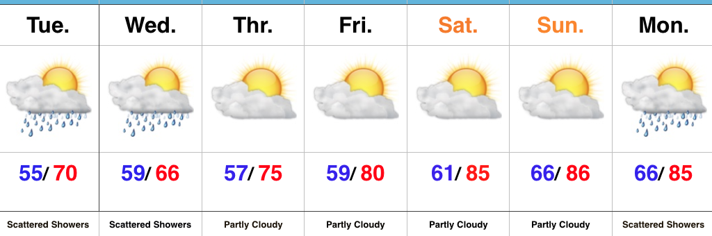
Weather conditions should remain dry to kick off the weekend (great day for the Whitestown Brewfest, by the way), but moisture will return for the second half of the weekend. Combine the increasing moisture with enough lift and widely scattered thunderstorms will fire Sunday. Overall coverage won’t be particularly impressive, but will be a harbinger of things to come as the new week unfolds. A couple of surface fronts will push up against the strong ridge in place as we progress through the work week. While these will “wash out” over the Ohio Valley, they’ll be sufficient enough to provide scattered-to-numerous showers and thunderstorms next week. Our parched soils will take anything they can get!
Upcoming 7-Day Precipitation Forecast:
- Snowfall: 0.00″
- Rainfall: 0.50″ – 1.00″
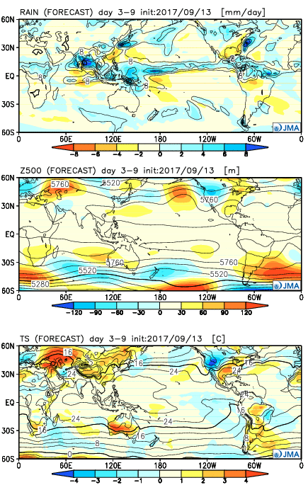

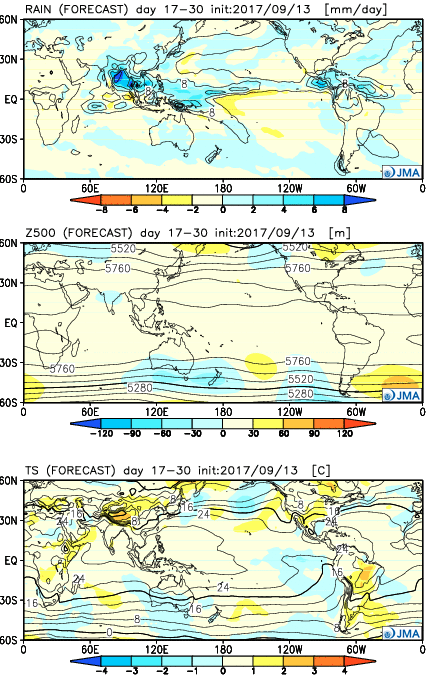
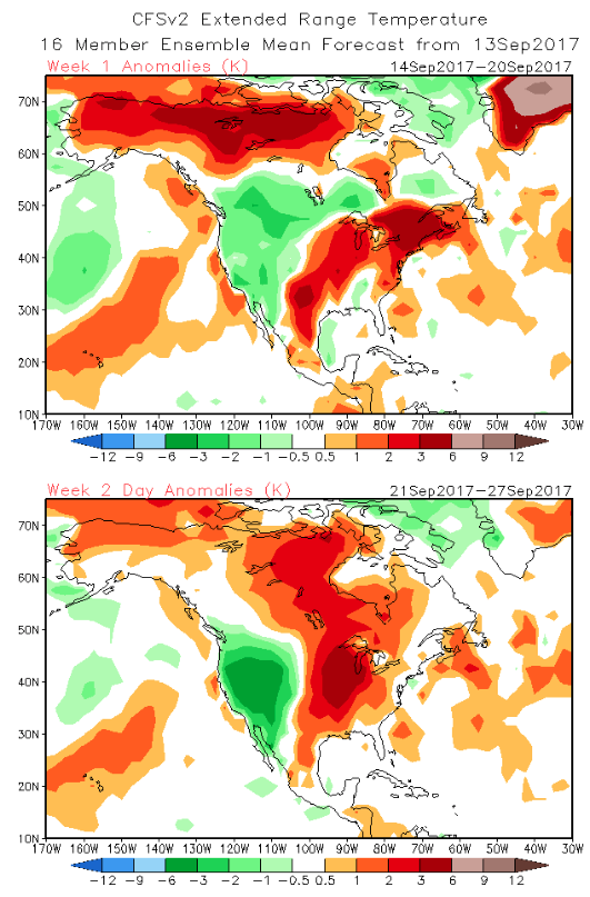
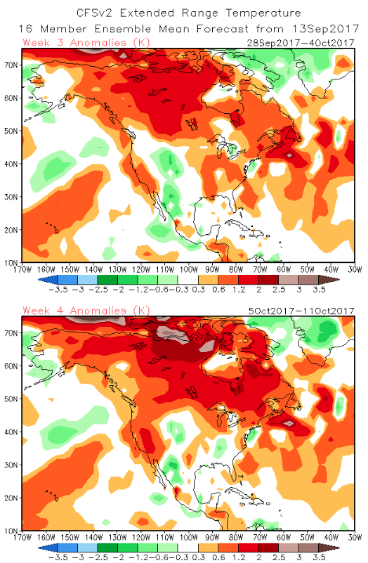
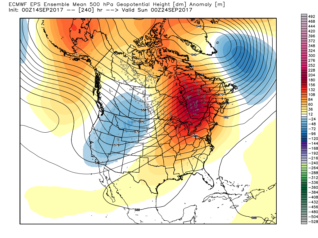 This will deliver temperature anomalies 5° to 10° above average as we traverse the back half of the month, including highs in the mid-to-upper 80s.
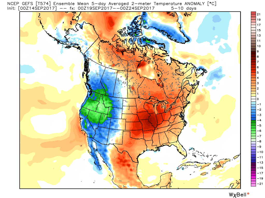 Meanwhile, our friends out west (where it’s been warm, month-to-date) will begin to experience early winter-like conditions, including high elevation snowfall across the central and northern Rockies.
 Highlights: