Spring; #Plant24 Outlook…

Updated 02.10.24 @ 7:20a

Though we still have a few weeks left of meteorological winter, spring and the #Plant24 season will be here before we know it! The headlines that we anticipate to claim the coming months include the following:

  • El Niño likely continues to collapse; La Niña state by late spring/ early summer
  • Widespread wetter than average conditions anticipated for a large chunk of the country, including central Indiana. Opportunity for above average severe weather episodes during the March through May (meteorological spring) time period.
  • Time to prep for a hyper active hurricane season along the Gulf and Southeast US coastlines.

Long range, seasonal forecast models, continue to show the current El Niño collapsing and moving swiftly towards a La Niña late spring and early summer.
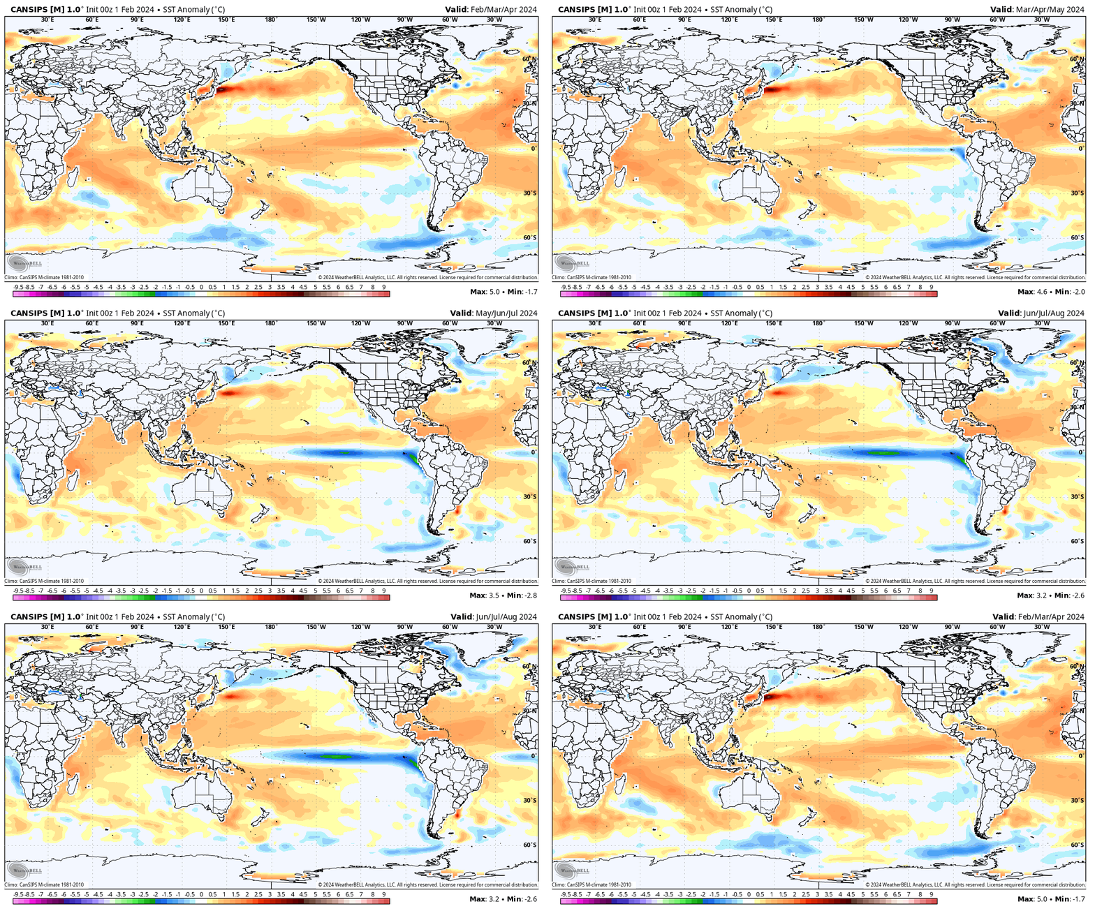
This transition will certainly have impacts on the anticipated precipitation and potential of a busier severe weather season this spring. We forecast a rather swift Nino collapse and subsequent onset of La Niña, which ups the ante for a wet spring, not only locally, but across a widespread chunk of the country. Undoubtedly, this could lead to plant24 impacts (delays) at times.

Seasonal products see the above average rain expected for spring 24.
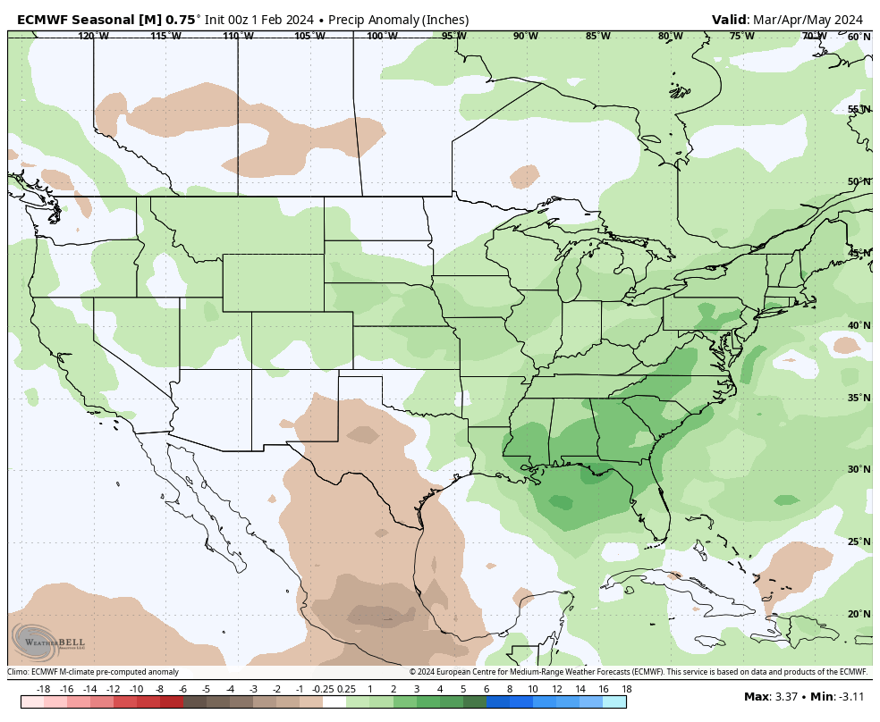
European Seasonal Precipitation Anomalies March through May
JMA Precipitation Anomalies March through May

From a temperature perspective, we forecast widespread milder than normal temperatures as a whole for the season across the northern tier, including central Indiana. We caution though that the way we get to slightly (1° to 2° above normal on the season) milder overall may include wild swings through the season. For example, we forecast a colder than normal 1st half of March, the potential of a significant flip to warmer the 2nd half and a cooler pattern to return for the bulk of April.
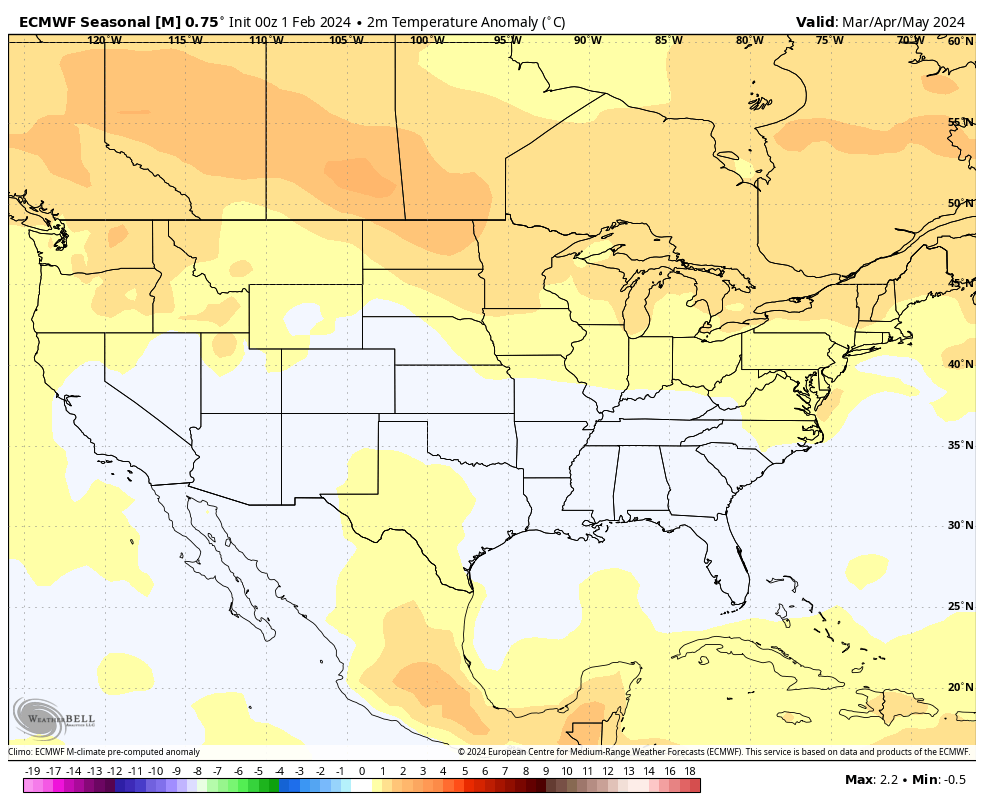
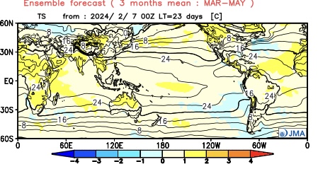
European seasonal temperature anomalies March through May
JMA temperature anomalies March through May

IndyWx.com Spring/ #Plant24 Outlook for central Indiana:

  • Temperatures that average 1° to 2° above normal overall for the March-May period.
  • Precipitation that runs 125% to 130% of normal during meteorological spring.

Wishing the best of luck and positive vibes to all in the months ahead, especially our #AGwx partners. Happy spring!

Permanent link to this article: https://indywx.com/spring-plant24-outlook/

Friday Evening Rambles…

Updated 02.09.24 @ 5p

Scattered showers/ embedded thunder overnight, opportunity for slushy, light snow accumulation, and long range rumblings highlight this evening’s rambles…

I. A thin line of broken showers and perhaps a rumble or two of thunder will push southeast across central IN during the predawn hours Saturday. More widespread, concentrated rain and embedded thunder will work across the southern 1/3 of the state overnight and early Saturday morning. Across central IN, rainfall amounts of 0.10″ to 0.25″ will be possible with this activity with more widespread 0.25″ to 0.50″ totals across the southern portion of the state.

The front will pass southeast across the region predawn Saturday with a northwest wind shift taking place from northwest to southeast prior to sunrise Saturday. Cooler (not cold by February standards) air will flow into the region over the weekend.

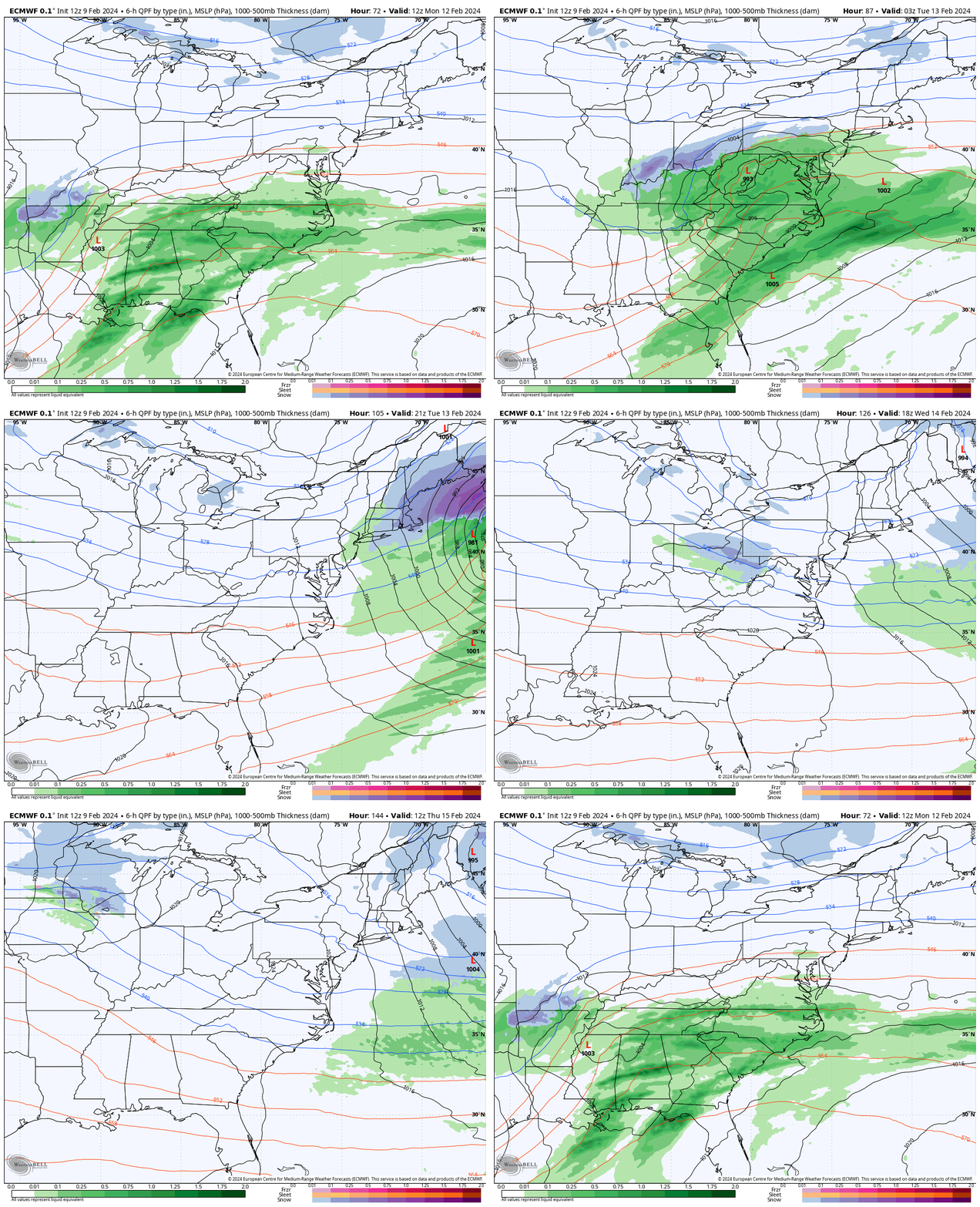
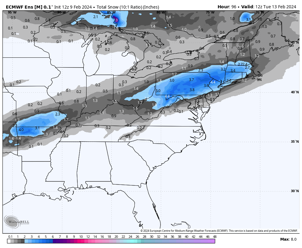
II. The second piece of energy that will lead to a significant rain and associated severe weather episode across the South and a big ole snowstorm for our friends across the Northeast early next week, still appears to mostly bypass our immediate region. It’s possible southern portions of the state (mostly south of Indianapolis) could see a light, slushy snow accumulation, but I think even in these areas the 1″, via today’s EPS is too “generous.” The reason? Snowfall rates, marginal temperatures, and the unseasonably warm ground. Further east, this will be a much different animal with a notable snowstorm anticipated for the central Appalachians into southern New England. Regardless, at least locally, Monday evening into Monday night would be the period to watch for the potential of the slushy wet snow accumulation potential.

III. The upcoming week will undoubtedly be much cooler than what we’ve grown accustomed to from February ’24 so far, but nothing overly cold for this time of year by any stretch of the imagination. We’ll watch for the threat of a couple of clipper systems that could deliver mixed rain/ snow or light snow, but significant snow makers aren’t on the horizon in the week ahead as of this evening. We’ll continue to closely monitor.

The opportunity is present for a shot of colder air behind one of these clippers next weekend.

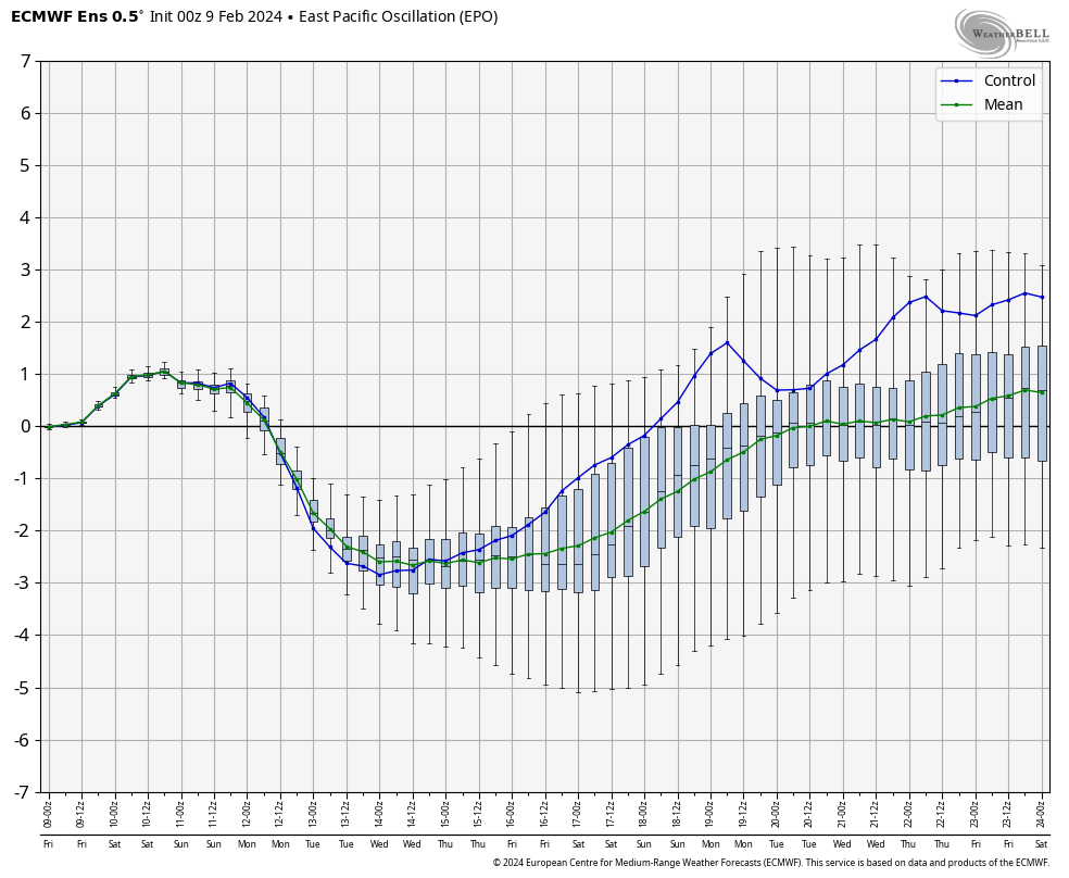
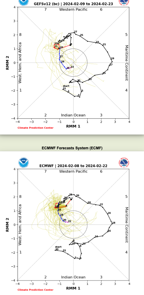
IV. The reason for “pause” this morning in the long standing idea here of a return to prolonged colder than normal weather into March came from a positive trend in the EPO and what at least appears (from this distance) any sort of MJO venture into Phase 8 will be very brief. If (still a bigger “if” than we prefer) we don’t keep that EPO negative and the MJO goes into the neutral phase, even a negative NAO won’t be able to impact the area with notable cold. Can the other players on the field at least keep the period closer to average or slightly cooler than normal? Yes, but any prolonged or significant cold would be highly unlikely if the EPO/ MJO combo doesn’t come to fruition. You better believe we’ll be watching trends carefully over the weekend into early next week.

Permanent link to this article: https://indywx.com/friday-evening-rambles/

VIDEO: Going For A New Record High This Afternoon; “Fly In The Ointment” Late Month Into Early March?

Updated 02.09.24 @ 7:14a With just enough sunshine we should easily set a new record in the city later this afternoon. Regardless, find a way to get outside and enjoy…

You must be logged in to view this content. Click Here to become a member of IndyWX.com for full access.  Already a member of IndyWx.com All-Access?  Log-in here.

Permanent link to this article: https://indywx.com/video-going-for-a-new-record-high-this-afternoon-fly-in-the-ointment-late-month-into-early-march/

VIDEO: Windy, But Unseasonably Mild; Colder Times Return Next Week…

Updated 02.08.24 @ 6a A weak frontal boundary will limp into the state later this evening. Ahead of the front, anticipate unseasonably mild air and a gusty day. A few…

You must be logged in to view this content. Click Here to become a member of IndyWX.com for full access.  Already a member of IndyWx.com All-Access?  Log-in here.

Permanent link to this article: https://indywx.com/video-windy-but-unseasonably-mild-colder-times-return-next-week/

Lunchtime Rambles: Trends For The Weekend And Early Next Week…

Updated 02.07.24 @ 1:39p

Today’s midday computer guidance is trending more bullish for trailing energy to deliver heavier precipitation across central IN and the Ohio Valley. While there are many more questions than answers with respect to precipitation type, confidence is increasing significantly that a period of more significant precipitation will come at us in (2) waves this weekend into early next week: Saturday and again Monday.

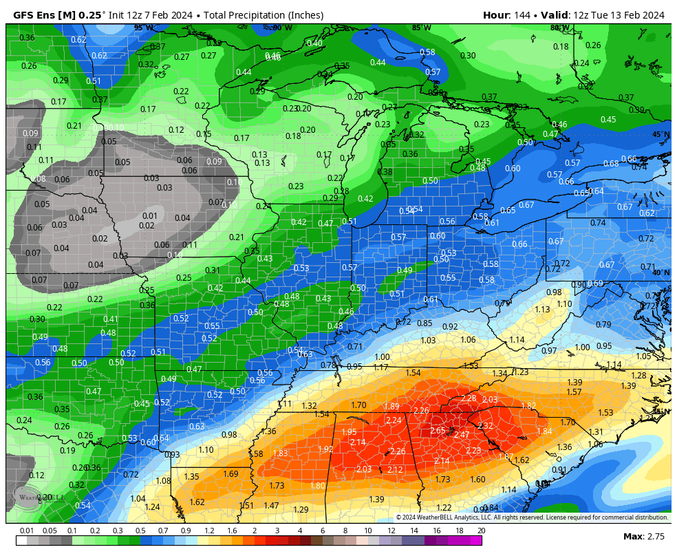
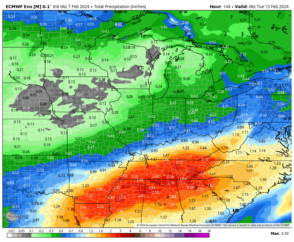
Today’s ensemble guidance (12z total precipitation GEFS and EPS shown below) is showing a northward adjustment in more significant moisture into the Ohio Valley over the weekend into early next week.


We’ll continue to closely monitor the trends over the next couple of days but as of now, we feel confident enough to hit the prospects of rain harder Saturday (still nothing overly heavy but certainly more than guidance suggested over the past few days) and another period of widespread precipitation to open the new work week on Monday. As colder air works into the region over the weekend, this secondary wave of moisture may feature more in the way of wintry conditions across at least a portion of the area. Far too early for specifics beyond this overall idea for this time period, but should wet snow work into the picture for some, the recent warm ground and marginal temperatures would likely limit pavement impacts. As colder air becomes more significant and entrenched down the road, winter weather headlines will likely become more frequent late Feb into March…

Permanent link to this article: https://indywx.com/lunchtime-rambles-trends-for-the-weekend-and-early-next-week/