
 Highlights:
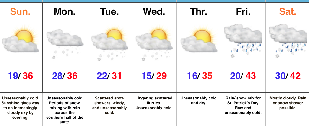
- Unseasonably cold
- Snowy Monday
- Cold week ahead
Sunny, But Cold…We may have sprung forward overnight, but Mother Nature can have a mind of her own. Despite gaining an extra hour of daylight in the evening, temperatures will feel more like the dead of winter this week. With the cold air comes snow chances, as well…
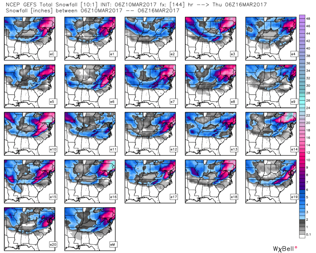
A frigid start to the day is at least accompanied by wall-to-wall sunshine, however, clouds will increase as we progress through the afternoon and evening hours. Eventually those clouds will lower and thicken and give way to snow overspreading the state from west to east during the predawn hours Monday. With marginally cold temperatures during the daytime Monday, we don’t anticipate big travel problems for most of central Indiana. That said, if your travels take you north, prepare for slick travel as a “plowable” snow falls for our neighbors across northern Indiana. As it stands now, we forecast generally an inch, or less, for the city, itself, Monday morning before melting occurs during the daytime. As colder air pours into the state Monday evening, an additional dusting to coating is possible in spots through central Indiana as scattered snow showers and heavier bursts continue into midweek. As mentioned, further north, several inches of snow (2″-5″) will fall for places like Lafayette, Kokomo, Marion and points north. Perhaps an even bigger story will be the cold that follows the early-week snow. Lows will fall into the middle teens for many central Indiana neighborhoods Wednesday and Thursday morning.
Looking ahead, confidence remains low in the late week forecast. That fast-moving northwest flow aloft can (and will) wreck havoc on model solutions and fine tuning will be required as we progress through the week.
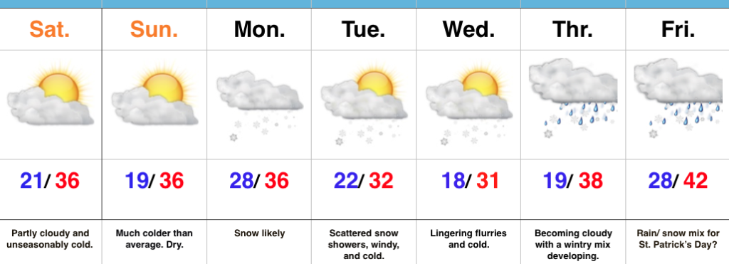
Upcoming 7-Day Precipitation Forecast:
- Snowfall: 1″ – 3″
- Rainfall: 0.25″ – 0.40″
 Highlights:
 Highlights:
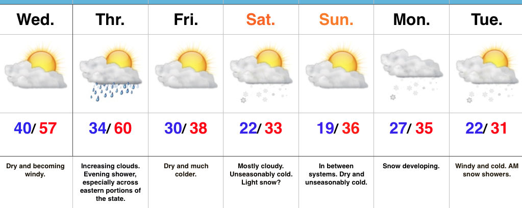 Highlights: