 Highlights:
- Shower and t-storm chances increase late
- Another storm system arrives Monday afternoon
- Late-week questions
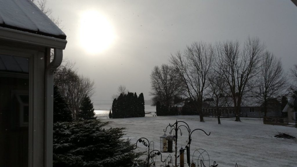
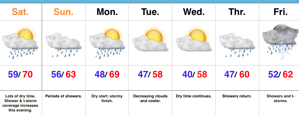
Active Period…Most of Saturday across central Indiana will feature dry conditions. It’s not until we get to Saturday evening and into the overnight that shower and thunderstorm coverage will begin to really increase in earnest. Periods of showers continue Sunday (especially the first of the day day).
A dry start to Monday will give way to increasing cloudiness with showers and thunderstorms arriving by the afternoon and evening hours. This fast-moving area of low pressure will then depart as quickly as it arrives and leave us with dry conditions Tuesday into Wednesday.
We’re then left with late-week questions. The GFS is significantly cooler than the European and we’ll craft this portion of the forecast with a blend- leaning more in the direction of the warmer European solution. Showers and thunderstorms are likely Thursday into Friday.
Upcoming 7-Day Precipitation Forecast:
- Snowfall: 0.00″
- Rainfall: 1.50″ – 2.00″
 Highlights:
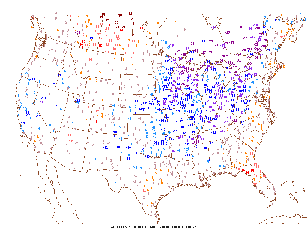 2.) Speaking of cold, to-date, March is running slightly colder than average (by 1.1°). Note the spring and summer-like warmth across the SW. “Pieces” of that warmth will eject northeast in modified fashion late March into April.
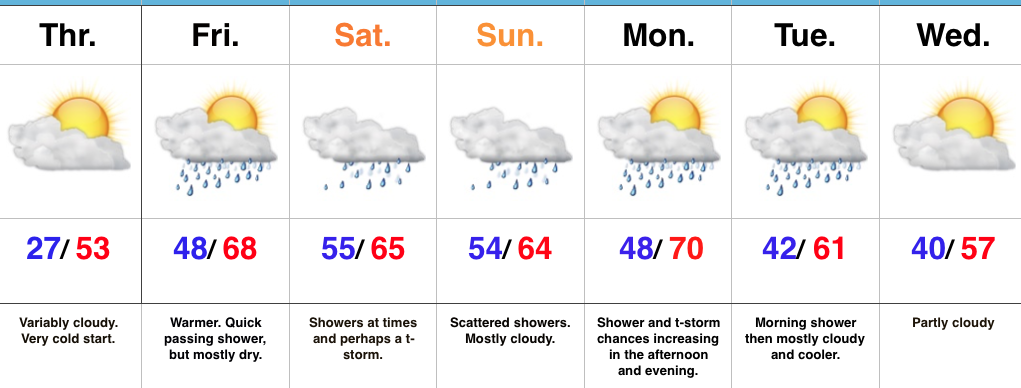
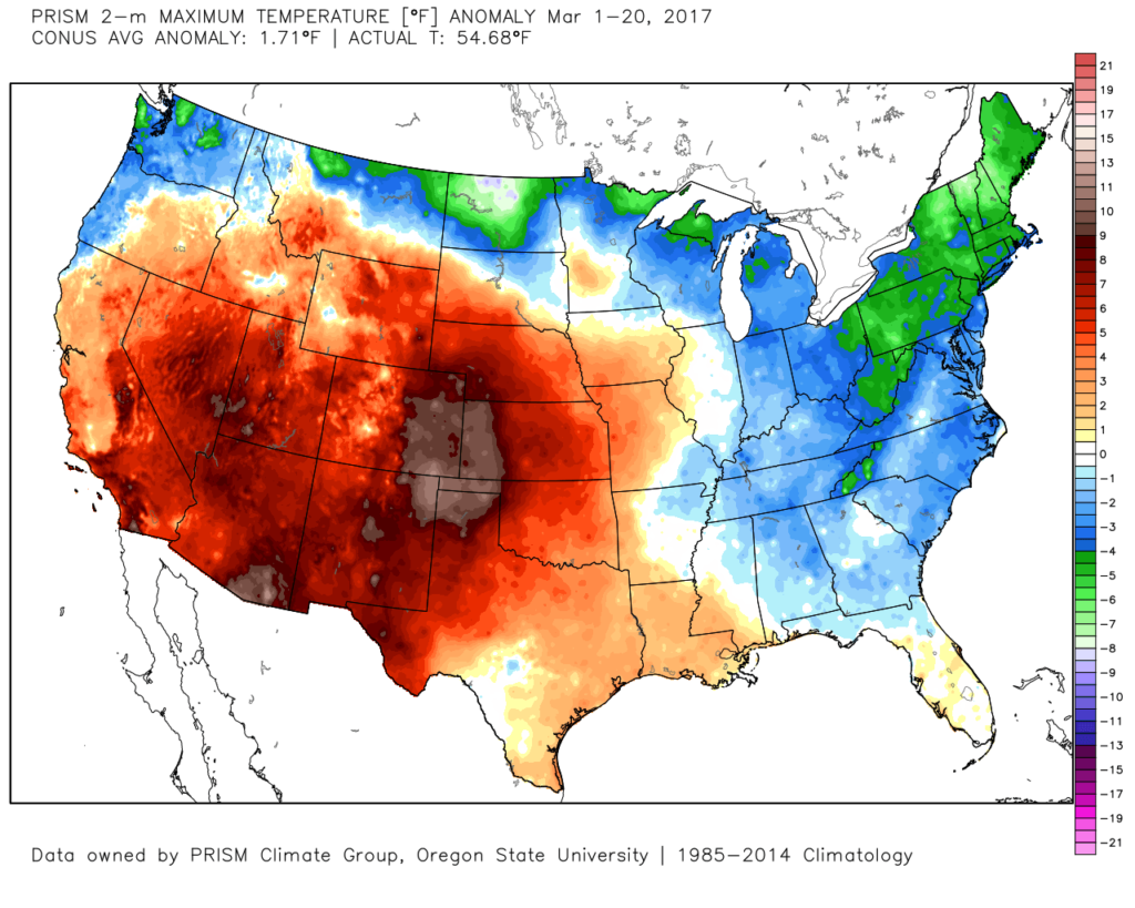 3.) High pressure will supply a dry, but cold Wednesday. Highs will run close to 10° below average (lower 40s), but at least we’ll enjoy the sun!
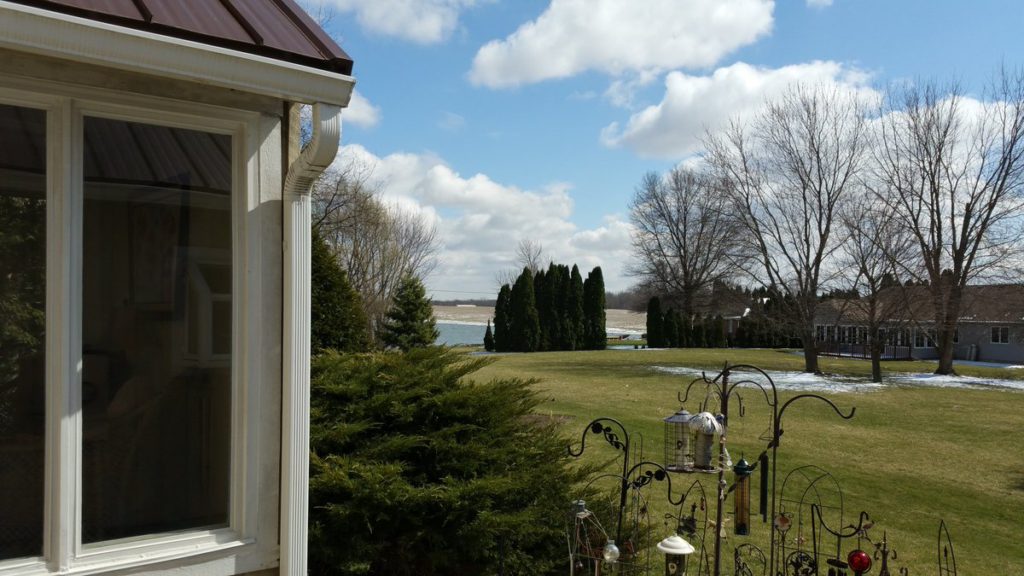
 4.) Temperatures will begin to warm as we progress through the latter portions of the week. We’ll be near seasonal norms Thursday (low 50s), and above normal Friday into the weekend (mid-upper 60s). With the warmer air, rain and storm chances will also be on the increase. As of now, we target best rain chances late Saturday into Sunday. A couple thunderstorms are also possible. Rainfall totals of 0.50″-1.00″ seem like a good bet with locally heavier amounts.
 5.) This is just the beginning of an active stretch of weather to wrap up the month of March. (3) additional storms will have to be monitored next week. Accordingly, precipitation anomalies will run above normal.
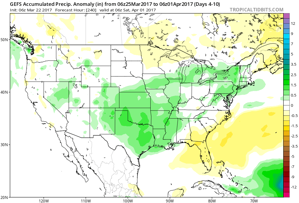
 Highlights:
 Highlights: