
 Highlights:
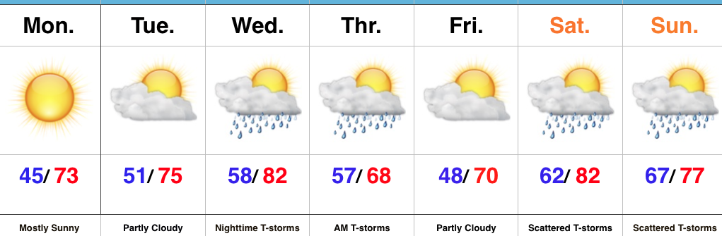
- Sun-filled open to the week
- Midweek storms
- Warm, humid, and stormy weekend
Dry Open To The Week Transitions To A Stormy Finish…High pressure and a refreshing northeast flow will continue to dominate our weather as we open up the work week. Dry skies will prevail and the crisp mornings will warm quickly into the 70s both today and Tuesday.
A cold front will approach late Wednesday and help showers and thunderstorms increase Wednesday night into Thursday morning.
We’ll be in between storm systems Friday and a pleasant close to the work week will result. That said, a warm front will lift north and move through the region Saturday and this will help shower and thunderstorm coverage increase significantly Saturday morning. A much warmer and more humid feel will overspread the area once the front blows through and an unstable airmass will continue to promote shower and thunderstorm chances Sunday. Locally heavy rains are a good bet this weekend.
Upcoming 7-Day Precipitation Forecast:
- Snowfall: 0.00″
- Rainfall: 2.50″ – 3.00″


 Finally, after Saturday morning thunder, we think the majority of next weekend is dry before a cold front brings a return to widespread showers and thunderstorms late Sunday.
 Highlights:
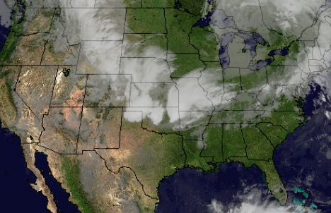
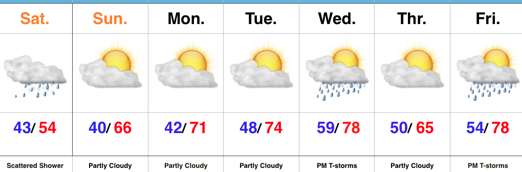
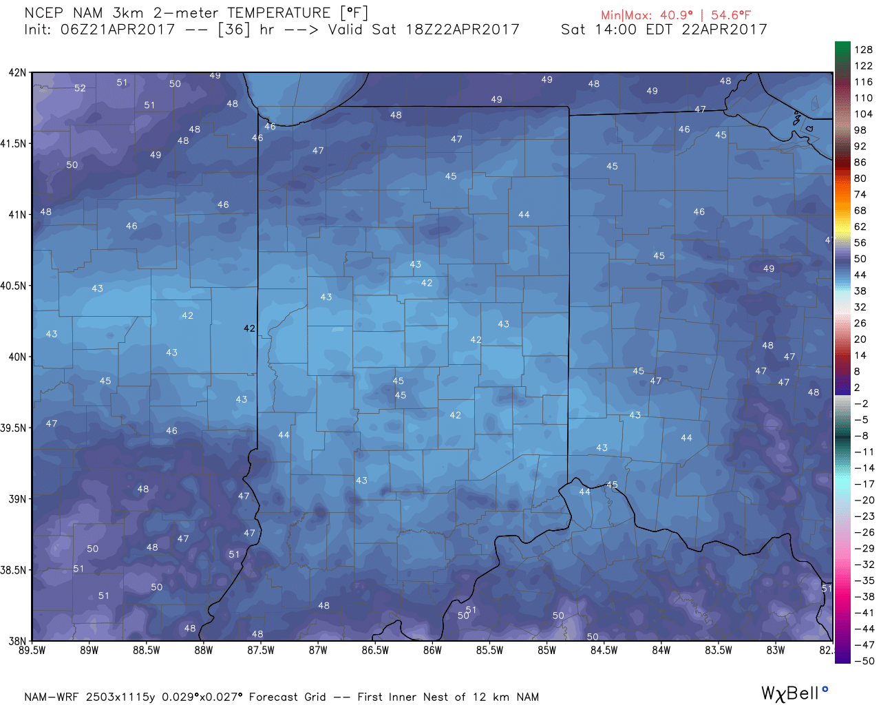
 It’ll be a much cooler day today (temperatures are running close to 20° cooler than this time Thursday morning) with highs only topping out around 60 for the city, itself, and only into the mid to upper 50s across north-central Indiana.
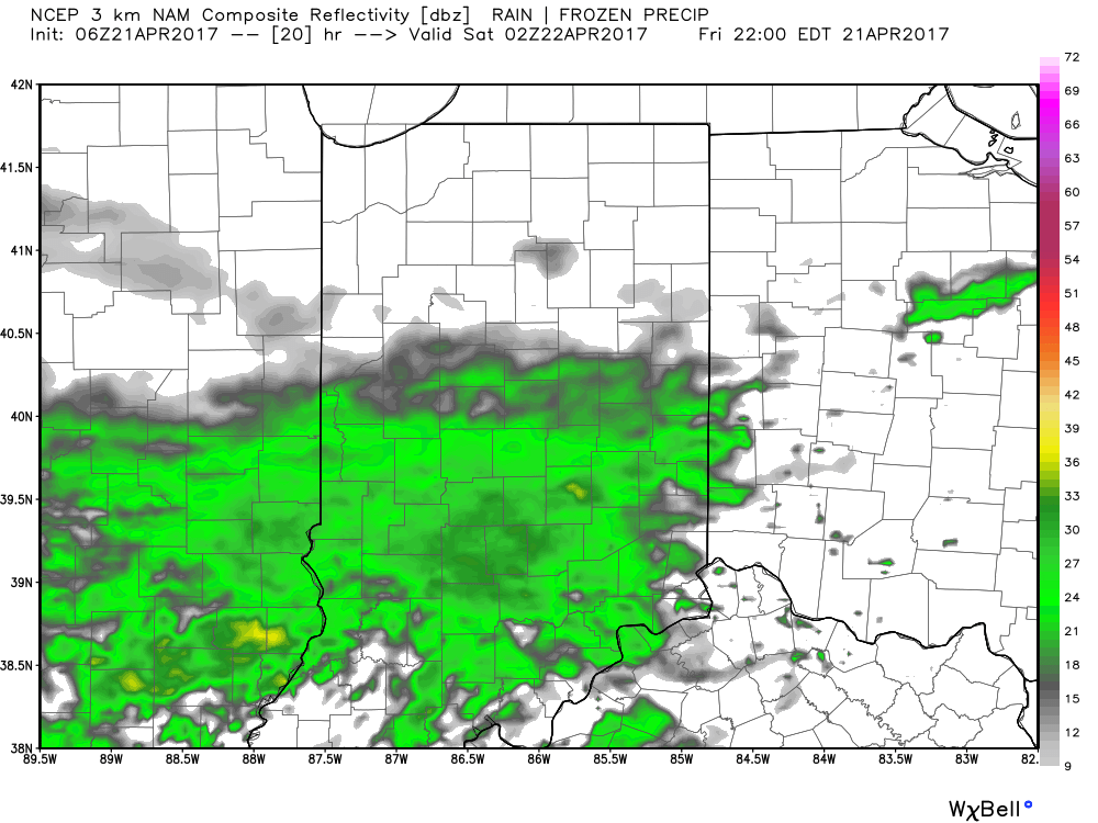
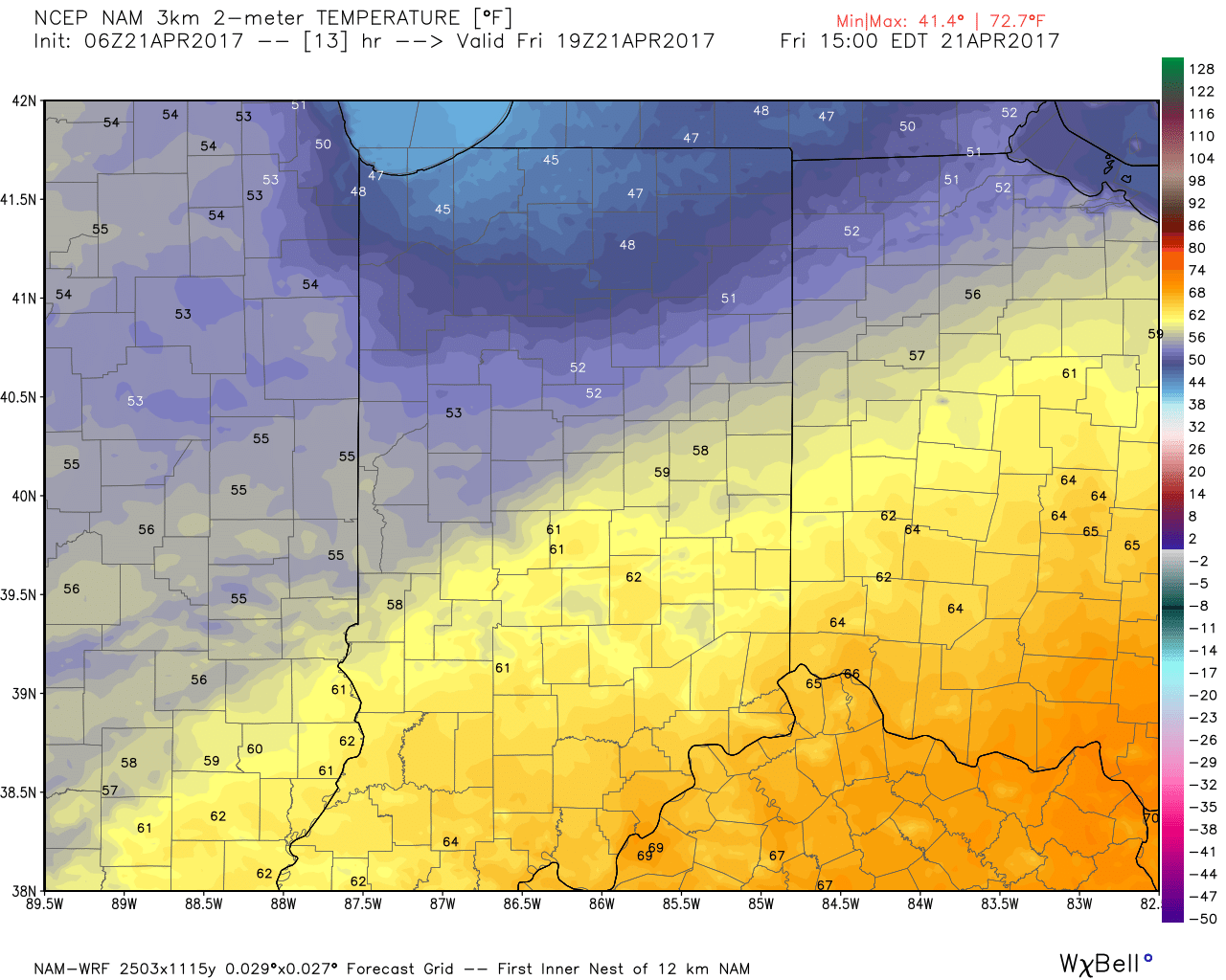 More widespread rain showers will move in overnight into Saturday. Heaviest rain will fall across the southern half of the state (1″-2″ possible). Factor in a strong and gusty easterly wind, temperatures only in the 40s for much of the day, and periods of rain and you have the makings for a downright “raw” Saturday.
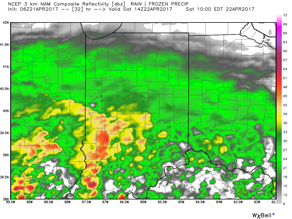
 The good news here is that we still think things dry out for the second half of the weekend. The last round of showers should pull off to the east Saturday night and pave way for a dry Sunday, including increasing sunshine as morning gives way to afternoon.
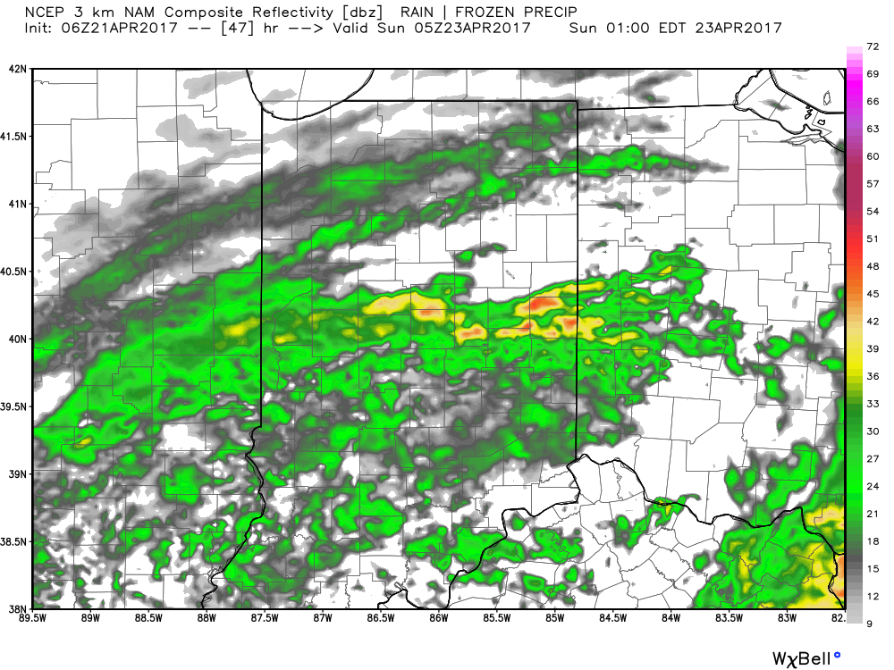 With the increasing sunshine Sunday, temperatures will respond closer to average highs in the middle 60s. After we spend most of Saturday in the 40s that sure will feel nice!
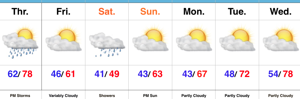 Highlights: