
 Highlights:
- Couple rounds of storms ahead for some
- Drier weather awaits
- Warming up
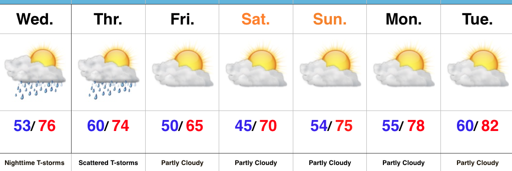
Nice Day Before Storm Chances Ramp Up Tonight…Once we get rid of the patchy fog this morning, a good deal of sunshine can be expected today before our next chance of storms. Better rain and storm chances will arrive tonight, especially north of the city. Locally heavy rain and a strong thunderstorm, or two, can be expected.
Scattered thunderstorms will continue Thursday morning before slowly settling south as we progress into the afternoon hours. This drier trend to end Thursday will be a prelude to the weekend. High pressure will build overhead and supply plentiful sunshine over Mother’s Day weekend, along with warmer temperatures. All-in-all, a well deserved, beautiful weekend awaits.
Dry, warm conditions will continue into early next week.
Upcoming 7-Day Precipitation Forecast:
- Snowfall: 0.00″
- Rainfall: 0.50″ -1.00″ (locally heavier amounts)
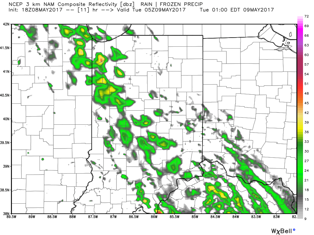
 Showers and thunderstorms will continue to impact the central portion of the state through the rush hour before storms diminish and give way to dry time early Tuesday afternoon.
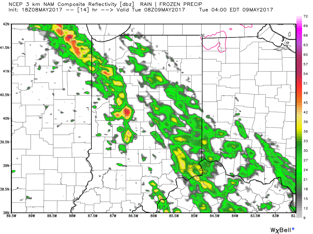
 Unsettled weather will continue as we push through midweek, including another round of showers and thunderstorms late Wednesday into Thursday (likely following a similar path to what tonight’s storms take).
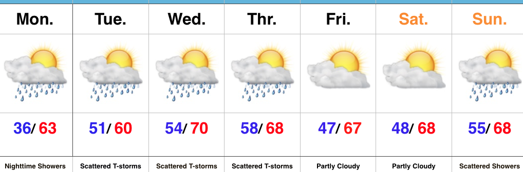 Highlights:
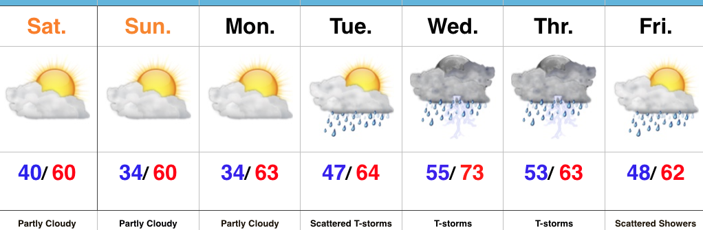 Highlights: