
 Highlights:
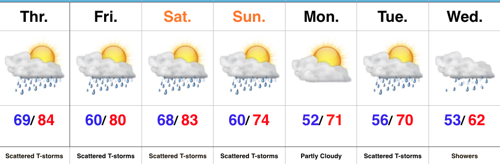
- Sunny open to the work week
- Midweek storms
- Storm chances remain for the long race and holiday weekend ahead
Pleasant Open To The Work Week…High pressure will support dry and pleasant weather conditions as we open up the work week. Expect plentiful sunshine and comfortable conditions to spend time outdoors today! Enjoy!
Unsettled weather will return for midweek as low pressure moves into the Ohio Valley. Scattered showers Tuesday will increase in overall coverage and intensity Wednesday, including the potential of locally heavy rainfall. With all of the clouds and rain around through midweek, temperatures will run significantly below average.
Thankfully, we’ll get a breather Friday, with a mostly dry day expected. We’ll turn the temperature up a couple notches heading into the long race and Memorial Day weekend. Additionally, expect an increasingly muggy feel with scattered thunderstorms returning to the forecast this weekend.
Upcoming 7-Day Precipitation Forecast:
- Snowfall: 0.00″
- Rainfall: 1.50″ – 2.00″
 Highlights:
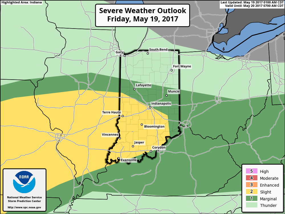
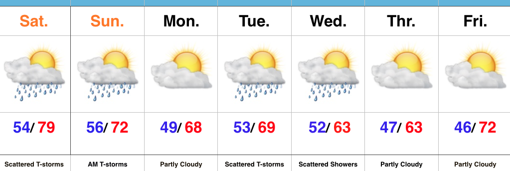
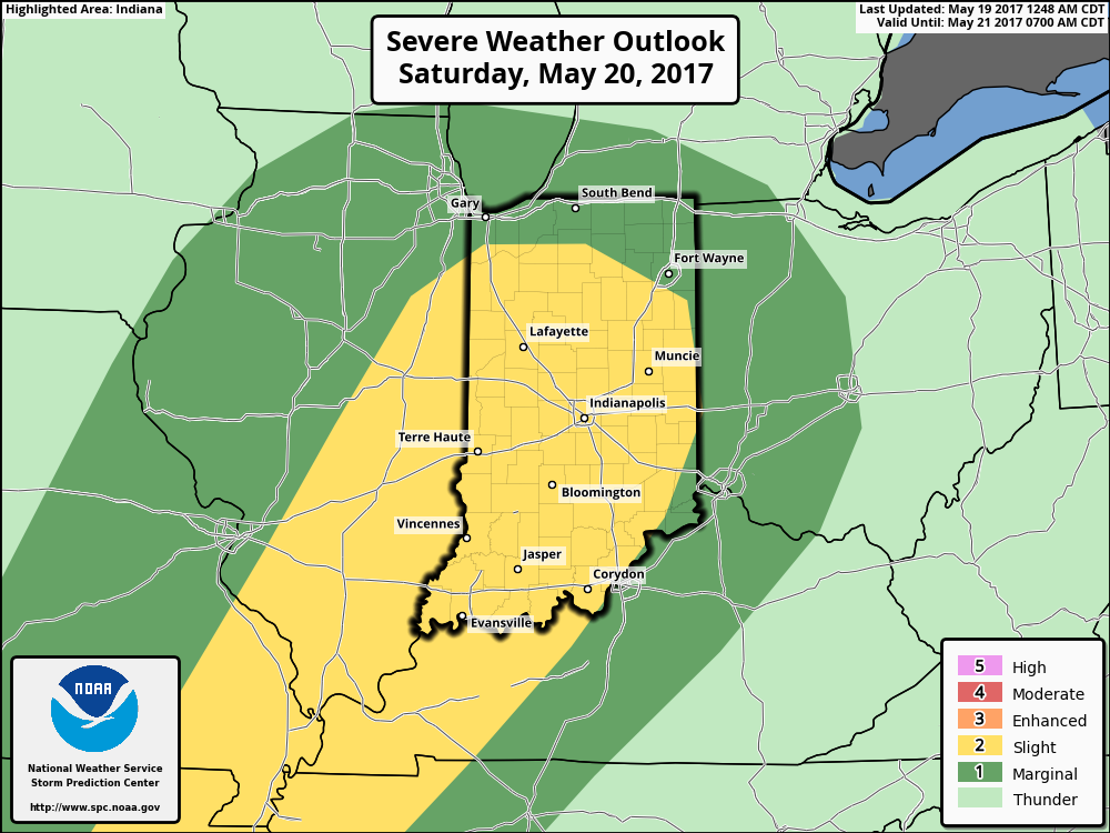 The culprit is a stalled frontal boundary that lies across the center of the state. This front will “bobble” around from time to time over the next 24 hours before lifting back north as a warm front Saturday evening. Accordingly, expect a significant temperature spread from north to south today and periods of showers and thunderstorms scattered about central Indiana. With high precipitable water values, localized heavy rains are expected, but, as mentioned, this won’t be a “uniform” event and there will be “haves and have nots.” Some neighborhoods can expect to pick up a 2-3 inches of rain between now and Sunday afternoon. Greatest severe threats include large hail and damaging straight line winds with storms, but we’ll also have to monitor things for the potential of a couple rotating storms as well.
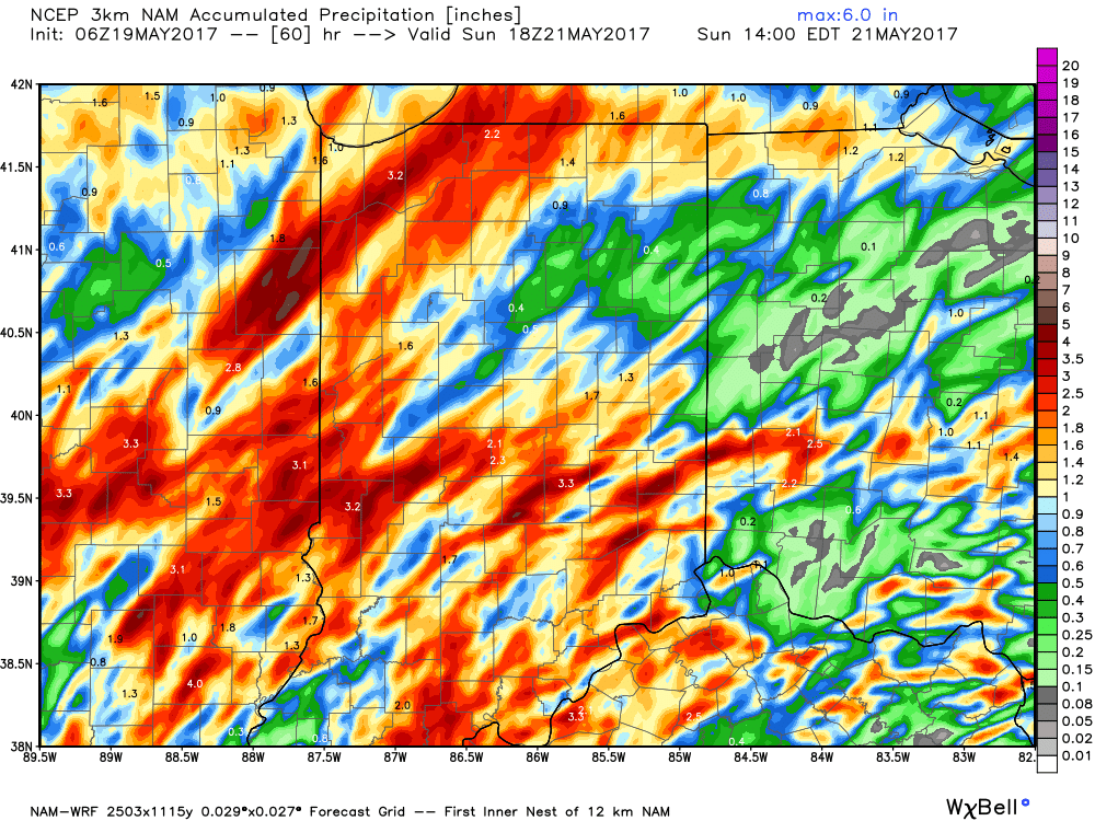
 Highlights: