
You must be logged in to view this content. Click Here to become a member of IndyWX.com for full access. Already a member of IndyWx.com All-Access? Log-in here.
Permanent link to this article: https://indywx.com/video-cool-changes-loom-next-week/
Aug 17
Thursday Morning Weather Notebook: Changes Brewing To Close August…
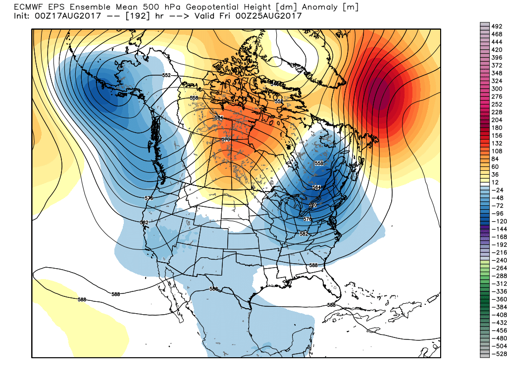
I. A cold front will move across the state this evening. Ahead of the front, a warm and moist air mass will remain in place and the frontal boundary will serve as a “trigger” to ignite scattered to numerous showers and thunderstorms, especially this afternoon and evening. While widespread, uniform rains aren’t anticipated, a couple of strong storms and localized downpours will develop ahead of the front.
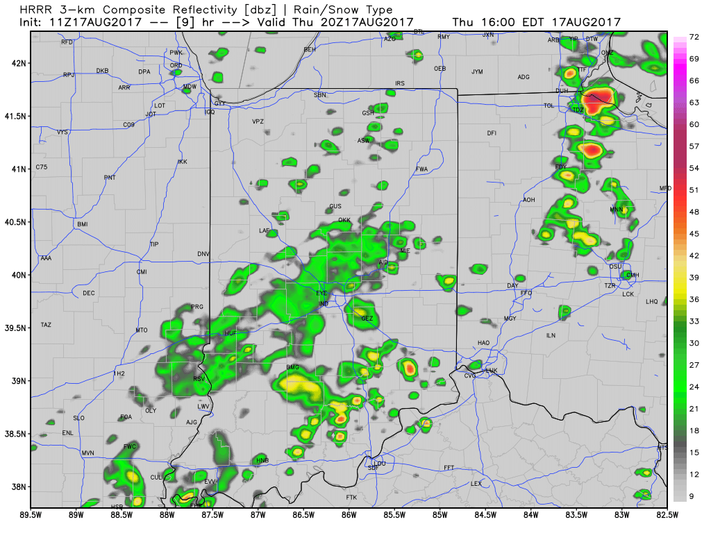
Scattered t-storms will impact the state today.
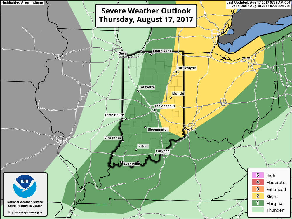
Eastern IN is included in a Slight Risk of severe weather this afternoon.
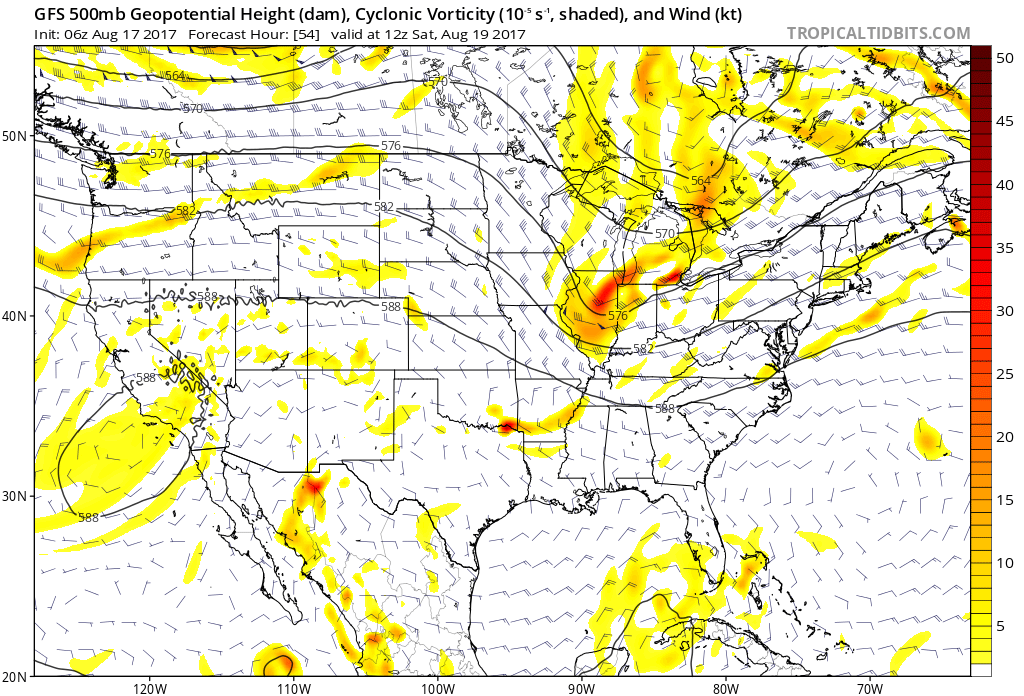
II. After a drier close to the work week (less humid, as well), an upper level disturbance will race across the Ohio Valley Saturday. This will provide enough lift to generate scattered showers and thunderstorms across the region, but all day rains won’t occur.
 III. Ridging will return early next week and, though brief, a shot of late-summer heat will eject northeast across the Mid West and Ohio Valley. Sunday through Tuesday will feature temperatures that top out in the upper 80s to around 90°.
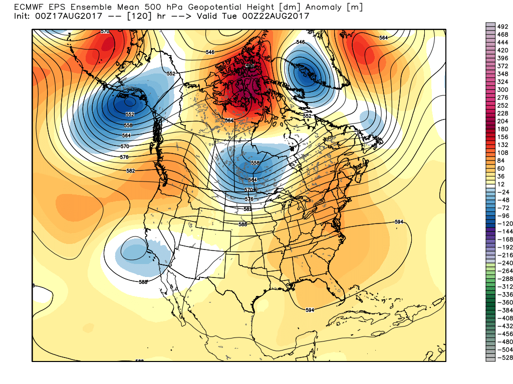 IV. A cold front will drop in by the middle of next week. Scattered showers and thunderstorms will accompany the frontal boundary, but the bigger story will be a dramatic change to a much cooler regime as we get set to put a wrap on the month of August. In fact, temperatures may grow cool enough to allow some 40s to develop across central and northern parts of the state at night. Meteorological summer sure looks like it’ll end with more of a fall-like feel…
Permanent link to this article: https://indywx.com/thursday-morning-weather-notebook-changes-brewing-to-close-august/
Aug 16
Warm And Muggy; “Splash And Dash” Storms…
 Highlights:
- Scattered storms
- Saturday showers
- Surge of heat ahead of a late week cool down next week
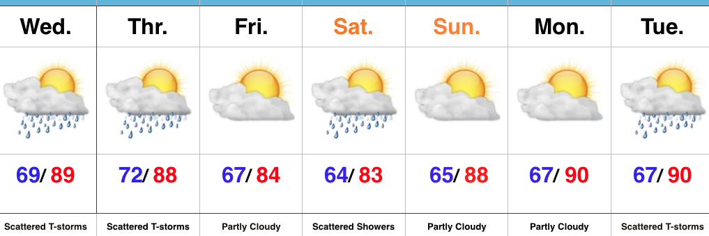
More Dry Time Than Stormy…A warm and moist southwesterly air flow will have things feeling quite muggy today. This tropical feel will also help fuel scattered thunderstorms by evening, continuing into tonight. While everyone won’t get wet today, those that do have the potential of picking up a quick 1″ in a short period of time. A cold front will cross the state Thursday and will keep scattered showers and thunderstorms going. While this isn’t a uniform soaking, we’ll take what we can get as things have been bone dry around these parts lately.
After a quiet and slightly cooler Friday, an upper level disturbance will deliver another round of showers and embedded thunderstorms Saturday. Dry weather will return to wrap up the weekend Sunday.
Looking ahead, a surge of heat, albeit brief, will have things feeling quite toasty around the Mid West early next week. We think we flirt with, or exceed, the 90° mark both Monday and Tuesday. Thunderstorms will increase Tuesday as a cold front drops in from the northwest. Behind the front, data still paints a much cooler regime for the second half of next week; fall-like!
Upcoming 7-Day Precipitation Forecast:
- Snowfall: 0.00″
- Rainfall: 0.75″ – 1.25″
Permanent link to this article: https://indywx.com/warm-and-muggy-splash-and-dash-storms/
Aug 15
VIDEO: Storm Chances Return And We Look Ahead To Meteorological Fall…
You must be logged in to view this content. Click Here to become a member of IndyWX.com for full access. Already a member of IndyWx.com All-Access? Log-in here.
Permanent link to this article: https://indywx.com/video-storm-chances-return-and-we-look-ahead-to-meteorological-fall/
Aug 14
Classic Mid-August Weather…
 Highlights:
- Dry open to the work week
- Unsettled times return
- Cooler air heading into the weekend
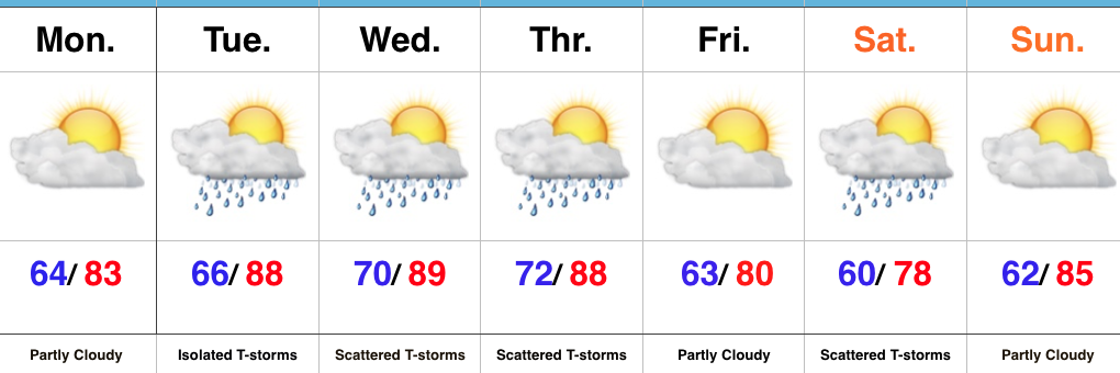
Storm Chances Begin To Increase…While southern portions of the state will get wet today, dry air should result in a rain-free Monday here across central Indiana. That will begin to change later this week as moisture returns and that muggy summer feel develops for midweek. In addition to the increasingly humid nature to our airmass, a cold front will approach from the west. Coverage of storms tomorrow should remain few and far between (isolated), but overall coverage will increase Wednesday into Thursday (scattered to numerous).
The cold front will sweep to our east Thursday night and result in a beautiful close to the work week, complete with cooler temperatures and lower humidity levels. The weekend will feature a disturbance dropping in from the northwest and this will be sufficient enough to kick up scattered showers and thunderstorms Saturday afternoon and evening before dry times return Sunday.
Upcoming 7-Day Precipitation Forecast:
- Snowfall: 0.00″
- Rainfall: 0.50″ – 1.00″
Permanent link to this article: https://indywx.com/classic-mid-august-weather/
