Heavy Rain This Morning; Nighttime Storms…
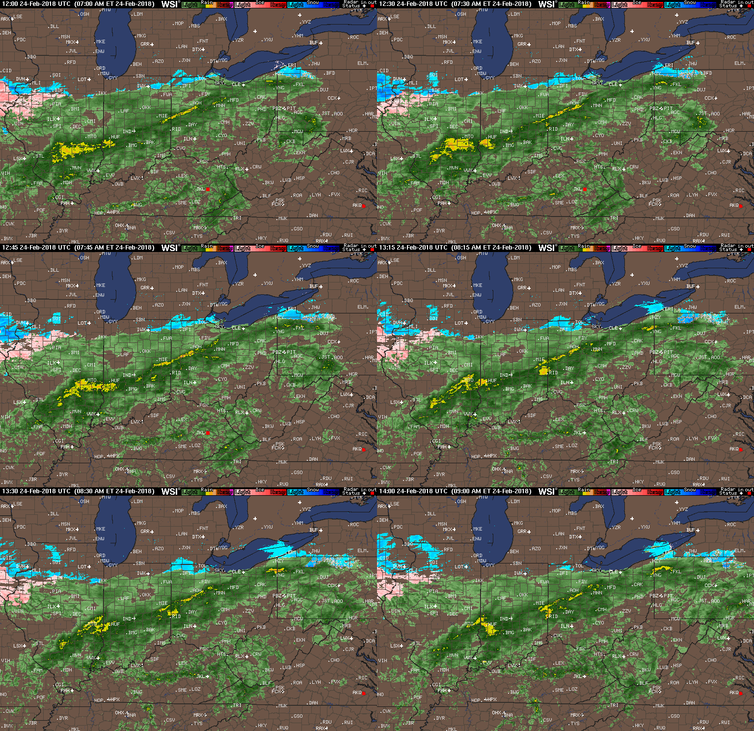 Our Saturday morning will be dominated by soaking rains as moisture continues to stream across the Midwest and Ohio Valley, including central Indiana. Add in temperatures in the lower to middle 40s and you have our official approval to sleep in this morning. 🙂
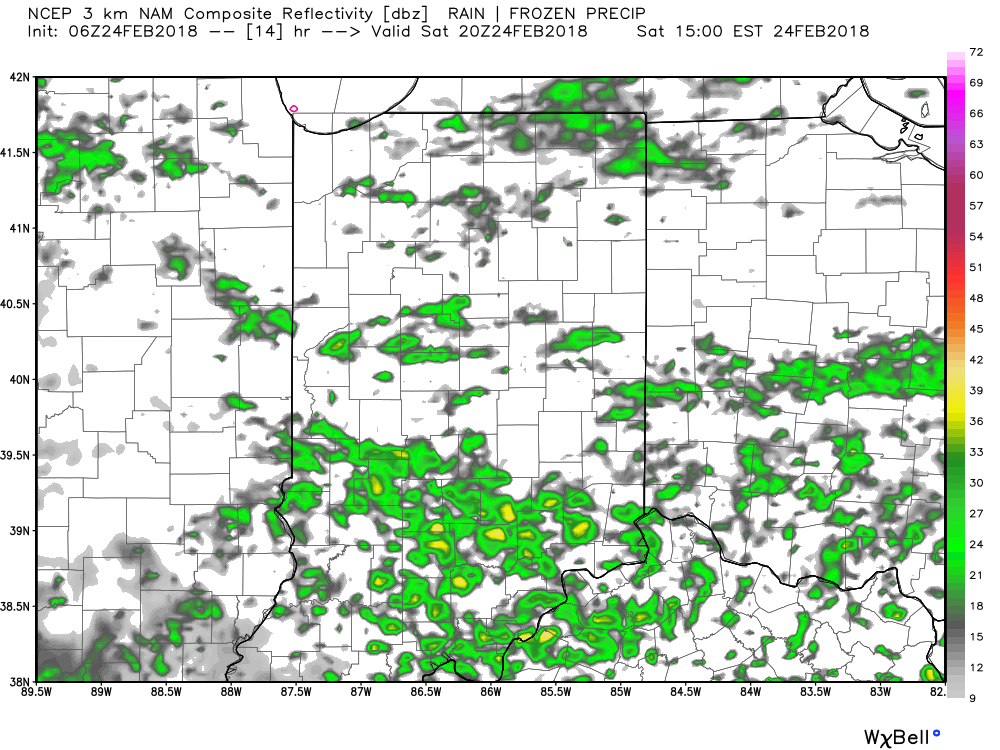
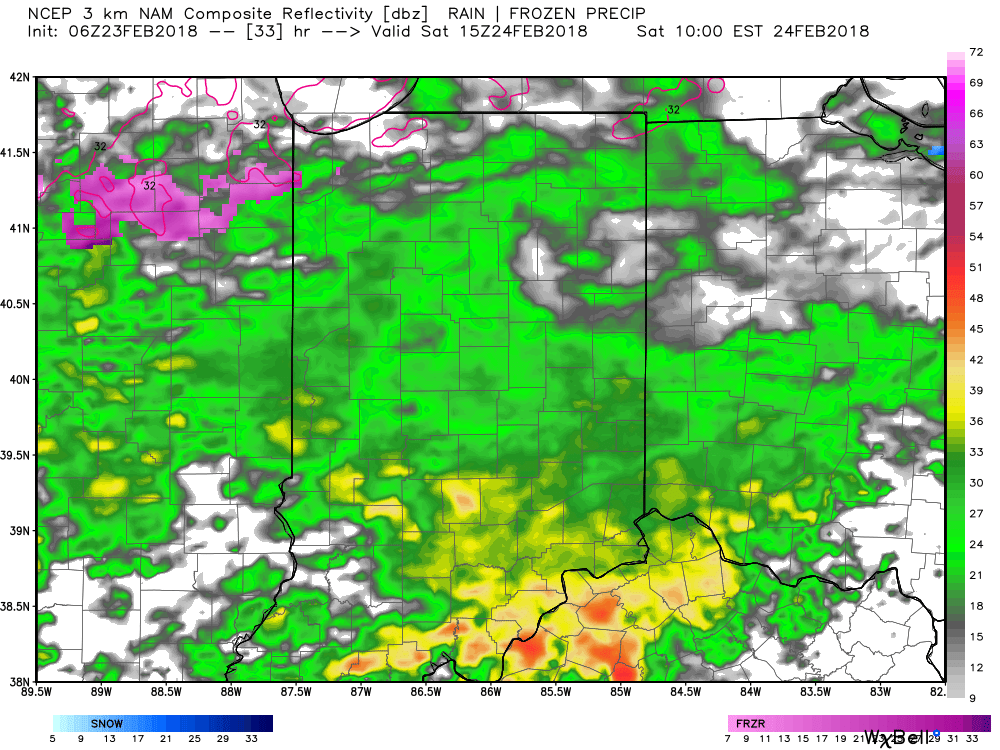
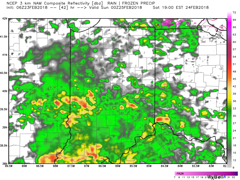
Steady rain will give way to briefly drier conditions early to mid afternoon. While scattered showers will still be present, widespread moderate to heavy rain will diminish. Here’s a look at the forecast radar at 3p:
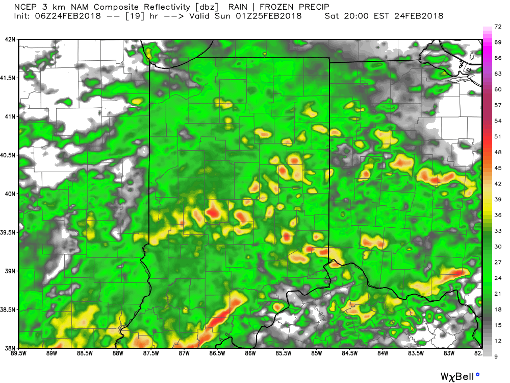
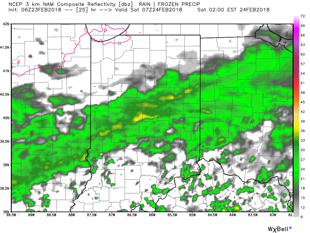
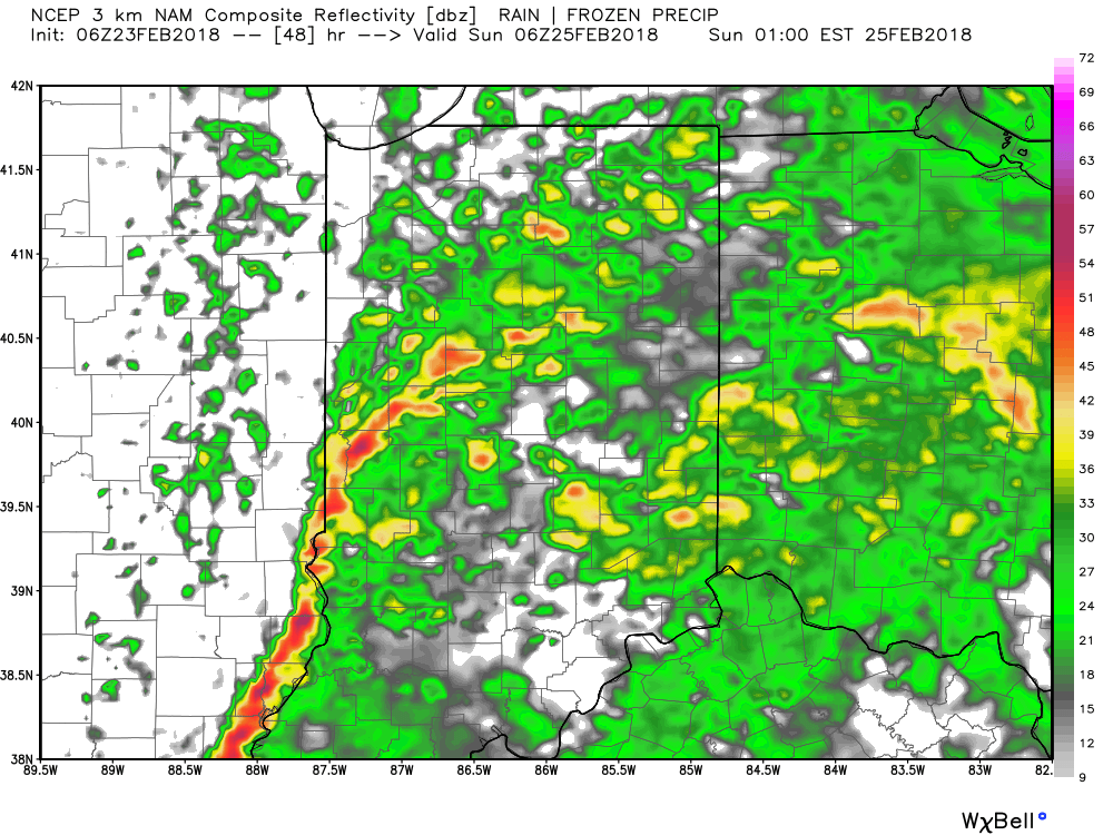
 Widespread rain and embedded thunderstorms will return by evening, and forecast radar products at 8p and 2a Sunday show the stormy times well:
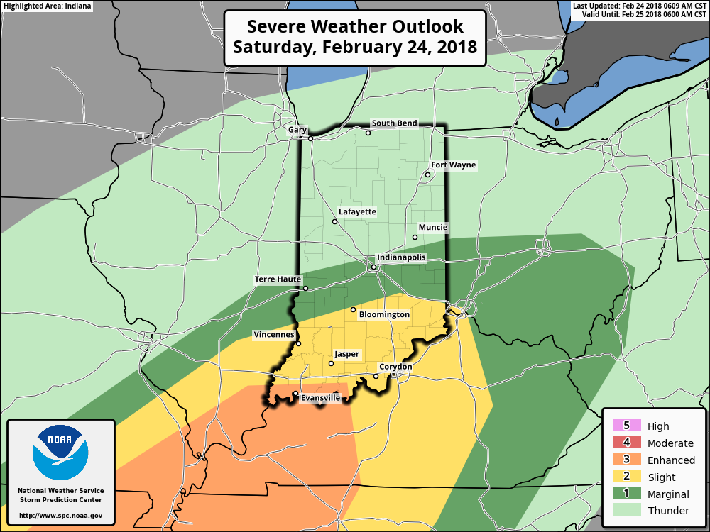
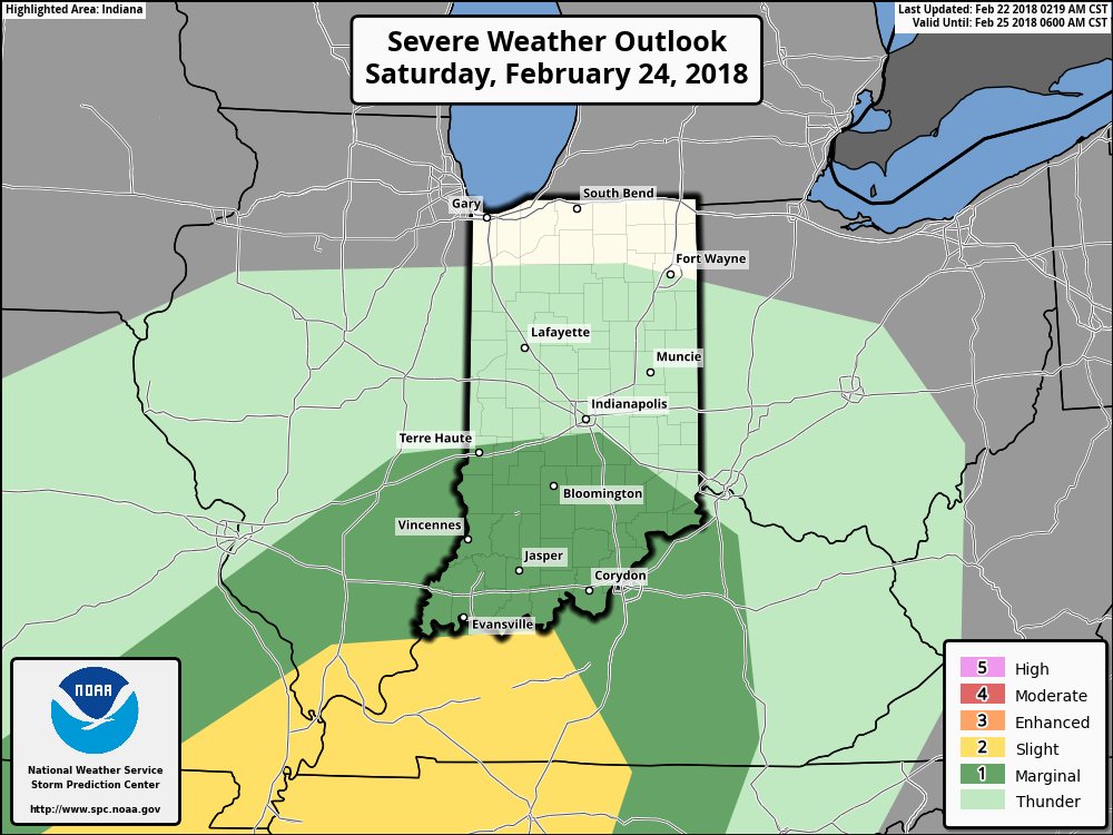
 A couple of storms may become strong to severe (especially downstate). Accordingly, the Storm Prediction Center has expanded the threat of severe weather to encompass more of the state.
We’re most concerned for the potential of stronger storms to produce damaging winds, but an isolated tornado can’t be ruled out tonight. Additionally, we’ll also have to be on guard for potential of flash flooding as storms will be capable of torrential rainfall. Heavy rain falling on already saturated soils may lead to problems in spots tonight into early Sunday.
 After early morning storms head east Sunday, high pressure will build in with drier conditions and increasing sunshine Sunday. It’ll be a very nice close to the weekend, and calm, pleasant conditions will continue as we progress through the early portions of the new work week.
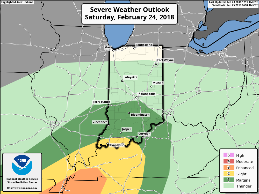

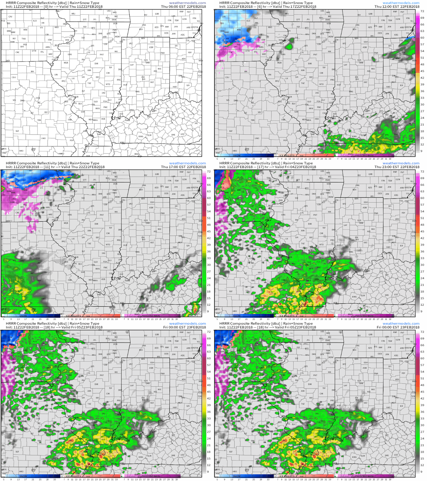 Embedded thunderstorms may target southern Indiana late tonight and Friday morning before more widespread thunderstorms (a couple could become strong) Saturday. The Storm Prediction Center (SPC) has included the southern half of the state in a “marginal risk” of severe thunderstorms Saturday.
 All total, additional rainfall between now and Sunday morning should reach 2″ to 3″ across a widespread portion of the southern half of Indiana with locally heavier amounts.
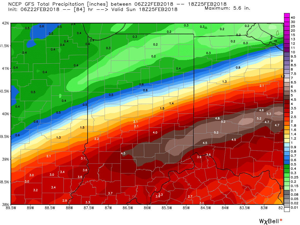 We’ll finally dry things out as we close the weekend and head into early next week as high pressure settles overhead.
 Next week will begin a pattern transition from the unseasonably warm weather we’ve enjoyed as of late to a colder regime for the first half of March. We note models continue to tank the NAO and AO.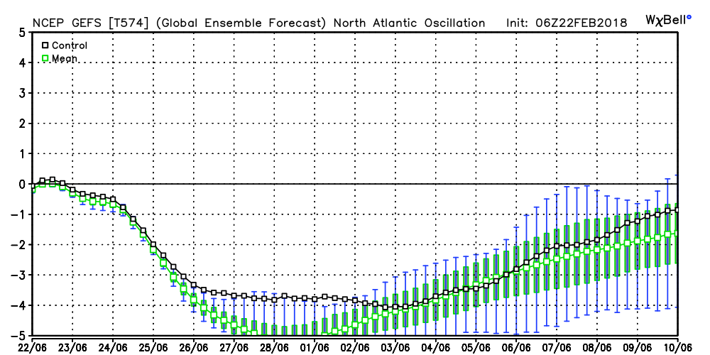
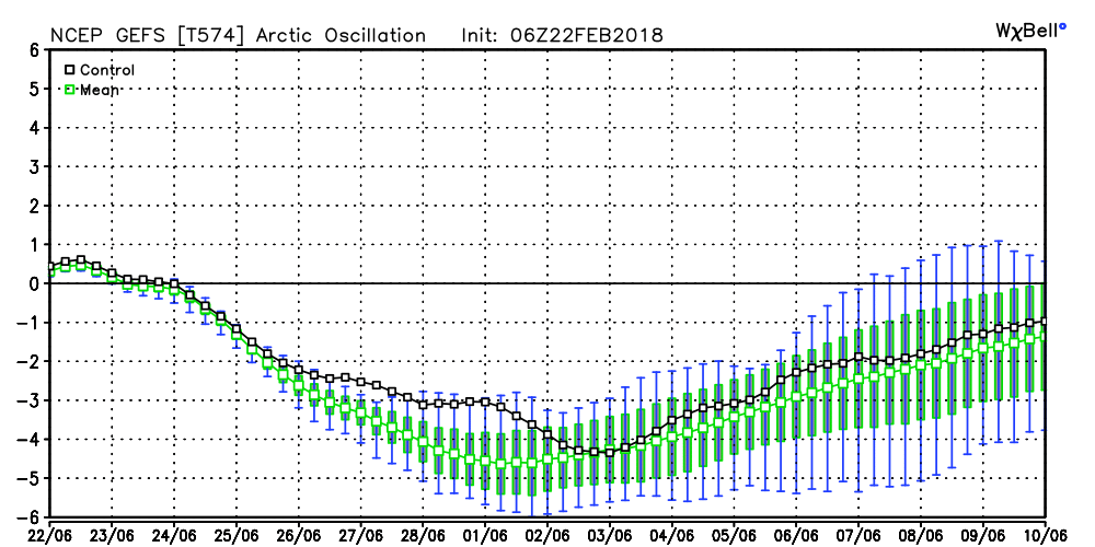 Accordingly, the models are seeing the trough and associated colder than average pattern returning to the eastern half of the country as we rumble through the first half of March. With such a strong block in place, this can turn into an active pattern for a couple weeks to go along with the cold. Both the GEFS and EPS agree on the overall look.
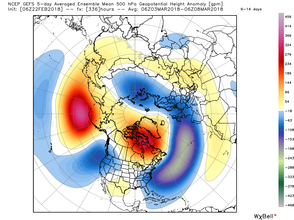 While there’s no way to get specific on the individual storm threats that will eventually come with this pattern, the potential is present for a few storms to “bowl” underneath the block through the first 10-15 days of the month. Each storm will have the capability of delivering wintry precipitation, but this can also be a tricky time of year where most, if not all, ingredients need to come together to create significant wintry events. In a winter that’s been frustrating to central Indiana snow lovers (frigid, but dry first half and milder, wetter second half), perhaps it would be fitting to get a couple good snow dumps in March (when most are wanting and ready for spring)…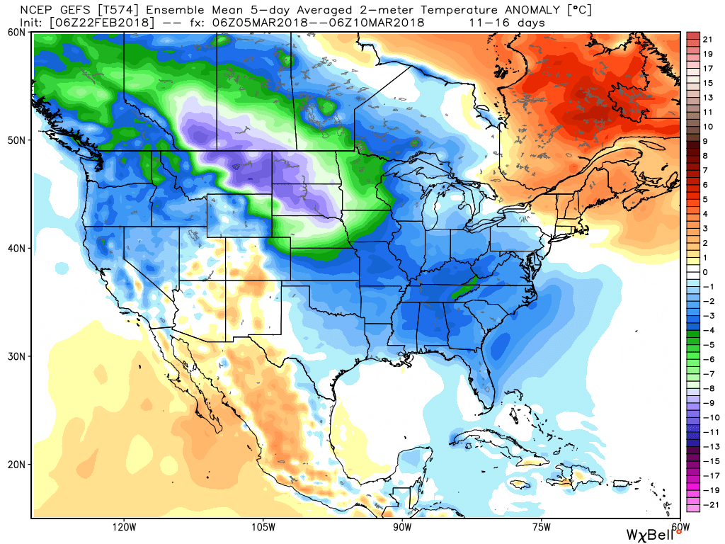
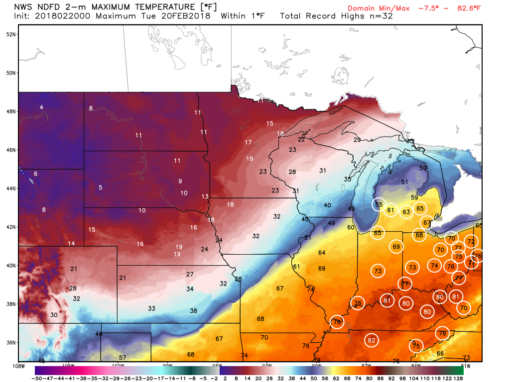 Steadiest rains will fall across the northern third of the state Tuesday with scattered downpours through the morning and afternoon hours across central Indiana.
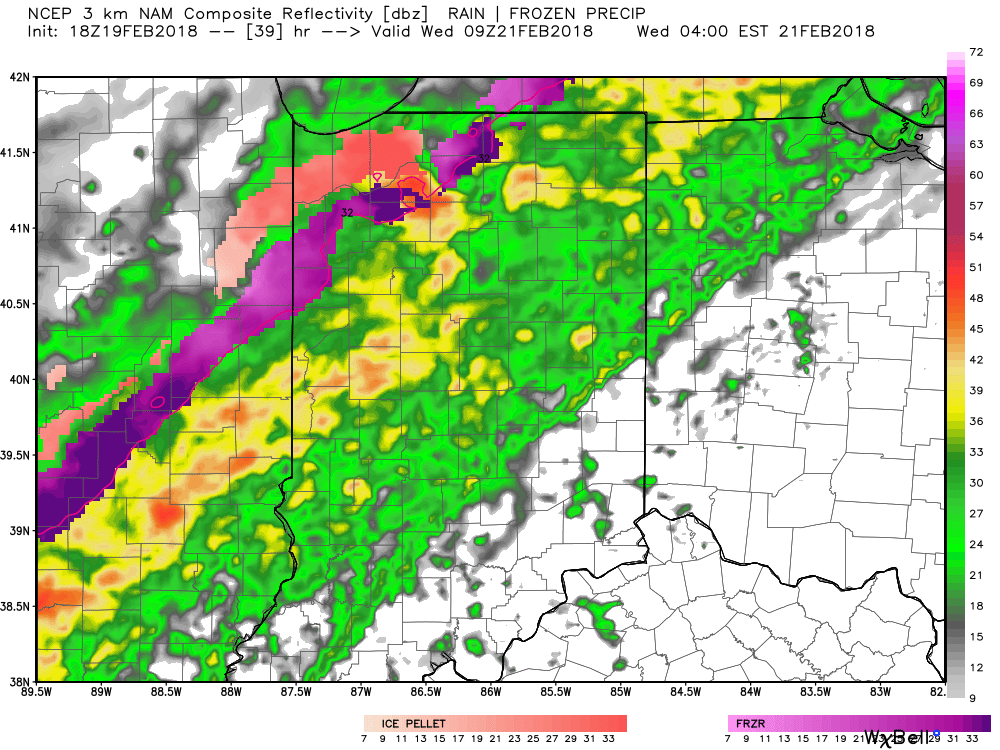
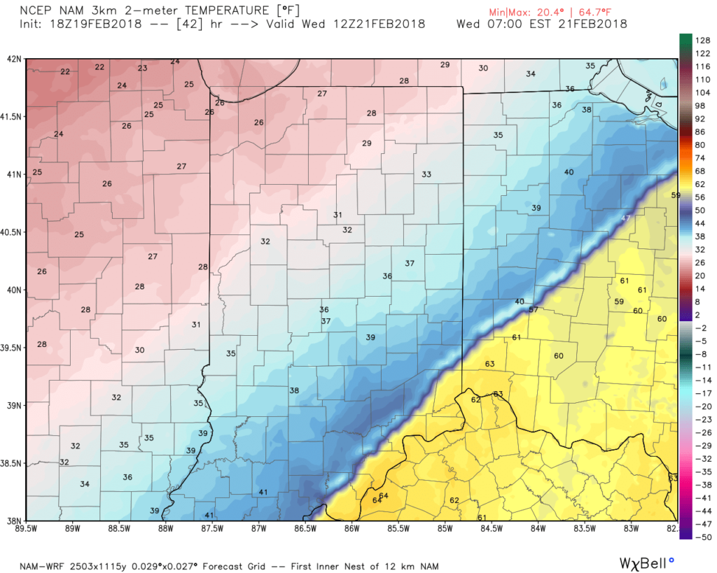 After a quieter time of things most of Thursday, we’re tracking three additional waves of moisture Friday and through the weekend. At times, rain will be heavy, and we’ll certainly have to be on guard for water rise and increasing flooding issues as the weekend arrives.
 By the time all is set and done Monday morning, we forecast additional widespread 3.5″ to 5″ rainfall totals with locally heavier amounts.