
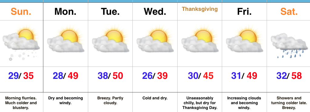
High pressure will remain in control of our weather as we open the short Thanksgiving week. This will supply plentiful sunshine today, along with an increasingly gusty southwest wind by this afternoon (30 MPH). A cold start (most in the middle 20s) will moderate to near seasonal norms by this afternoon (upper 40s to around 50).

A tightening pressure gradient will result in gusty winds this afternoon.
Reinforcing chilly air will blow into town Tuesday night. Ahead of this, weak moisture return will lead to a few showers Tuesday afternoon. Winds will shift to the northwest Tuesday night and help push a colder air mass into the state. This colder than average theme will continue for Thanksgiving Day, itself. Highs in the lower 40s Wednesday and Thursday can be expected with lows in the middle to upper 20s. Dry weather will quickly return Wednesday and Thursday.
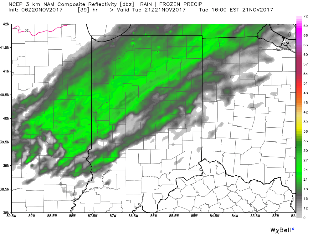
A few light showers will move into town Tuesday afternoon.
Finally, another weak weather maker will approach late Black Friday into the holiday weekend. This cold front will be enough to generate showers Saturday and will help push another shot of chill into the area as we close the weekend. Similar to Tuesday afternoon’s rain, amounts will be very light. In fact, total rainfall with both systems should fall in the 0.10″-0.25″ range.

 Highlights:
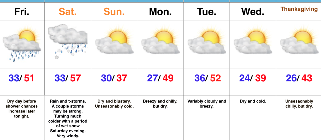 Highlights:
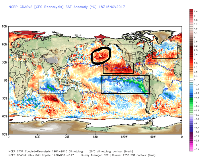
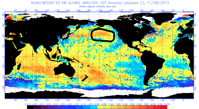
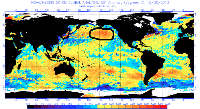
 What makes seasonal forecasting so challenging (and fun :-)) are the multiple features that can impact a forecast. We’ve talked about the importance of ENSO (various types of Nino and Nina events) in past updates, as well as low solar and QBO. All of these moving parts and pieces are coming together in a manner that seems to be favoring more of a cold, wintry regime, locally, this year. Is that us saying another blockbuster 2013-2014 winter awaits? Absolutely not (there are other differences noted above with the SST configuration). However, it is suggesting that this winter will be absolutely nothing like the past couple…
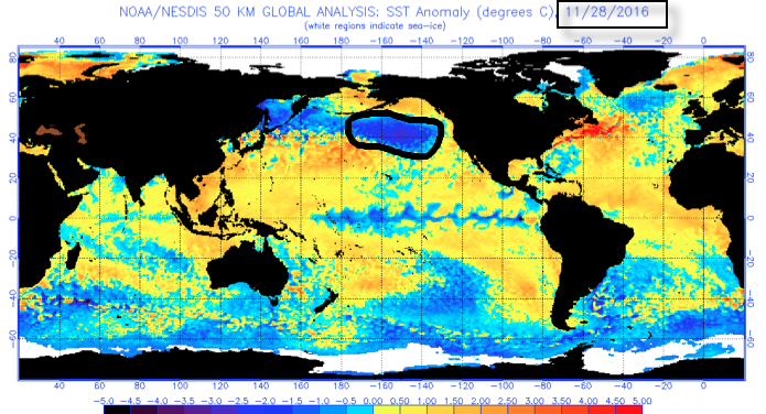