
 Highlights:
- Mild open to winter
- Christmas weekend snow
- Cold returns
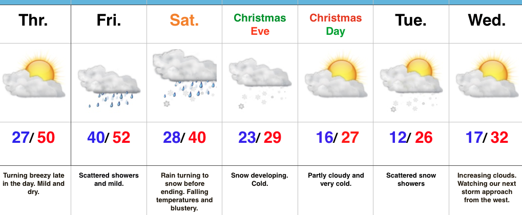
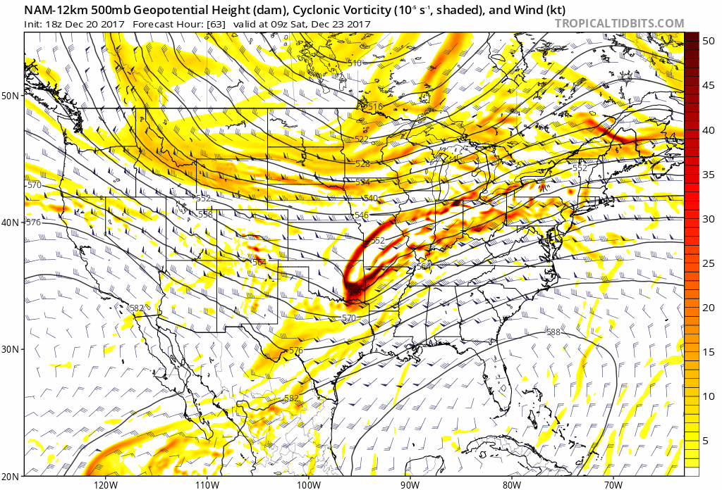
Pleasant Open To Winter…It’s a state divided today as clouds dominate across northern portions while the majority of central and southern IN will enjoy plenty of Vitamin D! It’ll also be unseasonably mild today and Friday as a southerly air flow returns in advance of an approaching cold front. That cold front will deliver spotty showers Friday and an area of low pressure will track along the boundary Saturday. This will result in more widespread rain overspreading the region Friday night into the day Saturday. As colder air begins to filter into the region, we’re still thinking a narrow band of wet snow will develop along the northern shield of precipitation Saturday morning.
Turning our attention to Christmas Eve shows upper level energy moving across the Ohio Valley and this will likely result in an expanding area of snow across the region. If trends continue, we’ll have to bust out the first snowfall map of the season Friday morning. Are you dreaming of a White Christmas?
A cold pattern will engulf the region next week and we’ll await the middle and latter portions of the week for the potential of additional wintry mischief. From this distance, it appears this very well may be a significant event.
Upcoming 7-Day Precipitation Forecast:
- Snowfall: 1″ – 3″
- Rainfall: 0.25″ – 0.50″
 II.) Additional upper level energy will rotate across the Ohio Valley Christmas Eve and this, combined with arctic air pushing into the region, should maximize moisture production and lead to a period of snow and snow showers Christmas Eve afternoon into early Christmas Day. This energy should feature some Christmas “magic” and be enough to provide a more widespread light accumulation across the region (when compared to Saturday).
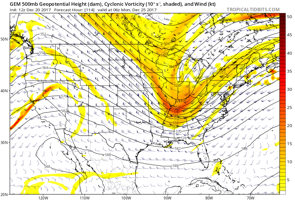 III.) As we look forward to middle and latter parts of next week, the pattern screams potential is on the table for a more widespread, significant winter storm (Plains to the Northeast). While obviously early on in the game, the overall pattern does back up the idea presented by modeling.
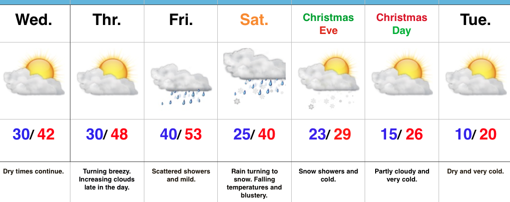 Highlights:
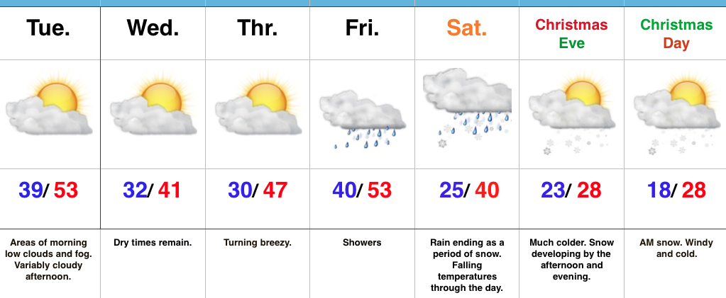 Highlights: