Overnight Storms Serve As A Small “Speed Bump” To A Gorgeous Weekend…
The morning is starting off on a beautiful note- brilliant blue skies (aside from a little patchy fog for northwestern ‘burbs early on), lower humidity, and temperatures around 60°. Pleasant conditions will continue today with plentiful sunshine and highs topping out in the middle 80s.
A cold front will approach late tonight, passing through central Indiana Sunday morning. This will deliver scattered thunderstorms during the overnight and pre dawn hours Sunday.
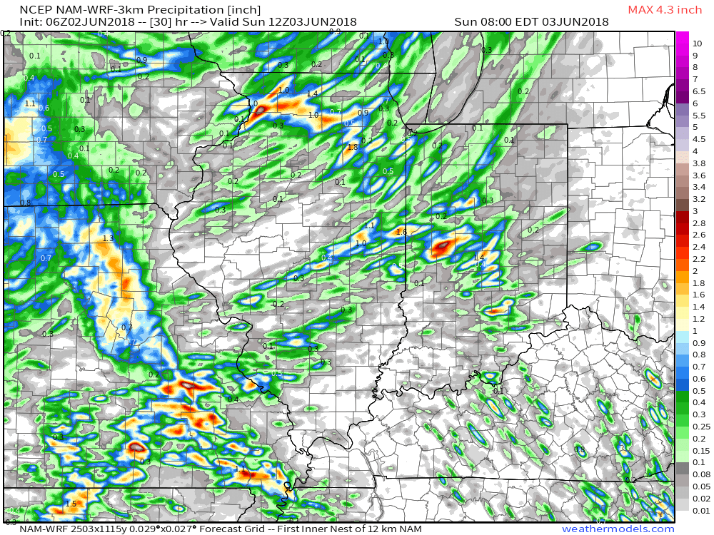
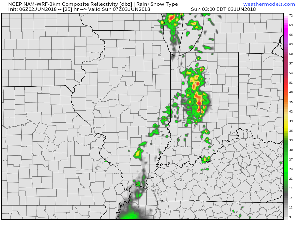 Unfortunately, this won’t be a widespread soaking rain, but there will be a few neighborhoods that cash in on locally heavy downpours. Where thunderstorms track, a couple of 1″+ reports can be expected.
 A pleasant air mass will arrive on the scene for the second half of the weekend and remain with us into early next week. With lower humidity in place, overnight lows will fall into the 50s early next week.
Dry conditions will remain as high pressure gains control before thunderstorm chances return by the middle of next week.

 Upper level energy will push east this afternoon and combine with an unstable air mass, along with unseasonably hot and humid air (highs today will reach the lower 90s across the southern half of the state with dew points around 70°), resulting in explosive thunderstorm development this evening. Storms will rumble east during the nighttime hours before exiting off to the east and diminishing during the early morning hours.
 We target the time frame of 6p to midnight for greatest storm coverage and the possibility of severe weather. While the greatest threat of severe is just south of the city, itself, I think all of central IN is in play for the possibility of strong to severe thunderstorms tonight. In addition to locally heavy rain, stronger storms could pose a damaging straight line wind threat along with large hail.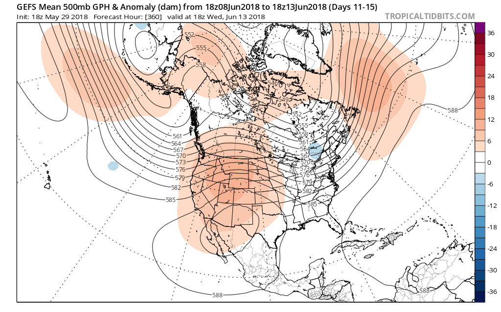
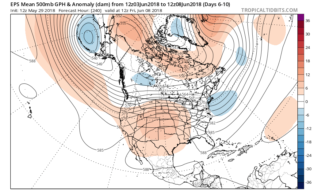 In addition to a wetter pattern, we would also want to pay attention to the potential of a gusty storm complex or two riding southeast around the hot dome off to our southwest.
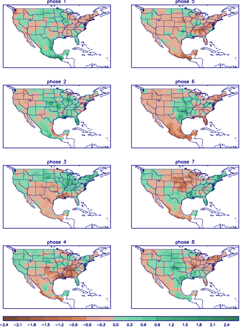 In closing, the JMA Weeklies led the charge in the idea of more active times returning in June, and the combination of GFS and European ensemble data suggests they had merit. With the added bonus of having the MJO on our side, it’ll be hard to avoid a change of the guard towards an overall wetter pattern in the weeks ahead. Perhaps Alberto’s remnant moisture is only the beginning…