Tuesday Morning Rambles: Drier Air Before Our Next Front…
I. Drier air will work into the region and limit rain chances today and Wednesday (isolated coverage at best). Highs will also warm back up to seasonal levels during the time.
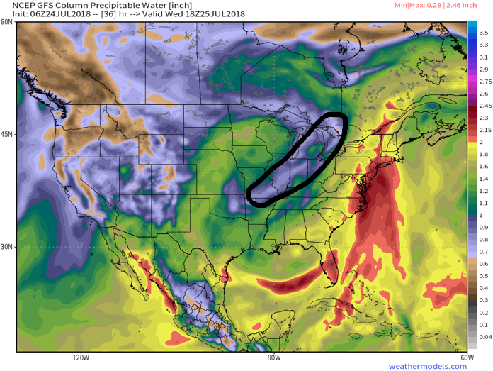
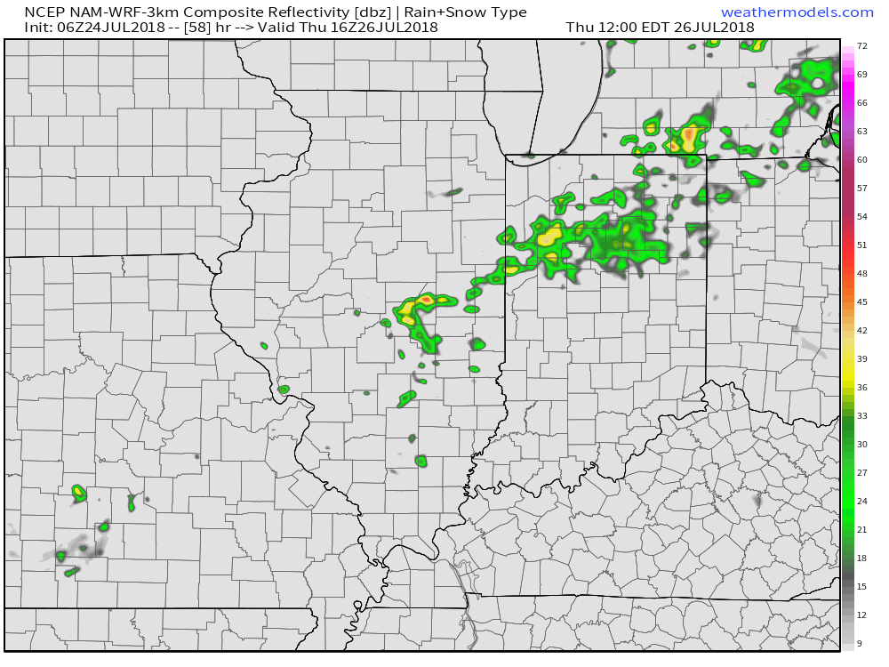
II. Our next frontal boundary will arrive Thursday afternoon. Scattered showers and a few thunderstorms are expected ahead of the front during the afternoon and evening hours. Behind the boundary, cooler and refreshing air will return to wrap up the work week.

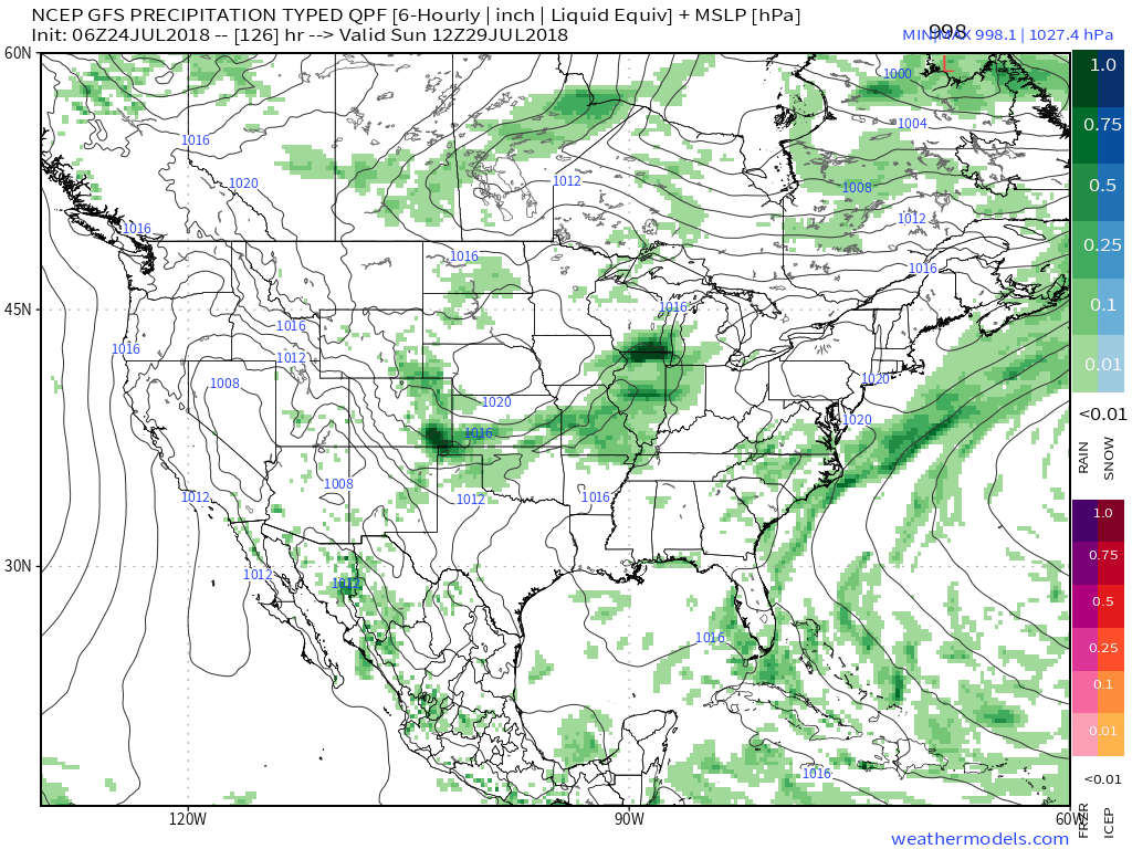
III. We’re timing out our next storm system for a weekend arrival. While the weekend won’t be a wash out, rain chances will return late Saturday into Sunday. Forecast models differ on the specifics with respect to timing, track, and rainfall amounts and all will have to be fine tuned over the next few days.

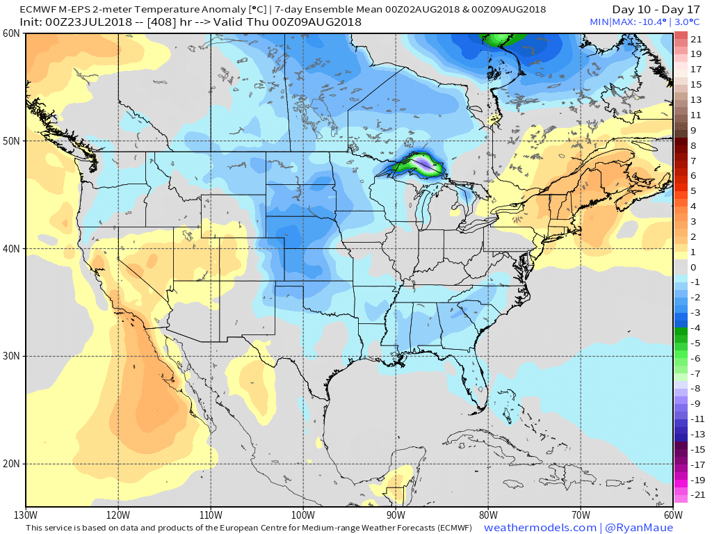
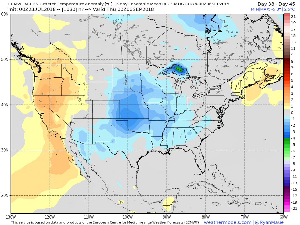
IV. Longer range, we don’t see any significant heat on the immediate horizon. On that note, while we aren’t saying additional hot days won’t occur the rest of the way in, we continue to believe the hottest weather of the summer is behind us. The new European Weeklies in last night continued a seasonal to cooler than average theme for August into early September. All images below are courtesy of weathermodels.com.


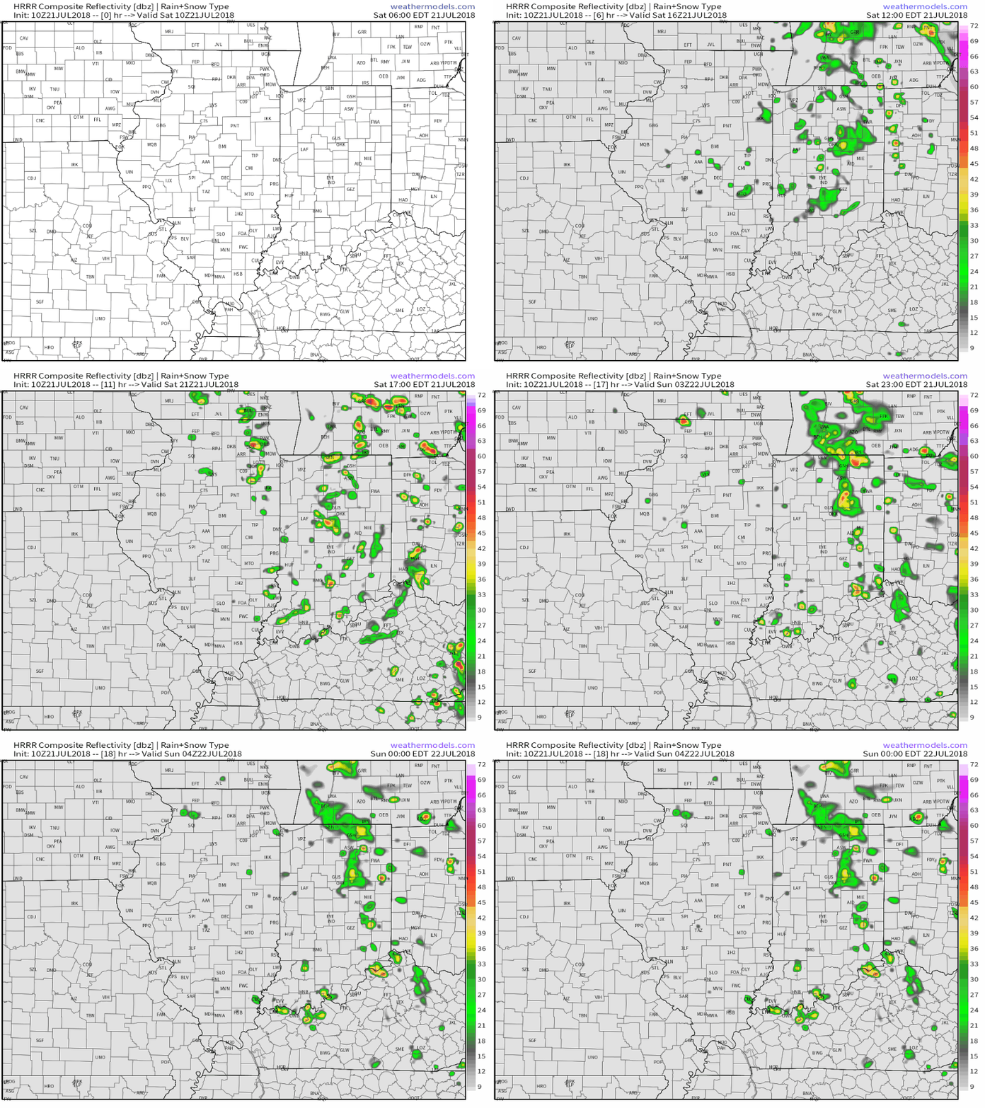
 As we look ahead, our weekend weather will continue to be dominated by a “cut off” area of low pressure. As it meanders around the region, shower and thunderstorm chances will remain. Aerial coverage of rain will reach greatest heights during the afternoon and evening hours today and Sunday. With the colder air aloft, don’t be surprised if a few of the stronger showers produce hail.
 Additionally, highs today will run close to 10° below the average high of the mid-80s.
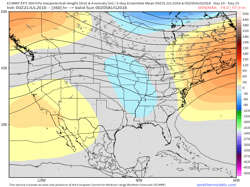
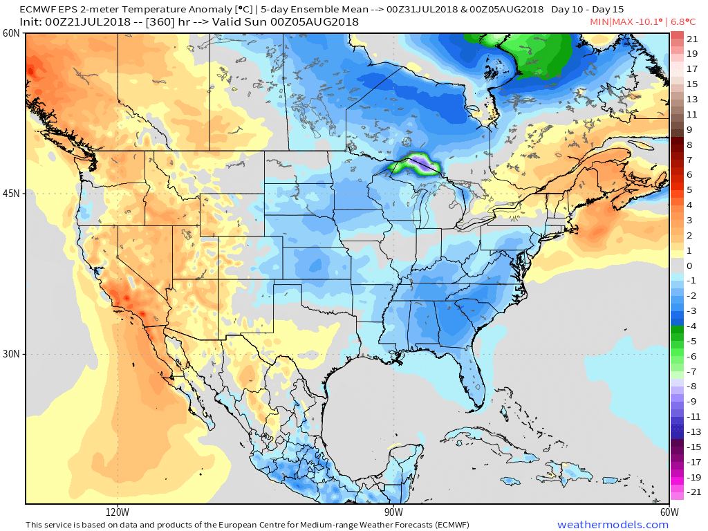 Longer term, the NEW JMA Weeklies suggest the worst of the summer heat is now behind us as they keeps the Weeks 3-4 time period unseasonably refreshing…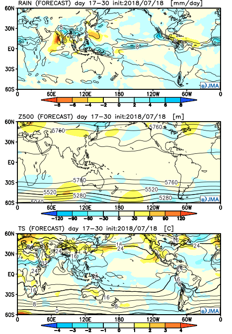
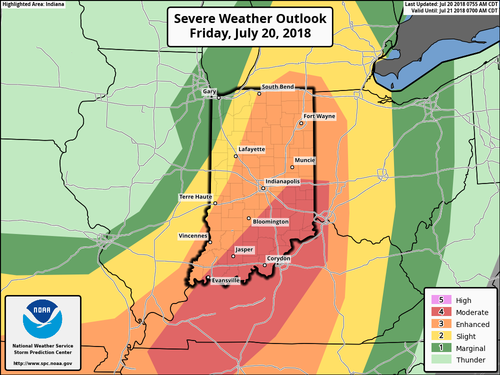 Part of the reason behind today’s severe weather has to do with an overall pattern shift. An intense short wave trough (especially for this time of year) will dig into the Great Lakes and Ohio Valley. At the surface, an area of low pressure will track from southern WI (this morning) before “cutting off” over the Ohio Valley this weekend. Additionally, a couple of frontal boundaries will swing through the state- the most potent being the boundary that surges east this afternoon and evening. The combination of ingredients spell trouble across at least a portion of the region- especially from Indianapolis and points south and east this afternoon and evening.