The Storm Prediction Center has expanded the Slight Risk of severe to encompass more of central Indiana as of the latest update:
 Concern is on the increase for the potential of strong to severe thunderstorms to impact central parts of the state Wednesday evening and night. That said, there are questions with how quickly the atmosphere will be able to recover from morning cloudiness and scattered thundershowers.
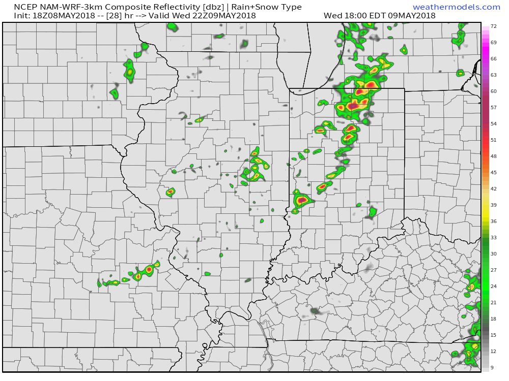
Forecast radar shows scattered showers and embedded thunder scooting through the state Wednesday morning, especially between the hours of 9a and noon.
 Current thinking leans towards a brightening sky through the mid and late afternoon hours which will help destabilize things for potentially a “more significant” event Wednesday evening and night (bracketing the hours of 6p to midnight from west to east).
We note the latest high resolution forecast radar guidance shows rather explosive development as we near the 6 o’clock hour.
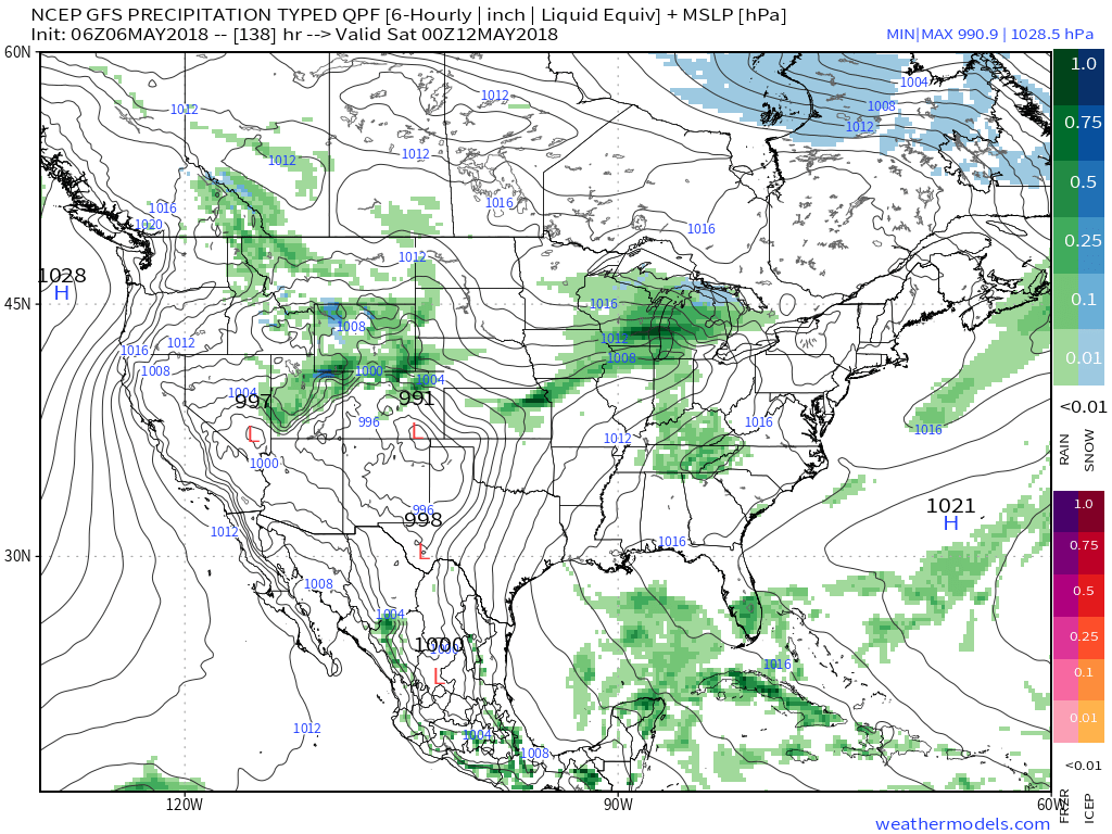
 Storms are expected to exit off to the east by midnight:
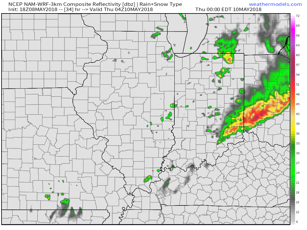 The primary concern that severe thunderstorms may deal central Indiana lies around damaging straight line winds and large hail, however, it should also be noted current parameters also suggest a couple of storms could spawn a tornado.
Bottom line, it’ll be important to keep close tabs on tomorrow’s forecast updates and ensure you have a means of receiving the latest information around watches and warnings that will likely come.
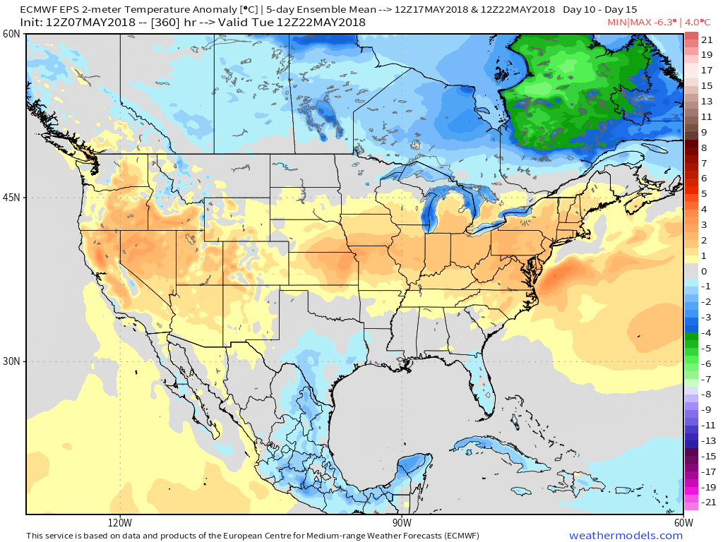
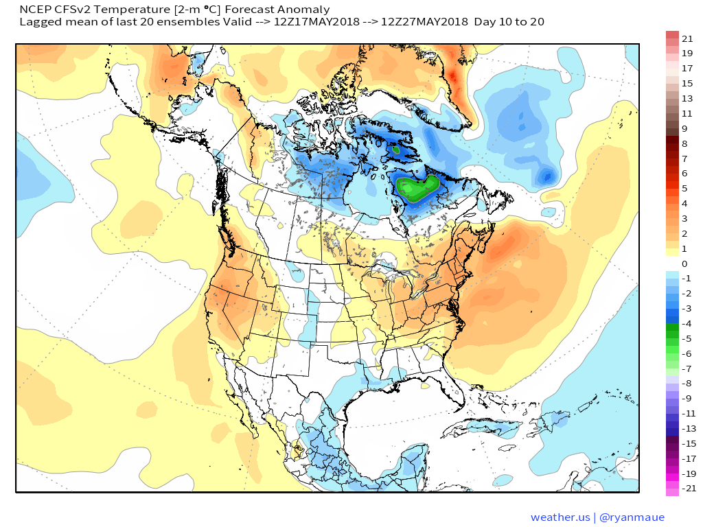
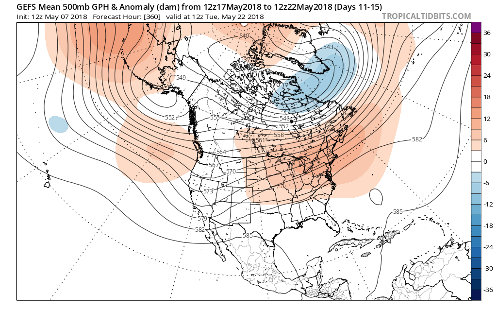 At the surface, all three major global models agree on warmth in the long range period, including the GEFS, EPS, and CFSv2:
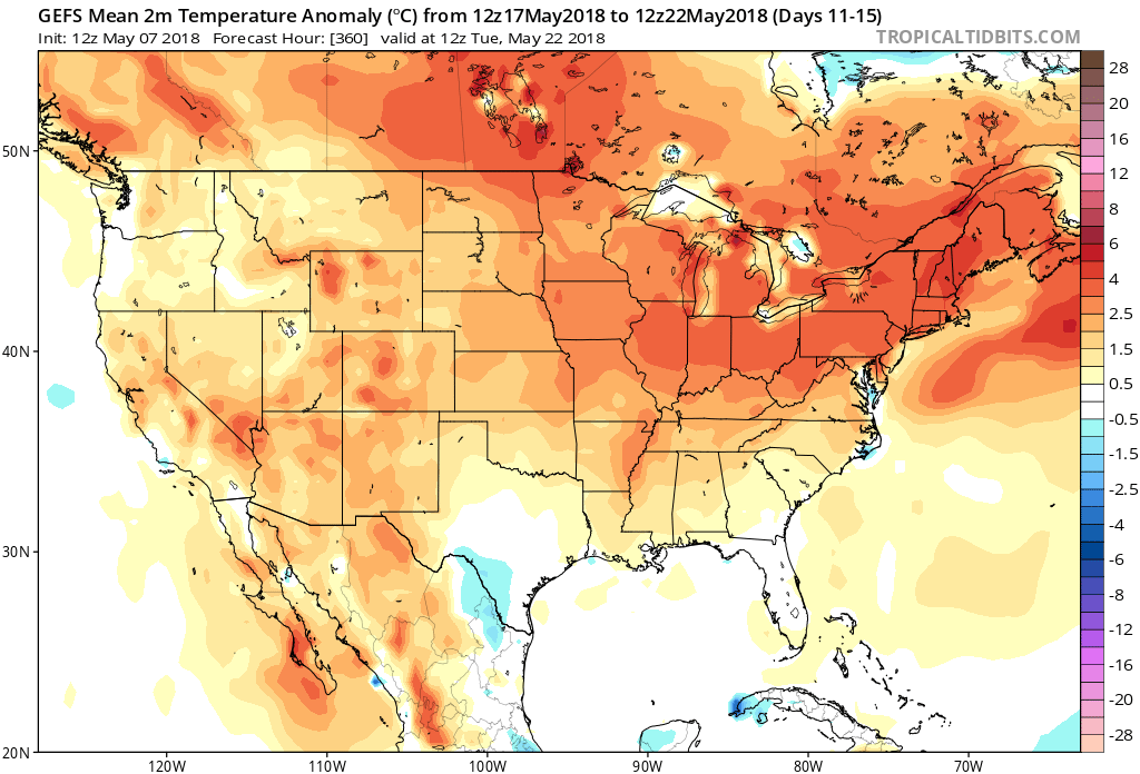
 Guidance suggests below average precipitation during the period. With broad scale ridging in place, we agree on a drier theme compared to normal. While trying to put our finger on the flip from the prolonged cold to warmer was difficult to nail down from March and April, May always looked like a drier than average month from several weeks out. (One note is the potential of active times across the Great Lakes region as “sudden summer” gains steam to the south and stubborn chill refuses to let go to our north. The gradient would promote heavier than normal precipitation relative to average).
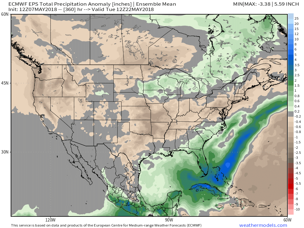
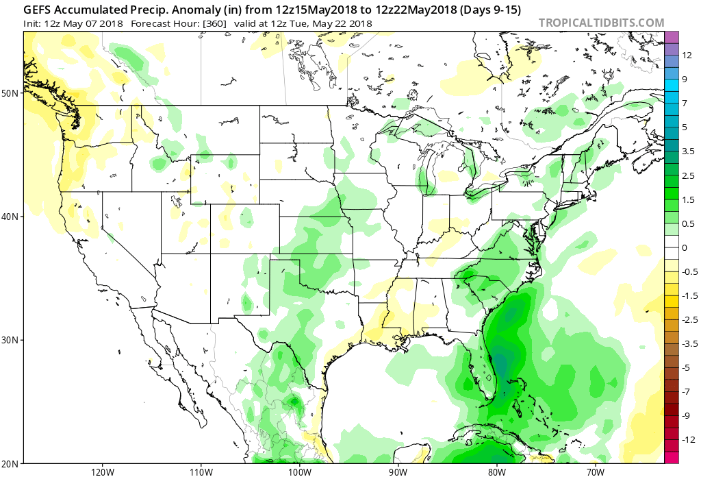 Given the agreement in the data, along with some additional pattern drivers, we continue to believe the medium to longer term period (including mid and late May) will feature an overall warmer than average pattern along with drier than normal conditions.
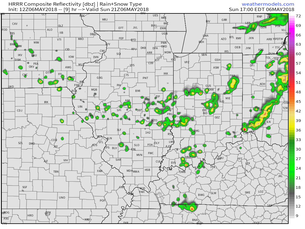 Drier and slightly cooler air will build in as we open the new work week. Overnight lows will fall into the mid and upper 40s both Monday and Tuesday mornings. High pressure will supply plentiful sunshine.
 A broad southwesterly air flow will return as we progress through the latter stages of the work week and head into next weekend. We’ll certainly notice an uptick in humidity by Thursday and that summer-like feel will remain into the weekend. The increased moisture will also result in periods of scattered showers and thunderstorms. Expect “splash and dash” variety of storms in a daily fashion beginning Wednesday evening.
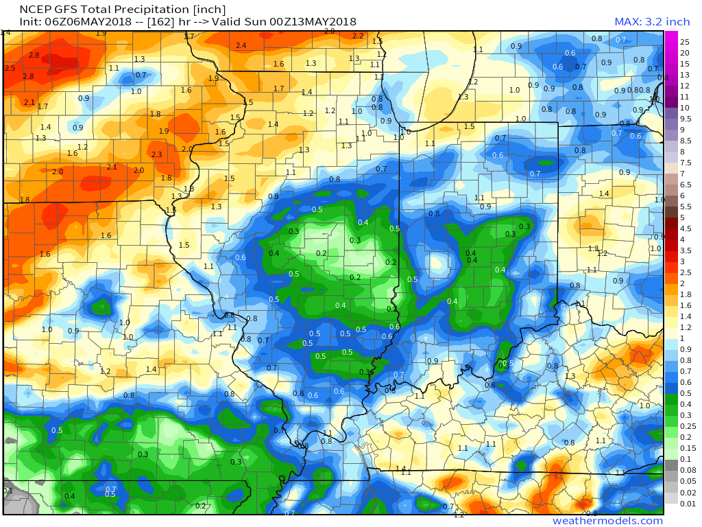
 While scattered storms will be on the radar daily from midweek on, significant widespread rainfall isn’t expected. There will be some locally heavier amounts, but for the most part across central Indiana, 7-day totals won’t exceed three quarters of an inch.