Quiet Period Of Weather Into Early Next Week…
Although we’re dealing with areas of drizzle, low clouds, and fog this morning, a relatively quiet period of weather is ahead as we put a wrap on the week and head through the weekend. At one time what I thought would be a more significant storm system and associated eastern wintry threat won’t come to fruition. While the eastern seaboard will deal with rain Friday into Saturday, we should remain free of any significant precipitation here on the home front.
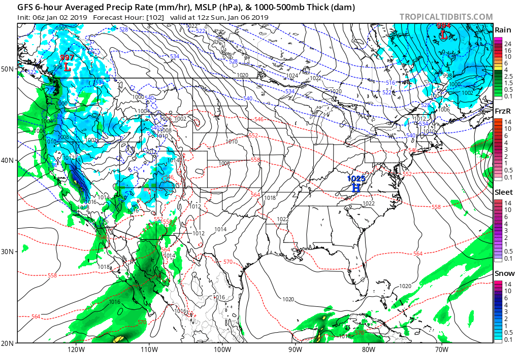
Our next storm system will arrive as we open up next week and we’ll forecast increasing rain chances next Monday. From this distance, moisture return isn’t terribly impressive and rainfall amounts should remain generally in the 0.25″ to 0.75″ range.
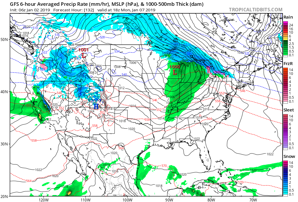
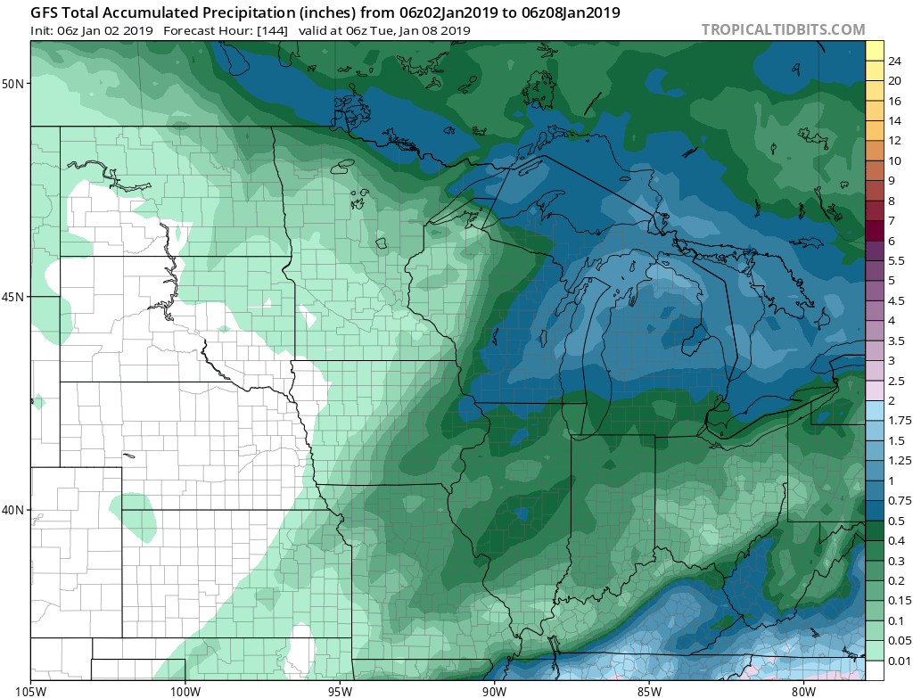 Colder air will follow behind this storm system with more authority and those wishing and hoping for legitimate wintry conditions may finally have their wish as we get closer to mid month. Speaking of cold and wintry times, we’ll have more on our updated long range thoughts later this week.
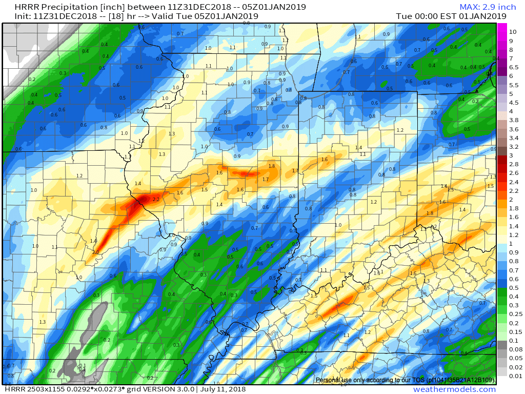 We’re also still monitoring the potential of strong to severe thunderstorms across southern portions of the state. The Storm Prediction Center now includes far southern Indiana in a Slight Risk for severe weather today. The primary concerns remain strong, damaging winds with a line of thunderstorms that may develop between 2p and 4p. If your travels take you south towards Louisville today remain weather-aware.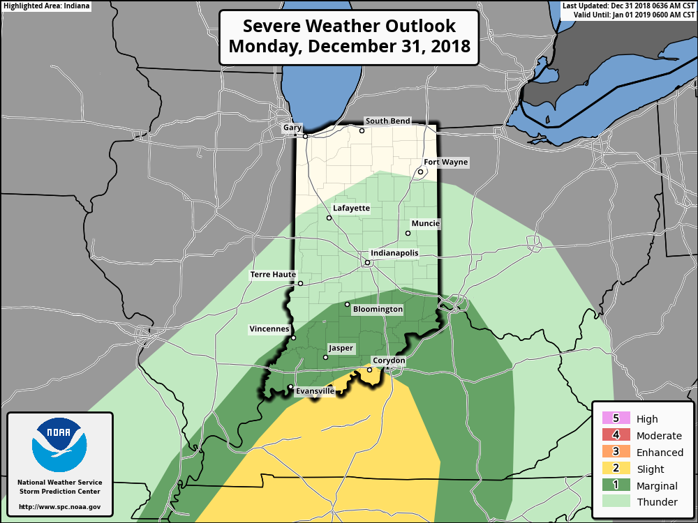
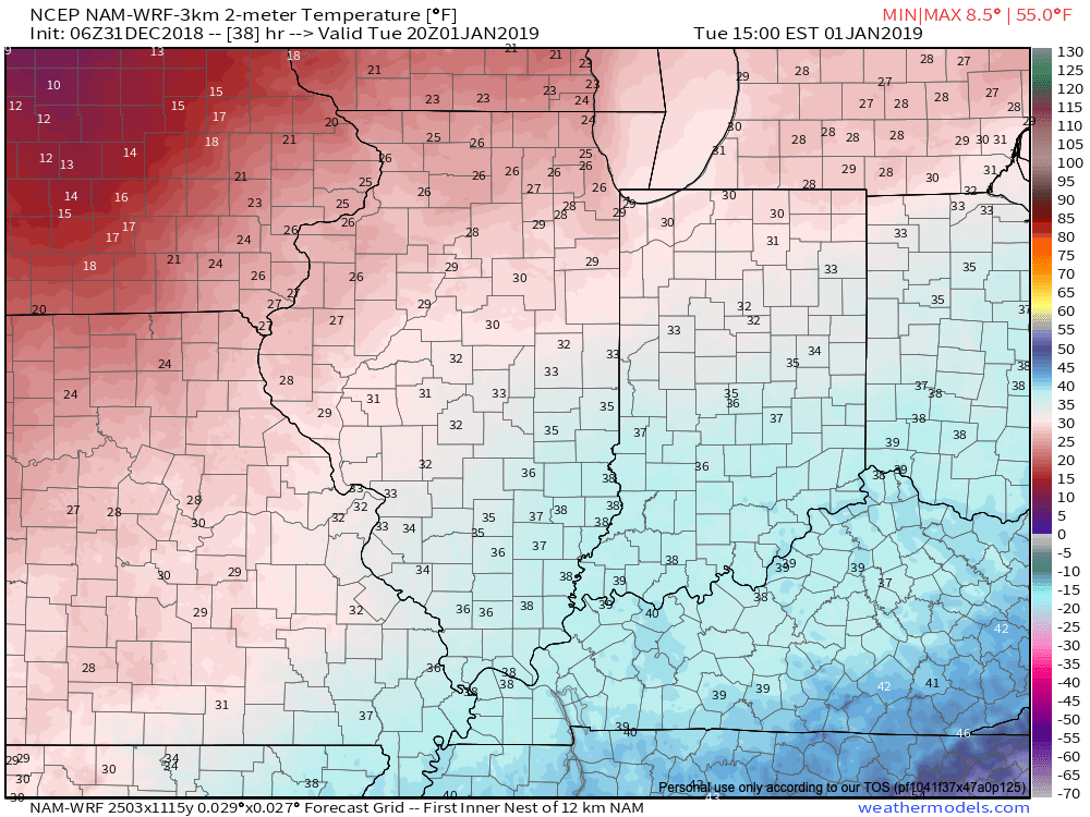
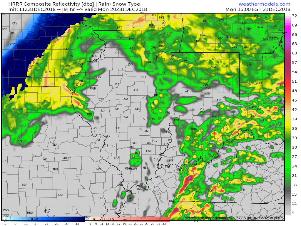 Temperatures will run 25° to 30° colder New Year’s Day and a couple of scattered snow showers may fly- especially across the favored snowbelt areas to our north.
 Have a happy and safe New Year’s Eve, friends!
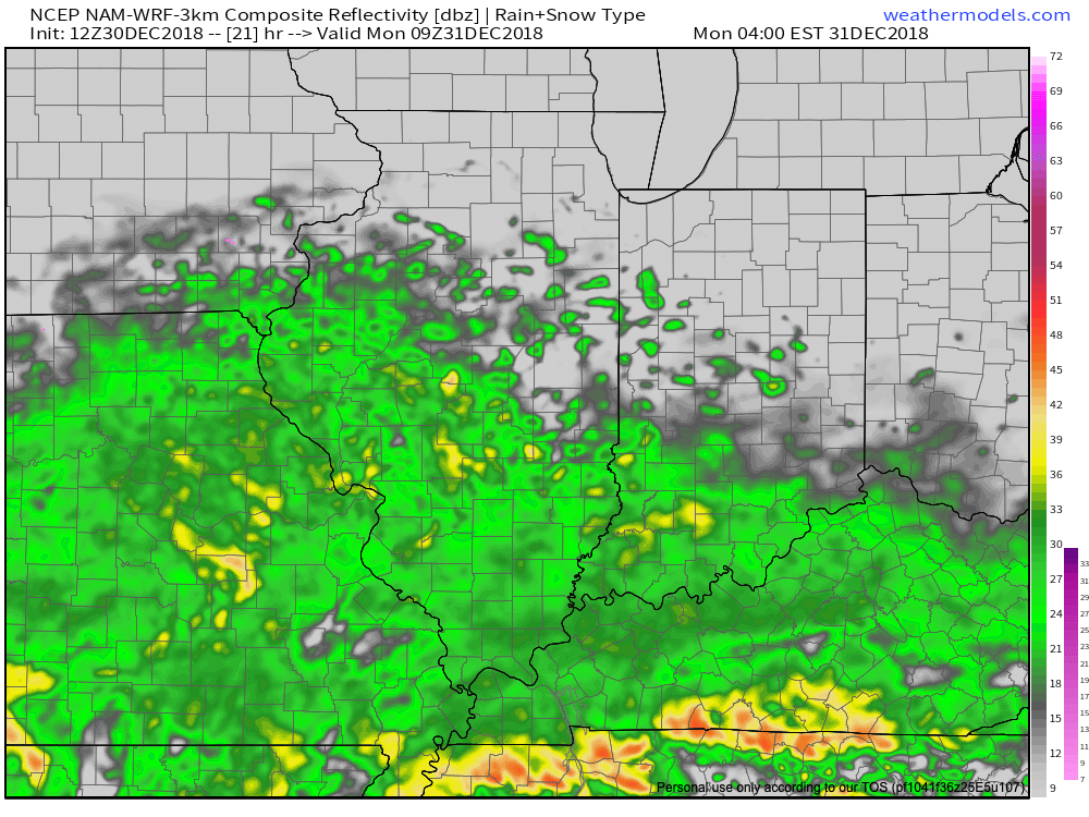

 Colder air will whip in here late tomorrow night and help lingering moisture fall as scattered snow showers New Year’s Day. More later on the potential of wintry “mischief” later in the week…
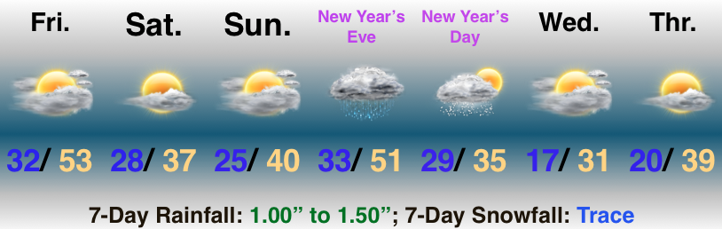 Highlights: