VIDEO: Tuesday Evening Rambles…
You must be logged in to view this content. Click Here to become a member of IndyWX.com for full access. Already a member of IndyWx.com All-Access? Log-in here.
You must be logged in to view this content. Click Here to become a member of IndyWX.com for full access. Already a member of IndyWx.com All-Access? Log-in here.
You must be logged in to view this content. Click Here to become a member of IndyWX.com for full access. Already a member of IndyWx.com All-Access? Log-in here.
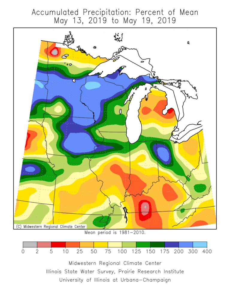
The month of May, though still active at times, has provided drier than normal conditions across a good chunk of the state. Officially, we’re (IND) running around half an inch below normal, month-to-date.
Precipitation departures from normal over the past week and month-to-date can be found below. Note the drier conditions, especially across the southern half of the state. Meanwhile, northern Indiana remains wetter then normal.

Unfortunately, a return of wet times looks likely. Latest data into the forecast office this evening, including the European Weeklies hot off the press, would suggest above normal rainfall can be expected for late-May, June, and a good portion of the summer for that matter.
There’s reason to believe this data is correct when we look at the latest MJO forecast. Note the MJO is expected to roll out of Phase 1 and into Phase 2 late-May and early-June- and potentially Phase 3 a bit later. Not only does this suggest the wet regime should pick back up in earnest across central Indiana, but also that the pattern will trend cooler (after what will be a hot and sultry stretch the 2nd half of this week into early portions of Week 2. The latest European Weeklies go right to this look for June, including a cooler than normal month overall.

Updated model data tonight still says a weak El Nino will continue through summer and this, too, argues for a wetter and cooler than average flavor to the 2019 Summer.
You must be logged in to view this content. Click Here to become a member of IndyWX.com for full access. Already a member of IndyWx.com All-Access? Log-in here.
A line of strong to severe thunderstorms will continue to march east across the state this evening. As has already been the case, the primary concern with this line of storms will be damaging straight line winds and the NWS has been busy issuing warnings this evening.
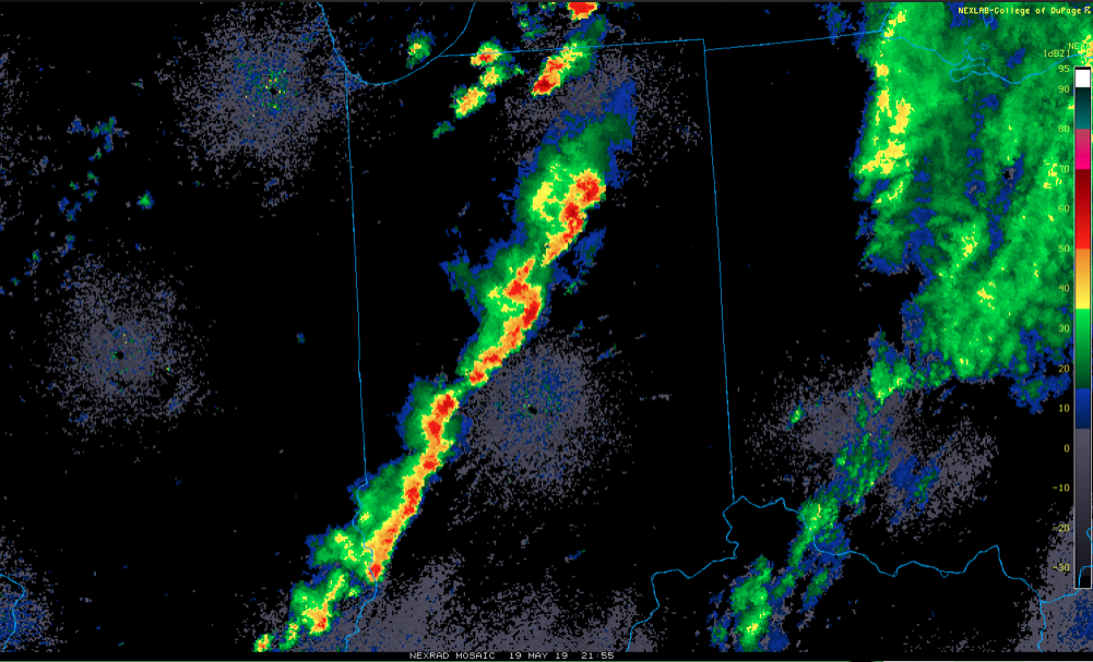
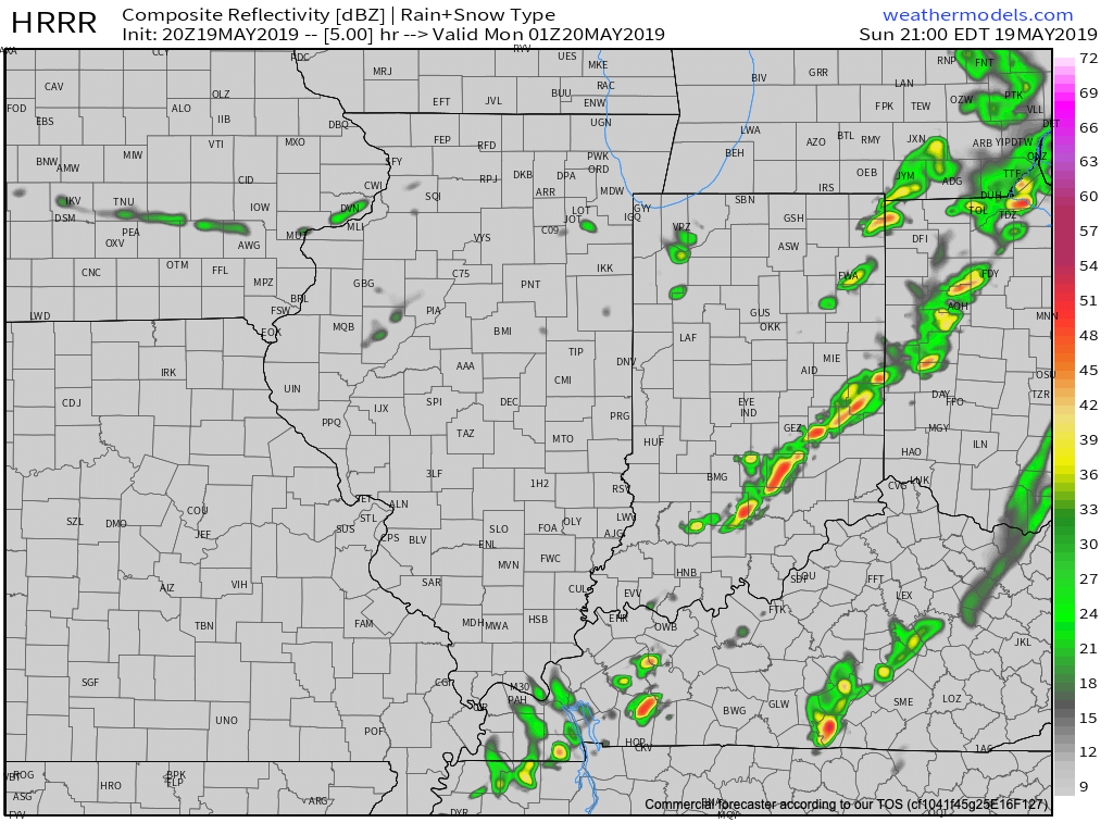
The line will pass into eastern Indiana over the next hour, or so, before weakening as it rumbles into Ohio.
Much cooler and drier air will work in overnight and you’ll certainly notice the difference out the door in the morning. Lows will fall into the lower 50s by morning. We’ll go even lower than that Tuesday morning with widespread middle 40s expected.

Resurgent warmth and humidity will make a return for the 2nd half of the week and with it will come that sultry feel. As a new heat ridge takes up residence across the region, storm systems will “flirt” with the area from time to time. Accordingly, we expect unsettled conditions not only for the 2nd half of the work week, but continuing into the Indy 500/ Memorial Day weekend. It certainly won’t rain and storm the entire time, but the threat for a passing storm at any time will be high.

More in the morning around the pattern evolution into early-June, but we continue to believe the MJO will have it’s say and that things will transition towards an eastern trough as we put a wrap on May and open June.