VIDEO: Pattern Turns More Active By The 2nd Half Of The Week; Early May Ideas…
You must be logged in to view this content. Click Here to become a member of IndyWX.com for full access. Already a member of IndyWx.com All-Access? Log-in here.
You must be logged in to view this content. Click Here to become a member of IndyWX.com for full access. Already a member of IndyWx.com All-Access? Log-in here.
Weekly Highlights:
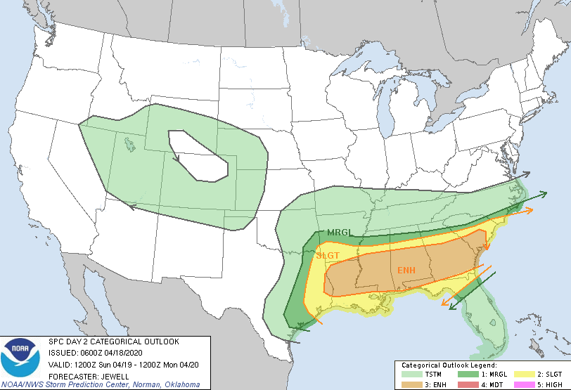
I. Another significant severe weather outbreak is expected across the Gulf Coast region Sunday into Monday.
II. An area of low pressure will bisect the country midweek, delivering widespread rain and thunderstorms to the Ohio Valley and offering up another threat of severe weather Wednesday-Thursday for the TN Valley into the Deep South.
III. A 3rd system will track out of the northern Plains and begin to affect the Ohio Valley next weekend with increased showers and thunderstorms.


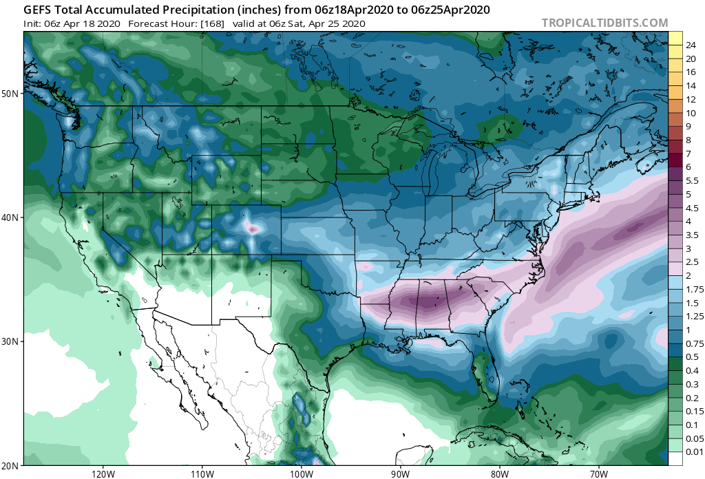
Forecast Period: 04.18.20 through 04.25.20
High pressure will build into the region today and supply a return of beautiful weather conditions. Albeit still cooler than normal, vastly improved weather conditions are on tap compared to the rain and snow of the past couple of days! Enjoy, friends!
A couple of weak and fairly moisture-starved cold fronts will give our immediate area “glancing blows” through early week. Scattered showers are all we can expect with these fronts Sunday and Tuesday. (Greater impacts from precipitation and cooler air can be expected off to our northeast with these fronts).
As we head into the back half of the forecast period, a couple of more significant storm systems will offer up better rainfall coverage, including the opportunity for thunderstorms Thursday into next weekend. We’ll keep an eye through the week on the potential of some stronger storms during this period, but as things stand now, the greater risk for severe appears to be off to our south.
One additional note- frost/ freeze conditions are possible Tuesday night into Wednesday morning across central parts of the state with overnight lows falling into the lower 30s.
You must be logged in to view this content. Click Here to become a member of IndyWX.com for full access. Already a member of IndyWx.com All-Access? Log-in here.
You must be logged in to view this content. Click Here to become a member of IndyWX.com for full access. Already a member of IndyWx.com All-Access? Log-in here.
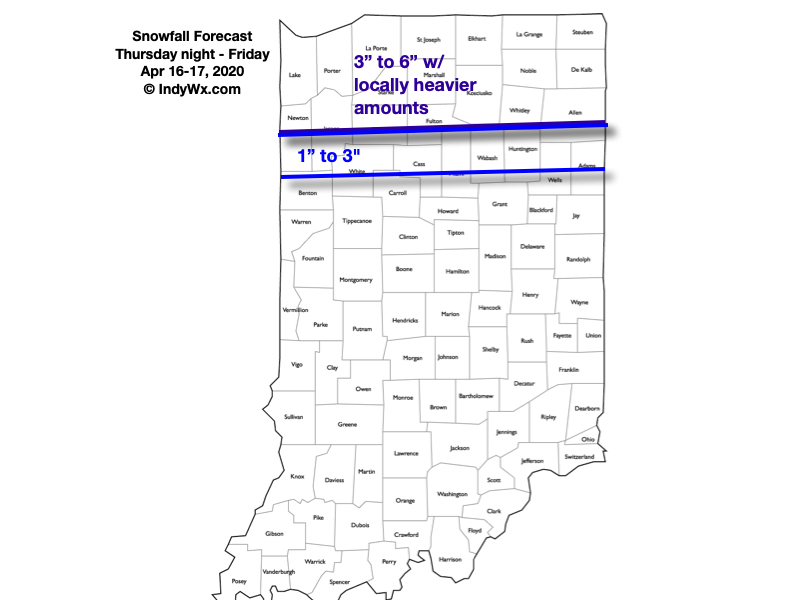
This unseasonably cold pattern was bound to produce a couple of additional wintry challenges (at the very least) before all was said and done, and this week isn’t disappointing. Guidance today has continued to trend snowier for northern parts of the state, and we fully expect periods of heavy, wet snow to begin falling across the northern 1/3 of Indiana tomorrow evening, continuing into Friday morning before eventually ending during the afternoon.
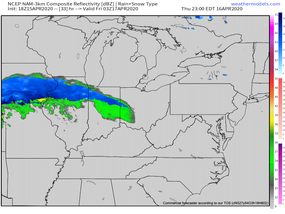
Snow will likely reach peak intensity around sunrise Friday morning, including 1″ to 2″ per hour snowfall rates. With the unseasonably cold air in place, we expect road crews to have to activate the plows as the snowfall intensity, combined with time of day will make a mess of area roadways across northern Indiana.
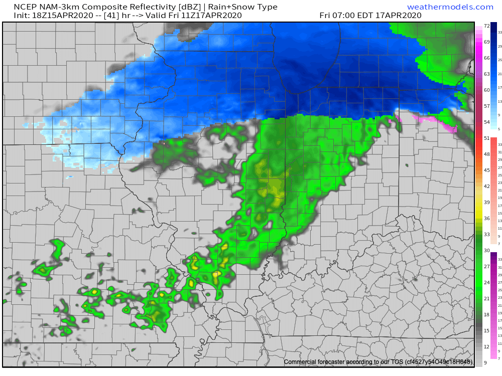
The snow will begin to diminish from west to east during the late morning and into the early afternoon Friday, but not before dumping several inches on the region. Our updated snowfall forecast is below. We’ll be back early in the morning with a fresh video update. Have a relaxing evening!