
You must be logged in to view this content. Click Here to become a member of IndyWX.com for full access. Already a member of IndyWx.com All-Access? Log-in here.
Permanent link to this article: https://indywx.com/video-tracking-3-systems-between-now-and-this-time-next-week/
Jan 01
Pattern Turns Stormy; Close Attention Required This Weekend…
A new year is here and we’ve got quite the active weather pattern to contend with over the next couple weeks (and likely beyond). Let’s time out the various features we’re tracking over the next 10 days.
1.) Thursday-Friday
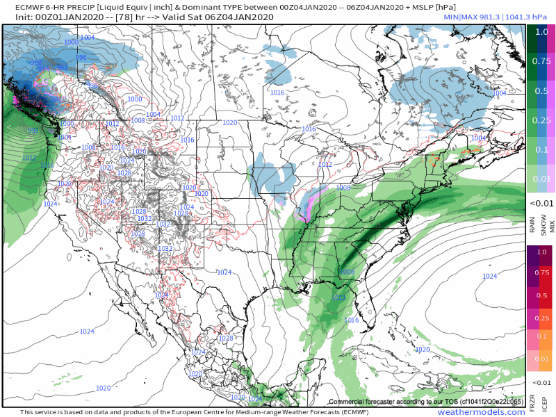
An area of low pressure will develop over eastern Texas tonight and track northeast into MO Thursday night. This surface low will move over Indiana Friday. Rain will return to central Indiana Thursday afternoon and continue in an “off and on” fashion into Friday. Rainfall totals of 0.50″ to 1″ will be common across the southern half of the state, including Indianapolis.

2.) Saturday-Sunday morning
Vigorous upper level energy will sweep southeast out of the Dakotas Friday before becoming “closed off” across MO Saturday and heading into the southern Appalachians Sunday.

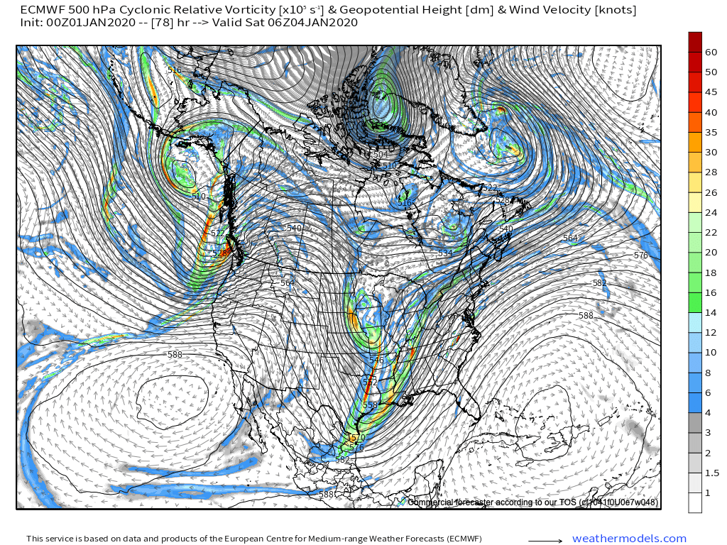
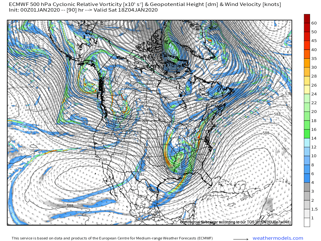
In response to this, a surface low is likely to develop across southern Indiana Friday night or Saturday morning before tracking northeast into PA Saturday night. With colder air pouring into the region, a renewed expanding area of precipitation Friday night into Saturday morning should become mixed with and change to snow across central Indiana during the day Saturday. If you have travel plans east or north into Ohio or northern IN, it’ll be important to pay close attention to future forecast updates, as this system has the potential to produce a swath of wet, plowable snowfall across the region Saturday into Sunday morning.
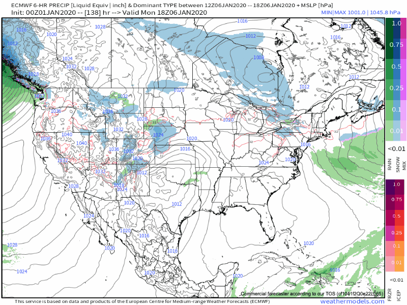
3.) Tuesday-Wednesday
Another storm system will approach from the southwest Tuesday into Wednesday. This, too, is one to watch as the timing is particularly interesting (coming at a point where we may see a phasing of the polar and southern branches of the jet stream). There’s no reason to get “cute” from this distance on specifics, but just know another potentially potent system awaits the middle of next week and could feature additional opportunities for wintry precipitation across our neck of the woods.
Permanent link to this article: https://indywx.com/pattern-turns-stormy-close-attention-required-this-weekend/
Dec 31
VIDEO: Opening Up 2020 On An Active Note…
You must be logged in to view this content. Click Here to become a member of IndyWX.com for full access. Already a member of IndyWx.com All-Access? Log-in here.
Permanent link to this article: https://indywx.com/video-opening-up-2020-on-an-active-note/
Dec 30
Important To Know What Lever To Pull And When…
As another year comes to a close and the winter pattern begins to “mature,” we thought we’d do a little rambling…
This evening’s rambles have to do with the variety of “drivers” that at times like to take control of our weather pattern. You hear us use terms like the MJO, EPO, AO, PNA, and NAO (amongst others) often, but at times, these various pattern drivers can have more impact than others, and at varied times of the year.
Traditionally, if the MJO (Madden Julian Oscillation) is highly amplified, that’s going to serve as the basis of our medium or longer range forecasts. However, if the MJO is in the null phase, other teleconnections can take control of the wheel. Sea-surface temperature configuration can give hints to the way these elements may behave during the season(s) ahead, but we caution each respective season takes on a flavor unique to it’s own. That’s what makes this business so fun, challenging, and, at times, frustrating. 🙂
It’s also important to understand when the ingredients noted above have the greatest impact on our immediate weather. We love to lean more heavily towards the NAO and AO mid-to-late winter into the spring, for instance. Case in point, a negative EPO and positive PNA can quickly trump a positive AO/ NAO this time of year, and vice-versa.
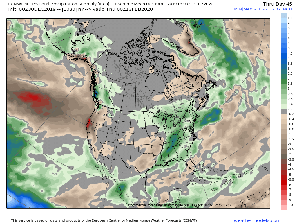
In the event you didn’t have a chance to see it Sunday, we released our January Outlook. We have a very stormy month outlined that includes cold “overwhelming” things as the month progresses. A lot of this has to do with the fact we think we see a “shake-up” with the MJO out of the warm phases and into the traditional cold phases of 8,1, and 2 taking shape during the 2nd half of the month. Additionally, we continue to believe the favorable north Pacific sea surface temperature configuration (for a cold Great Lakes and OHV) will begin to force the negative EPO/ positive PNA.
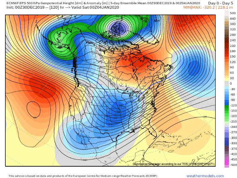
The NEW European Weeklies show the transitional time of things through the 1st half of the month, but note the building more persistent NW NA ridge during the 2nd half of the month and corresponding reflection of an eastern trough. Should the MJO be heading into Phase 8 around this time frame (and we think it will), this trough will likely correct stronger in future updates for late month.
The model sees the stormy time of things through the month and into February. (Important to note that even “warm” months this time of year can also feature above normal snow. Just see this December- nearly an inch above normal for the month). As things stand now, we see multiple opportunities for snow as January gets underway, including Saturday PM, and again Tuesday night into Wednesday.
Make it a great evening! We’ll be back early in the morning with a fresh video update.
Permanent link to this article: https://indywx.com/important-to-know-what-lever-to-pull-and-when/
Dec 30
VIDEO: Wintry New Year’s Eve; Walking Through The 1st Week Of 2020…
You must be logged in to view this content. Click Here to become a member of IndyWX.com for full access. Already a member of IndyWx.com All-Access? Log-in here.
Permanent link to this article: https://indywx.com/video-wintry-new-years-eve-walking-through-the-1st-week-of-2020/
