You must be logged in to view this content. Click Here to become a member of IndyWX.com for full access. Already a member of IndyWx.com All-Access? Log-in here.
II. Keeping eyes to the sky for periods of gusty storms.
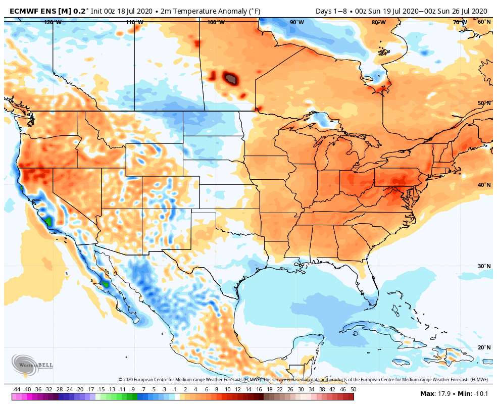
Temperatures will run above average across the eastern half of the country through the period.
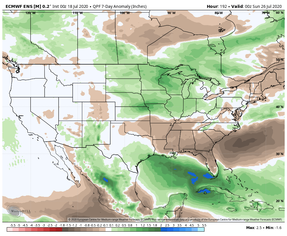
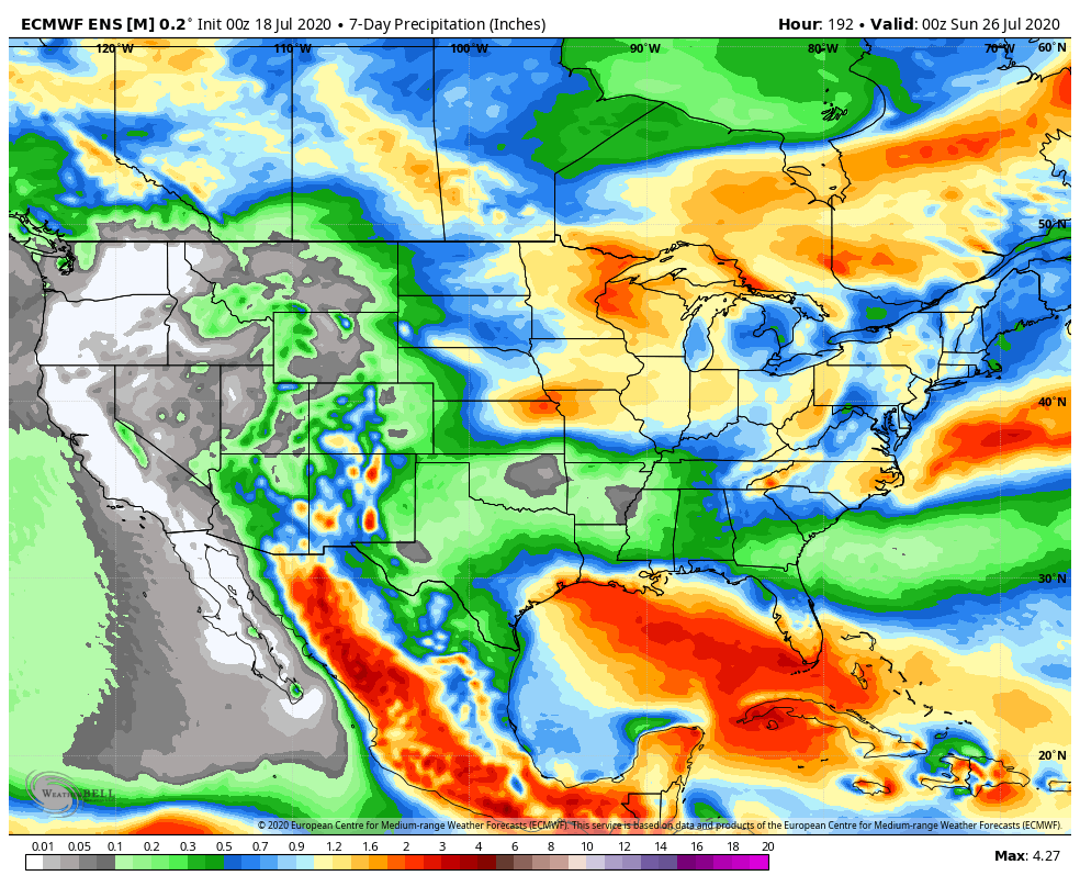
Above average rainfall is expected from the Northern Plains into the western Great Lakes and Ohio Valley through the period. The Southeast will run drier than normal.
Specific to central Indiana, we expect 7-day rainfall numbers to be very close to 1″ with locally heavier amounts.
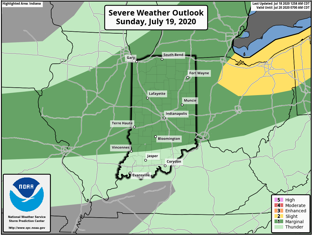
A threat of severe weather is present Sunday (damaging winds are the greatest concern).
Forecast Period: 07.18.20 through 07.25.20
A hot and humid stretch of weather will dominate the upcoming forecast period, including another multi-day stretch with highs in the lower 90s and lows in the lower 70s. The saving grace? Timely rains. After a mostly dry Saturday (only isolated storm coverage expected), more widespread storms are expected Sunday. Some of these could become strong to severe Sunday afternoon, including the threat of damaging winds as a complex moves south through the state. This unsettled theme will continue into the 1st half of the work week with each day offering up scattered showers and storms. Drier air will briefly nudge into the Ohio Valley Thursday and Friday before storm chances return next weekend.
You must be logged in to view this content. Click Here to become a member of IndyWX.com for full access. Already a member of IndyWx.com All-Access? Log-in here.
As we traverse the “dog days” of summer and look ahead to early autumn, what does the overall pattern hold? As is typical this time of year, the tropics are on the verge of becoming much more active, as well. Given analogs and other drivers, we suggest those with plans to the Gulf or Carolina beaches pay particularly close attention to the developments in the coming weeks and couple of months ahead.
The short-term is, obviously, highlighted by unseasonably warm-hot conditions but there’s reason to buy into the ‘mean’ ridge position retrograding west prior to month’s end. The large majority of long range data shows this taking place, as well.
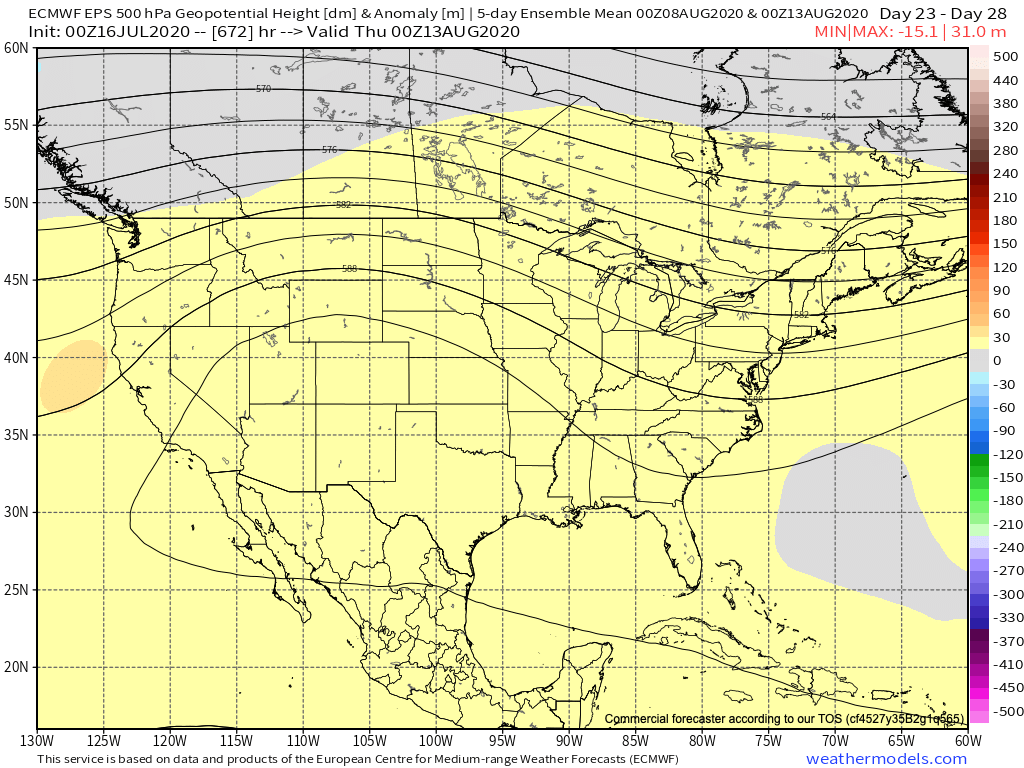
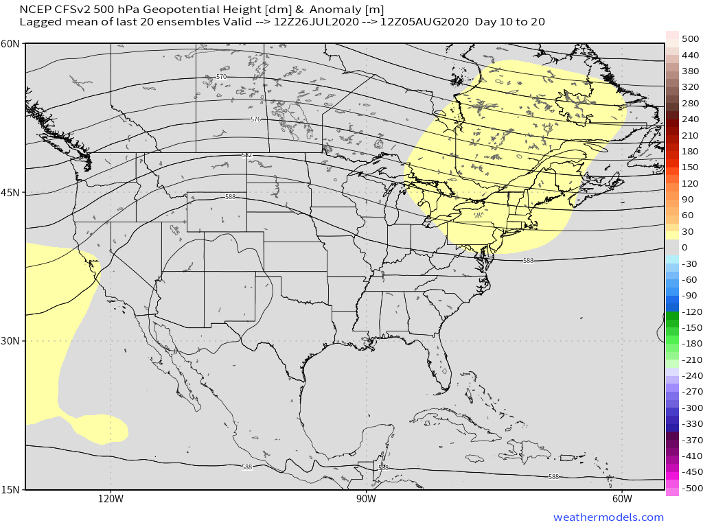
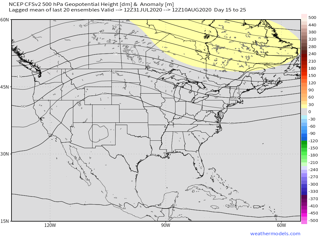
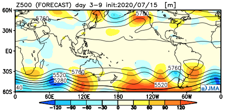
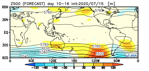
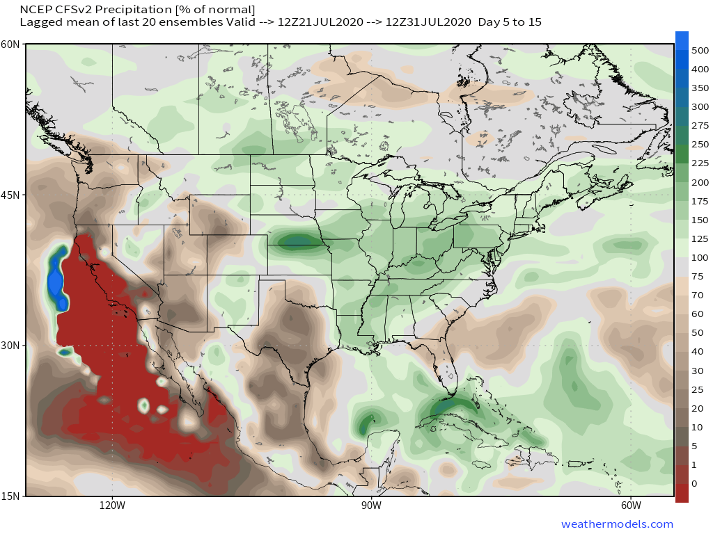
Note the way the new European Weeklies, CFSv2 Weeklies, and JMA Weeklies handle this evolution in similar fashion over the coming 2-3 weeks.
European Weeklies: July 26-31
European Weeklies: July 30-Aug 4
European Weeklies: Aug 8-Aug 13
CFSv2 Weeklies: July 21-31
CFSv2 Weeklies: July 26-Aug 5
CFSv2 Weeklies: July 31-Aug 10
JMA Weeklies: July 19-25
JMA Weeklies: July 26-Aug 2
The screaming message is that the period of heat this weekend into early next week will transition west by the 2nd half of next week and into the Week 2 time period. Furthermore, though not saying there can’t be periods of “transient” heat still yet the remainder of the summer, the bulk of the sustained heat should be behind us once to the middle of next week.
Additionally, data is bullish on a wet close to July. This makes sense with the northwest flow aloft.
As the crucial late-summer stretch hits and harvest season is on the horizon, there’s reason to believe a favorable precipitation pattern should persist- if not potentially a bit wetter than normal. The wildcard, of course, as is typically the case has to do with the tropics. It only takes 1 or 2 tropical systems with the “right” inland track to provide heavy rains into the inland regions and there’s many reasons to buy into the fact this will be quite a busy “heart” of the tropical season this year. We’ll have to handle those as they come, as the steering currents can vary in significant fashion and there’s no way to accurately pinpoint inland areas most at risk of late-summer/ early fall heavy rain events from these tropical threats. Certainly, if your plans take you down to the beautiful Gulf Coast or Carolina beaches, it’ll be important to pay close attention to the developments and goings on as the season matures…
Stay tuned as we continue to move forward. In addition to our August Outlook, we’ll have more on where we believe the pattern is heading this fall and winter in the coming weeks…
You must be logged in to view this content. Click Here to become a member of IndyWX.com for full access. Already a member of IndyWx.com All-Access? Log-in here.