Early-May Rumblings…

With a little over a week left in April, thoughts continue to focus more and more on May. While our official monthly outlook will come out later next week, we did want to present our early thoughts on the first week of the month.

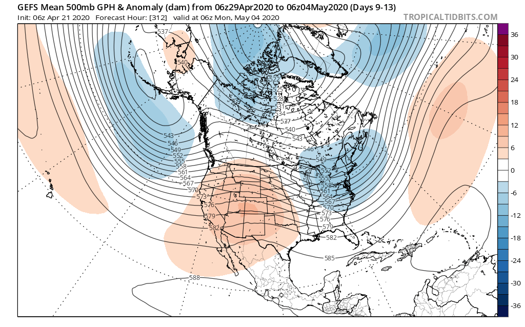
In short, a rather persistent upper trough is expected to dominate the eastern 1/3 of the country into the 1st week of the month. This should keep things cooler than normal, overall.

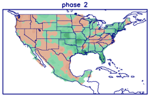
This also lines up perfectly with Phase 2 of the MJO in early May. (After a week of disagreement, model data now agrees that the MJO should “flirt” with Phase 3 before cycling back into Phase 2 early May). We note this favors cooler than normal temperatures across our portion of the country.

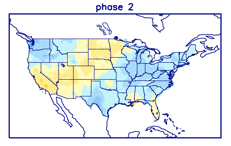
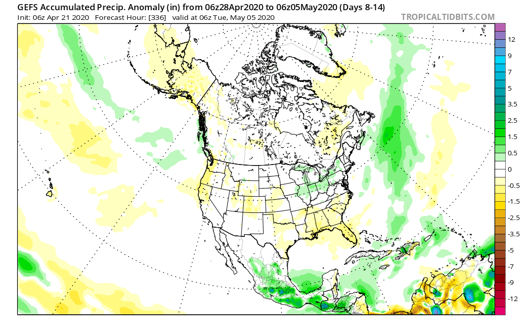
From a precipitation perspective, there aren’t particularly strong signals for wetter/ drier than average conditions with Phase 2 in May- at least for the Ohio Valley.

The positive PNA, however, can support a bit more of an active storm track through our region and that’s what model data is showing from this distance.

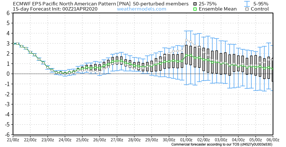
The positive PNA, of course, also supports cooler than normal temperatures across our portion of the country…

Permanent link to this article: https://indywx.com/early-may-rumblings/

Things Turn Much More Active This Week…

You must be logged in to view this content. Click Here to become a member of IndyWX.com for full access.  Already a member of IndyWx.com All-Access?  Log-in here.

Permanent link to this article: https://indywx.com/things-turn-much-more-active-this-week/

VIDEO: Pattern Turns More Active By The 2nd Half Of The Week; Early May Ideas…

You must be logged in to view this content. Click Here to become a member of IndyWX.com for full access.  Already a member of IndyWx.com All-Access?  Log-in here.

Permanent link to this article: https://indywx.com/video-pattern-turns-more-active-by-the-2nd-half-of-the-week-early-may-ideas/

Weekly #AGwx And #Severe Outlook…

Weekly Highlights:

I. Another significant severe weather outbreak is expected across the Gulf Coast region Sunday into Monday.

II. An area of low pressure will bisect the country midweek, delivering widespread rain and thunderstorms to the Ohio Valley and offering up another threat of severe weather Wednesday-Thursday for the TN Valley into the Deep South.

III. A 3rd system will track out of the northern Plains and begin to affect the Ohio Valley next weekend with increased showers and thunderstorms.

Wettest anomalies this week will be confined to the lower MS Valley, Deep South, and immediate East Coast.
Chilly weather (compared to normal) will continue to dominate the Great Lakes into the southern Appalachians and East.
Across immediate central Indiana, we’re expecting rainfall totals of 0.75″ to 1.25″ between now and next Saturday morning.
Unfortunately, another significant severe weather episode is expected across the Gulf Coast region on Sunday.

Forecast Period: 04.18.20 through 04.25.20

High pressure will build into the region today and supply a return of beautiful weather conditions. Albeit still cooler than normal, vastly improved weather conditions are on tap compared to the rain and snow of the past couple of days! Enjoy, friends!

A couple of weak and fairly moisture-starved cold fronts will give our immediate area “glancing blows” through early week. Scattered showers are all we can expect with these fronts Sunday and Tuesday. (Greater impacts from precipitation and cooler air can be expected off to our northeast with these fronts).

As we head into the back half of the forecast period, a couple of more significant storm systems will offer up better rainfall coverage, including the opportunity for thunderstorms Thursday into next weekend. We’ll keep an eye through the week on the potential of some stronger storms during this period, but as things stand now, the greater risk for severe appears to be off to our south.

One additional note- frost/ freeze conditions are possible Tuesday night into Wednesday morning across central parts of the state with overnight lows falling into the lower 30s.

Permanent link to this article: https://indywx.com/weekly-agwx-and-severe-outlook-3/

Late Season Wet Snow Storm For Northern Portions Of The Ohio Valley; Fresh Long Range Thoughts Into May…

You must be logged in to view this content. Click Here to become a member of IndyWX.com for full access.  Already a member of IndyWx.com All-Access?  Log-in here.

Permanent link to this article: https://indywx.com/late-season-wet-snow-storm-for-northern-portions-of-the-ohio-valley-fresh-long-range-thoughts-into-may/