
You must be logged in to view this content. Click Here to become a member of IndyWX.com for full access. Already a member of IndyWx.com All-Access? Log-in here.
Permanent link to this article: https://indywx.com/video-multiple-cold-weather-records-likely-to-be-challenged-over-the-next-couple-weeks/
May 03
Sunday Afternoon Video: More Like March Than May Over The Next Couple Weeks…
You must be logged in to view this content. Click Here to become a member of IndyWX.com for full access. Already a member of IndyWx.com All-Access? Log-in here.
Permanent link to this article: https://indywx.com/sunday-afternoon-video-more-like-march-than-may-over-the-next-couple-weeks/
May 02
Weekly #AGwx And #Severe Outlook…
Weekly Highlights:
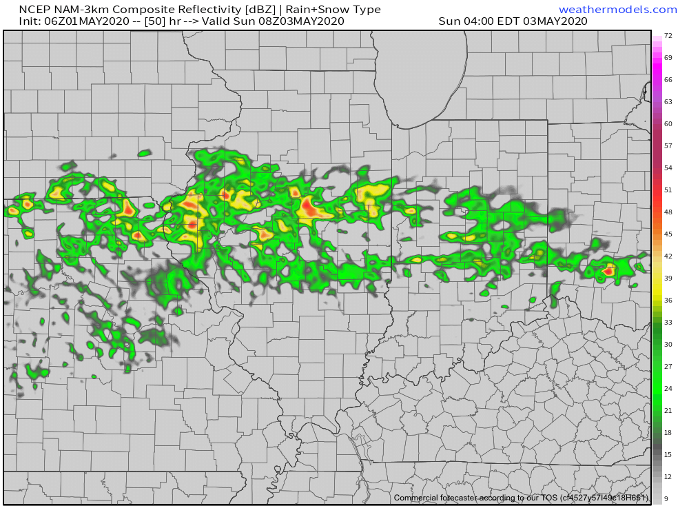
I. A cold front will settle south into a warm and at least marginally unstable environment tonight into early Sunday morning. This will result in a rather rapid expansion of thunderstorms across the central Ohio Valley tonight.
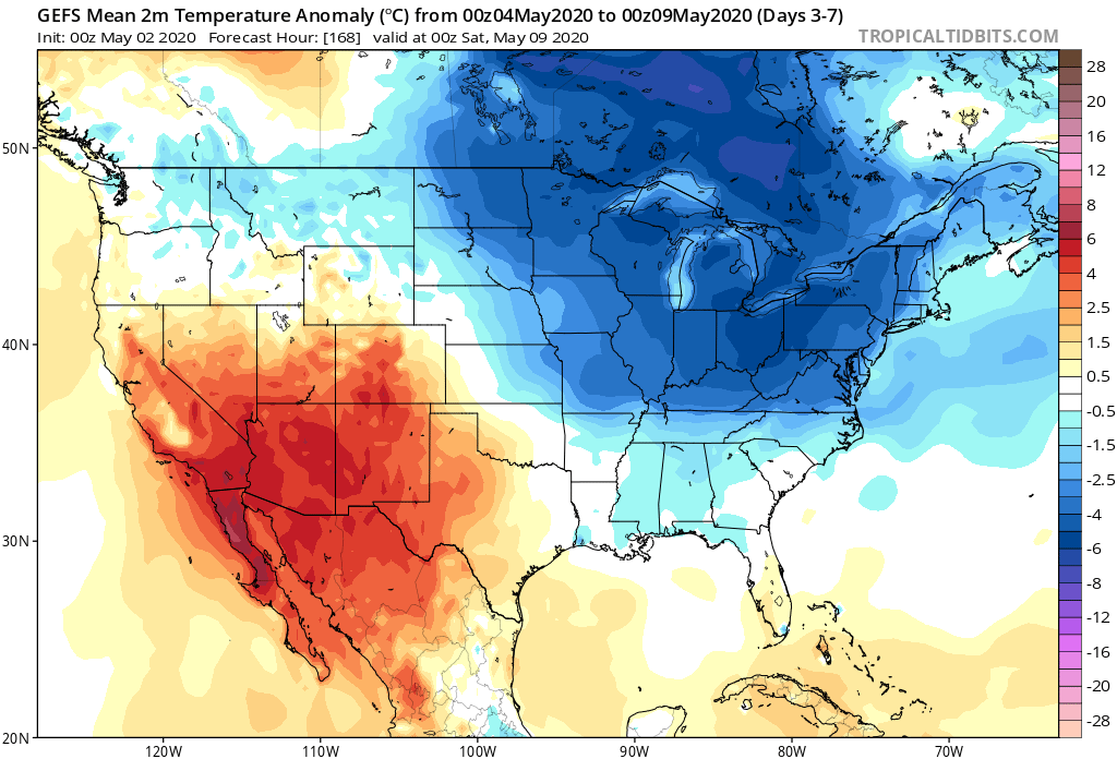
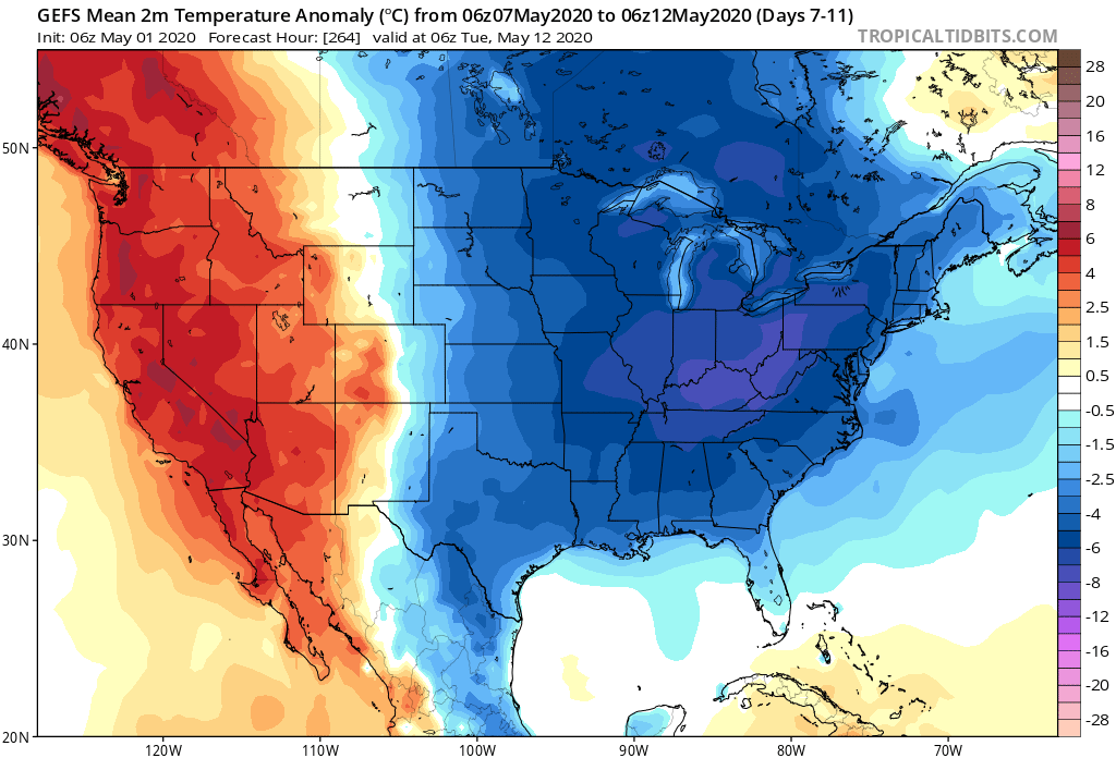
II. The next big item has to do with the unseasonably cold airmass that will unload into the eastern half of the country, but this is more of a late Week 1 into Week 2 situation.

Forecast Period: 05.02.20 through 05.09.20
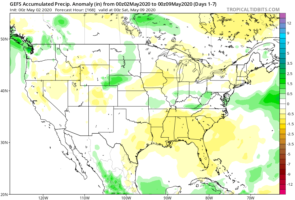
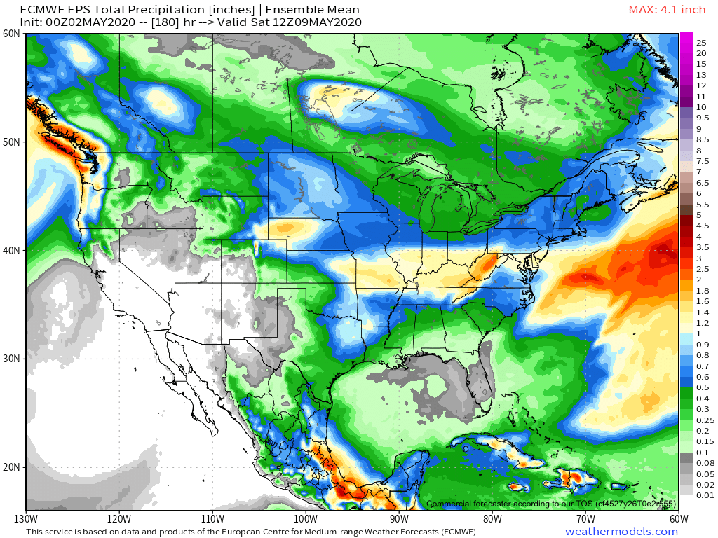
Most of our Saturday will feature dry and pleasant conditions. It’ll be a great day to get caught up on yard work around the house before things take on a stormy turn tonight. A cold front will settle into the briefly warmer and more humid air mass and will ignite thunderstorm development by late evening. A few of these storms will likely become strong to severe late evening into the overnight period, including the potential of large hail and damaging wind gusts. Once the front settles to our south, the convection will also move south and out of our area mid-late Sunday morning. Beforehand, a swath of 1” rains are likely throughout central Indiana with a few locally heavier totals.
There will then be a couple of additional cold fronts to track through the upcoming week: Monday night into Tuesday and again Friday into Saturday. Both fronts should provide additional rain chances during that time frame followed by cooler air.
It’s the weekend front that will usher in more of a winter-like feel including the threat of late season frost/ freeze conditions during the 7-10 day period. We may have not even seen the last of snow for the season…
Permanent link to this article: https://indywx.com/weekly-agwx-and-severe-outlook-5/
May 01
Welcome To May: Threat Of Record Cold Week 2…
A gorgeous Friday is dialed up complete with plentiful sunshine and temperatures warming quickly from the mid and upper 30s into the mid and upper 60s.
A couple weak impulses of energy will scoot through the Ohio Valley over the next 24 hours and while they will spark a few showers/ embedded thunder predawn Saturday and again Saturday night, most of the daytime hours Saturday will also feature dry conditions.
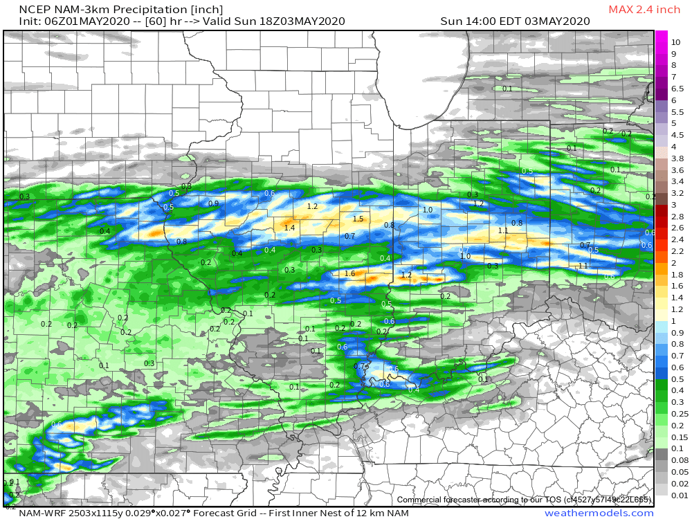
That begins to change Sunday as widespread showers and thunderstorms are expected to rumble across central Indiana, especially during the morning hours. Locally heavy downpours are likely.
A quick 1”-1.25” is a good bet across the heart of the state with this system Sunday morning.
Dry conditions will quickly return Sunday evening into Monday thanks to high pressure briefly building back into the region. This will lead to a pleasant open to the work week with highs topping out in the middle 60s.
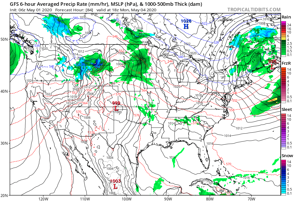
Unsettled weather returns as early as Tuesday with increased chances of showers and thunderstorms ahead of a strong cold front.

Though we’ll certainly turn cooler for the middle to latter part of the week, this will only be a precursor to what lies ahead behind yet another strong cold front late next week.
The air will likely challenge records into the Week 2 time frame (May 8th-14th), including the threat and increased likelihood of late season frost/ freezes. We also likely haven’t seen the last of the snow flakes for the season either…
Permanent link to this article: https://indywx.com/welcome-to-may-threat-of-record-cold-week-2/
Apr 30
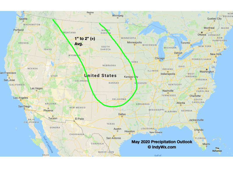
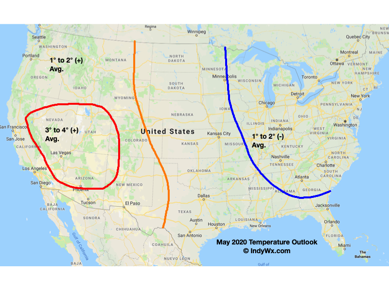
May 2020 Outlook: From One Extreme To The Other?
While a good chunk of the 1st half of the month likely features below normal temperatures, is there potential for a “sudden summer” flip in the pattern for the 2nd half of the month? Let’s discuss!
First and foremost, averages in May for Indianapolis feature lows rising from the upper 40s to the upper 50s by month’s end, highs increasing from the upper 60s to the upper 70s, and 5.05″ of rain. Of note, on average, May is the wettest month out of the year in Indianapolis.
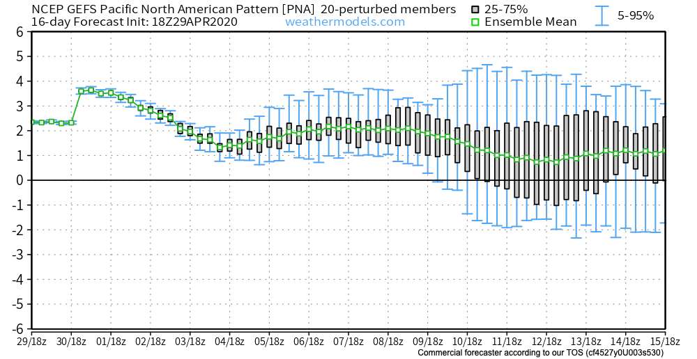
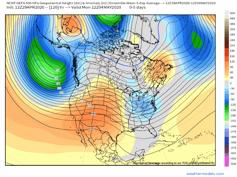
Teleconnections are aligned in a manner to drive rather widespread and persistent cooler than normal anomalies across the eastern portion of the country through the better part of the 1st half of May. Note the positive PNA and negative EPO and associated upper air pattern.

A persistent eastern trough will deliver an extended period of below normal temperatures through the first couple weeks of the month.
As chilly Canadian high pressure builds south behind departing cold fronts, we’ll have to remain on guard for the threat of late season frost/ freeze conditions lingering into the middle of the month.
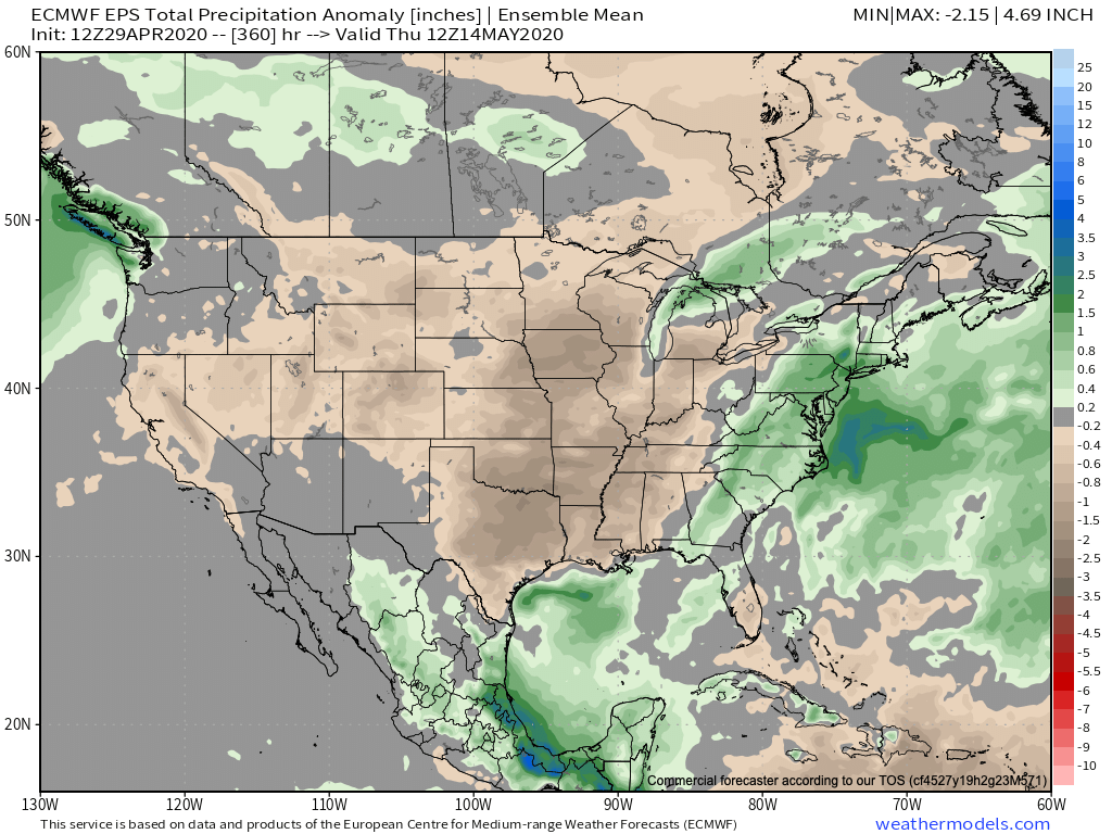
To no surprise, the cool Canadian air will be much drier than a “typical” May pattern that can occasionally tap into the Gulf of Mexico. Accordingly, the pattern should run drier than normal through the 1st half of the month.
While we’re confident on the cool, dry (relative to average) theme carrying the day through the 1st half, there will likely be a snap back in the pattern that will promote at least the threat of a “sudden summer” regime during the latter part of the month. Timing this adjustment will be a bit challenging, but we believe that’s on the table at some point late week 3 or week 4. Accordingly, we’re building our May Outlook to feature this warmer (to hotter) potential late month or else it would be even cooler across the East- overall.
We’ll, obviously, also have to keep close tabs on the MJO throughout the middle and latter part of the month for influences on the pattern.
Without further ado, here’s our May 2020 Outlook…
Permanent link to this article: https://indywx.com/may-2020-outlook-from-one-extreme-to-the-other/
