Midweek Storms; Still Eyeing Less Humid Conditions This Weekend…

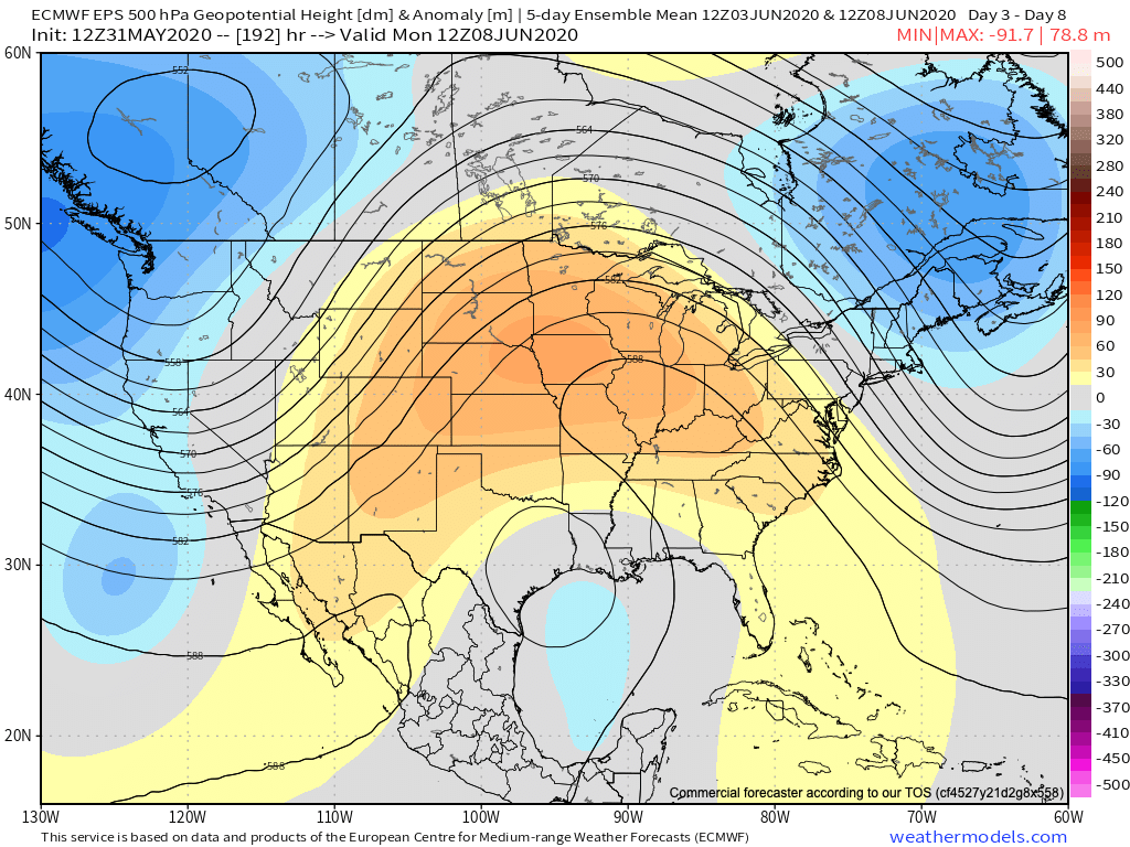
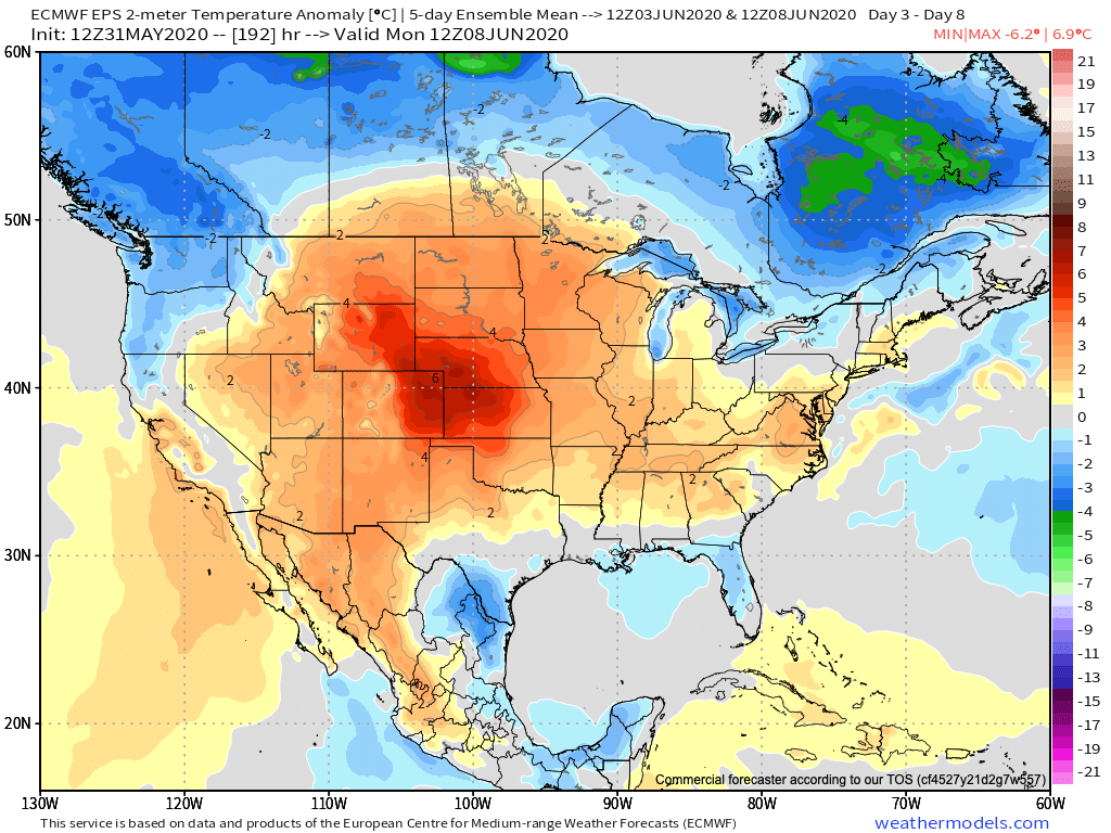
Most of our Wednesday will be rain and storm free with a very warm and tropical feel. Don’t let this lull you in to letting your guard down as storms are expected to still erupt to our north late afternoon before rumbling south into central Indiana this evening.

The biggest concern with this storm complex will be centered on the threat of damaging straight line winds as embedded lines of storms may “bow out” on their journey south this evening. Additionally, large hail will also be possible with a few of the storms. As such, the Storm Prediction Center (SPC) continues to include the heart of the state (and the Ohio Valley for that matter) in a Slight Risk of severe weather today.

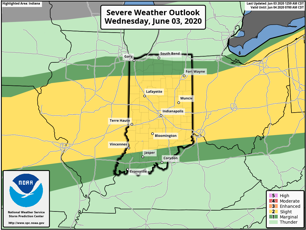
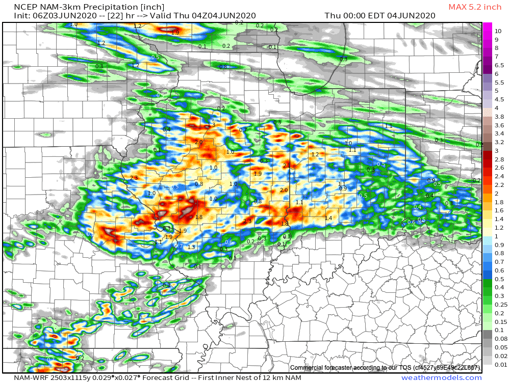
A good chunk of the region can expect 0.50″ to 1″ of rain this evening with locally heavier totals.

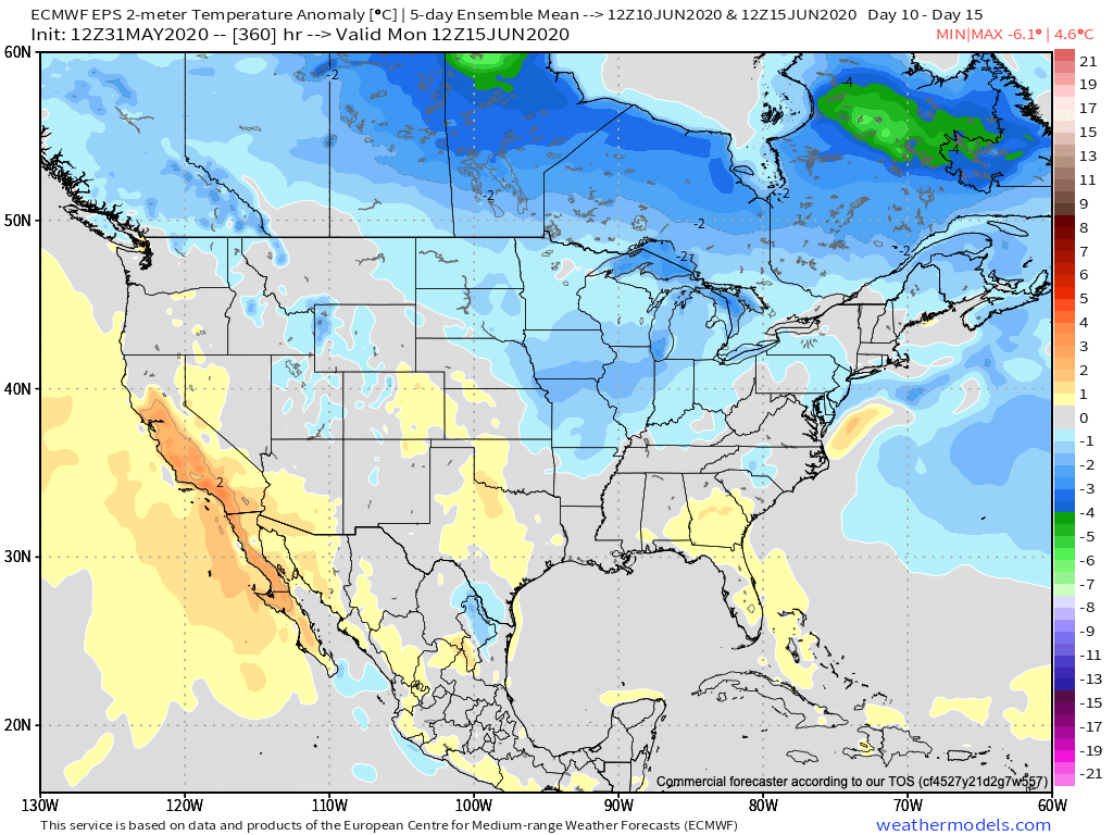
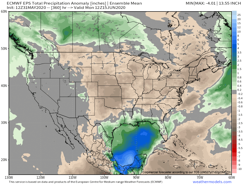
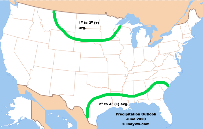
As we look ahead to the weekend, a front will sweep through the state and usher in a much less humid air mass Saturday night into early parts of next week. Sunday and Monday mornings should feature lows back into the upper 50s for most of central Indiana. Additionally, we’ll continue to keep close eyes on Tropical Storm Cristobal in the Gulf. There’s still the potential Cristobal’s remnant moisture will get entrained with an approaching cold front the middle to latter part of next week, leading to the threat of locally heavy rain across the MS Valley and parts of the Mid West and Ohio Valley. We’ll be able to become more specific as time draws closer.

Permanent link to this article: https://indywx.com/midweek-storms-still-eyeing-less-humid-conditions-this-weekend/

VIDEO: Monitoring Storm Potential Wednesday; Updated Summer Thoughts…

You must be logged in to view this content. Click Here to become a member of IndyWX.com for full access.  Already a member of IndyWx.com All-Access?  Log-in here.

Permanent link to this article: https://indywx.com/video-monitoring-storm-potential-wednesday-updated-summer-thoughts/

VIDEO: Things Turn More Active; Changeable Pattern…

You must be logged in to view this content. Click Here to become a member of IndyWX.com for full access.  Already a member of IndyWx.com All-Access?  Log-in here.

Permanent link to this article: https://indywx.com/video-things-turn-more-active-changeable-pattern/

June 2020 Outlook: “Transient” Is The Word…

The first month of meteorological summer is here and right on cue, we’re expecting a significantly warmer pattern to emerge. Does that set the tone for the month as a whole? In the words of Lee Corso: “not so fast my friend.”

After a refreshing weekend the first week of June, overall, is expected to be dominated by a MUCH warmer and more humid pattern. This is courtesy of an upper level ridge building east over the region (in response to the MJO moving into Phase 1, along with a strongly positive EPO).

Deeper into the month, it’ll be tough to hold onto this warm, humid regime as the EPO trends negative and the MJO shows signs of rumbling into Phase 2. In the month of June, Phase 2 delivers cooler than normal temperatures into our portion of the country, along with a good chunk of the East.

Sure enough, the latest European computer model is seeing this cooler trend developing by Week 2:

Given the longer range data, there’s reason to believe the cooler than normal temperatures will also be transient (similar to the warmth to open the month). Overall, drier than normal conditions are expected through the first month of meteorological summer. We’ll have to keep close tabs on where the drier pattern sets up as this can “feedback” on itself the deeper into summer we go.

Given the MJO and EPO forecasts, there’s reason to buy into a “transient” pattern that June should dish out. After a drier than normal 1st half of the month, precipitation should average out close to normal by month’s end. The one exception to this will have to do where remnant tropical moisture tracks inland in the Week 2 time period. From this distance, there are 2 camps pertaining to the potential track of soon-to-be Cristobal: TX/ LA coastline or FL panhandle. The next 7-10 days will be interesting. We’d recommend getting used to an ever-changing temperature pattern in the upcoming 3-4 weeks that should balance out close to average for our neck of the woods by month’s end.

Our official June Outlook looks like this:

Permanent link to this article: https://indywx.com/june-2020-outlook-transient-is-the-word/

VIDEO: Switching Gears In The Week Ahead…

You must be logged in to view this content. Click Here to become a member of IndyWX.com for full access.  Already a member of IndyWx.com All-Access?  Log-in here.

Permanent link to this article: https://indywx.com/video-switching-gears-in-the-week-ahead/