
You must be logged in to view this content. Click Here to become a member of IndyWX.com for full access. Already a member of IndyWx.com All-Access? Log-in here.
Permanent link to this article: https://indywx.com/video-storm-chances-ramp-up-today-timing-out-cold-fronts-between-now-and-early-august/
Jul 20
VIDEO: Timing Out Storms This Week And Eyes On The August Horizon…
You must be logged in to view this content. Click Here to become a member of IndyWX.com for full access. Already a member of IndyWx.com All-Access? Log-in here.
Permanent link to this article: https://indywx.com/video-timing-out-storms-this-week-and-eyes-on-the-august-horizon/
Jul 19
More Thoughts On August…
The last month of meteorological summer is on our doorstep and while we’re still several days from having our finalized forecast built, here are some early ideas on where the pattern is going for August. First, let’s start with some modeling:
European
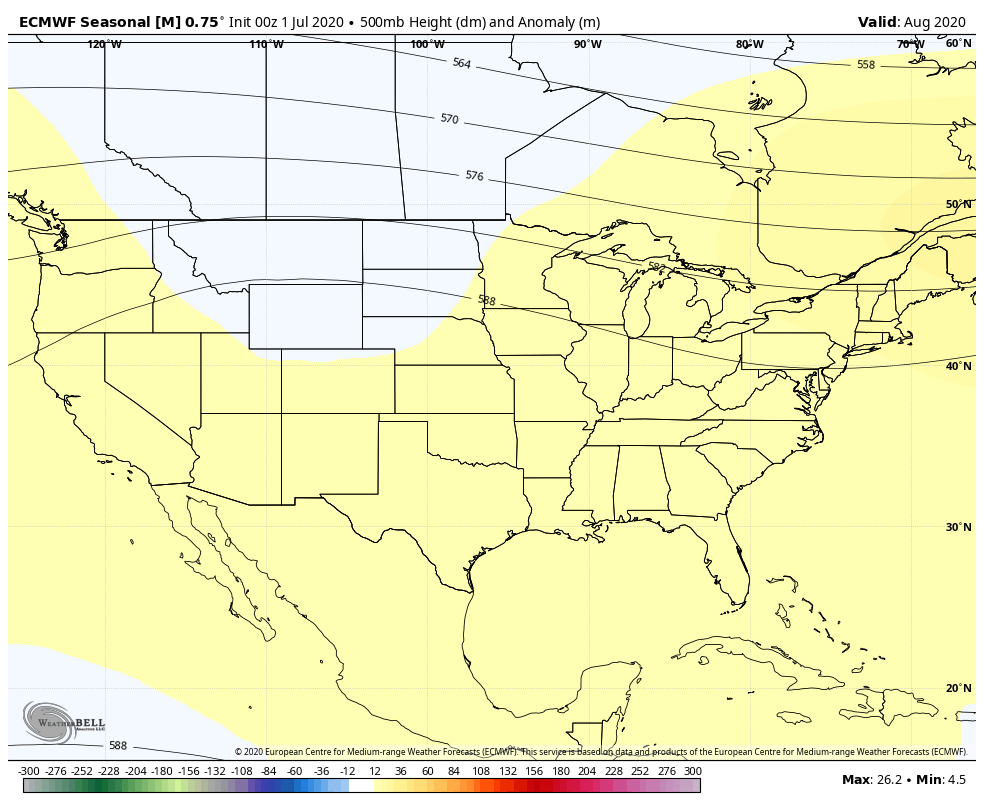
The Euro features the ‘mean’ ridge axis across the inner-mountain West with a northwesterly flow aloft into the Ohio Valley and eastern Lakes. Given the 500mb pattern, one would think the model would have the heat and wet areas shifted west to better correlate with the ridge placement, but that’s not the case. One item of note is that the model may be seeing tropical influences with the wet area across the Southeast and Mid Atlantic.
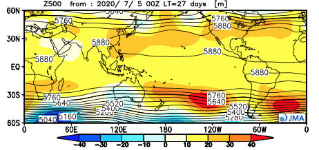
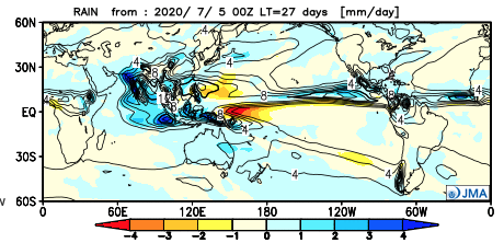
JMA
The JMA is similar with the handling of the 500mb pattern, but better aligns the temperature and precipitation pattern with this look at the upper levels. Brunt of the heat (relative to normal) is across the West with a wet Southeast and Ohio Valley.

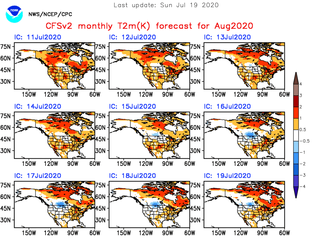
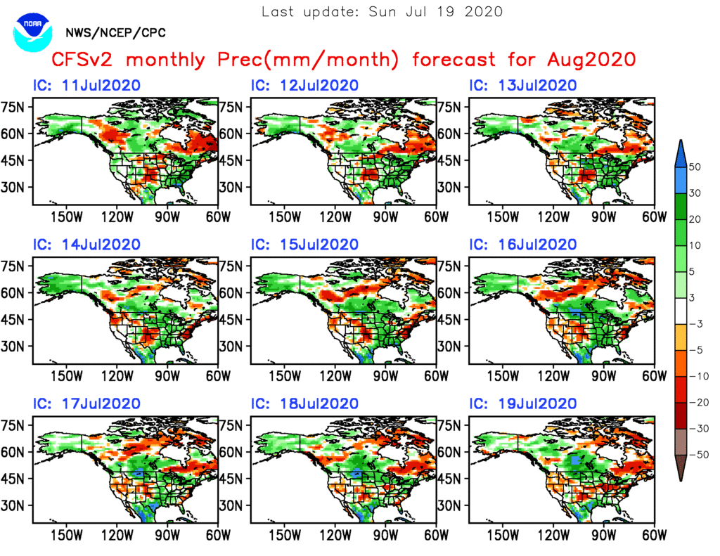
CFSv2
While a bit chaotic with the precipitation idea, the CFSv2 seems to be locking the warmer anomalies into the Central and East for August.
As has been the case, the MJO will likely have a big say in the August pattern (and continuing into the fall and winter). Despite modeled attempts in the past to swing things into Phases 4-7, we’ve been stuck in the 8,1,2, and 3 cycles over the past several months, and in Phases 1-2 over the past 40 days.

The EPO and PNA are in warm phases and this looks to continue overall into early August.
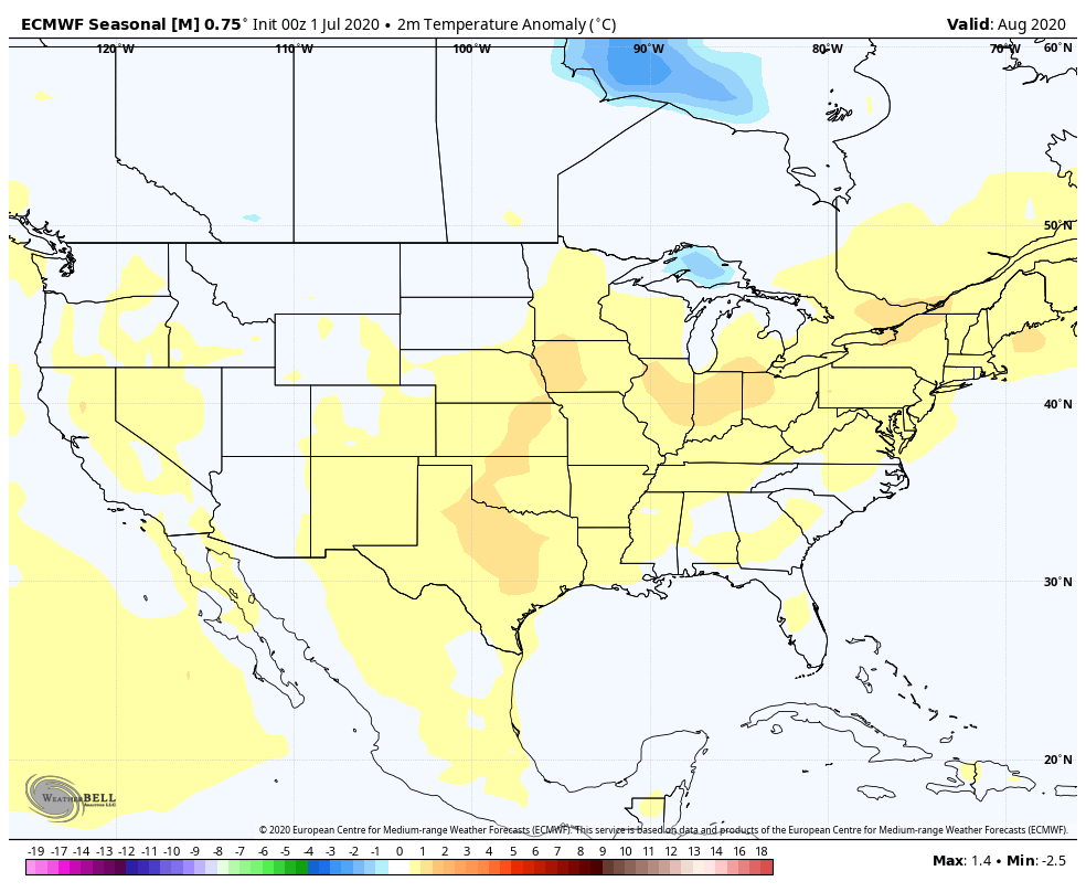
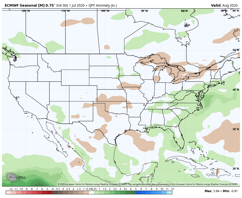
The early lean with our August forecast will feature a large area of above normal temperatures, including across the Ohio Valley (slightly so), along with near average precipitation. We’ll continue to look through the data and present our official August Outlook week after next.
Permanent link to this article: https://indywx.com/more-thoughts-on-august/
Jul 19
VIDEO: Strong Storms Later This Afternoon-Evening; Timing Out Rain Chances Through The Week Ahead…
You must be logged in to view this content. Click Here to become a member of IndyWX.com for full access. Already a member of IndyWx.com All-Access? Log-in here.
Permanent link to this article: https://indywx.com/video-strong-storms-later-this-afternoon-evening-timing-out-rain-chances-through-the-week-ahead/
Jul 18
Weekly #AGwx And #Severe Weather Outlook…
I. New heat wave gets underway.
II. Keeping eyes to the sky for periods of gusty storms.
Forecast Period: 07.18.20 through 07.25.20
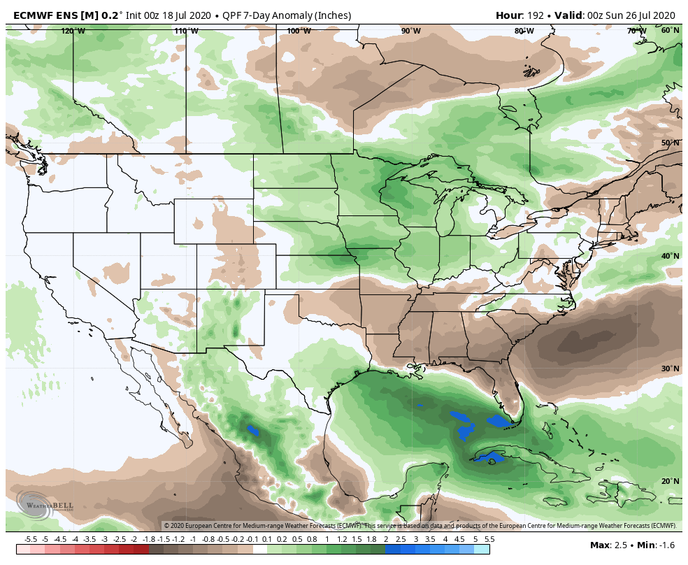
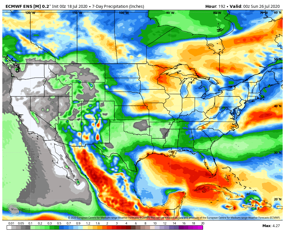
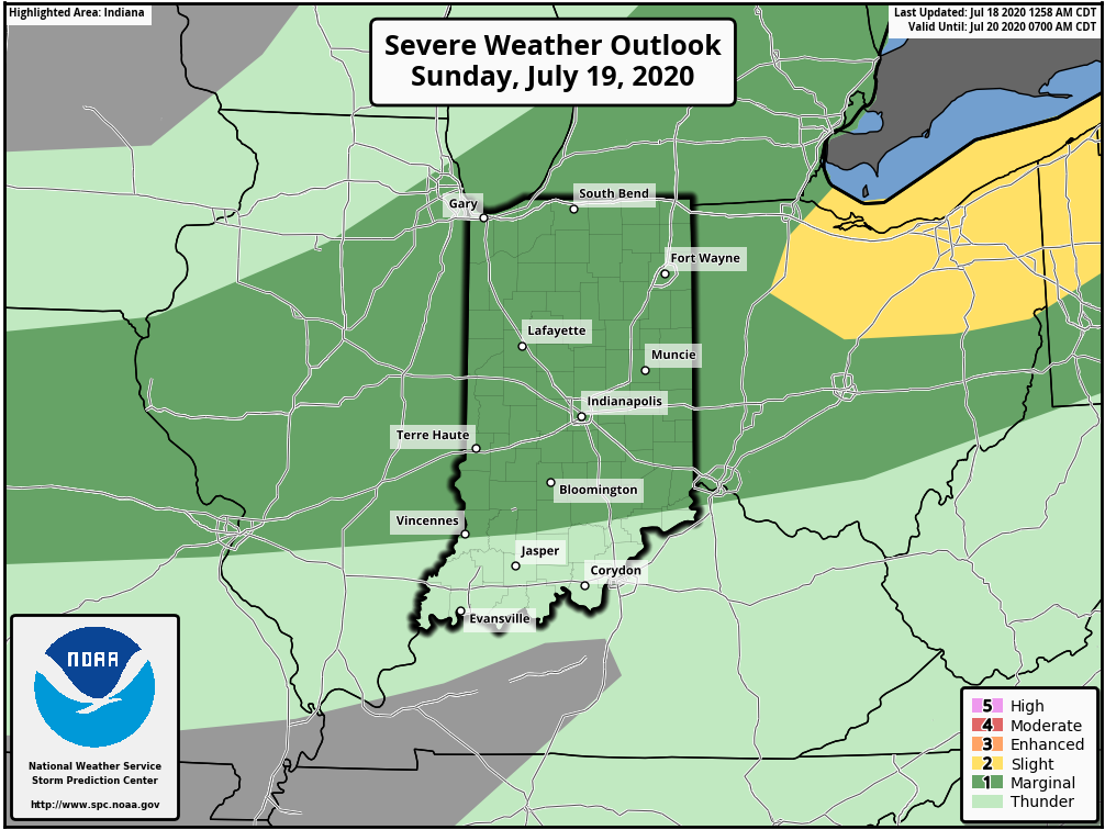
A hot and humid stretch of weather will dominate the upcoming forecast period, including another multi-day stretch with highs in the lower 90s and lows in the lower 70s. The saving grace? Timely rains. After a mostly dry Saturday (only isolated storm coverage expected), more widespread storms are expected Sunday. Some of these could become strong to severe Sunday afternoon, including the threat of damaging winds as a complex moves south through the state. This unsettled theme will continue into the 1st half of the work week with each day offering up scattered showers and storms. Drier air will briefly nudge into the Ohio Valley Thursday and Friday before storm chances return next weekend.
Permanent link to this article: https://indywx.com/weekly-agwx-and-severe-weather-outlook-14/
