2 Sides To Every Storm…

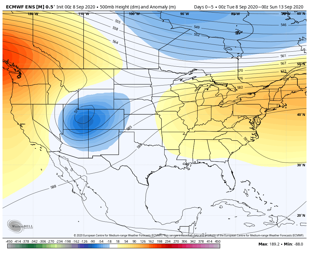
An early taste of winter is descending on the Rockies today (the town of Breckenridge camera will be fun to check in on from time to time over the next 24 hours). Places, such as Denver, that were in the 90s yesterday will fall into the 20s and 30s today with snow.

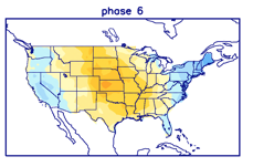
Note the big spread in temperatures across the country this morning and corresponding 24 hour temperature change:

We’ll remain on the mostly dry and warm side of this event until the weekend.

Once the storm system lifts northeast and gets close enough to impact our region, it’ll be in a much weaker state. Scattered showers and thunder are possible over the weekend, but widespread significant rainfall isn’t expected.

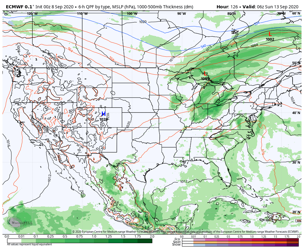
After heavy rains fell across north-central Indiana Monday, a much drier theme can be expected throughout the next several days. A widely scattered shower or thunderstorm is possible before Saturday, but most should remain rain-free. Even as the storm system draws closer, weekend rainfall should average only between 0.25″ and 0.50″ for most.

Cooler air (nothing to the extent or magnitude of what our friends out west are seeing) will filter in here late weekend and early next week. Lows into the 50s can be expected with a couple of days of highs in the 70s.

Permanent link to this article: https://indywx.com/2-sides-to-every-storm/

VIDEO: Discussing Where Strong Storms May Develop Later This Afternoon; Warm Week Ahead…

You must be logged in to view this content. Click Here to become a member of IndyWX.com for full access.  Already a member of IndyWx.com All-Access?  Log-in here.

Permanent link to this article: https://indywx.com/video-discussing-where-strong-storms-may-develop-later-this-afternoon-warm-week-ahead/

VIDEO: Stormy 24 hours Ahead; Amplified Pattern This Week…

You must be logged in to view this content. Click Here to become a member of IndyWX.com for full access.  Already a member of IndyWx.com All-Access?  Log-in here.

Permanent link to this article: https://indywx.com/video-stormy-24-hours-ahead-amplified-pattern-this-week/

Afternoon Video Update: Tracking A Significant Early Fall Storm System Next Week…

You must be logged in to view this content. Click Here to become a member of IndyWX.com for full access.  Already a member of IndyWx.com All-Access?  Log-in here.

Permanent link to this article: https://indywx.com/afternoon-video-update-tracking-a-significant-early-fall-storm-system-next-week/

Long Range Update: Making Sense Of The “Noise” Into Mid-Late September…

Over the past couple of days we’ve noted a tremendous amount of chaos within the medium range forecast models for next week. At times, the American data was suggesting October-like chill while the European data painted a picture that would make mid-summer proud. The end result will likely end up being a blend of the two extreme solutions (cooler, most certainly, but not to the extent once forecast off the GFS- and a far cry from the extreme heat shown from the European). We’ll handle that with our short to medium term updates from here on out.

As we look ahead to mid and late September, the baseline of our forecast remains unchanged and that’s the idea that the MJO will move into Phases 5 and 6. At first, this is a cool phase for the time of year, but once to around the 18th-20th, we flip the script to a drastically warmer period, compared to average. Note the (2) MJO analogs below:

This is very similar to what the latest CFSv2 and European Weeklies show:

After what will likely be a much more active and wetter week ahead, the following couple of weeks take on a dry look from the models:

Interestingly, Phase 5 of the MJO is also a dry phase this time of year, locally:

Much more throughout the weekend!

Permanent link to this article: https://indywx.com/long-range-update-making-sense-of-the-noise-into-mid-late-september/