I hope this finds you having a great Friday morning! Just wanted to drop a quick note to let you know of connectivity issues from the road this morning. I…
You must be logged in to view this content. Click Here to become a member of IndyWX.com for full access. Already a member of IndyWx.com All-Access? Log-in here.
Unfortunately there likely won’t be any significant changes to our precipitation pattern until late autumn and winter. Until then, we’ll have to take any drop of rain we can find. Once the pattern flips though, it may do so in quick and rather dramatic fashion (still expecting a wet winter).
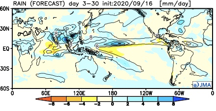
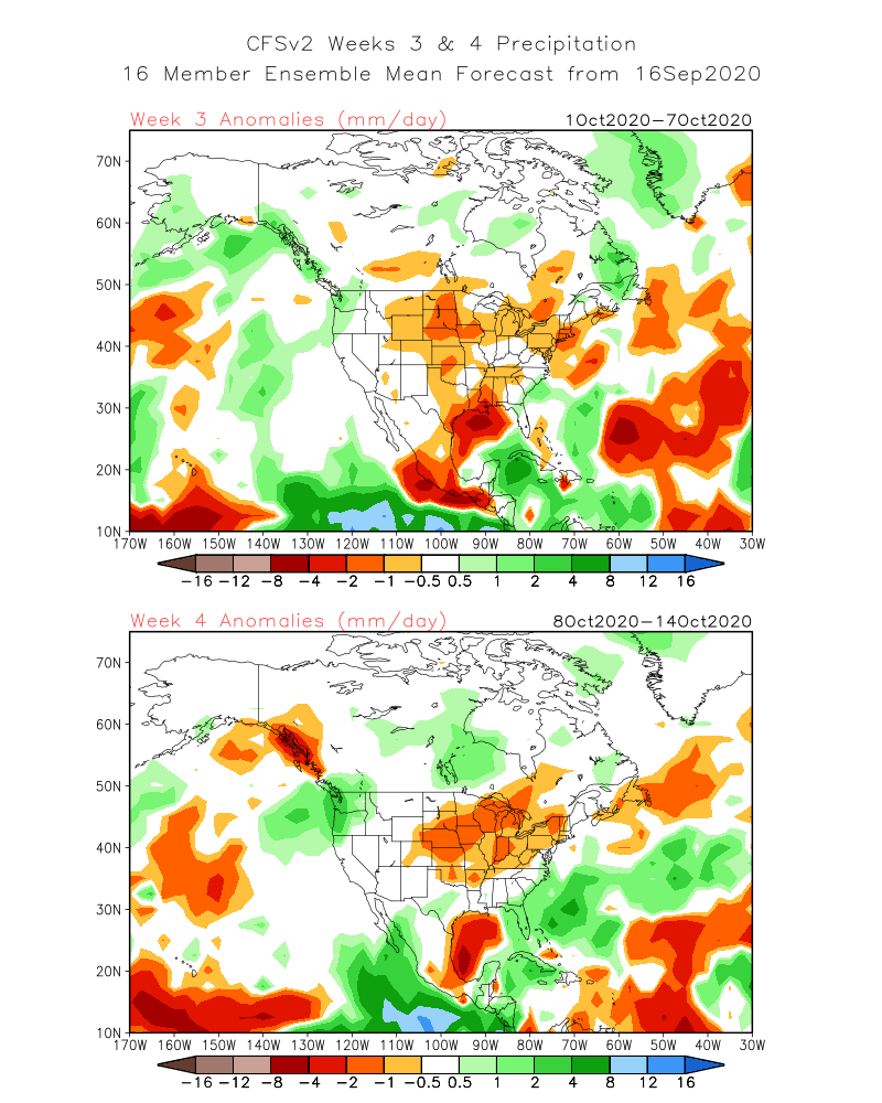
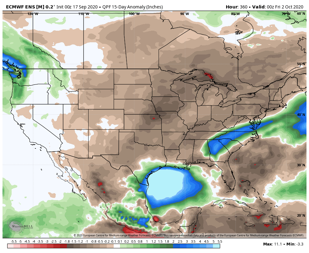
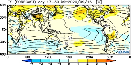
The consensus of long range data shows the dry pattern continuing over the upcoming few weeks, including the JMA Weeklies, CFSv2 Weeklies, and ensemble products.
Analogs and other teleconnections support this dry theme. At least in the immediate range (through mid October) the only way to bust up this dry pattern is to get tropical moisture involved.
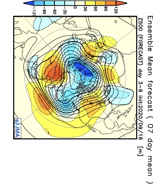
The new JMA Weeklies maintain the ‘mean’ ridge position across the West for the majority of the upcoming few weeks, but there will likely be attempts to expand the ridge across the northern tier Week 2 and 3 that would lead to at least transitional periods of much warmer air, after the cool period in the short term.
The model sees the ridge expanding Weeks 3-4 and the associated warmth that spreads east after the chilly regime.
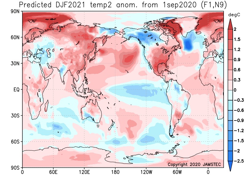
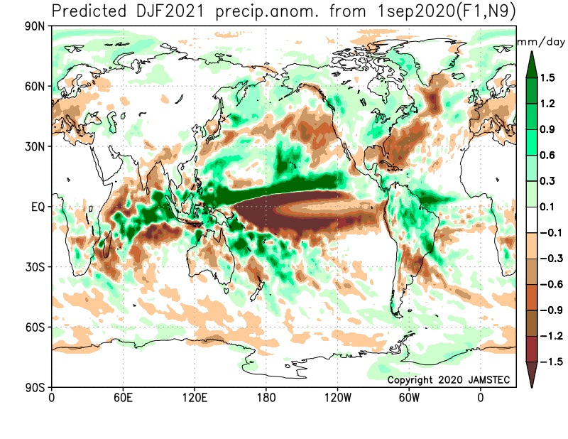
The new JAMSTEC seasonal data is also in and maintains a warm look this winter. A lot of this has to do with an expected persistent southeastern ridge. We agree with this but, as is the case each winter, there will be challenges that have to be dealt with.
We also agree with the active storm track through the Ohio Valley and associated well above normal precipitation in the December through February period.
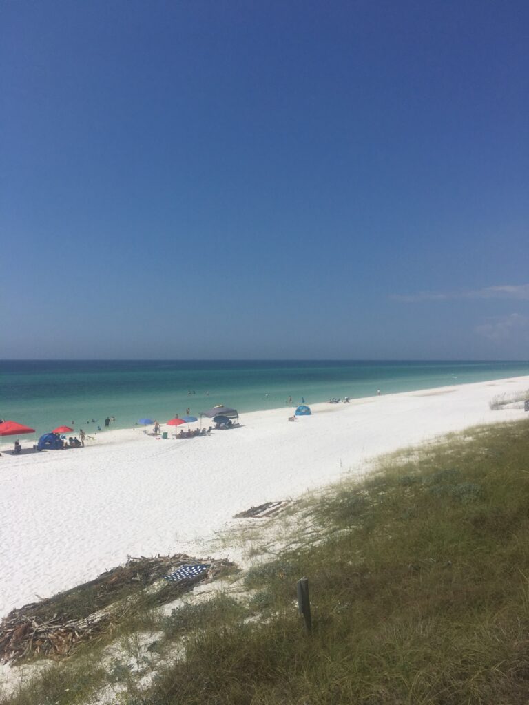
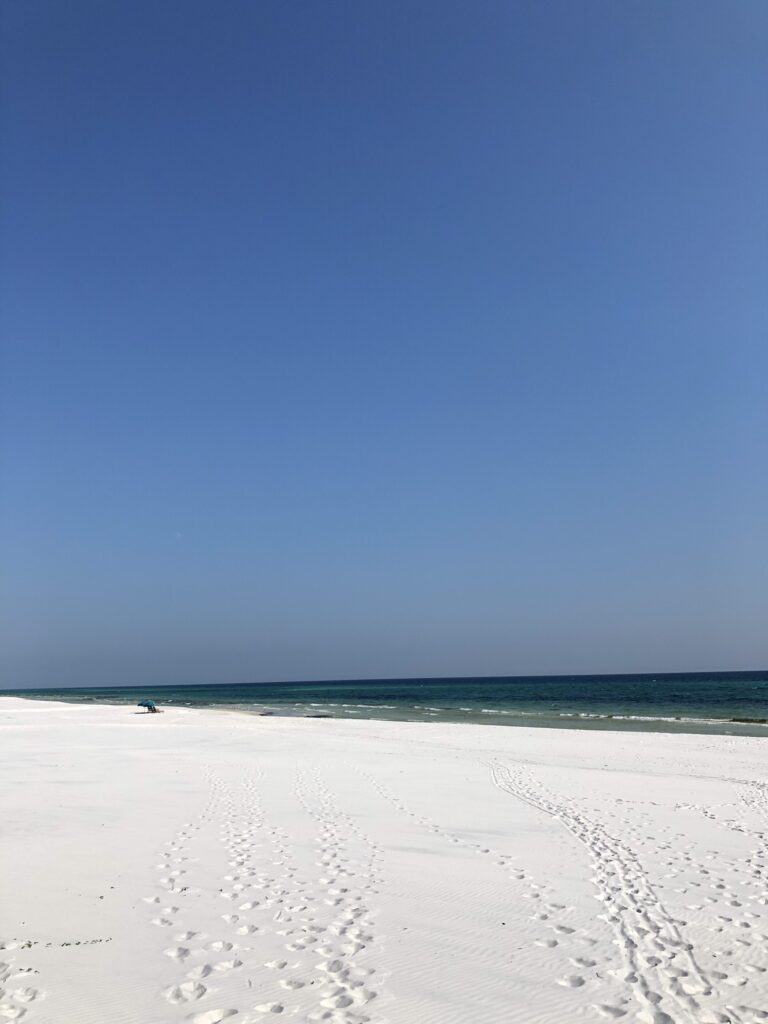
Each autumn my family and I visit the gorgeous stretch of beaches on 30A (along the Florida panhandle). 99% of our visits have been met with pristine conditions, and I can count on one hand how many times (not all day washouts) rain has chased us inside.
For reference on what these beaches typically look like this time of year, I wanted to share a couple photos from last year’s trip. For those who haven’t been to Santa Rosa, Seaside, or Grayton Beach, this is what you normally can expect, including clear water and sugar-white sand. That is unless a hurricane threatens. While officially making landfall well to our west (roughly 150 miles in Gulf Shores, AL), the impacts were significant along the Florida panhandle. As Sally pushes inland, things are now slowly beginning to diminish here along the coast. It looks like we’ll finish this event in Grayton Beach with just shy of 19” of rain, 88 MPH winds, and at least 2 attempts of water spouts (not confirmed due to the intensity of rain and being at night).
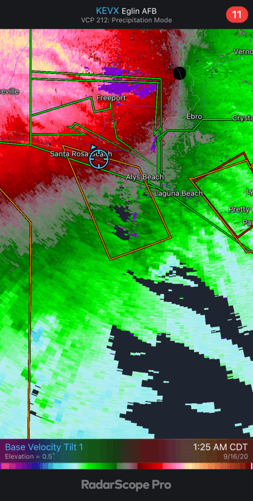
Note the radar signatures around 1:45a this morning.
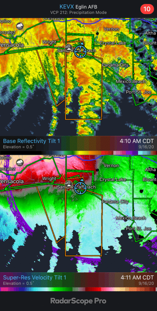
And again just after 4:30a.
It’s still tough to get out and explore the damage in our neighborhood, but a quick scan shows some of the impacts to houses, especially roofs and front porches.
The surf has also been something to behold. Many times, as the photos to begin showed, it’s tough to get 1’ to 2’ waves. This storm produced 12’ to 14’ waves, locally, along with a 4’ storm surge. In my 36 years, I’ve, personally, never seen waves like this on these beaches- including Michael, Ivan, and Opal.
See some of the videos I recorded this morning below:
Normally, this home is 50-75 yards away from the oceanfront.
The storm is, thankfully, now beginning to wind down here and we’re fully expecting to be back out on the beautiful beaches (though we know they’ll look very different from what we’re accustomed to) for an evening sunset. Our friends across the southeast states now will have to deal with flooding rain, gusty winds, and quick spin-up tornado potential between now and Friday evening.
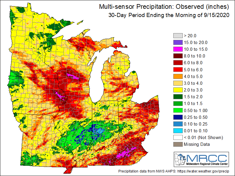
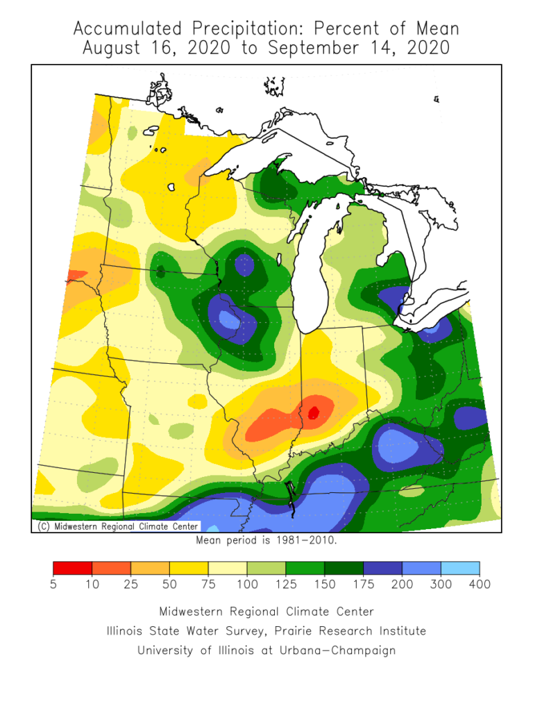
The upcoming (10) days will offer little, if any, relief from the recent dry stretch. Note the expanding (albeit still localized in the grand scheme of things) area of dry over the past (30) days:
Some areas from south-central IL into central IN have only seen 0.10” to 0.50” over the past month.
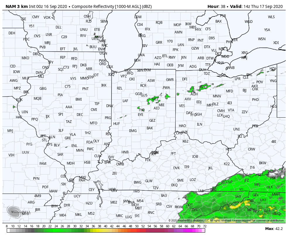
While a cold front will slip through the state Thursday, only isolated, weak showers are expected. Most will avoid any rain (best chance of seeing a passing shower will be across northern IN but even these won’t amount to much).
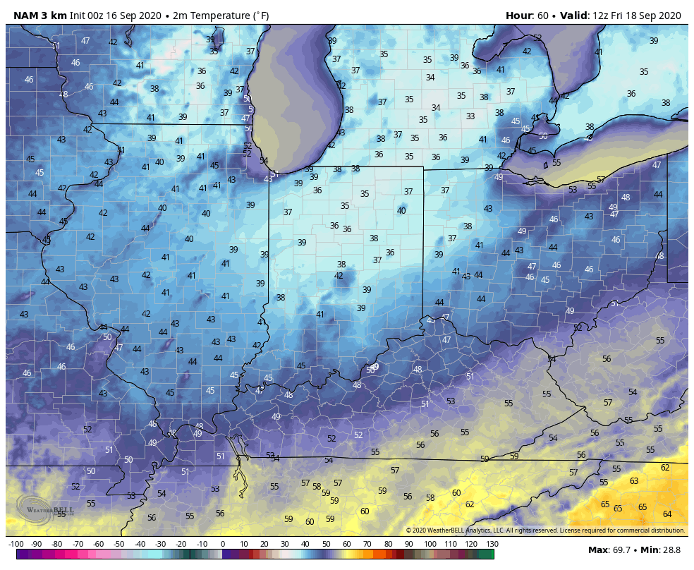
Of more interest will be the true jab of fall air behind the boundary. The dry ground will aid in allowing temperatures to fall to lower levels than if we had recently been dealing with wet conditions. In fact, outlying areas across central and northern parts of the state can expect the first frost of the season (2-3 weeks earlier than average) this weekend into early next week with overnight lows falling into the mid to upper 30s.
Quick follow up: Many have asked, and we are safe along the beaches of Walton Co. here in the Florida panhandle. Sally (now a category 2, 100 MPH hurricane) is making landfall near Gulf Shores, AL- 150 mi. to our west. We’ve accumulated over 15” of rain since 12a Tuesday and torrential downpours continue. Early this morning winds have gusted over 60 MPH and water spouts have been observed just off the coast of where we’re staying. As long as we maintain power, we’ll have a fresh video post later today.
You must be logged in to view this content. Click Here to become a member of IndyWX.com for full access. Already a member of IndyWx.com All-Access? Log-in here.