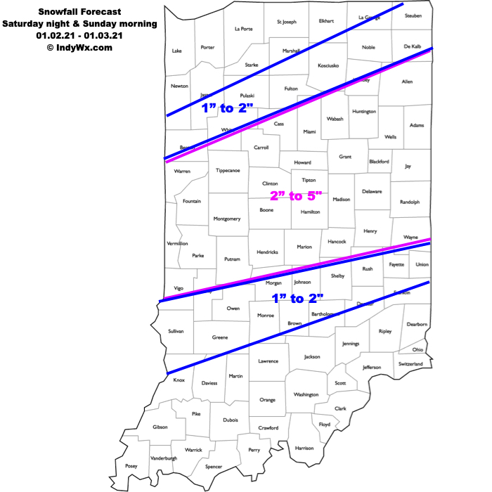
Type: Impactful wintry weather
What: Accumulating snow
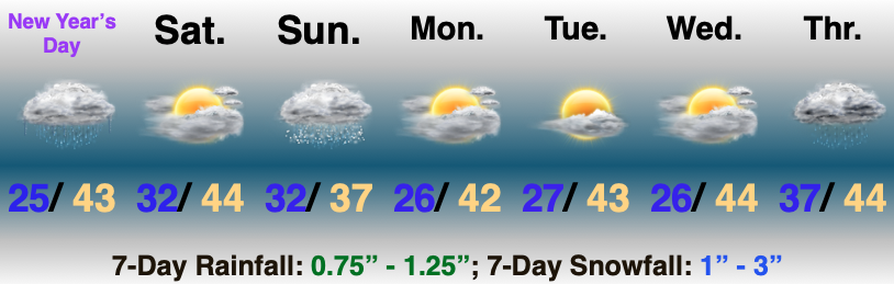
When: 11p Saturday – 11a Sunday
Temperatures: Lower 30s
Wind: E shifting to the NW Sunday morning 5-15 MPH
Blowing/ Drifting: Minimal
Pavement Impacts: Plowing and salting will be required
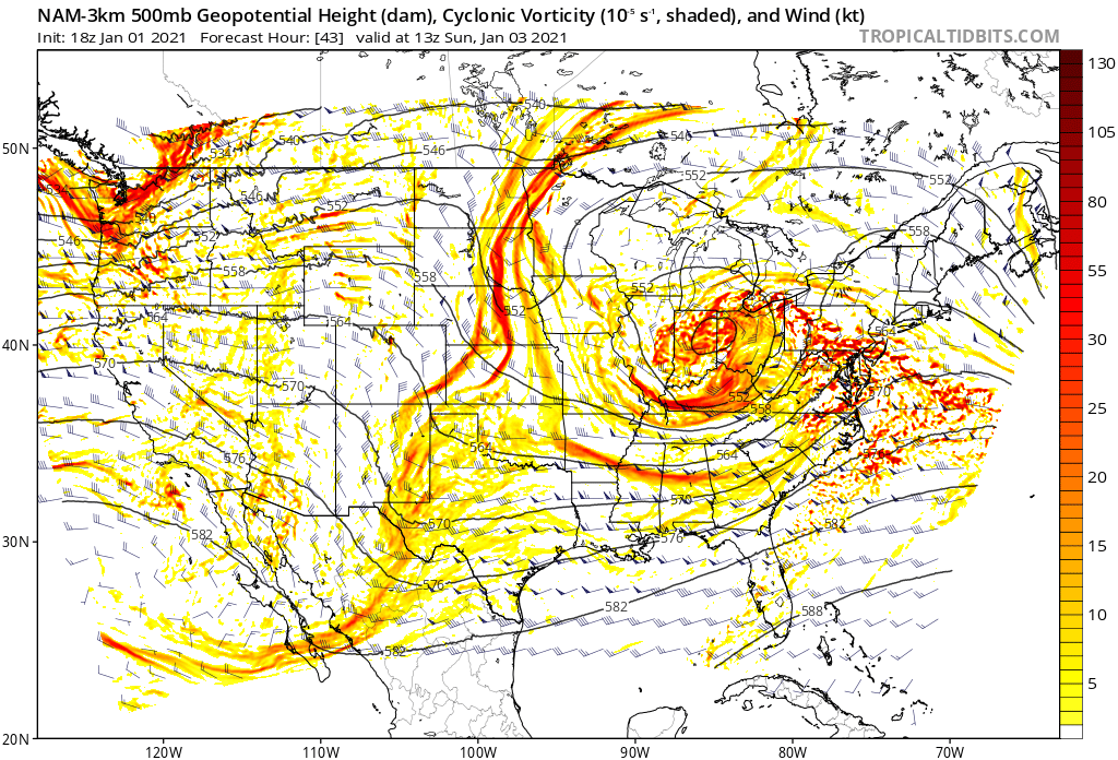
Summary: A cold core upper level disturbance will lift northeast out of north-central Texas tonight and directly over Indiana Saturday night and Sunday morning. After a dry period of weather through the daytime Saturday, a mix of rain and snow will overspread central IN by late evening. As the upper level disturbance moves overhead, the column of air should become just cold enough to allow the wintry mix to transition to all snow during the overnight. Embedded bands of moderate to heavy snow may develop early Sunday morning. The system will pull east of the state Sunday afternoon, allowing the snow to come to an end by mid to late morning.
Confidence: Medium – high
Next Update: Saturday morning