Winds Of Change On The Doorstep…

Updated 08.31.21 @ 8:11a

We have one more day of humid conditions, but a wholesale pattern change will have things feeling much different around these parts beginning tomorrow, and continuing for the foreseeable future.

Note the drier air beginning to invade northern portions of IL, IN, and OH this morning. While dew points are still stuck in the mid-upper 60s, locally, that less humid air is heading south.

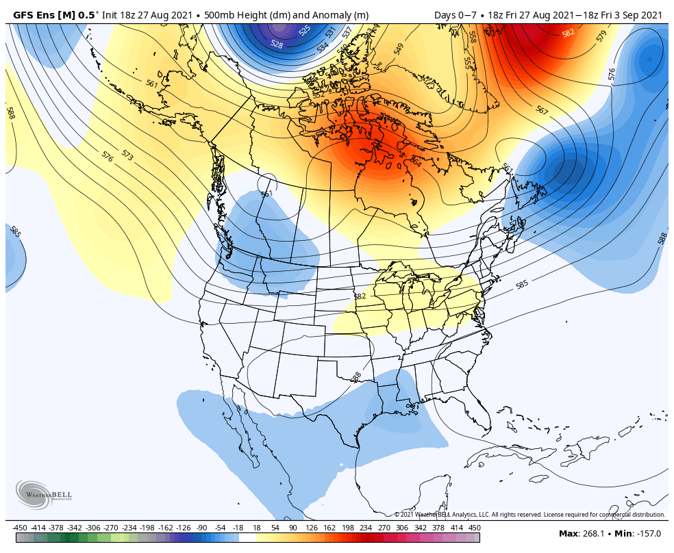
Note how the trough really amplifies next week across the eastern portion of the country. This will pull down an extended stretch of cooler, less humid air as we move through the better part of the first half of September.

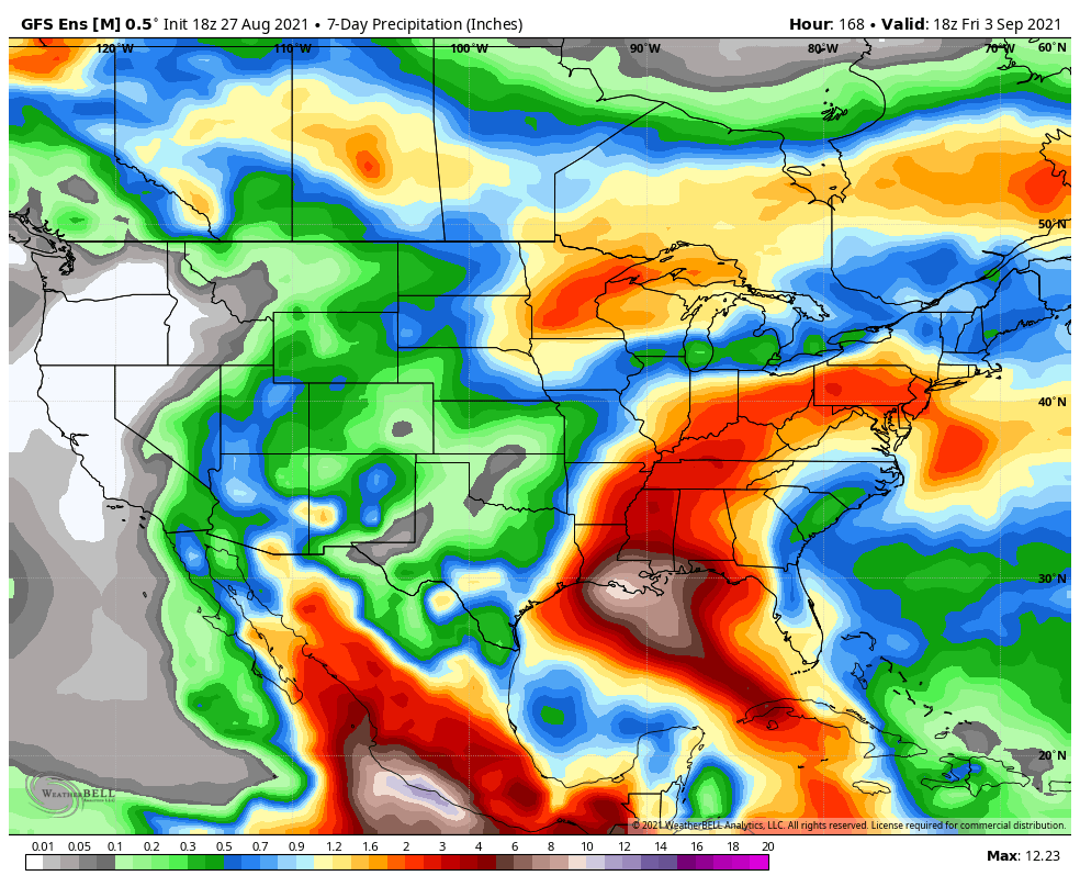
A reinforcing cold front will sweep through here Saturday (yes, we’re giving in to building rain and storm chances into our Saturday forecast) with unsettled conditions.

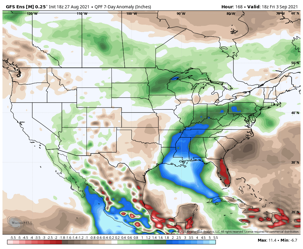
This is likely going to set the stage for an overall wetter, cooler stretch of weather next week. Additional rain chances will arrive Tuesday and Thursday of next week.

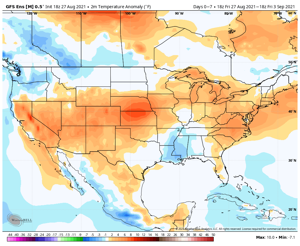
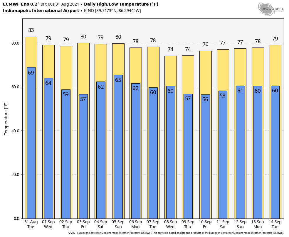
8 of the past 10 days featured highs at or above the 90° mark, and was easily the hottest stretch of the summer. Looking ahead, a “hint” of fall shows up on the medium range charts just in time for us to kick off meteorological fall (officially, tomorrow).

Much more later, including our September Outlook…

Permanent link to this article: https://indywx.com/winds-of-change-on-the-doorstep/

VIDEO: Tracking Heavy Storms Over The Next 24-36 Hours Before Much Drier, Cooler Air Invades To Close Out The Week…

Updated 08.30.21 @ 7:50a

You must be logged in to view this content. Click Here to become a member of IndyWX.com for full access.  Already a member of IndyWx.com All-Access?  Log-in here.

Permanent link to this article: https://indywx.com/video-tracking-heavy-storms-over-the-next-24-36-hours-before-much-drier-cooler-air-invades-to-close-out-the-week/

VIDEO: Devastating Hurricane Ida Makes Landfall This Afternoon; Tracking BIG Changes Here By Midweek, Continuing Into Labor Day Weekend…

Updated 08.29.21 @ 11a

You must be logged in to view this content. Click Here to become a member of IndyWX.com for full access.  Already a member of IndyWx.com All-Access?  Log-in here.

Permanent link to this article: https://indywx.com/video-devastating-hurricane-ida-makes-landfall-this-afternoon-tracking-big-changes-here-by-midweek-continuing-into-labor-day-weekend/

Weekly #AGwx And Severe Weather Outlook…

Updated 08.28.21 @ 6a

A persistent trough will remain in place across the northern Rockies while weak ridging takes up shop across the Great Lakes region.
Warmest anomalies through the forecast period can be expected across the Mid-Atlantic and central Plains, into the Southwest. The northern Rockies will remain cooler than normal. The cooler than normal conditions across the central Gulf Coast region is associated with the daytime highs being lower as Ida moves north early in the period.
The biggest focus through the middle of the week will have to do with the remnant moisture associated with Ida. Active times will return to the upper Midwest as well.
We forecast 7-day rainfall amounts to check-in between 1″ and 1.5″ for most of central Indiana.

Forecast Period: 08.28.21 through 09.04.21

The period will open with an active weather pattern. A cold front will slowly press south through early week. At the same time, Hurricane Ida is forecast to make landfall along the north-central Gulf Coast (likely along the LA coastline) Sunday afternoon, and as a major hurricane at that. The remnant moisture of Ida will lift north before curling east. Eventually, we believe the remnant moisture of Ida will get tangled up with the aforementioned cold front. While we’ll need to keep a close eye on data to see if any adjustments are needed early week, as of now, we believe the heavy rain threat will lie just south of our immediate area (more so along and south of the OH River). We’ll keep a close eye on things. Regardless, scattered to numerous showers and thunderstorms are expected as the cold front sinks south. By midweek, the region will be in a much drier (and somewhat cooler) northeasterly airflow. Dry conditions are expected to continue into the holiday weekend ahead with slowly moderating temperatures.

Permanent link to this article: https://indywx.com/weekly-agwx-and-severe-weather-outlook-43/

VIDEO: Explaining How Ida And A Cold Front Can Work Together To Draw In MUCH Drier, Cooler Air Leading Up To The Labor Day Weekend…

Updated 08.27.21 @ 9:15a

You must be logged in to view this content. Click Here to become a member of IndyWX.com for full access.  Already a member of IndyWx.com All-Access?  Log-in here.

Permanent link to this article: https://indywx.com/video-explaining-how-ida-and-a-cold-front-can-work-together-to-draw-in-much-drier-cooler-air-leading-up-to-the-labor-day-weekend/