VIDEO: Warm Start To The Work Week Before Cooler Air Presses In…
Updated 03.06.23 @ 2a
You must be logged in to view this content. Click Here to become a member of IndyWX.com for full access. Already a member of IndyWx.com All-Access? Log-in here.
Updated 03.06.23 @ 2a
You must be logged in to view this content. Click Here to become a member of IndyWX.com for full access. Already a member of IndyWx.com All-Access? Log-in here.
Updated 03.05.23 @ 5:08p
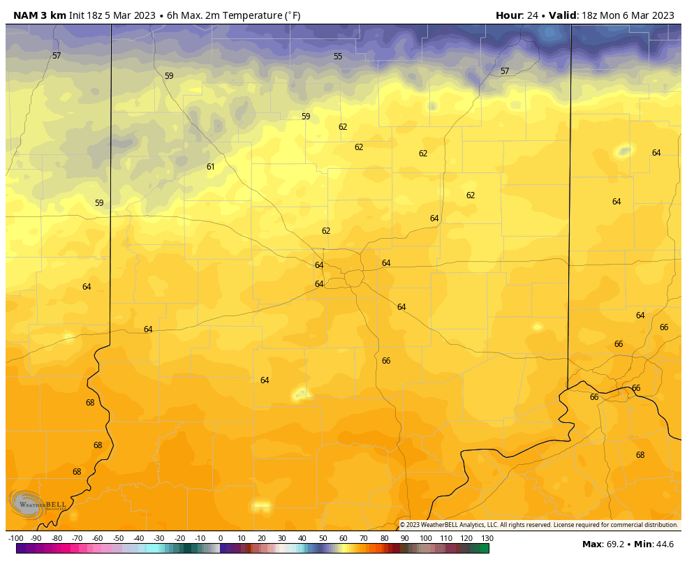
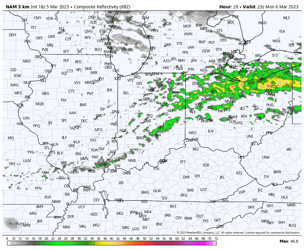
I. If you can, be sure to spend some time outside this afternoon or Monday. Highs into the 50s this afternoon will be replaced with mid to upper 60s across central IN Monday afternoon. While shower chances will return across northern parts of the state Monday morning, most of the day should be dry, locally. A few showers could sneak in here tomorrow evening (shown below) but not before what should otherwise be an unseasonably pleasant open to the work week.
II. A colder airmass will settle south into the region for midweek. We’re talking about lows falling back below freezing and highs in the 40s with a gusty northerly breeze at times, but we should stay on the dry side.

III. Our next system of significance is slated to impact the area as we close out the work week. Models are struggling mightily with respect on how they handle upper level energy transferring to the east coast. As such, operational guidance ranges anywhere from more of a “white to wet” solution in the Thursday evening and Friday time frame. We still have time to watch things unfold but the initial thought is that this won’t be a big deal from a wintry perspective, locally. At this point, I’m not even confident enough to say this will be a heavy precipitation producer, but can see a scenario where that changes should the energy phase a little sooner. Stay tuned, but as of now, it appears as if the pattern will be too progressive to allow this to become a big event for our immediate region.
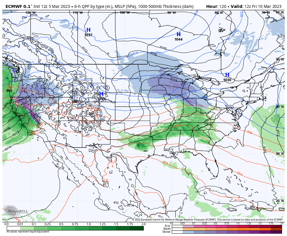
IV. Another system appears likely to open up early next week, but similar to our late week system, there are more questions than answers at this distance. While confidence remains high on a continued active pattern and one that also turns progressively colder (compared to normal), the all-important specific details are up for great debate.
Updated 03.04.23 @ 7:33a
You must be logged in to view this content. Click Here to become a member of IndyWX.com for full access. Already a member of IndyWx.com All-Access? Log-in here.
Updated 03.03.23 @ 7:40a
You must be logged in to view this content. Click Here to become a member of IndyWX.com for full access. Already a member of IndyWx.com All-Access? Log-in here.
Updated 03.02.23 @ 11:03p
Type: Flooding and Severe Weather; North-Central IN Wet Snow
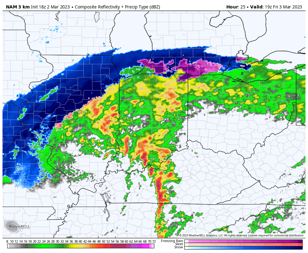
What: Heavy rain and severe weather; north-central Indiana heavy wet snow
When: Friday, 3/3/23
Wind: Variable 20-30 MPH with gusts to 50 MPH
Summary: A deepening area of low pressure will track into the central Ohio Valley as we close the work week. This will lead to an expanding area of heavy precipitation through the overnight and into Friday morning. Precipitation will fall in the form of heavy rain across central portions of the region, including the Indianapolis area, along with a flood threat. Further north, heavy wet snow will develop across northern IN, into the greater CHI area and into central MI. Note: Early 00z guidance is shifting this area of low pressure further southeast which puts more of north-central parts of the state in play for wet snow accumulation Friday afternoon. We’ll continue to monitor overnight trends but the possibility is there that the rain-snow line will have to shift south compared to what most of the data has been showing the past couple of days. Widespread rainfall amounts of 2”+ can be expected into central IN along with non-thunderstorm gusts of 50+ MPH.
We bracket the 1p to 4p window for the threat of severe storms. This risk lies from Indianapolis proper and points south. We anticipate a line of storms to “bow” out, leading to an elevated damaging wind threat across southern IN during this time period but we also note the potential of a couple of quick spin-up tornadoes within this line of storms, as well. It’ll be important to have a means of getting any and all warnings Friday. Keep tuned to local media or have a way to receive the latest National Weather Service updates. All of the “action,” including the heavy rain threat is expected to wind down Friday evening, including much calmer and quieter conditions returning Friday night.
We’ll be back with a fresh video discussion no later than 7:30a Friday.