Wet Thursday; Major Improvements In Time For Halloween; Jab Of Early Season Arctic Air To Open Next Week…

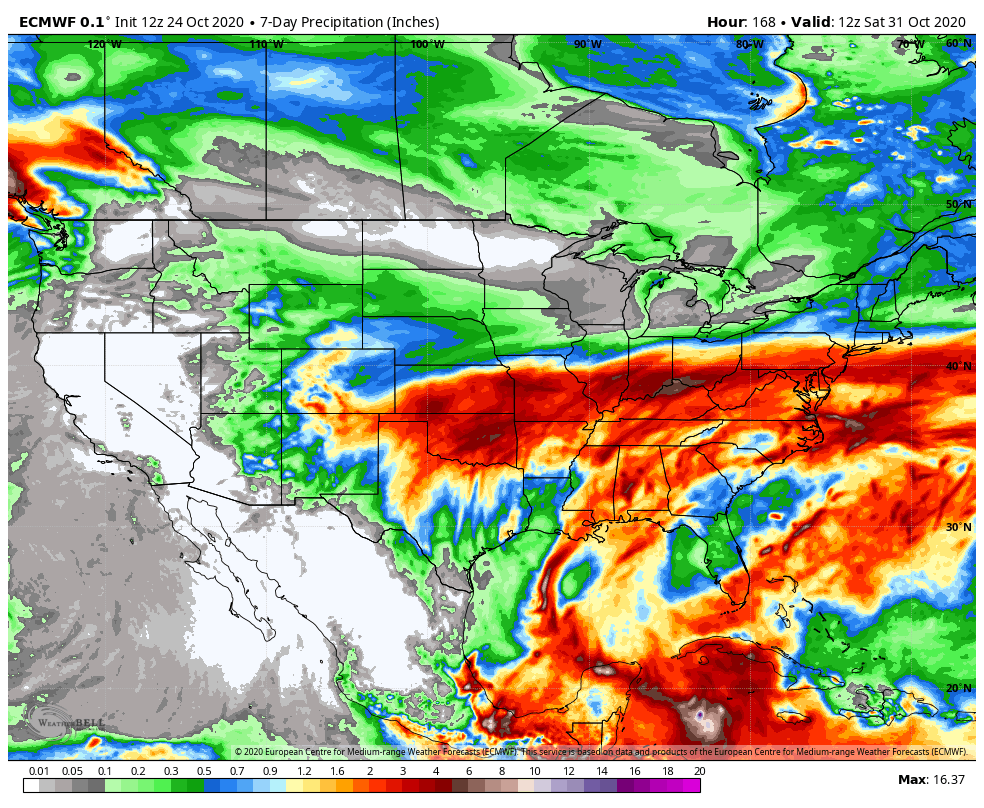
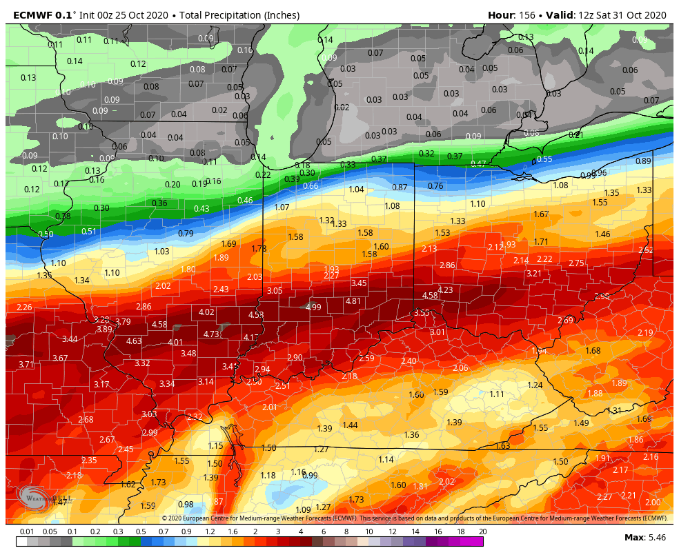
Rain is falling across all of central and southern portions of the state this morning, but there’s a sharp cut-off across northern Indiana, thanks to a frontal boundary. It’s a “what you see is what you get” kind of day as steady rain will continue into the afternoon before becoming more showery in nature. Additional rainfall amounts will range from between 0.25″ and 0.75″.

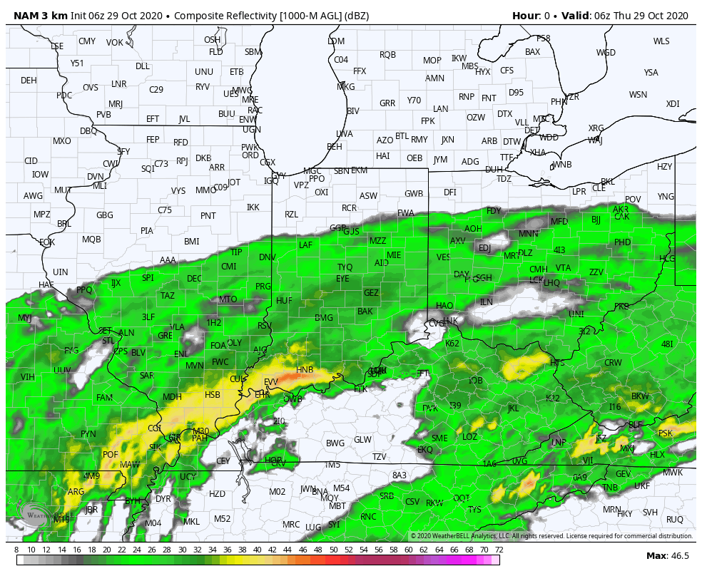
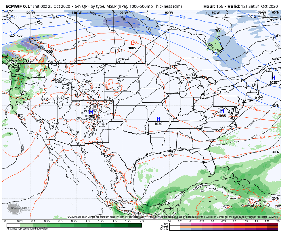
Rain will exit the state off to the southeast by 9p-10p this evening, but by that time there could be a few lake effect rain showers flowing off Lake Michigan and impacting far northwest IN as cooler air pours into the region.

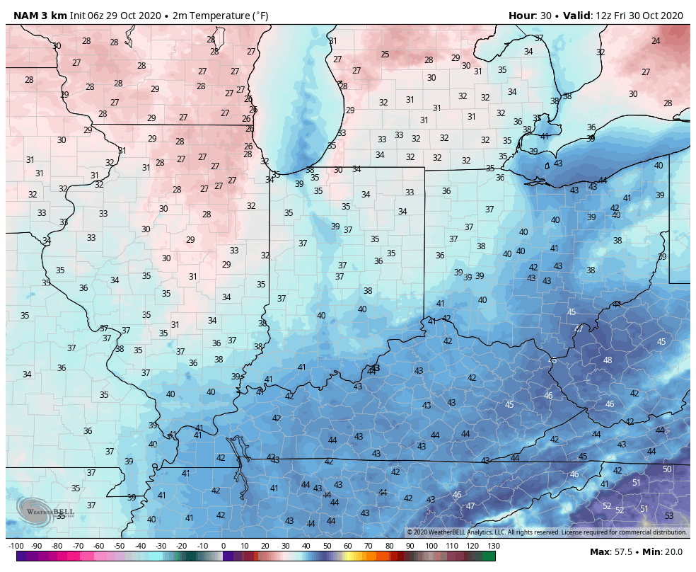
Speaking of that, lows tonight and Friday morning will fall into the middle 30s for most of central IN.

High pressure will build into the region as we wrap up the week and help supply a return of dry, sunny weather Friday and Halloween, itself.

Our quiet weather will give way to blustery and colder conditions to close the weekend and open up the new work week as the arctic comes visiting for the first time this season.

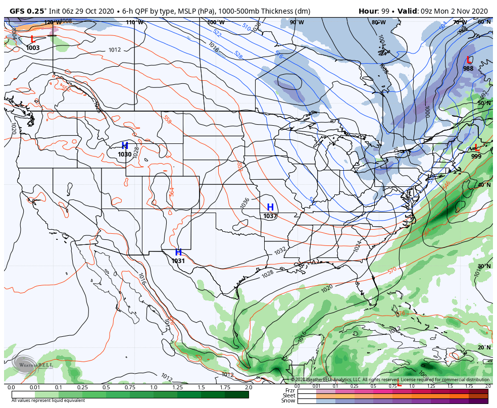
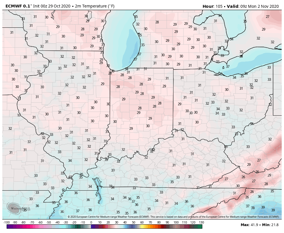
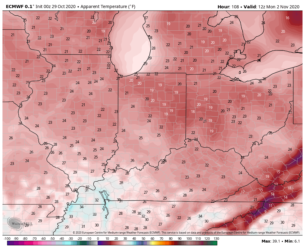
This is the type system that will generate the first lake effect snow event of the season for the eastern Great Lakes Snow Belt communities. We can expect a hard freeze Monday morning with temperatures falling into the upper 20s and wind chill values into the 10s.

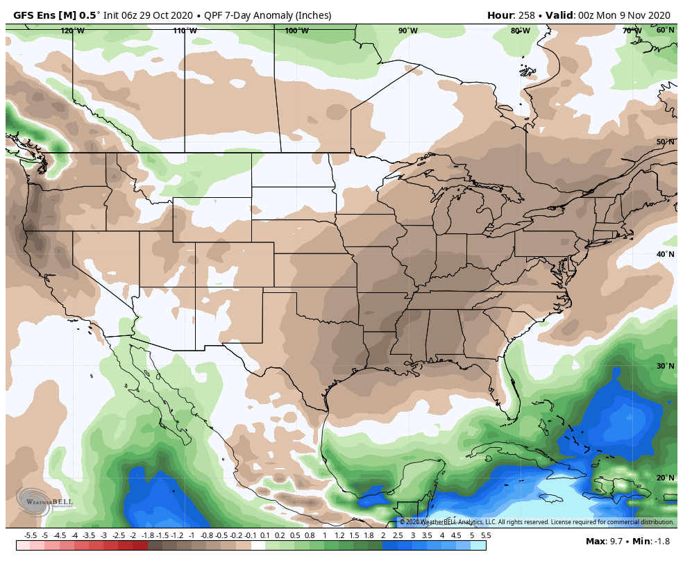
As next week matures, temperatures will begin to moderate and high pressure will supply an extended period of dry conditions. Overall, we’re looking at a much quieter week ahead compared to the past couple of weeks.

Permanent link to this article: https://indywx.com/2020/10/29/wet-thursday-major-improvements-in-time-for-halloween-jab-of-early-season-arctic-air-to-open-next-week/

November 2020 Outlook…

You must be logged in to view this content. Click Here to become a member of IndyWX.com for full access.  Already a member of IndyWx.com All-Access?  Log-in here.

Permanent link to this article: https://indywx.com/2020/10/28/november-2020-outlook/

VIDEO: Wind-Driven Rain Event Overspreads The Region Overnight; Sharp Jab Of Early Season Arctic Air To Open The New Week…

You must be logged in to view this content. Click Here to become a member of IndyWX.com for full access.  Already a member of IndyWx.com All-Access?  Log-in here.

Permanent link to this article: https://indywx.com/2020/10/28/video-wind-driven-rain-event-overspreads-the-region-overnight-sharp-jab-of-early-season-arctic-air-to-open-the-new-week/

VIDEO: Heavy Rain Builds In Wednesday Night; Jab Of Early Season Arctic Air Sunday-Monday…

You must be logged in to view this content. Click Here to become a member of IndyWX.com for full access.  Already a member of IndyWx.com All-Access?  Log-in here.

Permanent link to this article: https://indywx.com/2020/10/27/video-heavy-rain-builds-in-wednesday-night-jab-of-early-season-arctic-air-sunday-monday/

VIDEO: Zeta Heads For The Central Gulf Coast; Tracking (2) Rounds Of Rain, Locally, And A Much Drier, Cooler Weekend…

You must be logged in to view this content. Click Here to become a member of IndyWX.com for full access.  Already a member of IndyWx.com All-Access?  Log-in here.

Permanent link to this article: https://indywx.com/2020/10/26/video-zeta-heads-for-the-central-gulf-coast-tracking-2-rounds-of-rain-locally-and-a-much-drier-cooler-weekend/

Chilly And Damp Open To The Work Week Gives Way To Heavier Rain Midweek; Dry, Cool Halloween On Deck…

Considerable cloudiness will be around today, but we should hold off on any significant rainfall until Monday (only expecting sprinkles or areas of drizzle beforehand). It’ll be a chilly day with highs struggling to make it out of the 40s today.

As we move into Monday, the first of 2 waves of moisture will overspread the state. We think a more widespread shield of rain (still primarily on the light side) will arrive early-to-mid afternoon, continuing into Tuesday morning.

Light rain will overspread the state Monday afternoon.

In general, rainfall amounts should check-in between 0.25″ and 0.40″ across central Indiana with this “1st wave” (most of which falls Monday PM).

Things become more complex by midweek as a stronger surface low moves out of the Plains and across the Ohio Valley. Additionally, we’ll need to keep close eyes on Zeta’s remnants as it’s possible the aforementioned storm system could pull the remnant tropical moisture into the mix. Regardless of whether or not tropical moisture directly or indirectly gets involved, a period of heavy rain is likely Wednesday evening through the day Thursday.

Precipitable water values will approach 2″ for a period of time midweek, supporting the likelihood of heavy rainfall. (Also note the deep, tropical plume feeding into the Southeast region, courtesy of Zeta’s remnants).

Additional rainfall midweek should be in the 1.5″ to 2.5″ range for most of the region, but locally heavier amounts are possible, especially across southern portions of the state.

We’ll clear all of this mess out of here as we head into the weekend and we still believe we’re looking at ideal Halloween weather- dry, crisp, and sunny, thanks to a sprawling area of high pressure.

Permanent link to this article: https://indywx.com/2020/10/25/chilly-and-damp-open-to-the-work-week-gives-way-to-heavier-rain-midweek-dry-cool-halloween-on-deck/

VIDEO: Short-Term Update Looks Closer At Halloween; Interesting Longer Range Developments That Raise Potential Of Colder Pattern Towards Thanksgiving…

You must be logged in to view this content. Click Here to become a member of IndyWX.com for full access.  Already a member of IndyWx.com All-Access?  Log-in here.

Permanent link to this article: https://indywx.com/2020/10/24/video-short-term-update-looks-closer-at-halloween-interesting-longer-range-developments-that-raise-potential-of-colder-pattern-towards-thanksgiving/

VIDEO: Timing Out When Strong Storms Arrive Today; Chilly Close To The Month…

You must be logged in to view this content. Click Here to become a member of IndyWX.com for full access.  Already a member of IndyWx.com All-Access?  Log-in here.

Permanent link to this article: https://indywx.com/2020/10/23/video-timing-out-when-strong-storms-arrive-today-chilly-close-to-the-month/

VIDEO: Storms Ignite Ahead Of Sharply Colder Air Friday PM; Looking Into Early November…

You must be logged in to view this content. Click Here to become a member of IndyWX.com for full access.  Already a member of IndyWx.com All-Access?  Log-in here.

Permanent link to this article: https://indywx.com/2020/10/22/video-storms-ignite-ahead-of-sharply-colder-air-friday-pm-looking-into-early-november/

NEW JMA Weeklies Are In; November Preview…

This evening’s client video will have our complete long range update included within. This morning we wanted to review the latest JMA Weeklies and look ahead to at least a “hint” of what November could provide:

In short, the evolution from Week 1 to Weeks 3-4 shows the anomalous cold spreading east, but modifying from the mid-winter like conditions presently across the northern Plains by the time the chill reaches the eastern seaboard.

Week 1

Notice how the pattern is expected to remain wetter than normal during the Week 1 period.

Week 2 features the chill spreading east and a drier pattern evolving. We agree with both.

By the time we get to the Weeks 3-4 period, a northeastern ridge is shown to develop with the ‘mean’ trough position settling into the West. I would expect future updates to trend warmer across the East during this time frame and, conversely, colder across the West.

By this time, of course, we’ll be into November. While our complete November Outlook will be posted next week, I believe it’ll be an average to slightly above average month from a temperature perspective, locally (after the chilly start). Some of this has to do with the expected MJO movement and likelihood for the ‘mean’ trough to be favored across the West.

More later tonight! Have a great Thursday!

Permanent link to this article: https://indywx.com/2020/10/22/new-jma-weeklies-are-in-november-preview/

IndyWx.com