A Closer Look At Thanksgiving Week

Today’s model data continues the theme of a southern and eastern storm for the days surrounding Thanksgiving.  We’ll continue to monitor for any potential shift northwest, but as of now, the trend remains for a “suppressed” storm track.  Here’s a look at the individual GFS ensemble members, off today’s 12z run.  Taken at face value, 3 out of 10 members show some light snow in the air.
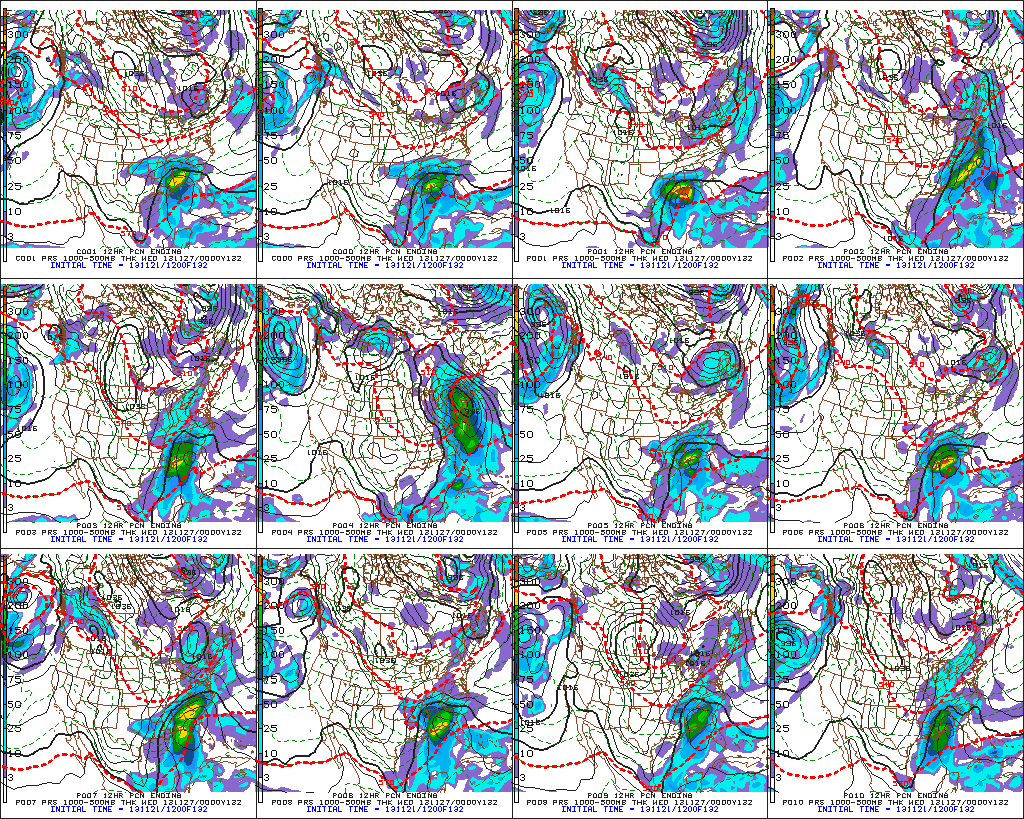
f132

For now, the big story still appears to be the unseasonably cold air around for Thanksgiving.  The ECMWF, Canadian, and American models (GFS and NAM) continue to hammer home the idea of a frigid Thanksgiving ahead (relative to the time of year, of course).  I’m not convinced we won’t have to deal with some light snow next week at some point, but for now, the bigger story still appears to be  impressive early season cold, and this cold pattern isn’t going away anytime soon.

The latest European forecast data illustrates this well.  Note each and every day is well below normal, aside from tomorrow (cold air pushes in tomorrow PM).  This is a snap shot of the average temperature (in degrees C) over the upcoming 10 day period.  The blues, greens, and purples showcase the cold, relative to average.
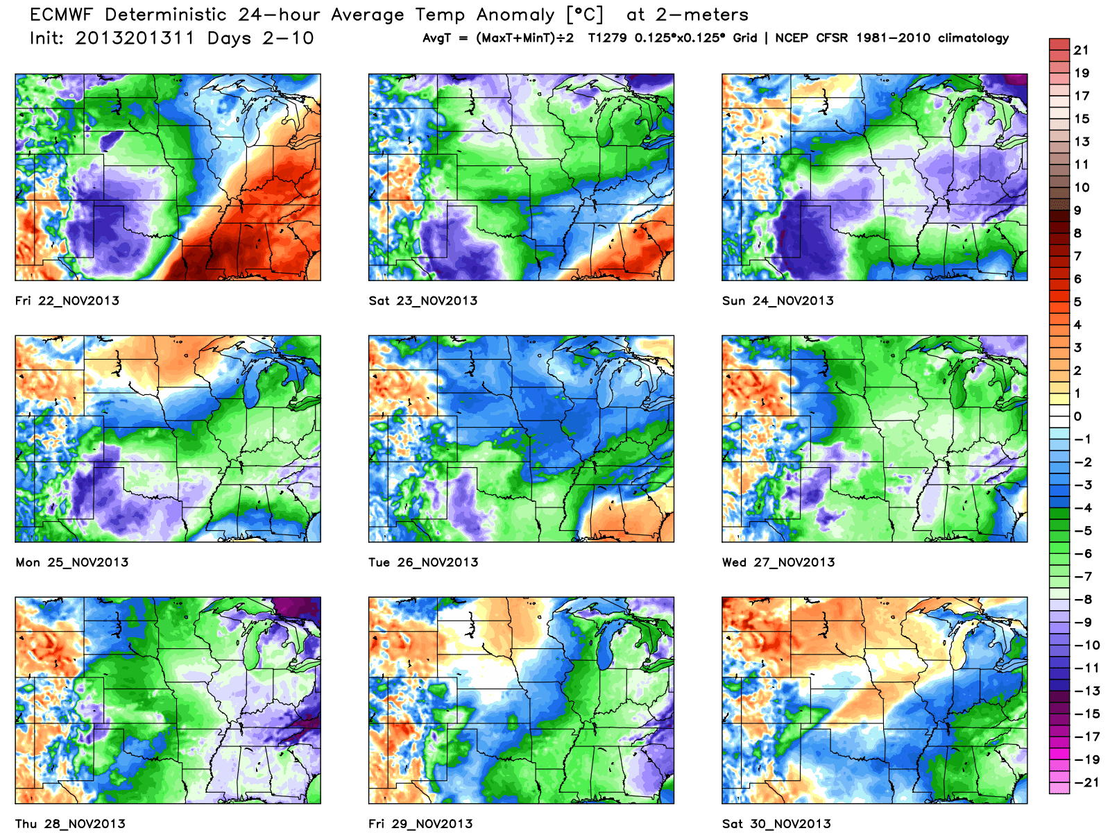
tavg_anom_ecmwf_mc_1


A Closer Look At Thursday

* A video update was posted late last night and talks about the rain, bitterly cold weekend ahead, and  looks at Thanksgiving.  Scroll below for that update.

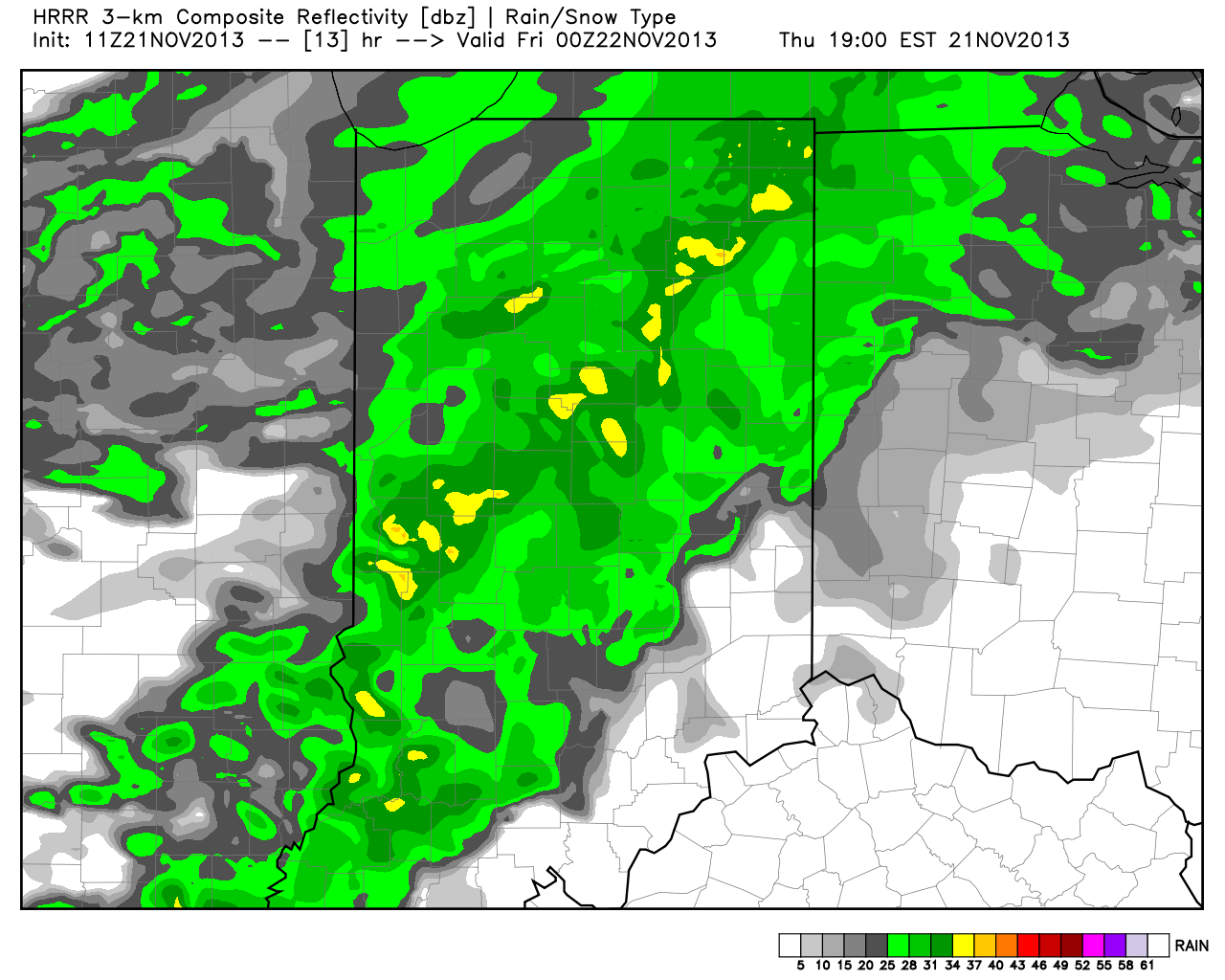
Today will feature scattered light to moderate rain, but as noted last night, that rain will grow more widespread tonight.  The latest HRRR simulated radar shows that well.

hrrr_ref_indy_14

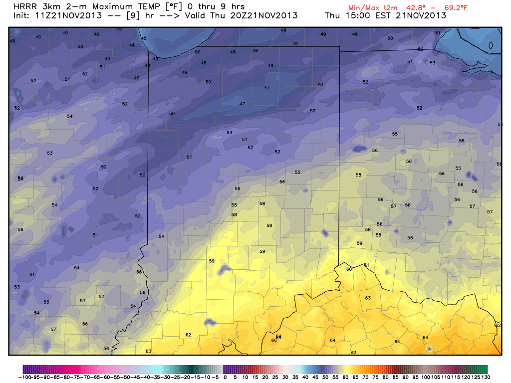
High temperatures today are forecast to reach the middle 50s, per the latest HRRR.

hrrr_t2m_max_indy_10

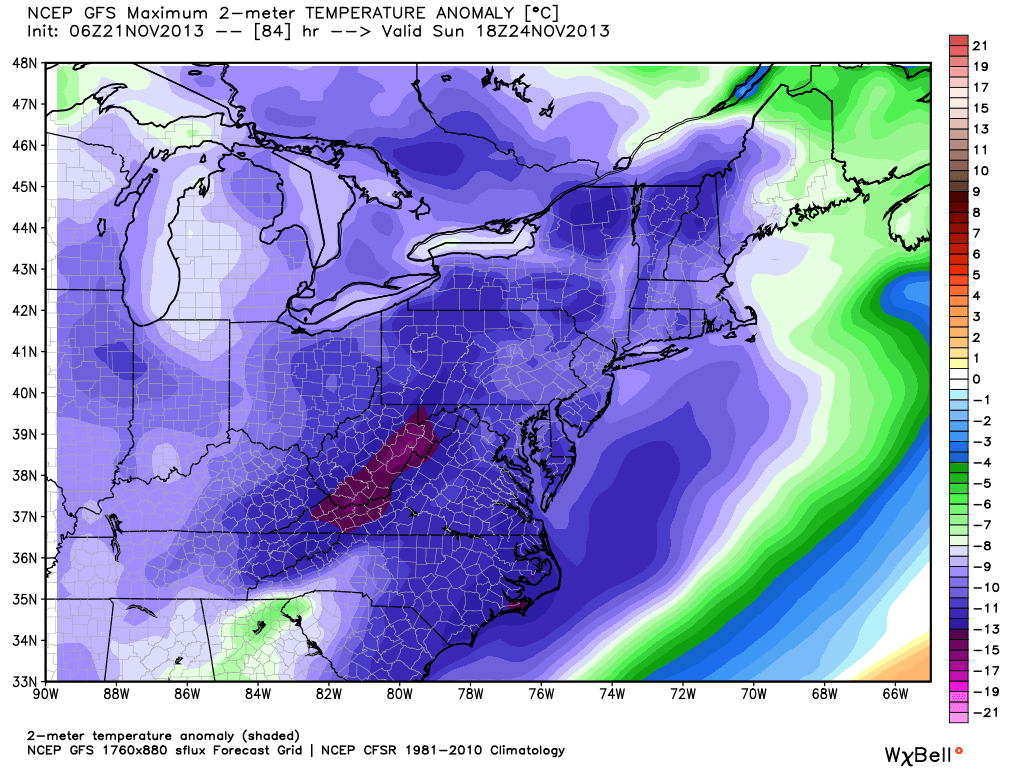
We’re still tracking major league early season arctic air due in here this weekend.  Take a look at just how far below normal these temperatures are come Sunday (shown in degrees celsius).  Wow!  Our forecast high of 24 will be the coldest November day in 13 years and a whopping 25 degrees below normal!  Thanks, as always, to Weatherbell Analytics model suite for this data.

gfs_t2max_anom_ma_29


Arctic Cold, Autumn, Rain

Wednesday Evening Video Update: Rain Moving In; Arctic Blast This Weekend

http:/ Tonight’s Video Highlights: We talk rain and amounts for Thursday and Friday. The coldest air of the season and coldest November day in some 13 years is ahead! A…

You must be logged in to view this content. Click Here to become a member of IndyWX.com for full access.  Already a member of IndyWx.com All-Access?  Log-in here.

Monday Forecast: A Calmer, Colder Week Ahead…

Updated 11.17.13 @ 8:46pm

Zionsville, IN Sunday was a violent day across central Indiana, including multiple tornado touchdowns (Lebanon and Kokomo, for example), heavy rain (widespread 1″+ totals), and damaging straight line winds (numerous trees and power lines down across the region, fueled by 70-80 MPH wind gusts).

Thankfully the new work week will dawn with a much calmer weather pattern in place, albeit much cooler.  High pressure will dominate our region, featuring dry and mostly sunny conditions both Monday and Tuesday.  Monday will still be a bit breezy and we’ll note a stronger push of cold air arriving Monday night, setting the stage for a seasonably chilly Tuesday and Wednesday.

Our next weather maker will arrive as we wrap up the work week. The culprit will be a cold front blowing through the Hoosier state and while model data differs significantly on precipitation totals in the Thursday-Friday time period, we’re confident in rain falling followed by a big blast of cold air for the weekend.

Looking ahead to Thanksgiving week, the threat is there for some wintry “mischief” as southern branch low pressure attempts to attack the cold high to our north… We have plenty of time to watch this, but just make a mental note in the back of your mind for now as you prep for Thanksgiving holiday travel.

Monday: Mostly sunny; 40/ 51

Status-weather-clear-icon


Tuesday: Mostly sunny; 29/ 48

Status-weather-clear-icon


Wednesday: Increasing afternoon cloudiness; 30/ 51

Status-weather-clouds-icon


Thursday: Cloudy and raw with rain likely; 43/ 49

Status-weather-showers-scattered-icon


Friday: Cloudy with rain likely; 44/ 49

Status-weather-showers-scattered-icon


Saturday: Mostly cloudy and colder; 30/ 39

images


Sunday:  Mostly sunny and cold; 19/ 30

Status-weather-clear-icon