Rain was plentiful over the region over the past 48 hours. While widespread 2″ rainfall was common for all of central Indiana, the heaviest rainfall fell across southern and eastern Indiana.
Here are a couple of illustrations of the rainfall totals. The first image is storm total rainfall from the past 24 hours. Note the heavy, 4″ type rains over southern and eastern Indiana. The second image is off the awesome Weatherbell model site and shows the heavy rainfall event over Indiana that unfolded on a bigger scale. Needless to say, the short term drought concerns that we were dealing with August and September have been erased.


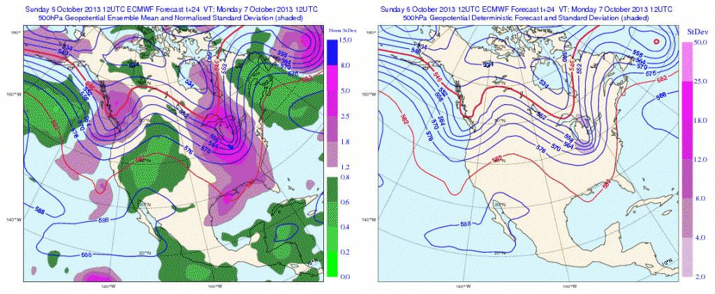
Temperatures are running MUCH cooler over the region today and we also note a drier, more fall-like, air mass building into the region. A couple of other items- it’s easy to see where the cold front is currently located (as of this post) as many in Ohio are still dealing with warm, humid conditions. Additionally, the cold core upper level low remains to our west and will rotate over our region Monday. This will lead to an unseasonably cool day with mostly cloudy skies and the potential of a scattered shower.

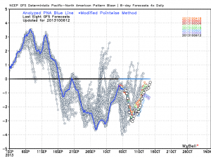
As we move forward, despite the cooler air to welcome in the new work week, we remain in a warmer than average pattern overall. The PNA continues to dominate the pattern and until this goes positive, don’t look for any sort of sustained cool weather across the eastern US.
The European operational and ensemble show the current trough and associated cool air retreating and allowing a warmer southwesterly air flow to build in this week.
Monday
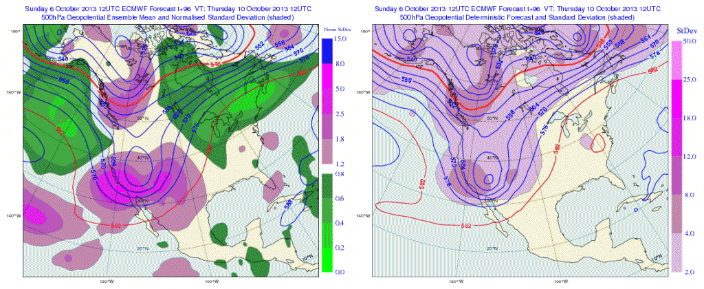
Thursday
 After a quiet time ahead (and much needed to dry out), our next significant storm system appears to arrive around mid month. Both the GFS and European model are in agreement with this idea. Does another potential significant rain maker and associated severe weather event lie ahead mid month? Possibly.
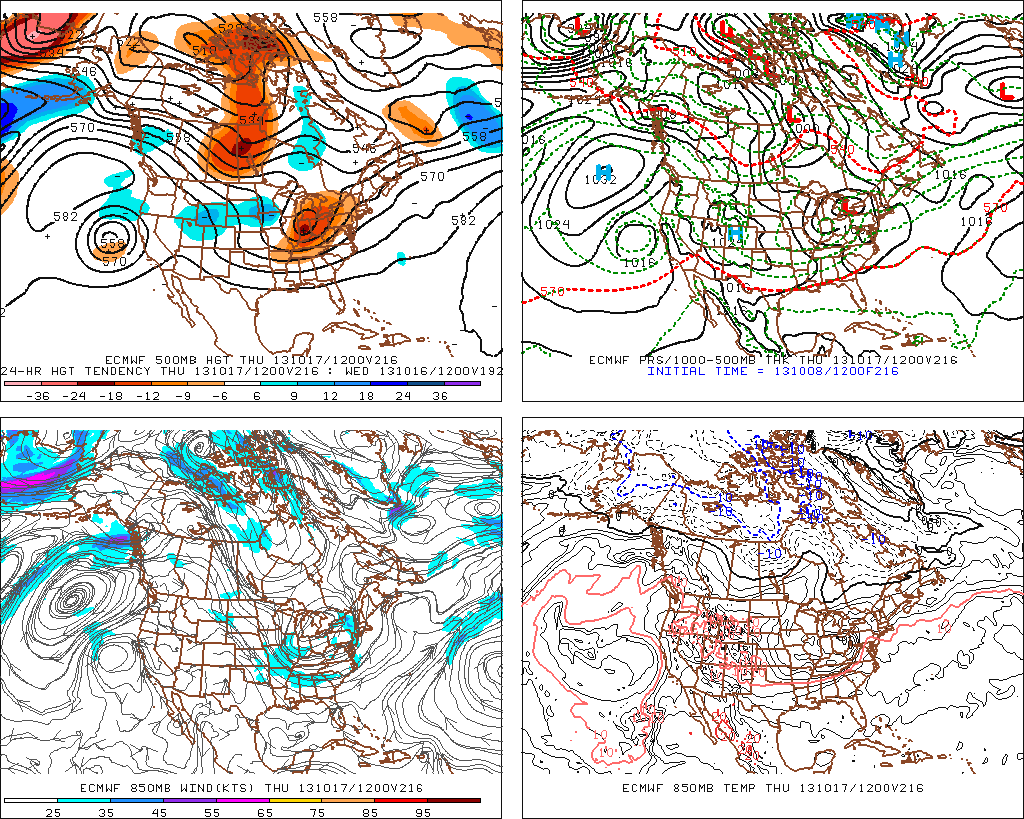
Here’s a look at the upper air pattern out at Day 10 off the European model. We note another significant storm system ejecting out into the Plains states, most likely after dumping another impressive early autumn snow on the central and northern Rockies.

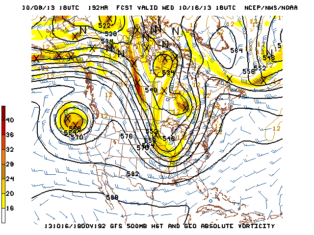
The GFS idea is something similar to that of the European, suggesting confidence is relatively high, at least from this distance.

All of that said, we’re still in a “transient” pattern as the next big storm is shown crashing onshore along the west coast by both models. We shouldn’t be surprised by a “transient” pattern this time of year. It’s October, after all- a month notorious for many swings on the thermometer.
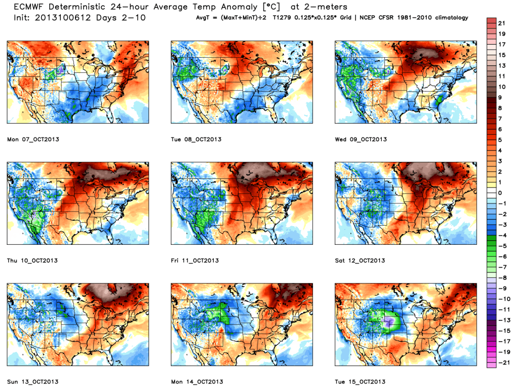
We’ll close with a look at the European’s temperatures anomalies over the course of the next 10 days. Note the chill of early week erased with above normal warmth for the majority of the period. Also, pay attention to the unseasonable chill coming off the Rockies and into the Plains towards the end of the period below. This is associated with the mid month storm.