An Incredibly Quiet Week Ahead Of A Potentially Busy Thanksgiving Week…

Updated 11.10.23 @ 6:54a

Simply put, for this time of year, the upcoming 5-7 days is as quiet as it can be around these parts. Look for much more sunshine than we typically see this time of year along with moderating temperatures after a seasonably chilly weekend. Highs will return into the lower 60s for a good chunk of the work week ahead. All in all it’ll be a perfect week to get a jump on that exterior Christmas decorating or any end of year yard work. Enjoy!
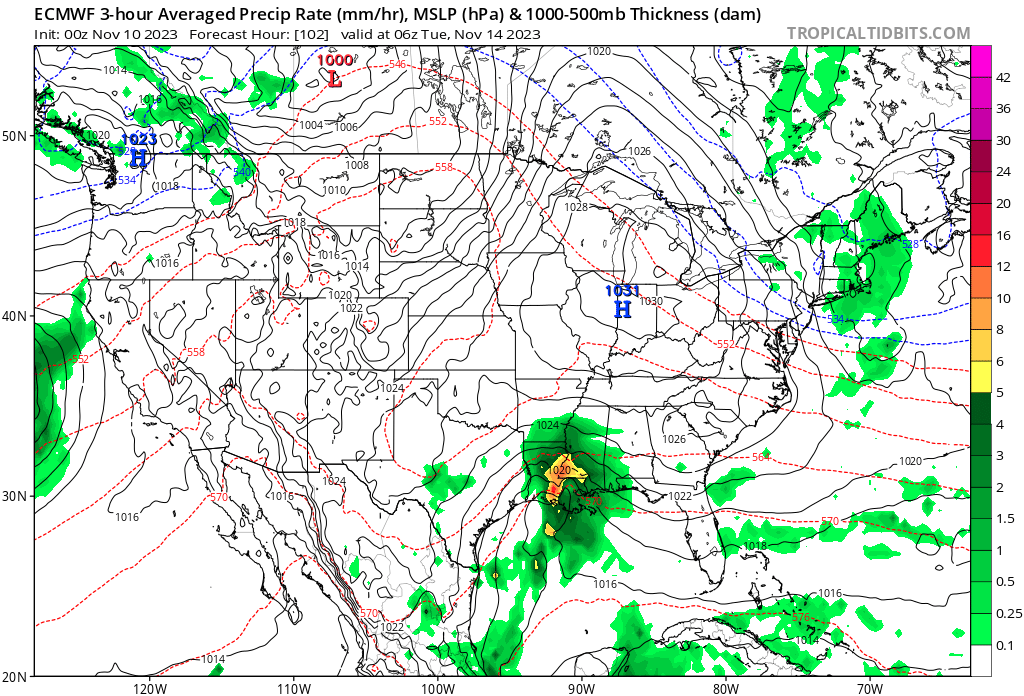
An area of high pressure will keep our region quiet in the week ahead while the “action” shifts to the south and east.

As we look ahead to Thanksgiving week, there are growing indications of a much more active pattern that will emerge. While still too early for specifics, there are likely to be some weather-related impacts to holiday travel (both going and coming home) from a couple of stronger storm systems.

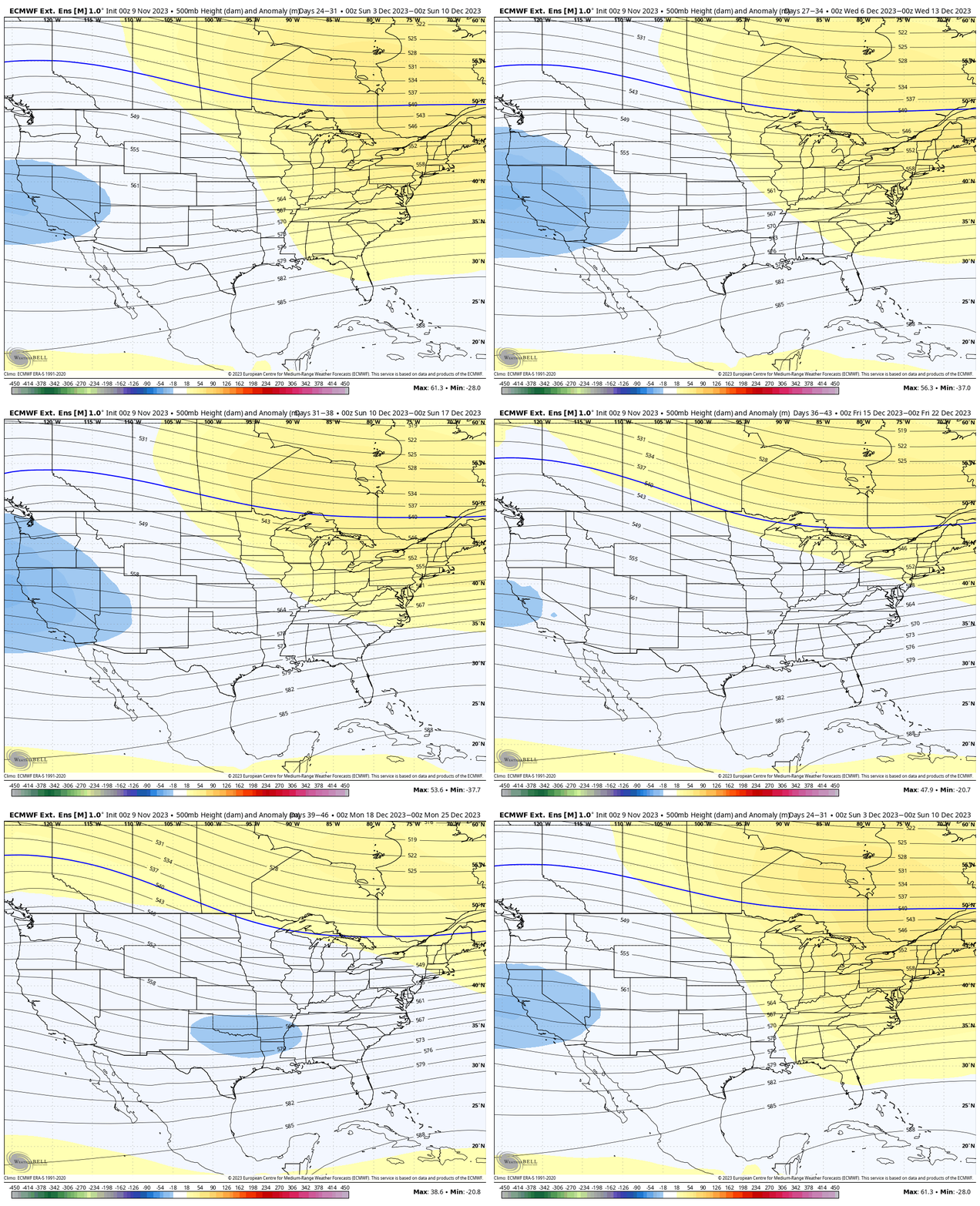
One more quick note before closing, the NEW European Weeklies are in and present an “intriguing” signal as we get closer to Christmas. Note the model see the early December ridge get washed away and a trough beginning to emerge south-central. I’d watch for the model to grow stronger and more expansive (colder impacts) in time. . .
Permanent link to this article: https://indywx.com/an-incredibly-quiet-week-ahead-of-a-potentially-busy-thanksgiving-week/

LR Update: Thanksgiving And Early December…

Updated 11.09.23 @ 10:49a

With Thanksgiving only 2 weeks from today (incredibly hard to believe), we’re able to start to get a better idea on the overall weather pattern as the “official” kickoff to the holiday season nears. The first point we want to drive home is that we should begin to see a much more active regime evolve during this 2 week period. From a temperature perspective, the pattern overall continues to look milder than average, but there will be a couple opportunities for transient pops of colder air, potentially around the all-important Thanksgiving holiday, itself.

Note how modeling sees the more active pattern evolving over the next 3-4 weeks (green represents above normal precipitation). – A significant change not only for our neck of the woods but certainly for our friends and neighbors down south (badly needed for a region suffering an expanding drought. Speaking of which, all of the dry/ droughty southern tier should reverse in significant fashion as the active Nino storm track gets going over the coming months. As the pattern continues to evolve into the ‘24 spring and summer, the south-central severe drought will be erased.

Despite attempts of troughs to roll into the Ohio Valley, they will struggle with staying power over the next 3-4 weeks. The latest JMA Weekly product and Euro/ GFS ensemble blend looks very solid given where the pattern drivers currently reside.

Week 1

Week 2

Weeks 3-4

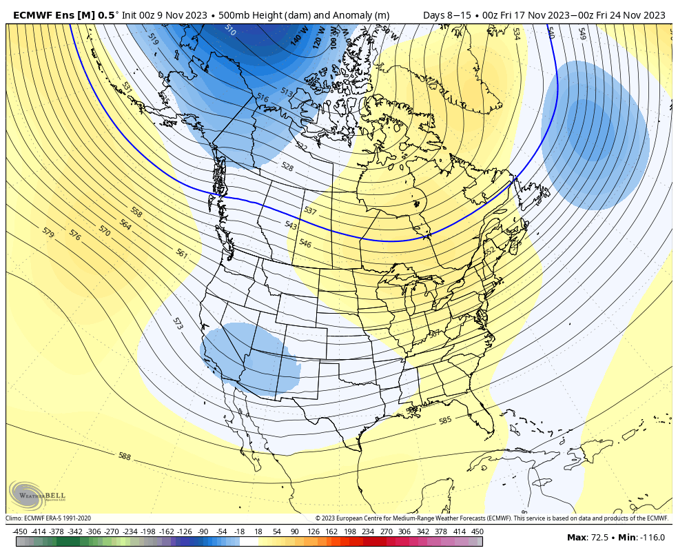
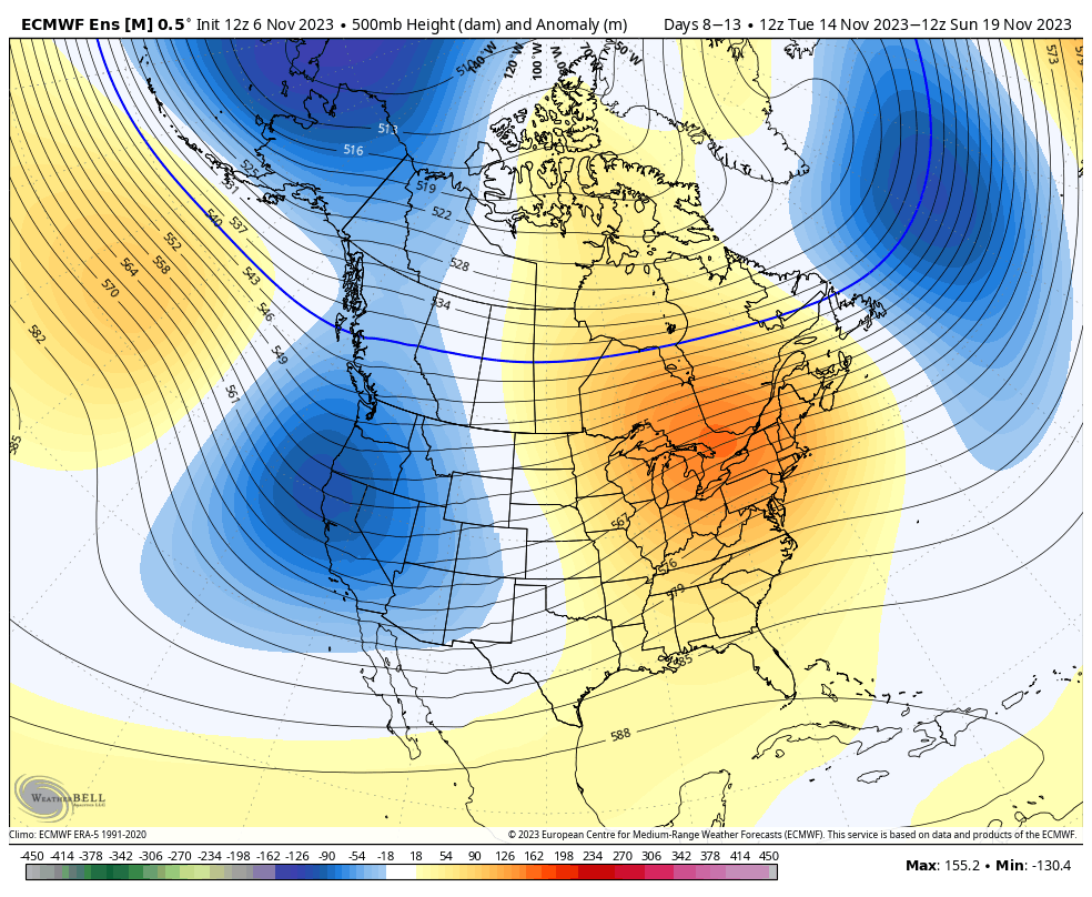
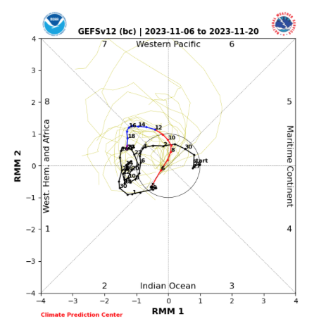
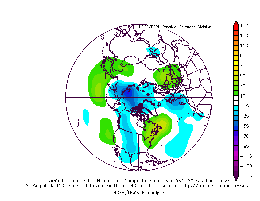
The pattern drivers of a primarily positive EPO, negative PNA, and MJO in 8/1 (all unchanged from our post earlier this week) all suggest a predominant eastern ridge, western trough placement over the upcoming 2-3 weeks.

We’ll continue to keep close tabs on the regime, especially centered on 11/22 – 11/26.

Make it a great Thursday!

Side note: Confidence is increasing that this Nino will evolve into a central-based event which will up the chances of colder/ snowier prospects come late December and on into January. More on that later next week in a more extensive update specific to this transition.

Permanent link to this article: https://indywx.com/lr-update-thanksgiving-and-early-december/

VIDEO: Record Territory Today And Windy; Showers Arrive This Evening With Cooler Air To Follow…

Updated 11.08.23 @ 7:31a

You must be logged in to view this content. Click Here to become a member of IndyWX.com for full access.  Already a member of IndyWx.com All-Access?  Log-in here.

Permanent link to this article: https://indywx.com/video-record-territory-today-and-windy-showers-arrive-this-evening-with-cooler-air-to-follow/

An Overall Warm Ride Into The Thanksgiving Holiday; Any Changes On The Horizon?

Updated 11.07.23 @ 5:15a

Despite a weekend setback that will continue into the early portion of Week 2, updated forecast model data continues to scream that we’ll run above to well above normal as the Thanksgiving holiday nears.

The pattern drivers support the warmer than normal call over the next couple of days. Note the primarily positive EPO and negative PNA.

This should help keep the ‘mean’ ridge position across the upper Mid West and Great Lakes over the next couple of weeks.

We’ll keep close eyes on the negative trend of that EPO towards the end of the period (image 1 above) to see if it continues in the coming days. If so, there’s the potential we could pull the anticipated western trough east in perhaps a bit quicker fashion than models currently see (say the last week of November, potentially).

As it is, another big pattern driver, the Madden-Julian Oscillation will begin to rev up in the coming days. A circle through Phase 7/8 this time of year supports the warm signals shown from the PNA and EPO.

Permanent link to this article: https://indywx.com/an-overall-warm-ride-into-the-thanksgiving-holiday-any-changes-on-the-horizon/

VIDEO: Warm Midweek Trends Colder For The Weekend…

Updated 11.06.23 @ 7:26a

You must be logged in to view this content. Click Here to become a member of IndyWX.com for full access.  Already a member of IndyWx.com All-Access?  Log-in here.

Permanent link to this article: https://indywx.com/video-warm-midweek-trends-colder-for-the-weekend/