The search for that first 90 degree day will have to go on (and on and on and on…) as the pattern remains one that will continue to make it very difficult for any sort of long-lasting, sustained, heat. In fact, we’re actually going to trend temperatures even cooler as we move into Week 2- the exact opposite of what you’d come to expect as we rumble into mid to late July.
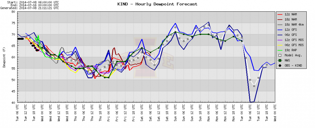
Before we get into next week, let’s focus on the shorter term. Drier air is on our doorstep as a cold front sweeps central Indiana this evening. This will set the stage for a very pleasant mid week stretch, including temperatures that remain below average and dew points that fall into the 50s. Note the latest dew point plot below, indicating dew points falling into the 50s, and remaining there for the better part of the next (3) days:
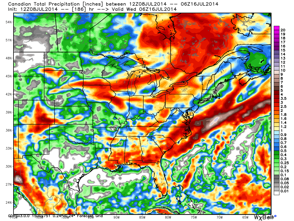
We will turn much more humid (oppressively so) over the weekend and this will help aid in thunderstorm development over the weekend. Most of the region can expect around an inch of rain, on average, between Friday night and Tuesday, mostly thanks to complexes of thunderstorms. However, there will be locally heavier totals exceeding 2″ in spots.
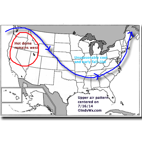
A MUCH stronger front will sweep the state Tuesday and result in temperatures and weather conditions that are much more fall-like than summer. A couple days next week have the potential to remain in the 60s for highs (centering on Tuesday-Wednesday for that as of now) and overnight lows could dip into the middle 40s to near 50. Breezy north and northwest winds can also be anticipated. – Certainly far from what you’d expect for this time of year!
Here’s what the upper air pattern will look like next week:


