- Beautiful Sunday
- Clouds and rain return
- Colder late week
- Eyeing a potentially wintry end to November
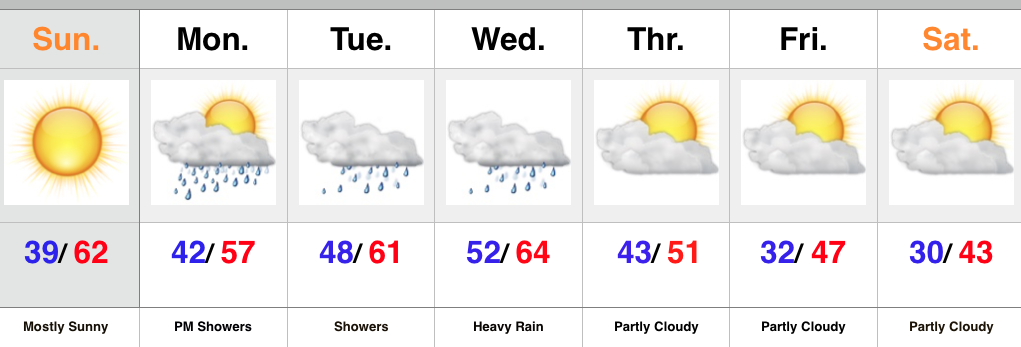
Our next storm system is coming ashore along the West Coast this morning. That storm will impact our weather this week, but today we’ll focus on the sunshine and beautiful conditions. Temperatures will climb into the lower to middle 60s. With what lies ahead, we’d highly suggest taking advantage of the nice weather today and finish up any of that outdoor work you may have.
Clouds will increase Monday and the initial surge of moisture will provide showers and light rain by afternoon and evening. A strong southerly flow continues Tuesday into Wednesday with periods of rain. It won’t rain the entire time, but more times than not. A push of heavy rain still appears likely Tuesday night into Wednesday.
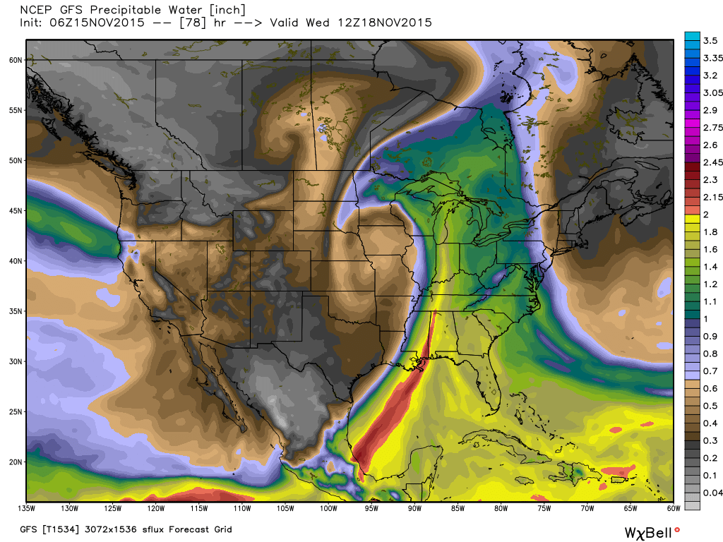
The image below is a look at forecast PWATs, thanks to Weatherbell.com, for Tuesday night. When these values reach 1.5″-2″ that’s a good indication for very heavy rains. We’ll continue to forecast widespread 2″+ type rainfall with this storm system.
 Once this next storm moves out, we’ll get back to drier and colder times to end the work week. Attention will then shift to a colder, potentially wintry, end to the month, including the Thanksgiving holiday. It’s too early for specifics on storminess, but model data does hint at a storm of “interest” around Thanksgiving. With colder air making a return, it’s certainly possible this next storm has a wintry component to it…
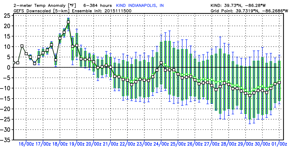
The latest GFS ensemble temperature anomaly chart shows the colder than average pattern setting in to wrap up November.


