 Highlights:
- Dry, warm close to the work week
- Warm weekend
- Much cooler air awaits
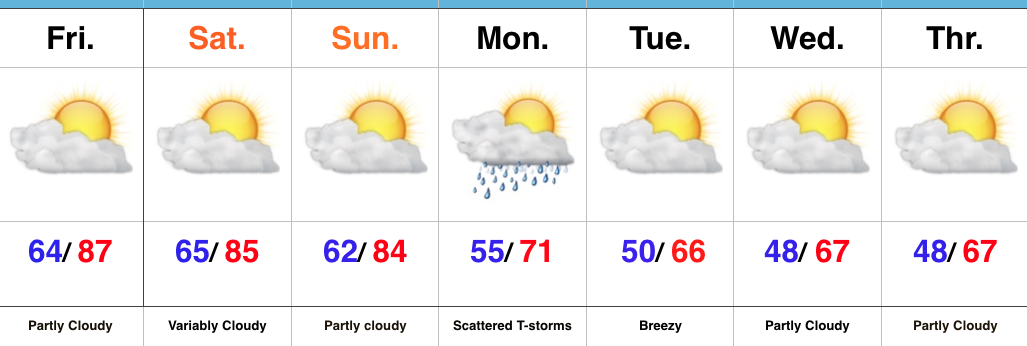
Summer Feel Gives Way To An Autumn Chill…A backdoor cold front will press into central IN over the weekend and will serve as a focal point for increased clouds at times (northern portions of the state today and more of central IN Saturday). While an isolated to widely scattered shower is possible with this front, most will remain rain-free straight through the weekend. Temperatures will remain well above normal across the region.
A stronger cold front will march towards the area to open the work week. Showers and embedded thunder will accompany the frontal boundary as it pushes through the region. We’ll then note a marked NW wind shift by evening and that will help usher in a true push of fall air. A stretch of mornings with lows in the 40s and highs in the 60s during the day will take us through mid week. Those cooler readings will really being to ignite the color change across central IN.
Upcoming 7-Day Precipitation Forecast:
- Snowfall: 0.00″
- Rainfall: 0.50″
