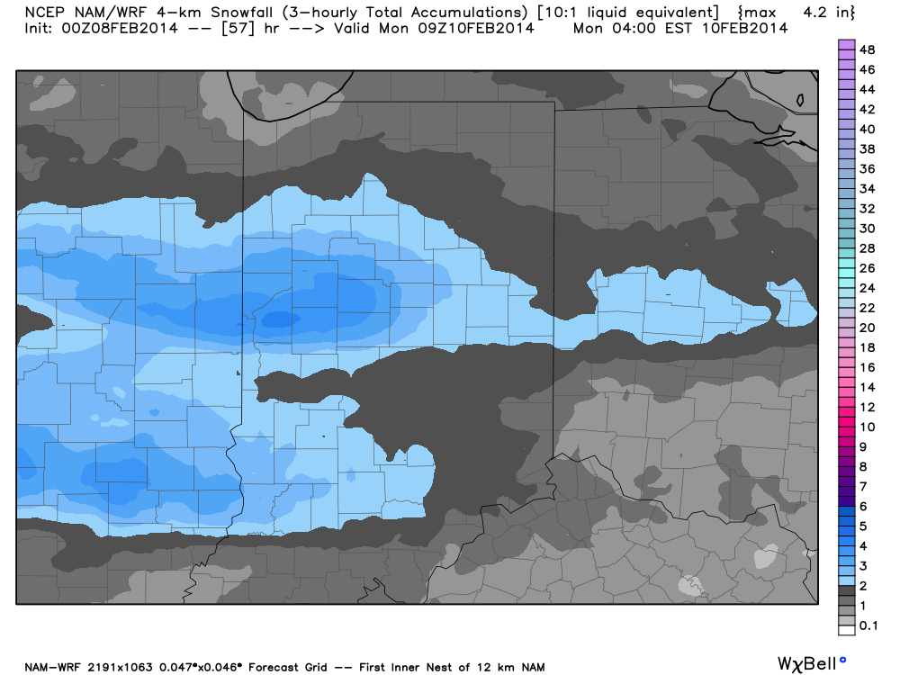
We’re still dealing with some questions that will have to be sorted out for the weekend’s snow. Latest high resolution data suggests we may see a couple of waves of accumulating snow cross the state this weekend. Namely, we’re focused on late Saturday night into Sunday morning and again Sunday night into Monday morning. Scattered snow showers will fall during the day Saturday, but shouldn’t be a big deal and won’t impact everyone.
It’s a tough and challenging pattern we’re in over the next 60 hours and forecast models will continue to struggle with handling upper level energy as it ejects off the Rockies and heads east. While our initial idea of a more organized, robust, storm system won’t come to fruition, it’s certainly possible some central Indiana neighborhoods deal with a “few” inches of fresh snow by Monday morning. It’ll be important to stay tuned to latest forecasts this weekend as what may seem to be a rather harmless inch, or so, of snow could pile up to the tune of 2″-5″ for some areas should latest high resolution model data, hot off the press, come to fruition.
Case in point, the latest high resolution NAM model, courtesy of Weatherbell Analytics, paints a couple of stripes of snow across central Indiana and seems to have a pretty good handle on the evolution of things over the next 48-60 hours. It should be noted that not all model data suggests accumulating snow is ahead this weekend. THAT SAID, many times, in similar weather patterns, the high resolution data performed better. We’ll fine tune things and have a fresh updated 7-Day forecast available to you in the morning. Make it a great night!

