Good evening and welcome in to IndyWx.com!
We continue to closely monitor radar and satellite trends tonight and keep a close eye on severe developments to our west. As the video discusses, the clouds and rain from earlier today have helped in a big way from at least limiting what today “could have been” from a severe perspective.
That’s not saying we’re signaling the all-clear by any stretch of the imagination, it’s just saying that the clouds and rain from earlier have helped to keep us from really destabilizing the local atmosphere and the clearing we’re seeing now may be too little too late in regards to widespread severe weather here.
All of that said, keep a close eye on local radar tonight and remain weather aware. The dynamics at play could result in a thunderstorm turning severe rather rapidly tonight and we’ll continue to closely monitor.
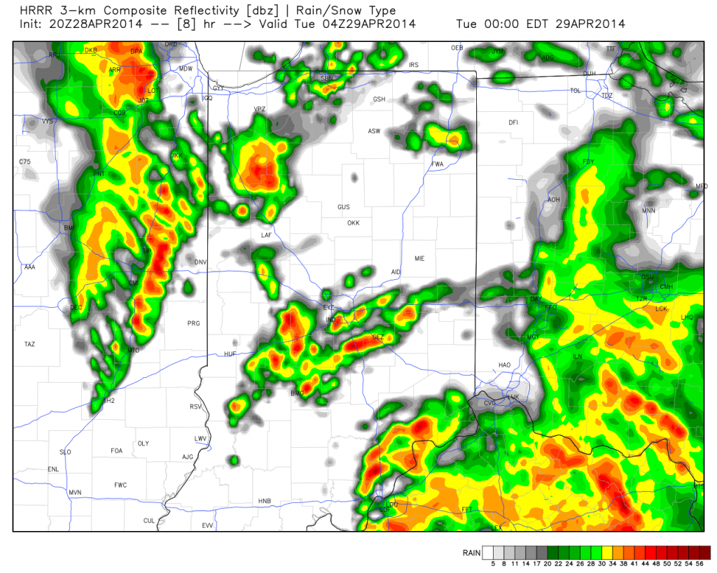
Strong to potentially severe thunderstorms will impact central Indiana during the overnight period:
The video below has more details:

