Updated 02.07.24 @ 1:39p
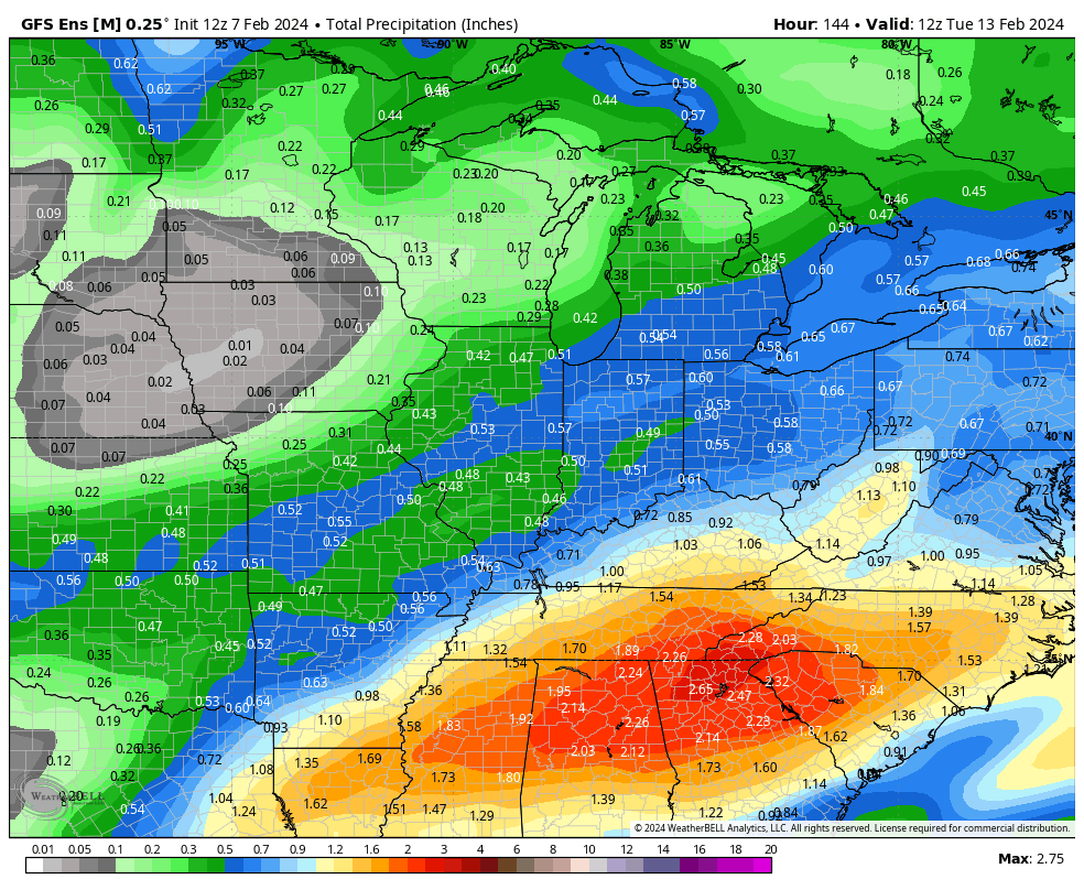
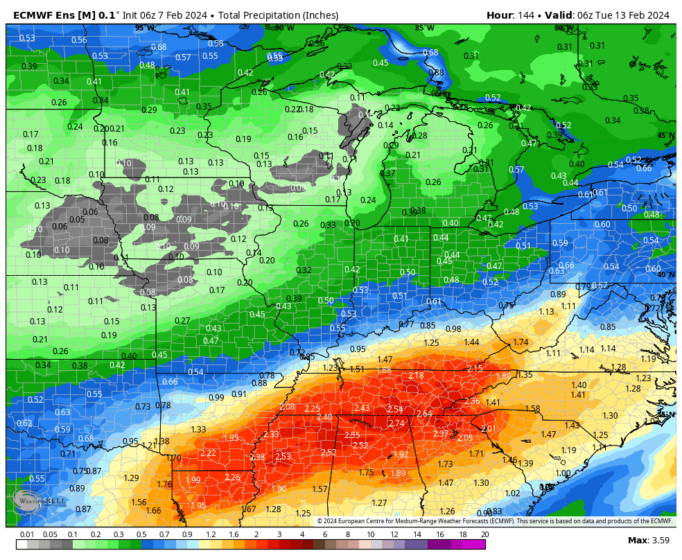
Today’s midday computer guidance is trending more bullish for trailing energy to deliver heavier precipitation across central IN and the Ohio Valley. While there are many more questions than answers with respect to precipitation type, confidence is increasing significantly that a period of more significant precipitation will come at us in (2) waves this weekend into early next week: Saturday and again Monday.
Today’s ensemble guidance (12z total precipitation GEFS and EPS shown below) is showing a northward adjustment in more significant moisture into the Ohio Valley over the weekend into early next week.


We’ll continue to closely monitor the trends over the next couple of days but as of now, we feel confident enough to hit the prospects of rain harder Saturday (still nothing overly heavy but certainly more than guidance suggested over the past few days) and another period of widespread precipitation to open the new work week on Monday. As colder air works into the region over the weekend, this secondary wave of moisture may feature more in the way of wintry conditions across at least a portion of the area. Far too early for specifics beyond this overall idea for this time period, but should wet snow work into the picture for some, the recent warm ground and marginal temperatures would likely limit pavement impacts. As colder air becomes more significant and entrenched down the road, winter weather headlines will likely become more frequent late Feb into March…

1 comment
I’m confused. I thought I have right membership to view ?