Meteorological spring begins in a few days (runs March through May). We’ve already touched on the expected busy severe weather season and want to dedicate this post towards looking deeper into the weather pattern and the resulting precipitation and temperature impacts.
The latest longer-range data continues to be in very good agreement on the upper air pattern. In short, the balance of the spring season looks to offer up a continued theme of warmer than average temperatures for our region. (Not saying we won’t have to deal with a wintry “trick or two” over the first couple weeks of March). When we look at spring, as a whole, we believe it’ll be one known more for the warmth and active, stormy times.

CFSv2 March Temperature Anomalies
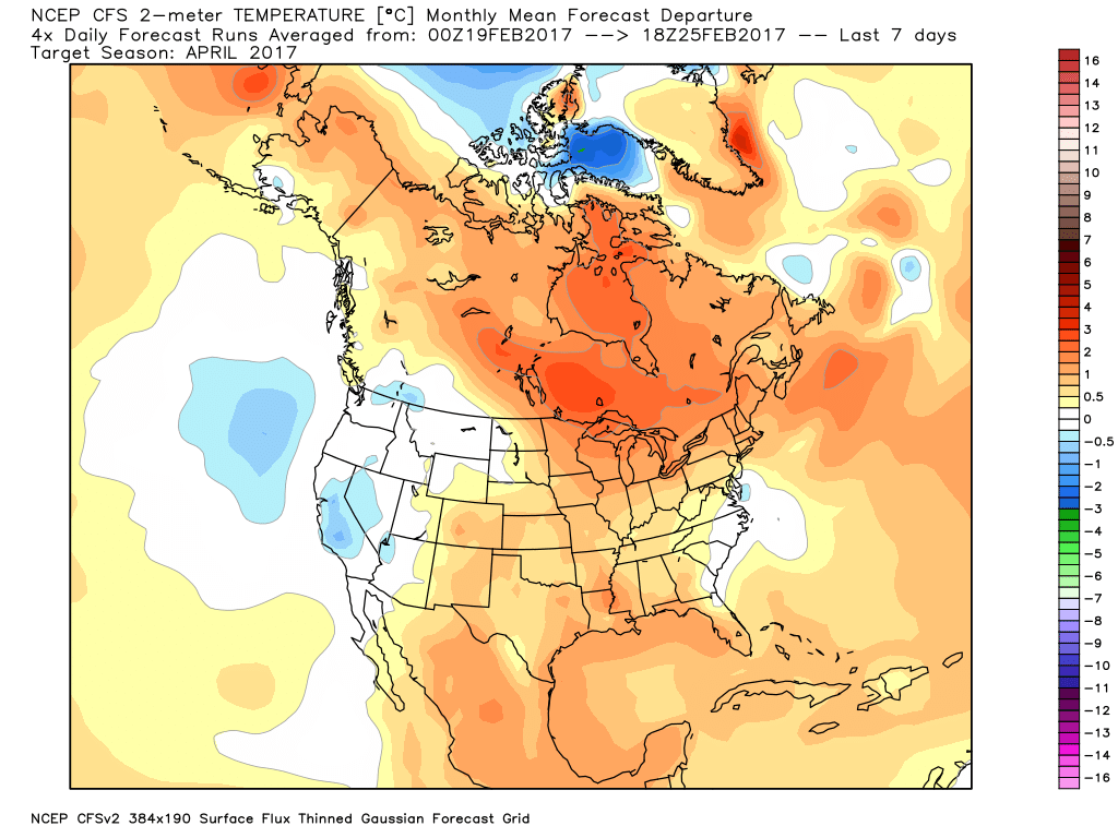
CFSv2 April Temperature Anomalies
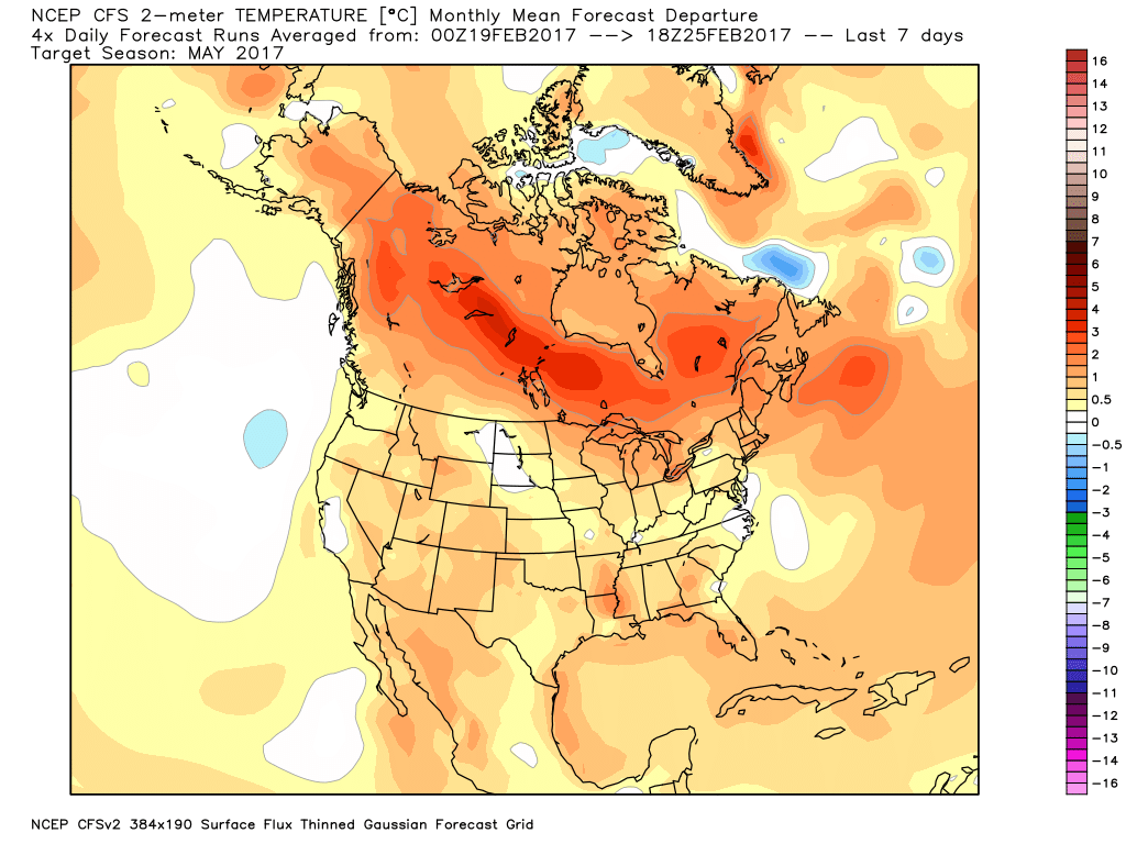
CFSv2 May Temperature Anomalies
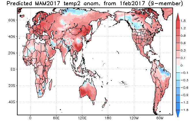
JAMSTEC March through May Temperature Anomalies
The latest JMA monthly idea is one that has to raise an eye brow as it would paint an early summer across the Ohio Valley and Great Lakes. Anomalous warmth (true summer-like air) would develop with a strong ridge over the Great Lakes and northeast. This is something we’ll have to keep an eye on. A big caveat here is how strong and quickly the coming El Nino develops. It should be noted, El Nino years can feature some of the hottest air early, not late, in the summer season (relative to averages), and the JMA would, indeed, yield an early summer with such a look.
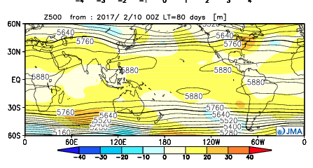
JMA May Forecast 500mb Pattern
It should also be noted modeling is suggesting a wet look, locally, especially during the early portions of spring. The JAMSTEC and JMA are particularly bullish on a wet pattern.

JAMSTEC March through May Precipitation Anomalies

JMA March through May Precipitation Anomalies
The CFSv2 hits the wet March hard before a drier regime mid and late spring.

March Precipitation Anomalies

April Precipitation Anomalies
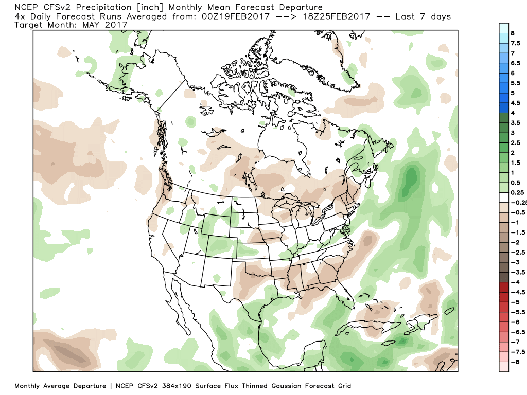
May Precipitation Anomalies
In closing, we seem to have a bit of a bumpy ride in front of us as meteorological spring begins. While Old Man Winter hasn’t been seen much as of late, don’t be shocked if he makes his presence felt a few more times through the first half of March- both from a cold and snow perspective. That said, data really points towards more of an overall warm regime developing the second half of the month, and continuing through the majority of spring, for that matter. We’re keeping a close eye on May for an early summer-like feel to take hold, locally. Subsequent JMA updates will be monitored closely. We also remain confident of an active severe weather season. Note the tendency of model data (above) to pull the mean trough position to the northwest March into April. The clash of late-season wintry conditions west, combined with unseasonably warm temperatures across the east (not to mention the warmer than average Gulf of Mexico) likely will equal busy times as we progress through the spring severe weather season.
