Our weekend weather will remain relatively quiet. Sure, we’ll have a weak system pass through the state Sunday afternoon. While this could deal out a light shower (potentially mixed with a little sleet), significant accumulation isn’t anticipated. This will allow us to look ahead to potential “more important” items down the road.
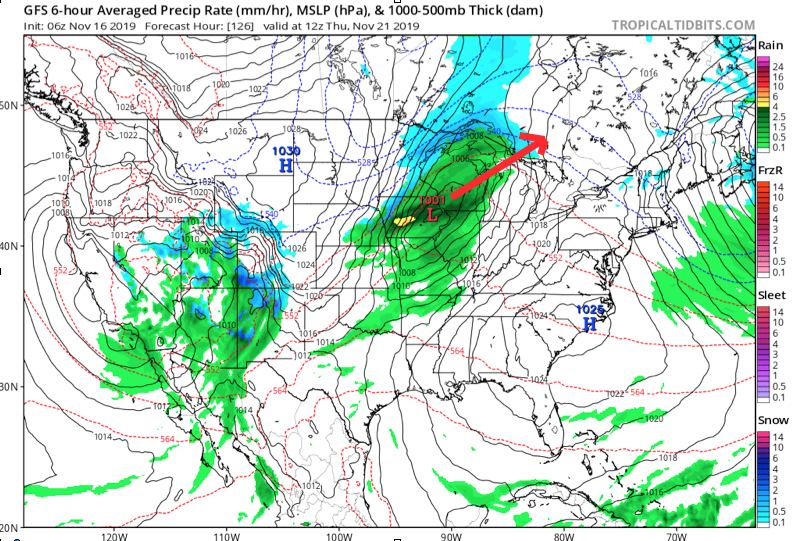
Initially, the flow will back to the southwest midweek, allowing a briefly milder regime to blow into the Ohio Valley for about 24-48 hours. An area of low pressure will track from the lee of the Colorado Rockies Tuesday, across the Plains and into the Great Lakes Thursday into Friday. This will result in a period of rain and gusty winds late Wednesday into Thursday. We’re not expecting particularly hefty rain with this system, with most central Indiana rain gauges around the 0.25″ to 0.50″ range.

Once the low lifts into the Lakes, it’ll help sling a cold front through the Ohio Valley Thursday night. This will result in a much colder close to the work week.
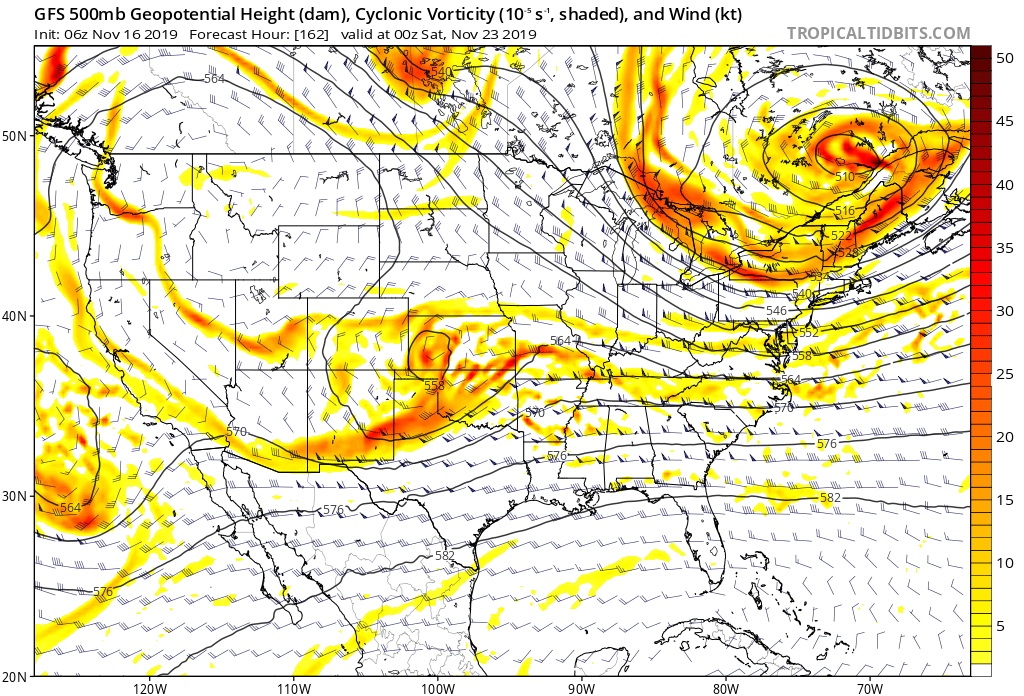
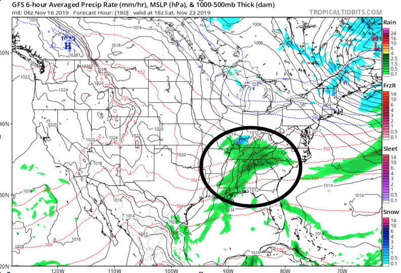
As colder air is seeping into the region, additional upper level energy will be ejecting out of the Four Corners region Friday evening. Eventually, this will result in a surface wave developing over the mid-South region Friday night into Saturday morning.


While the majority of operational data currently shows this wave remaining suppressed, history tells us we need to pay special attention to model trends over the next several days. All too often, seemingly “harmless” systems in the medium term that appear to scoot off to our south will trend north. The upper air pattern suggests this may be the case this go around as well.
As it is, some of the individual ensemble members are already jumping on this. Hunch here is that as we go through the upcoming week, a legitimate interior winter threat will be present for next weekend…

