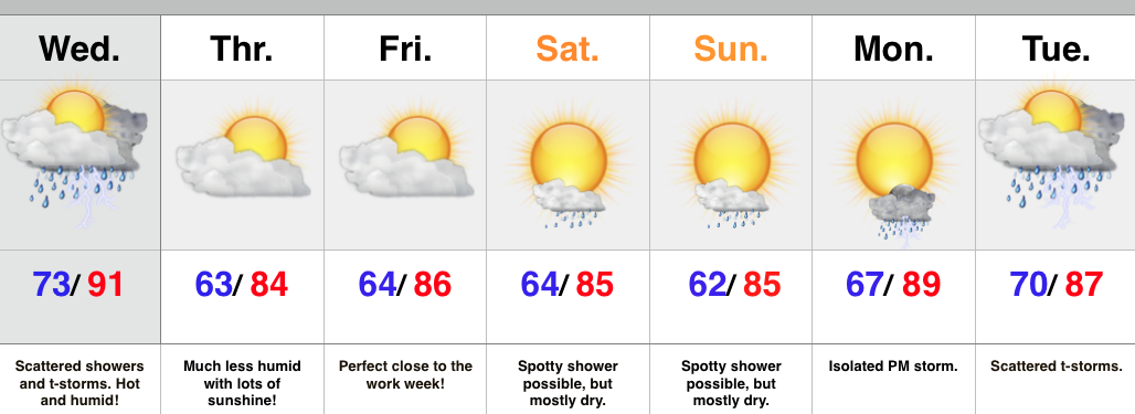
- Thundery Wednesday
- Much more refreshing feel to close the week
- Storm chances return early next week
A cold front will move through the region Wednesday afternoon and evening. The front will slice into a very warm and humid air mass so strong to severe thunderstorms will be possible, especially late morning into the afternoon/ evening. We’re not forecasting widespread severe, but with all of the moisture in the atmosphere, locally heavy rain and additional flash flooding can’t be ruled out.
At any rate, a much more pleasant feel can be expected to wrap up the work week. We note dew points plunge from the upper 70s Wednesday morning into the upper 50s Thursday morning. Talk about nice!
While we have to maintain a mention of a shower over the weekend, the majority will be rain-free. The pesky NW flow aloft may push a weak disturbance into central IN so we have to mention the threat of an isolated shower Saturday into Sunday.
Looking ahead, next week is potentially an active one, including a heavy rain threat followed by a big push of early August cool air.
Upcoming 7-Day Rainfall Forecast: 1.5″ – 2″ (locally higher totals under storms)

