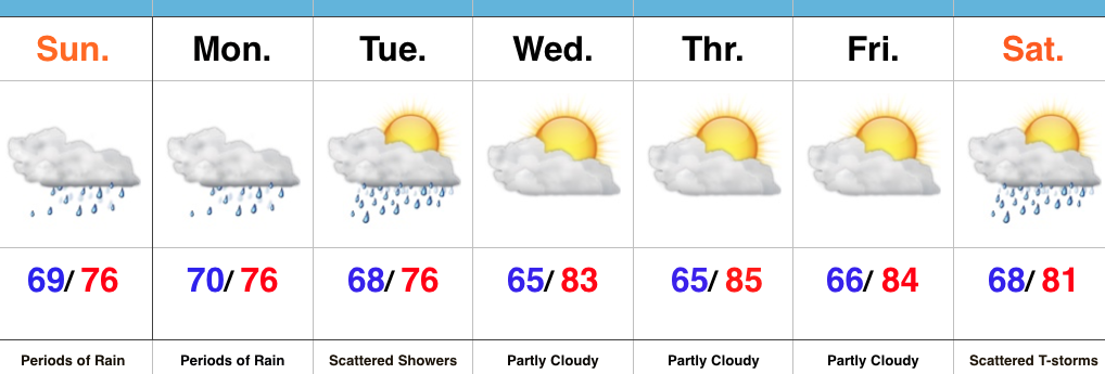
 Highlights:
- Periods of heavy rain
- Drying out come mid week
- Cold front arrives next weekend
Flooding Concerns…Renewed heavy rain is pushing through central IN as we write up the morning forecast package. This conveyor belt of moisture will continue to lift northeast and eventually break up and diminish during the late morning and early afternoon. Despite scattered showers this afternoon, drier times will ensue, overall. Unfortunately, this drier period won’t last long as another slug of moisture lifts north late tonight and continues Monday. Additional heavy rainfall can be expected, including the potential of rainfall rates approaching 2″+/ hour. Given the water-logged soils across the region, concerns of flash flooding are very high Monday.
Eventually, we’ll dry things out come mid week and introduce more sunshine back into the forecast. Our next item on the agenda will be a cold front that will sweep through the state Saturday. Scattered showers and thunderstorms will accompany the boundary as it moves through the region before much drier and cooler air blows in for the second half of the weekend. In fact, a welcomed early fall preview awaits come Sunday. Thoughts of football, pumpkin “everything,” bonfires, and apple cider will be prevalent this time next week…
Upcoming 7-Day Precipitation Forecast:
- Snowfall: 0.00″
- Rainfall: 2″-4″ (locally heavier totals)
