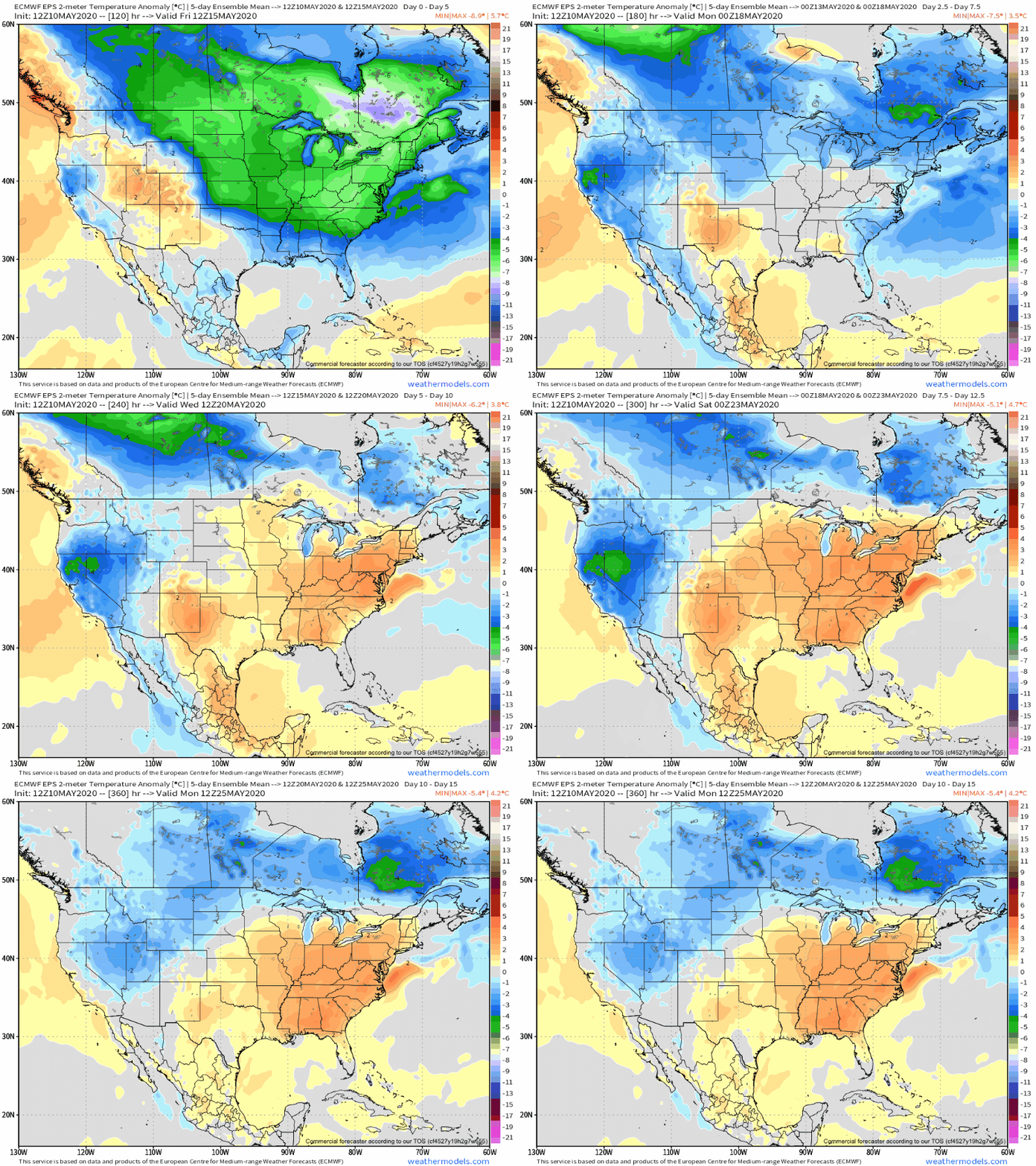
The work week will get off to the same unusually chilly start we’ve begun to grow accustomed to. Additional frost and freeze threats are present Tuesday and Wednesday mornings if skies can clear (big if there). However, significant changes loom as we flip the page to the second half of the work week and longer term indications suggest we’re well on our way to a true summer-like feel by week 2.
Note how bullish the European ensemble is regarding the significant pattern flip over the next couple weeks.

A lot of this is driven by a change in the EPO. This is the kind of pattern that stands to at least threaten sending high temperatures soaring to between 85°-90° between Week 2 and month’s end. Talk about a contrast from the late winter and early spring-like chill to open the month!
The transition in the pattern is likely to be met with a much more active storm track through the area beginning midweek. There will be a threat of locally heavy rain and stronger storms that will continue at times into the weekend and beyond into next week, as well.
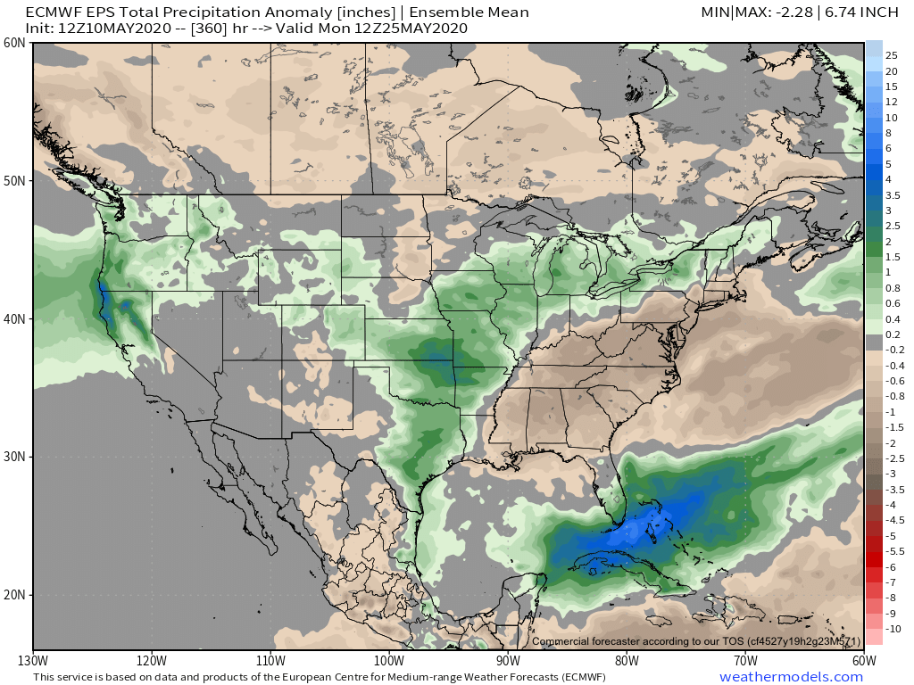
For a month that’s gotten off to a dry start, we’ll likely recover quickly with this wetter regime that accompanies the flip to warm.
We continue to believe most central Indiana neighborhoods will see between 1.75”-2.25” late week into the weekend, but there will be locally heavier amounts. The majority of data also suggests a corridor of wetter than normal conditions sets up from the Plains into the northern Ohio Valley/ Great Lakes into Week 2.
Stay tuned.

