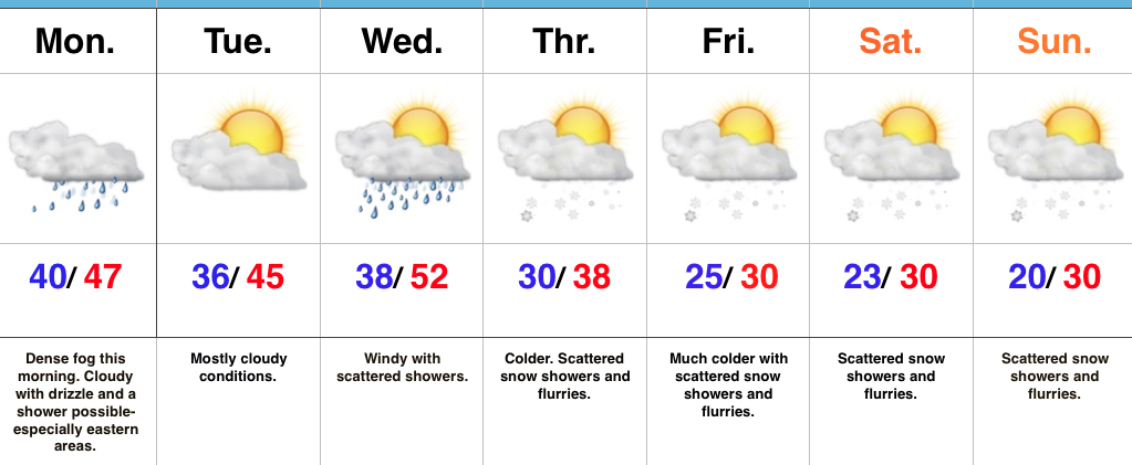
 Highlights:
- Dense fog this morning
- Turning much colder this week
- Scattered snow showers late week
Low Beams On…Dense fog engulfs most of central IN this morning. Make sure you have the low beams on this morning as you head off to work and school and allow extra time. A shower is possible at any point today, but particularly across the eastern half of the state.
Our next storm system will push through mid week. Southwest winds will increase Wednesday and scattered showers will accompany a cold front moving through the state. Temperatures will fall Wednesday night into Thursday and scattered snow showers will develop.
The theme late in the week and for the weekend will be a wintry one. Upper level energy will interact with the colder conditions and result in scattered snow showers from time to time into the weekend. The active northwest flow will remain into next week, as well, and we’ll have to keep a close eye for the prospects of a more “robust” clipper impacting the region just beyond this forecast period.
Upcoming 7-Day Precipitation Forecast:
- Snowfall: Dusting – 1″
- Rainfall: 0.10″ – 0.25″
