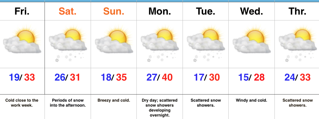
 Highlights:
- Cold times
- First accumulating snow of the season
- Additional disturbances to monitor next week
Snow Arrives Late Friday Night And Early Saturday…75% of our Thursday featured overcast skies and periodic flurries and light snow. Thankfully, a bit of drier air is working in to provide a brighter close to the day. A cold night is on deck as many fall into the teens.
A fast moving upper air disturbance will drop southeast into the Ohio Valley Saturday. This will help spread a swath of snow across central Indiana overnight Friday into the wee morning hours Saturday. Additionally, we’ll have to monitor the potential of enhanced lake effect bands across central and east-central portions of the state Saturday morning into the early afternoon. In general, we expect 1″ to 2″ of snow to accumulate across central Indiana, but note there may be a couple of heavier totals where lake effect bands set up.
Another fast-paced disturbance will blow into town Monday night into Tuesday, followed by another Wednesday night into Thursday. Cold weather will dominate through the period.
Upcoming 7-Day Precipitation Forecast:
- Snowfall: 2″ – 3″
- Rainfall: 0.00″
