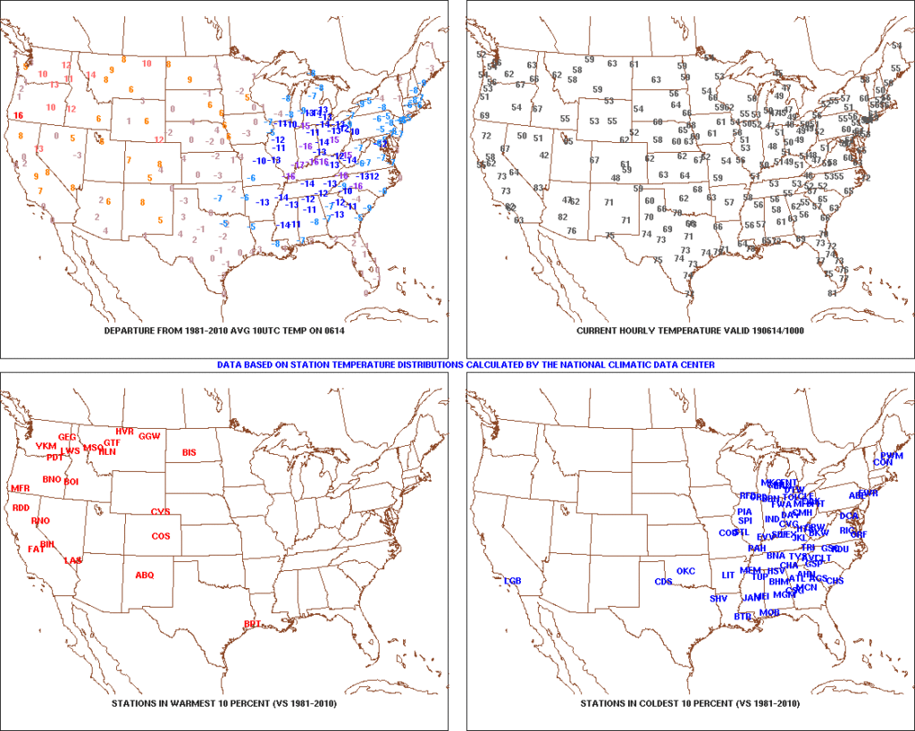
Temperatures are in the 40s area-wide this morning across central Indiana. Speaking of the 40s, they extend all the way south into the north Georgia mountains as we start our Friday. (Hard to believe for mid June). Widespread below normal temperatures continue to dominate the eastern portion of the country.

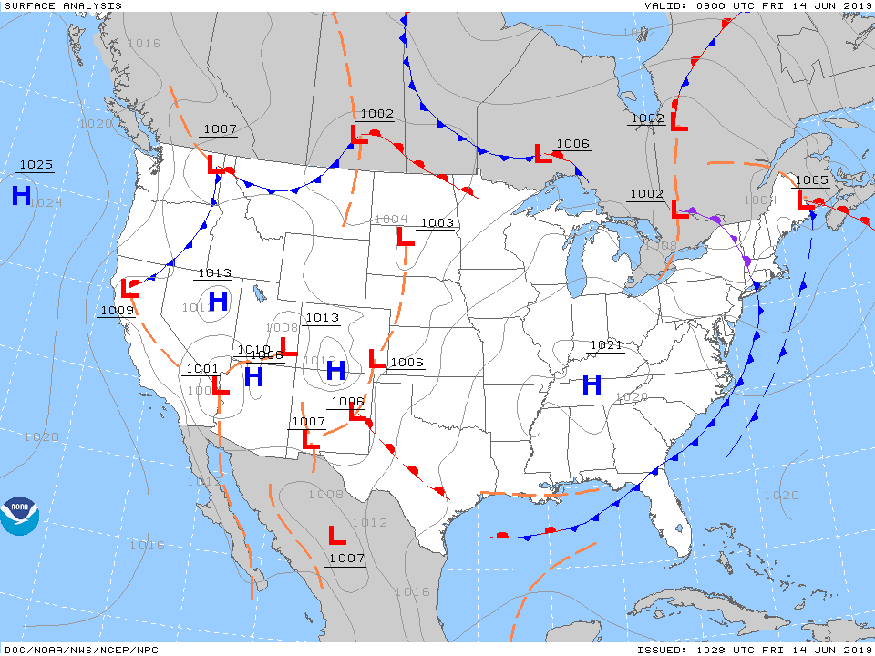
High pressure will remain in control of our weather today and help feature dry conditions with plentiful sunshine and pleasant temperatures. Highs today will top out in the middle 70s after the crisp start to the day.

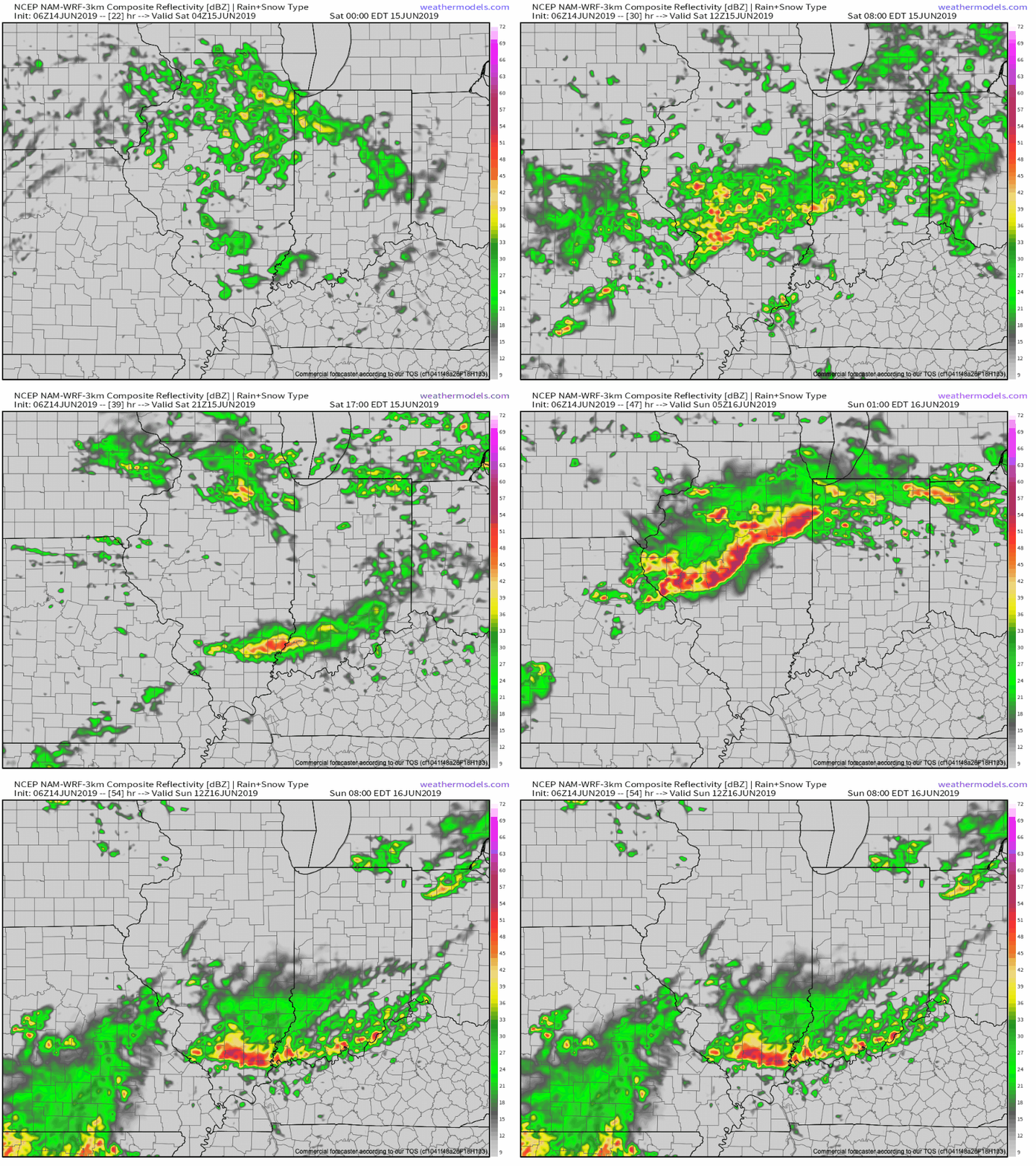
Unfortunately, the cool, dry conditions will quickly give way to an increasingly moist airmass overnight into Saturday morning and rain will follow. The reason? We’ll be on the backside of the area of high pressure with a southwest flow aloft helping transport moisture northeast into the Ohio Valley. At the same time, a series of warm fronts will pass over the weekend, featuring periods of more concentrated storms and associated heavy rainfall. Finally, a cold front will push south Sunday into Monday before stalling out just south of our area Tuesday.
While this may provide a briefly drier period Tuesday, we’ll have to contend with periods of heavy rain and storms before hand. More specific around timing, we think rain may begin as early as 11p to midnight this evening before becoming more widespread and heavier Saturday morning. We’d suggest having a Plan B for outdoor activities this weekend as more time than not, it’ll likely be raining across central Indiana.

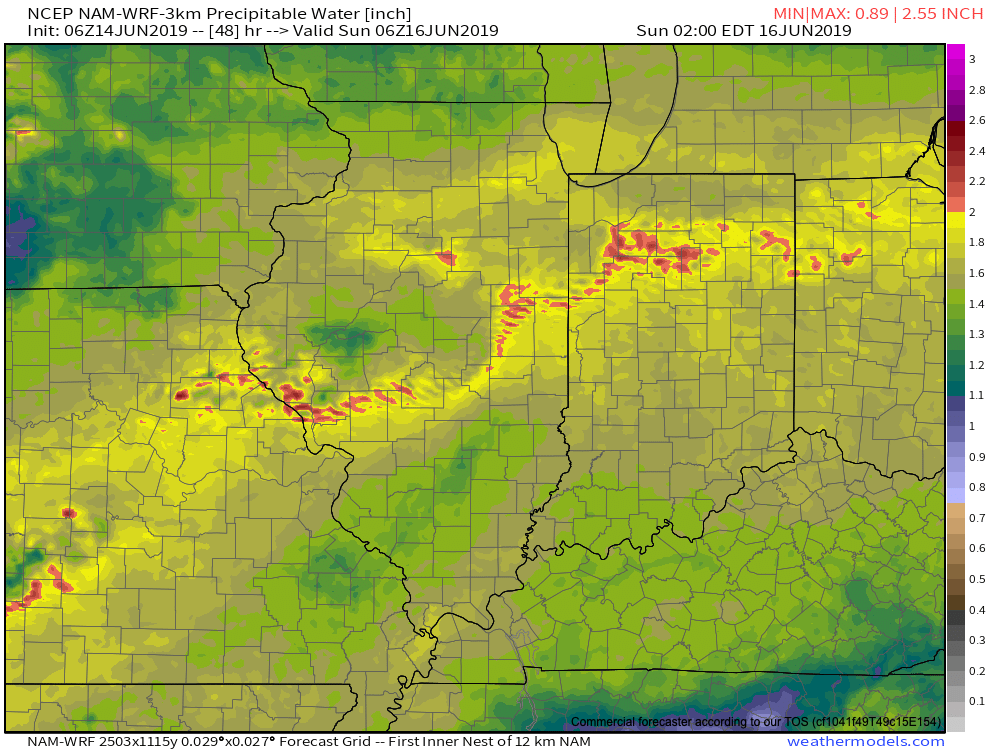
As mentioned earlier, we’ll replace the cool, dry air mass with more of a tropical feel this weekend and at times precipitable water values (PWATs) will approach 2″. This raises our confidence in the potential and likelihood of heavy rainfall.

Widespread 1″ to 2″ rainfall totals can be expected across central Indiana this weekend, with locally heavier amounts. After a briefly drier period Tuesday, rain will return by the middle of next week. Unfortunately, widespread 7-day totals (ending Thursday night) will likely be in the 2.5″ to 3.5″ range across central Indiana…
