Updated 01.25.21 @ 1:42p
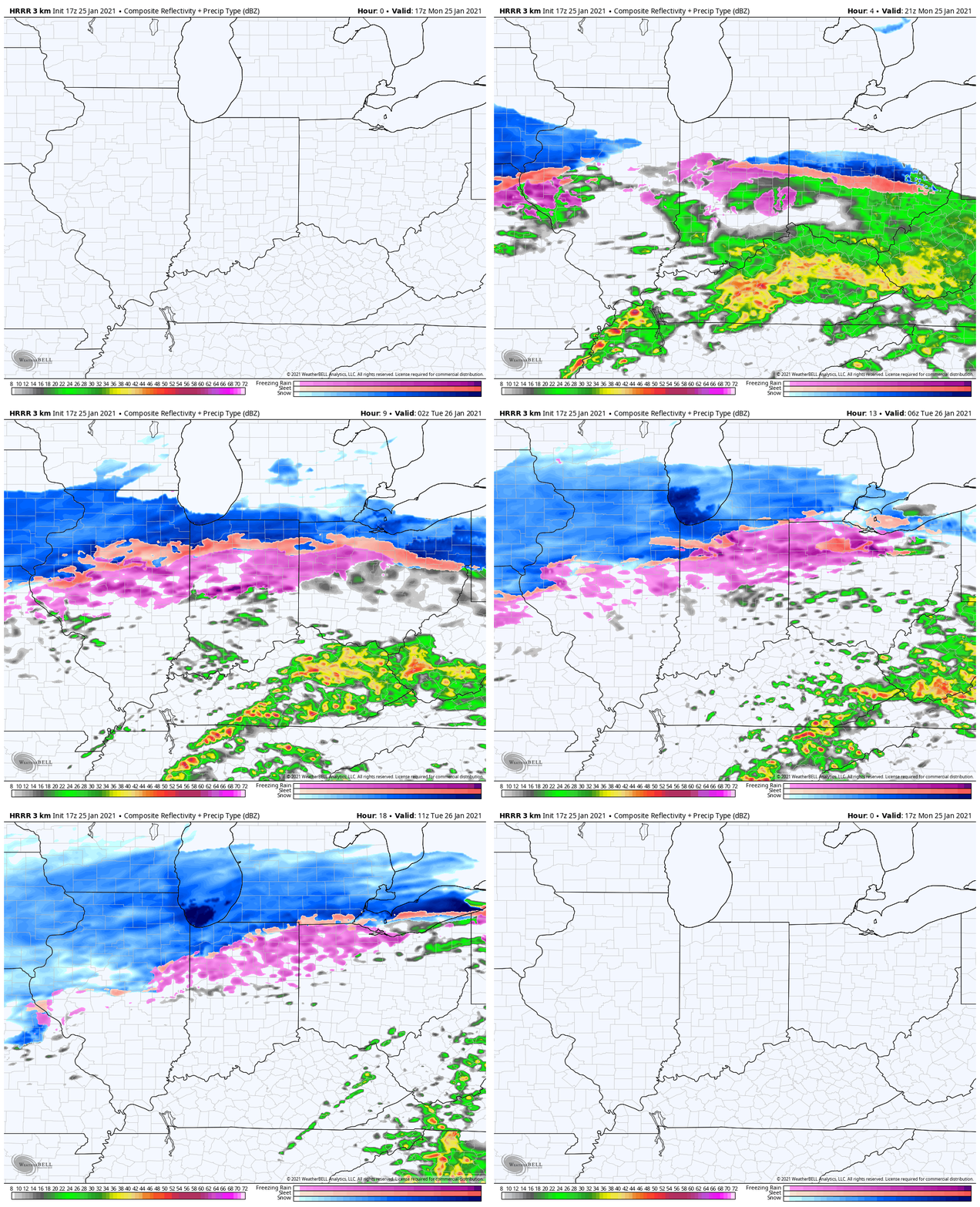
After a wintry mix that featured everything (and the kitchen sink ;-)) during the onset has predominantly transitioned over to sleet and freezing rain across immediate central Indiana. Look for this to continue for the next couple of hours before the 1st wave of significant moisture moves east by mid to late afternoon.
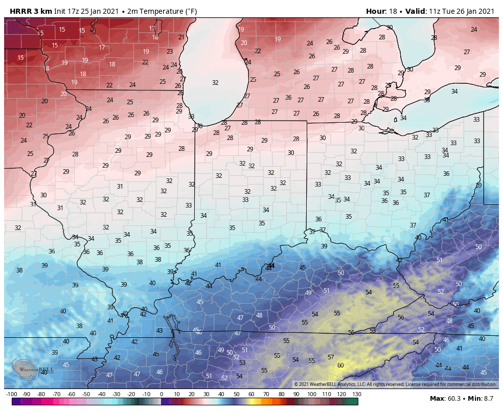
As we look forward, another wave of lighter precipitation will target the northern half of the state (especially from Indianapolis and points north) later this evening into Tuesday morning. Though precipitation should be lighter with this next wave, the concern is that it may still fall as “frozen” (sleet) or “freezing” (rain) during this time period, especially from the northern Indianapolis suburbs and points north as temperatures look to hover around, or just below, the freezing mark through the evening. The difference of just 1° truly will make a world of difference of the associated impacts regarding travel tonight and early Tuesday morning north of the city. You can see how high resolution guidance keeps the sub-freezing air locked in place just north of Indianapolis tonight.

For our clients in the salting and snow removal business, plan to remain busy during the overnight across the northern half of the state as this next wave of moisture moves in. An additional .10 to .25 (liquid equivalent) can be expected for central Indiana with liquid equivalent amounts of .25 to .50 across the northern 1/3 of the state.

More on this and what lies ahead for midweek in our evening video update. Stay safe out there, friends!
